Category:Eardisland
village in Herefordshire, England, UK  | |||||
| Upload media | |||||
| Instance of | |||||
|---|---|---|---|---|---|
| Location | Herefordshire, West Midlands, England | ||||
| official website | |||||
 | |||||
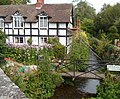
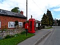
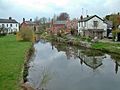
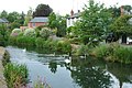
English: Eardisland is a village and civil parish on the River Arrow west of the market town of Leominster in Herefordshire. The civil parish includes the hamlets of Upper Hardwick, Lower Hardwick and Lower Burton.
Nederlands: Eardisland is een plaats en civil parish in het bestuurlijke gebied Herefordshire, in het Engelse graafschap Herefordshire met 520 inwoners.
Polski: Eardisland – wieś w Anglii, w hrabstwie Herefordshire. Leży 21 km na północny zachód od miasta Hereford i 204 km na północny zachód od Londynu. Miejscowość liczy 520 mieszkańców.

Subcategories
This category has the following 8 subcategories, out of 8 total.
A
- Arrow Green (1 F)
E
- Eardisland Dovecote (6 F)
- Eardisland War Memorial (2 F)
L
- Lower Hardwick (4 F)
M
- St Mary The Virgin, Eardisland (15 F)
S
- Staick House (5 F)
U
- Upper Hardwick (1 F)
Media in category "Eardisland"
The following 200 files are in this category, out of 280 total.
(previous page) (next page)-
 'River Arrow' Sign at Eardisland - geograph.org.uk - 5921255.jpg 3,648 × 2,736; 3.5 MB
-
 A muddy field, Hardwick - geograph.org.uk - 3855265.jpg 640 × 480; 241 KB
-

-
 A riverside cottage, Eardisland - geograph.org.uk - 1814743.jpg 640 × 480; 131 KB
-
 A44 - Golden Cross junction - geograph.org.uk - 2587926.jpg 640 × 480; 45 KB
-
 A44 at Legion Cross - geograph.org.uk - 2587931.jpg 640 × 480; 94 KB
-

-
 A44 at Windmill Hill - geograph.org.uk - 2587930.jpg 640 × 480; 84 KB
-
 A44 junction for Hardwick - geograph.org.uk - 5891746.jpg 640 × 366; 53 KB
-
 AA Telephone Box at Eardisland - geograph.org.uk - 5922488.jpg 3,648 × 2,736; 3.71 MB
-
 Adlen House (Eardisland) - geograph.org.uk - 5922510.jpg 3,648 × 2,736; 3.26 MB
-
 Approaching Eardisland - geograph.org.uk - 5679087.jpg 1,600 × 901; 673 KB
-
 Arable land east of Pembridge, Herefordshire - geograph.org.uk - 3680846.jpg 1,280 × 739; 441 KB
-
 Arrow Bank Country Holiday Park - geograph.org.uk - 5048837.jpg 1,024 × 680; 297 KB
-
 Arrow Barns (Eardisland) - geograph.org.uk - 5922536.jpg 3,648 × 2,736; 2.95 MB
-
 Arrow Barns, Eardisland - geograph.org.uk - 3094698.jpg 640 × 533; 87 KB
-
 Arrow Bridge (Eardisland) - geograph.org.uk - 5921390.jpg 3,648 × 2,736; 4.73 MB
-
 Arrow Bridge (Eardisland) - geograph.org.uk - 5922579.jpg 3,648 × 2,736; 3.7 MB
-
 Arrow Bridge (Eardisland) - geograph.org.uk - 5922581.jpg 3,648 × 2,736; 2.63 MB
-
 Arrow flood plain, Eardisland - geograph.org.uk - 5210595.jpg 1,024 × 683; 436 KB
-
 Arrow Lawn (Eardisland) - geograph.org.uk - 5921404.jpg 3,648 × 2,736; 4.14 MB
-
 Arrow Lawn Cottage, Eardisland - geograph.org.uk - 3372634.jpg 2,074 × 1,422; 946 KB
-
 Bend in the lane at Broom - geograph.org.uk - 1814712.jpg 640 × 480; 258 KB
-
 Between Shobdon and Pembridge - geograph.org.uk - 6076382.jpg 1,024 × 768; 244 KB
-
 Black and White reflections, Eardisland - geograph.org.uk - 635041.jpg 640 × 480; 107 KB
-
 Bridge Cottage (Eardisland) - geograph.org.uk - 5921307.jpg 3,648 × 2,736; 3.92 MB
-
 Bridge Cottage (Eardisland) - geograph.org.uk - 5921621.jpg 3,648 × 2,736; 3.15 MB
-
 Bridge Cottage (Eardisland) - geograph.org.uk - 5922556.jpg 3,648 × 2,736; 4.16 MB
-
 Bridge Cottage, Eardisland - geograph.org.uk - 3094614.jpg 640 × 508; 94 KB
-
 Bridge in Eardisland - geograph.org.uk - 1814738.jpg 640 × 480; 187 KB
-
 Bridge Inscription, Eardisland (geograph 7283267).jpg 1,024 × 901; 316 KB
-
 Bridge over the River Arrow - geograph.org.uk - 5052357.jpg 800 × 531; 134 KB
-
 Bridge over the River Arrow, Eardisland - geograph.org.uk - 3948496.jpg 4,320 × 3,240; 4.39 MB
-
 Bridge, Eardisland - geograph.org.uk - 5210103.jpg 1,024 × 683; 426 KB
-
 Bridgend (Eardisland) - geograph.org.uk - 5922567.jpg 3,648 × 2,736; 3.74 MB
-
 Broom Farm - geograph.org.uk - 2621446.jpg 640 × 480; 76 KB
-
 Burton Court, Eardisland - geograph.org.uk - 3273237.jpg 2,448 × 1,558; 833 KB
-
 Cattle grazing in a field - geograph.org.uk - 5048800.jpg 800 × 531; 129 KB
-
 Cattle in a field near Dilwyn - geograph.org.uk - 5048254.jpg 1,024 × 680; 291 KB
-
 Cider orchard south of Eardisland - geograph.org.uk - 5679424.jpg 1,600 × 901; 698 KB
-

-
 Communications Centre, Eardisland - geograph.org.uk - 3094724.jpg 640 × 468; 102 KB
-
 Cottage near Eardisland Bridge - geograph.org.uk - 2982054.jpg 1,798 × 1,158; 515 KB
-
 Cottage on Lime Lane, Eardisland (geograph 5857690).jpg 1,024 × 680; 322 KB
-
 Country road at Lower Burton - geograph.org.uk - 5048195.jpg 1,024 × 680; 361 KB
-
 Country road near Eardisland - geograph.org.uk - 5048822.jpg 1,024 × 680; 351 KB
-
 Country road near Twyford - geograph.org.uk - 5671052.jpg 683 × 1,024; 283 KB
-
 Country road passing Pigmore Common - geograph.org.uk - 5048199.jpg 1,024 × 680; 299 KB
-
 Cross Inn at Eardisland - geograph.org.uk - 945132.jpg 640 × 480; 82 KB
-
 Crown Inn and Restaurant, Eardisland - geograph.org.uk - 3094639.jpg 640 × 431; 75 KB
-
 Daffodils in Eardisland - geograph.org.uk - 364012.jpg 640 × 426; 145 KB
-
 Dovecote at Eardisland - geograph.org.uk - 5921247.jpg 3,648 × 2,736; 4.18 MB
-
 Dovecote at Eardisland - geograph.org.uk - 5921333.jpg 2,736 × 3,648; 4.09 MB
-
 Dovecote at Eardisland - geograph.org.uk - 5921371.jpg 3,648 × 2,736; 4.58 MB
-
 Dovecote at Eardisland - geograph.org.uk - 5921413.jpg 2,736 × 3,648; 4.16 MB
-
 Dovecote at Orchard Green (Eardisland) - geograph.org.uk - 5922527.jpg 3,648 × 2,736; 4.25 MB
-
 Dovecote in Eardisland - geograph.org.uk - 5052352.jpg 680 × 1,024; 275 KB
-
 Dovecote in Eardisland - geograph.org.uk - 5844327.jpg 1,024 × 768; 306 KB
-
 Dovecote ^ The Manor House (Eardisland) - geograph.org.uk - 5921362.jpg 3,648 × 2,736; 4.72 MB
-
 Drive to Lyme Green - geograph.org.uk - 5050065.jpg 1,024 × 680; 296 KB
-
 Eardisland - geograph.org.uk - 2691850.jpg 640 × 480; 90 KB
-
 Eardisland - geograph.org.uk - 5210594.jpg 1,024 × 683; 284 KB
-
 Eardisland Castle - geograph.org.uk - 5922474.jpg 3,648 × 2,736; 5.11 MB
-
 Eardisland Castle - geograph.org.uk - 5922481.jpg 3,648 × 2,736; 4.93 MB
-
 Eardisland church - geograph.org.uk - 5859231.jpg 1,024 × 768; 289 KB
-
 Eardisland church - geograph.org.uk - 5859234.jpg 1,024 × 768; 323 KB
-
 Eardisland Community Shop - geograph.org.uk - 5750430.jpg 5,582 × 3,726; 4.29 MB
-
 Eardisland Grammar School - geograph.org.uk - 5921423.jpg 3,648 × 2,736; 4.27 MB
-
 Eardisland under a cloud inversion - geograph.org.uk - 5548725.jpg 1,024 × 683; 236 KB
-
 Eardisland Village scene (geograph 945126).jpg 640 × 480; 81 KB
-
 Eardisland Village scene - geograph.org.uk - 945120.jpg 640 × 480; 119 KB
-
 Eardisland War Memorial - geograph.org.uk - 5921627.jpg 3,648 × 2,736; 4.13 MB
-
 Eardisland, Bridge and River Arrow. - geograph.org.uk - 150563.jpg 640 × 435; 153 KB
-
 Eardisland, Broome Lane - geograph.org.uk - 5750427.jpg 7,359 × 4,912; 7.31 MB
-
 Eardisland, North Herefordshire.jpg 5,000 × 3,312; 19.88 MB
-
 Eardisland, Old AA Box at The Cross Inn. - geograph.org.uk - 150550.jpg 640 × 433; 123 KB
-
 Eardisland, that way - geograph.org.uk - 1814765.jpg 640 × 480; 80 KB
-

-
 Entrance to Burton Court - geograph.org.uk - 5048184.jpg 1,024 × 680; 359 KB
-
 Entrance to Lime Farm - geograph.org.uk - 5050067.jpg 800 × 531; 120 KB
-
 Entrance to Lyme Farm, Eardisland - geograph.org.uk - 1814742.jpg 640 × 480; 214 KB
-
 Entrance to Twyford - geograph.org.uk - 2621448.jpg 640 × 480; 74 KB
-
 Farmland at Lower Burton - geograph.org.uk - 5048192.jpg 800 × 531; 134 KB
-
 Farmland east of Pembridge, Herefordshire - geograph.org.uk - 3680848.jpg 1,280 × 763; 473 KB
-
 Farmland near Little Broome - geograph.org.uk - 5048828.jpg 800 × 531; 102 KB
-
 Farmland north of Pembridge - geograph.org.uk - 5671050.jpg 1,024 × 683; 240 KB
-
 Farmland south-west of Eardisland, Herefordshire - geograph.org.uk - 3680841.jpg 1,024 × 636; 323 KB
-
 Farmland south-west of Eardisland, Herefordshire - geograph.org.uk - 3680854.jpg 1,024 × 635; 325 KB
-
 Field beside the River Arrow - geograph.org.uk - 5048818.jpg 800 × 531; 153 KB
-
 Field near Broom - geograph.org.uk - 1814714.jpg 640 × 480; 221 KB
-
 Field near Sytches Farm - geograph.org.uk - 1814638.jpg 640 × 480; 173 KB
-
 Field opposite Burton Court - geograph.org.uk - 5048187.jpg 1,024 × 680; 294 KB
-
 Field, Lower Hardwick - geograph.org.uk - 5576268.jpg 1,024 × 683; 375 KB
-
 Fields and lane near Folly Farm - geograph.org.uk - 1814719.jpg 640 × 480; 270 KB
-
 Fields near Sytches Farm - geograph.org.uk - 1814637.jpg 640 × 480; 184 KB
-
 Fields near Upper Hardwick - geograph.org.uk - 1814753.jpg 640 × 480; 186 KB
-
 Fields south of Eardisland - geograph.org.uk - 3855267.jpg 640 × 480; 234 KB
-
 Fields west of Eardisland - geograph.org.uk - 1814721.jpg 640 × 480; 186 KB
-
 Fields, Grove House - geograph.org.uk - 4413702.jpg 800 × 533; 330 KB
-

-
 Fishing in the Arrow, Eardisland - geograph.org.uk - 3094584.jpg 640 × 468; 89 KB
-
 Flowers on the bend - geograph.org.uk - 4083811.jpg 1,600 × 1,200; 698 KB
-
 Former Post Office (Eardisland) - geograph.org.uk - 5922525.jpg 3,648 × 2,736; 4.08 MB
-
 Frosty field - geograph.org.uk - 5637565.jpg 1,600 × 901; 645 KB
-
 Frosty November dawn - geograph.org.uk - 5637571.jpg 1,600 × 901; 746 KB
-
 Frosty pasture - geograph.org.uk - 5637572.jpg 1,600 × 901; 712 KB
-
 Gas main crosses the lane - geograph.org.uk - 1814757.jpg 640 × 480; 192 KB
-
 Golden Cross - geograph.org.uk - 3852914.jpg 640 × 480; 223 KB
-
 Golden Cross - geograph.org.uk - 5048140.jpg 800 × 531; 116 KB
-
 Grass strip - geograph.org.uk - 5576272.jpg 1,024 × 683; 375 KB
-
 Half-timbered Cottage, Eardisland. - geograph.org.uk - 150555.jpg 431 × 640; 154 KB
-
 Hedgerow oaks near Eardisland - geograph.org.uk - 5210596.jpg 1,024 × 683; 425 KB
-
 Hilltop near Sytches Farm - geograph.org.uk - 1814639.jpg 640 × 480; 146 KB
-
 Holiday Cottage To Let - geograph.org.uk - 4294146.jpg 4,000 × 3,000; 3.13 MB
-
 Houses at Eardisland - geograph.org.uk - 5921365.jpg 3,648 × 2,736; 3.82 MB
-
 Houses in Eardisland - geograph.org.uk - 5859240.jpg 1,024 × 768; 349 KB
-
 Inside the AA Telephone Box at Eardisland - geograph.org.uk - 5922491.jpg 2,736 × 3,648; 2.74 MB
-
 Knapp House (Eardisland) - geograph.org.uk - 5922533.jpg 3,648 × 2,736; 4.3 MB
-
 Lane approaching Twyford corner - geograph.org.uk - 1814697.jpg 640 × 480; 224 KB
-
 Lane at Twyford entrance - geograph.org.uk - 2621449.jpg 640 × 480; 97 KB
-
 Lane from Lower Hardwick meets the A44 - geograph.org.uk - 1814750.jpg 640 × 480; 245 KB
-
 Lane Junction for the Hardwicks - geograph.org.uk - 1814752.jpg 640 × 480; 87 KB
-
 Lane north of Twyford corner - geograph.org.uk - 1814699.jpg 640 × 480; 217 KB
-

-
 Lane southwards from Broom - geograph.org.uk - 1814715.jpg 640 × 480; 178 KB
-
 Lane to Bidney Farm - geograph.org.uk - 1814758.jpg 640 × 480; 207 KB
-
 Lane to Lower Burton - geograph.org.uk - 1814759.jpg 640 × 480; 209 KB
-
 Leaving Eardisland - geograph.org.uk - 1814747.jpg 640 × 480; 186 KB
-
 Lone oak - geograph.org.uk - 5637566.jpg 1,600 × 1,232; 946 KB
-
 Lychgate at St. Mary the Virgin Church (Eardisland) - geograph.org.uk - 5922424.jpg 3,648 × 2,736; 4.08 MB
-
 Manacles on the Whipping Post - geograph.org.uk - 873045.jpg 480 × 640; 71 KB
-
 Mill Stream (Eardisland) - geograph.org.uk - 5921272.jpg 3,648 × 2,736; 4.69 MB
-
 Mill Stream Bridge ^ Old Grammar School (Eardisland) - geograph.org.uk - 5921270.jpg 3,648 × 2,736; 4.51 MB
-
 Mill stream bridge, Eardisland - geograph.org.uk - 3094603.jpg 640 × 575; 144 KB
-
 Mill Stream Cottage Eardisland Herefordshire.jpg 4,928 × 3,264; 12.04 MB
-
 Mill Stream Cottage.jpg 5,928 × 3,926; 11.82 MB
-
 Mill stream, Eardisland - geograph.org.uk - 3094566.jpg 640 × 530; 130 KB
-
 Moat at Eardisland Castle - geograph.org.uk - 5922479.jpg 3,648 × 2,736; 4.96 MB
-
 Narrow path, Lime - geograph.org.uk - 5210104.jpg 1,024 × 683; 555 KB
-
 Near Upper Hardwick - geograph.org.uk - 4084017.jpg 3,860 × 2,804; 2.26 MB
-
 No through road in Eardisland - geograph.org.uk - 5052358.jpg 800 × 531; 155 KB
-
 Oak tree in a field - geograph.org.uk - 5048812.jpg 1,024 × 680; 260 KB
-
 Oaks at dawn - geograph.org.uk - 5637573.jpg 1,600 × 901; 647 KB
-
 Old House in Eardisland - geograph.org.uk - 4273161.jpg 1,600 × 1,197; 764 KB
-
 Orchard windpump - geograph.org.uk - 171524.jpg 640 × 480; 78 KB
-
 Paddock at Streamford - geograph.org.uk - 1814760.jpg 640 × 480; 176 KB
-
 Phone box and post box, Eardisland - geograph.org.uk - 3948423.jpg 4,320 × 3,240; 4.13 MB
-

-
 Potato field - geograph.org.uk - 5048175.jpg 800 × 531; 128 KB
-
 Reflected trees, Eardisland - geograph.org.uk - 635060.jpg 640 × 480; 135 KB
-
 Reflections in the Arrow, Eardisland - geograph.org.uk - 634949.jpg 640 × 306; 50 KB
-
 Restored AA box at Eardisland - geograph.org.uk - 1063002.jpg 480 × 640; 209 KB
-
 Rhydimoor Lane - geograph.org.uk - 5637567.jpg 1,600 × 901; 719 KB
-
 Ripening barley - geograph.org.uk - 5050074.jpg 1,024 × 680; 320 KB
-
 Ripening wheat field - geograph.org.uk - 5048831.jpg 800 × 531; 171 KB
-
 River Arrow - geograph.org.uk - 5210098.jpg 1,024 × 683; 486 KB
-
 River Arrow at Eardisland - geograph.org.uk - 1063004.jpg 640 × 480; 243 KB
-
 River Arrow at Eardisland - geograph.org.uk - 2982070.jpg 1,798 × 1,158; 424 KB
-
 River Arrow bridge, west of Eardisland - geograph.org.uk - 1814720.jpg 640 × 480; 231 KB
-
 River Arrow in Eardisland - geograph.org.uk - 4273199.jpg 4,000 × 3,000; 2.68 MB
-
 River Arrow, Eardisland - geograph.org.uk - 3094576.jpg 640 × 480; 76 KB
-
 River outside the Dovecot - geograph.org.uk - 945139.jpg 640 × 480; 128 KB
-
 Road to Eardisland - geograph.org.uk - 5679084.jpg 1,600 × 901; 699 KB
-
 Road to Eardisland at Streamford - geograph.org.uk - 1814761.jpg 640 × 480; 95 KB
-
 Road to Hinton Manor - geograph.org.uk - 5050064.jpg 1,024 × 680; 313 KB
-
 Road to Legion Cross - geograph.org.uk - 5679425.jpg 1,600 × 901; 641 KB
-
 Round straw bales - geograph.org.uk - 5048813.jpg 1,024 × 680; 258 KB
-

-
 Sheep grazing at Streamford - geograph.org.uk - 1814762.jpg 640 × 480; 191 KB
-
 Shobdon Hill - geograph.org.uk - 6210868.jpg 1,024 × 683; 127 KB
-
 Sign at Eardisland - geograph.org.uk - 5921618.jpg 3,648 × 2,736; 4.38 MB
-
 Sign at the AA Telephone Box at Eardisland - geograph.org.uk - 5922502.jpg 3,648 × 2,736; 3.7 MB
-
 Sign at The Cross Inn (Eardisland) - geograph.org.uk - 5922546.jpg 3,648 × 2,736; 2.8 MB
-
 Sign by Mill Stream (Eardisland) - geograph.org.uk - 5921338.jpg 3,648 × 2,736; 4.78 MB
-
 Sign inside the AA Telephone Box at Eardisland - geograph.org.uk - 5922492.jpg 3,648 × 2,736; 3.29 MB
-
 Sign to St. Mary the Virgin Church (Eardisland) - geograph.org.uk - 5922540.jpg 3,648 × 2,736; 2.93 MB
-
 Small field at Streamford, 1 - geograph.org.uk - 5679078.jpg 1,600 × 901; 717 KB
-
 Small field at Streamford, 2 - geograph.org.uk - 5679082.jpg 1,600 × 901; 704 KB
-
 Small section of Roman Road - geograph.org.uk - 5637576.jpg 1,600 × 901; 679 KB
-
 St Mary's Walk houses, Eardisland - geograph.org.uk - 3094729.jpg 640 × 477; 75 KB
-
 St. Mary the Virgin Church (Bell Tower ^ Eardisland) - geograph.org.uk - 5922438.jpg 2,736 × 3,648; 4.14 MB
-
 St. Mary the Virgin Church (Bell Tower ^ Eardisland) - geograph.org.uk - 5922445.jpg 3,648 × 2,736; 3.96 MB
-
 St. Mary the Virgin Church (Bell Tower ^ Eardisland) - geograph.org.uk - 5922452.jpg 2,736 × 3,648; 3.98 MB
-

-

-
 St. Mary the Virgin Church (Eardisland) - geograph.org.uk - 5922431.jpg 3,648 × 2,736; 4.34 MB
-
 St. Mary the Virgin Church (Eardisland) - geograph.org.uk - 5922459.jpg 3,648 × 2,736; 3.34 MB
-
 St. Mary the Virgin Church (Eardisland) - geograph.org.uk - 5922465.jpg 3,648 × 2,736; 3.68 MB
-
 St. Mary the Virgin Church (Eardisland) - geograph.org.uk - 5922466.jpg 3,648 × 2,736; 3.62 MB
-
 St. Mary the Virgin Church (Eardisland) - geograph.org.uk - 5922471.jpg 3,648 × 2,736; 3.96 MB
-
 St. Mary the Virgin Church (Eardisland) - geograph.org.uk - 5922477.jpg 3,648 × 2,736; 4.4 MB
-
 Stubble near Golden Cross - geograph.org.uk - 3852900.jpg 640 × 480; 260 KB
-
 Swans at Mill Stream (Eardisland) - geograph.org.uk - 5921263.jpg 3,648 × 2,736; 3.29 MB
-
 Swans at Mill Stream (Eardisland) - geograph.org.uk - 5921273.jpg 3,648 × 2,736; 3.31 MB
-
 Swans at Mill Stream (Eardisland) - geograph.org.uk - 5921310.jpg 3,648 × 2,736; 4.76 MB
-
 Swans at Mill Stream (Eardisland) - geograph.org.uk - 5921348.jpg 3,648 × 2,736; 3.85 MB
-
 Swans at Mill Stream (Eardisland) - geograph.org.uk - 5921350.jpg 3,648 × 2,736; 4.28 MB
-
 Swans on the Arrow - geograph.org.uk - 718814.jpg 640 × 426; 102 KB
-
 The A44 at Golden Cross - geograph.org.uk - 6153448.jpg 1,832 × 1,132; 1.13 MB
-
 The A44 at Golden Cross - geograph.org.uk - 6160701.jpg 1,920 × 1,280; 878 KB


_-_geograph.org.uk_-_5922510.jpg)


_-_geograph.org.uk_-_5922536.jpg)

_-_geograph.org.uk_-_5921390.jpg)
_-_geograph.org.uk_-_5922579.jpg)
_-_geograph.org.uk_-_5922581.jpg)

_-_geograph.org.uk_-_5921404.jpg)


_-_geograph.org.uk_-_5921307.jpg)
_-_geograph.org.uk_-_5921621.jpg)
_-_geograph.org.uk_-_5922556.jpg)


.jpg)


_-_geograph.org.uk_-_5922567.jpg)


_-_geograph.org.uk_-_5922442.jpg)


.jpg)


_-_geograph.org.uk_-_5922527.jpg)


_-_geograph.org.uk_-_5921362.jpg)


.jpg)


_-_geograph.org.uk_-_5922525.jpg)


_-_geograph.org.uk_-_5922533.jpg)


_-_geograph.org.uk_-_5922424.jpg)

_-_geograph.org.uk_-_5921272.jpg)
_-_geograph.org.uk_-_5921270.jpg)


_-_geograph.org.uk_-_5922427.jpg)


_-_geograph.org.uk_-_5922546.jpg)
_-_geograph.org.uk_-_5921338.jpg)

_-_geograph.org.uk_-_5922540.jpg)


_-_geograph.org.uk_-_5922438.jpg)
_-_geograph.org.uk_-_5922445.jpg)
_-_geograph.org.uk_-_5922452.jpg)
_-_geograph.org.uk_-_5922461.jpg)
_-_geograph.org.uk_-_5922468.jpg)
_-_geograph.org.uk_-_5922431.jpg)
_-_geograph.org.uk_-_5922459.jpg)
_-_geograph.org.uk_-_5922465.jpg)
_-_geograph.org.uk_-_5922466.jpg)
_-_geograph.org.uk_-_5922471.jpg)
_-_geograph.org.uk_-_5922477.jpg)

_-_geograph.org.uk_-_5921263.jpg)
_-_geograph.org.uk_-_5921273.jpg)
_-_geograph.org.uk_-_5921310.jpg)
_-_geograph.org.uk_-_5921348.jpg)
_-_geograph.org.uk_-_5921350.jpg)

