Category:East Brookfield, Massachusetts
town in Worcester County, Massachusetts, United States of America    | |||||
| Upload media | |||||
| Instance of | |||||
|---|---|---|---|---|---|
| Part of |
| ||||
| Location | Worcester County, Massachusetts | ||||
| Population |
| ||||
| Area |
| ||||
| Elevation above sea level |
| ||||
| official website | |||||
 | |||||
Subcategories
This category has the following 3 subcategories, out of 3 total.
E
- East Brookfield station (4 F)
Q
- Quaboag Pond (3 F)
Media in category "East Brookfield, Massachusetts"
The following 24 files are in this category, out of 24 total.
-
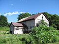 1880 Barn, Podunk, East Brookfield MA.jpg 2,272 × 1,704; 1.64 MB
-
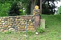
 Boston Post Road Milestone 63, East Brookfield MA.jpg 3,264 × 2,448; 3.15 MB
-
 Cranberry River (Massachusetts) map.jpg 1,553 × 2,581; 4.02 MB
-
 East brookfied ma mun center.JPG 2,592 × 3,888; 4.67 MB
-
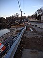 East Brookfield construction.jpg 2,448 × 3,264; 2.8 MB
-
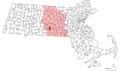 East Brookfield ma highlight.png 788 × 466; 54 KB
-
 East Brookfield MA Town Hall 1.jpg 1,067 × 1,600; 311 KB
-
 East Brookfield Route 9 Bridge, Dam Spillway (5577072523).jpg 355 × 247; 13 KB
-
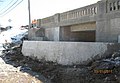
 East Brookfield, Route 9 Bridge, Dam Construction (5577072553).jpg 335 × 251; 17 KB
-
 East Main Street, East Brookfield MA.jpg 2,272 × 1,704; 1.38 MB
-
 EastBrookfield-MA.jpg 1,839 × 2,301; 1.06 MB
-
 Flag of East Brookfield, Massachusetts.png 322 × 216; 6 KB
-
 Hodgkins School, East Brookfield MA.jpg 2,272 × 1,704; 1.07 MB
-
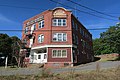 Keith Block, East Brookfield MA.jpg 5,472 × 3,648; 5.91 MB
-
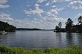 LakeLashaway.jpg 1,024 × 680; 219 KB
-
 Lashaway Inn sign.jpg 2,448 × 3,264; 3.79 MB
-
 MA Route 49 northbound entering East Brookfield from Sturbridge MA.jpg 2,272 × 1,704; 1.43 MB
-
 North Brookfield Rail Trail W, East Brookfield MA.jpg 4,032 × 3,024; 6.93 MB
-
 North Brookfield Rail Trail, East Brookfield MA.jpg 4,032 × 3,024; 6.29 MB
-
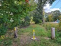
 Post Road mile marker 62, East Brookfield MA.jpg 2,592 × 1,728; 1.18 MB
-
 Seal of East Brookfield, Massachusetts.png 160 × 158; 102 KB
-
 Union Chapel, Podunk MA.jpg 2,272 × 1,704; 1.84 MB
-

-


_map.jpg)


.jpg)
.jpg)


_highlighted.svg)