Category:East Didsbury
suburb in Manchester, Greater Manchester, England, UK .JPG) | |||||
| Upload media | |||||
| Instance of | |||||
|---|---|---|---|---|---|
| Location | Manchester, Greater Manchester, North West England, England | ||||
 | |||||
English: East Didsbury is situated in the Manchester City Council ward of Didsbury East in the City of Manchester
Subcategories
This category has only the following subcategory.
Media in category "East Didsbury"
The following 51 files are in this category, out of 51 total.
-
 "Tesco" at Parrs Wood - geograph.org.uk - 1278081.jpg 589 × 425; 106 KB
-
 ABC Weekend TV studios in Didsbury Manchester.jpg 1,618 × 1,056; 273 KB
-
 Austin Drive - geograph.org.uk - 4303884.jpg 1,600 × 1,200; 308 KB
-
 Bonfire at Bradley Fold - geograph.org.uk - 1181489.jpg 640 × 480; 55 KB
-
 Bowls club - geograph.org.uk - 4986918.jpg 4,000 × 2,992; 4.64 MB
-
 Bradley fold allotments - geograph.org.uk - 1181493.jpg 640 × 480; 58 KB
-
 Brayside Road - geograph.org.uk - 3345715.jpg 800 × 547; 73 KB
-
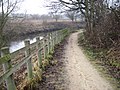
 Bridge STY-32 - geograph.org.uk - 5455365.jpg 1,280 × 1,085; 1.1 MB
-
 Bus Stop B on Parrs Wood Lane - geograph.org.uk - 3491837.jpg 640 × 505; 198 KB
-

-
 Didsbury Road - geograph.org.uk - 1955867.jpg 640 × 607; 127 KB
-
 Didsbury, Stenner Woods - geograph.org.uk - 4612719.jpg 1,024 × 768; 251 KB
-
 Didsbury, tennis court - geograph.org.uk - 4612766.jpg 1,024 × 759; 236 KB
-
 East Didsbury - Broughville Drive - geograph.org.uk - 1231108.jpg 640 × 480; 176 KB
-
 East Didsbury - geograph.org.uk - 3610940.jpg 640 × 381; 155 KB
-
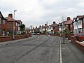
 East Didsbury - Kingston Road - geograph.org.uk - 1231112.jpg 640 × 480; 221 KB
-
 East Didsbury - Mellington Avenue - geograph.org.uk - 1231111.jpg 640 × 480; 167 KB
-
 East Didsbury - Millgate Lane - geograph.org.uk - 1231113.jpg 640 × 480; 253 KB
-

-
 East Didsbury Bus Terminus - geograph.org.uk - 1955924.jpg 640 × 487; 116 KB
-
 East Didsbury from Station Approach - geograph.org.uk - 5455357.jpg 1,280 × 960; 924 KB
-
 East Didsbury Gardens - geograph.org.uk - 1269364.jpg 640 × 480; 168 KB
-
 East Didsbury Parrs Wood bus terminal.jpg 1,600 × 1,200; 275 KB
-

-
 Entrance to Playing Fields - geograph.org.uk - 1952659.jpg 640 × 480; 134 KB
-
 Entrance to Tesco - geograph.org.uk - 3048184.jpg 640 × 435; 134 KB
-
 Erigeron in The Old Parsonage Gardens - geograph.org.uk - 3547853.jpg 4,608 × 3,456; 3.01 MB
-
 Fletcher's Moss - geograph.org.uk - 1331922.jpg 640 × 480; 159 KB
-
-
 Mellington Ave., East Didsbury. - geograph.org.uk - 146441.jpg 445 × 640; 124 KB
-
 Not Open 24 Hours - geograph.org.uk - 1269379.jpg 640 × 478; 130 KB
-
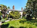
 Old Parsonage Gardens - Azalea corner - geograph.org.uk - 2960501.jpg 3,456 × 2,304; 3.21 MB
-
 Old Parsonage Gardens - geograph.org.uk - 1331960.jpg 591 × 640; 192 KB
-
 Old Parsonage Gardens - geograph.org.uk - 1331968.jpg 640 × 556; 165 KB
-
 Old Parsonage Gardens - geograph.org.uk - 1331977.jpg 640 × 480; 170 KB
-
 Old Parsonage Gardens - geograph.org.uk - 1331991.jpg 640 × 480; 199 KB
-
 Old Parsonage Gardens' vintage milepost - geograph.org.uk - 2954447.jpg 2,304 × 3,456; 1.93 MB
-
 Parrs Wood bus terminus, East Didsbury - geograph.org.uk - 4965221.jpg 1,024 × 768; 195 KB
-
 Parrs Wood Road, East Didsbury - panoramio.jpg 2,048 × 1,536; 1.93 MB
-
 Parrswood - geograph.org.uk - 3202284.jpg 640 × 480; 464 KB
-
 Shop parade on Kingsway - panoramio.jpg 2,048 × 1,536; 910 KB
-
 Shops on Lane End Road - geograph.org.uk - 3526116.jpg 1,024 × 768; 227 KB
-
 Shops on Lane End Road - geograph.org.uk - 801193.jpg 640 × 480; 89 KB
-
 Sports hall.jpg 120 × 120; 6 KB
-
 St James' Churchyard - geograph.org.uk - 1331893.jpg 640 × 624; 228 KB
-
 St James' Lychgate - geograph.org.uk - 1331880.jpg 640 × 585; 197 KB
-
 Tesco Clocktower - geograph.org.uk - 1269371.jpg 640 × 546; 120 KB
-
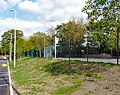
 The Gateway, East Didsbury - geograph.org.uk - 2930284.jpg 3,742 × 2,495; 1.12 MB
-
 The Parrswood, Didsbury - geograph.org.uk - 2926738.jpg 3,872 × 2,592; 3.34 MB
-

-


