Category:East Goscote
English: East Goscote is a village and civil parish in the Charnwood district of Leicestershire, England, just north of Syston. It is a medium sized village with a population of approximately 3,000.
village in the United Kingdom  | |||||
| Upload media | |||||
| Instance of | |||||
|---|---|---|---|---|---|
| Location | Charnwood, Leicestershire, East Midlands, England | ||||
 | |||||
Subcategories
This category has only the following subcategory.
S
Media in category "East Goscote"
The following 38 files are in this category, out of 38 total.
-
 Autumn golf - geograph.org.uk - 3756201.jpg 1,280 × 960; 580 KB
-

-
 Bend on Broome Lane - geograph.org.uk - 1008270.jpg 640 × 480; 99 KB
-

-
 Broome Lane - geograph.org.uk - 1008264.jpg 640 × 415; 70 KB
-
 Broome Lane bridges - geograph.org.uk - 3756194.jpg 1,280 × 960; 442 KB
-
 Broome Lane, East Goscote - geograph.org.uk - 2859478.jpg 1,024 × 683; 70 KB
-
 Business units, East Goscote - geograph.org.uk - 2131799.jpg 640 × 480; 228 KB
-
 East Goscote from the 'hill' - geograph.org.uk - 3756233.jpg 1,280 × 960; 316 KB
-
 East Goscote recreation ground - geograph.org.uk - 3756229.jpg 1,280 × 960; 345 KB
-
 East Goscote village sign - geograph.org.uk - 853656.jpg 640 × 610; 97 KB
-
East Goscote.ogg 4 min 37 s; 1.33 MB
-
 Houses on Long Furrow, East Goscote - geograph.org.uk - 3040440.jpg 640 × 408; 65 KB
-
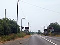
 Leading to level crossing - geograph.org.uk - 936349.jpg 640 × 480; 105 KB
-
 Level crossing on north side of East Goscote - geograph.org.uk - 3585549.jpg 1,024 × 768; 115 KB
-
 Ling Dale, East Goscote - geograph.org.uk - 1839267.jpg 640 × 480; 68 KB
-

-
 Long Furrow, East Goscote - geograph.org.uk - 2131791.jpg 640 × 480; 246 KB
-
 Long Furrow, East Goscote - geograph.org.uk - 3756241.jpg 1,280 × 960; 254 KB
-
 Long Furrow-East Goscote postbox ref LE7 518 - geograph.org.uk - 3756238.jpg 1,280 × 960; 415 KB
-

-

-
 Old Pump House - geograph.org.uk - 936332.jpg 640 × 480; 137 KB
-
 Old Pump House - geograph.org.uk - 936343.jpg 640 × 480; 71 KB
-
 Old Pump House Internal View - geograph.org.uk - 936336.jpg 640 × 480; 58 KB
-
 Pavilion, East Goscote - geograph.org.uk - 4431962.jpg 640 × 426; 49 KB
-
 Pump House Front Elevation - geograph.org.uk - 936364.jpg 640 × 480; 118 KB
-
 Rail level crossing near East Goscote - geograph.org.uk - 2859483.jpg 1,024 × 757; 100 KB
-
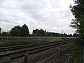 Railway line from Leicester to Peterborough - geograph.org.uk - 5057577.jpg 2,000 × 1,500; 339 KB
-

-
 River bend Broome Lane, East Goscote - geograph.org.uk - 936382.jpg 640 × 480; 142 KB
-
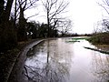
 River Wreake in autumn - geograph.org.uk - 3756205.jpg 1,280 × 960; 610 KB
-
 Road and river - geograph.org.uk - 936357.jpg 640 × 480; 98 KB
-
 Saiston Sheet Metal - geograph.org.uk - 4431983.jpg 640 × 375; 27 KB
-

-
 Warren Way - geograph.org.uk - 3756236.jpg 1,280 × 960; 203 KB
-
 East Goscote, Leicestershire - geograph.org.uk - 141432.jpg 640 × 427; 99 KB
-
 East Goscote, Leicestershire - geograph.org.uk - 50034.jpg 640 × 480; 97 KB


