Category:East Hanney
village and civil parish in Vale of White Horse district, Oxfordshire, England  | |||||
| Upload media | |||||
| Instance of | |||||
|---|---|---|---|---|---|
| Location | Vale of White Horse, Oxfordshire, South East England, England | ||||
| official website | |||||
 | |||||
English: East Hanney is a village and civil parish in the Vale of White Horse district, in the county of Oxfordshire, England.
Subcategories
This category has the following 4 subcategories, out of 4 total.
E
- Hanney Chapel (3 F)
- Lower Mill, East Hanney (3 F)
Media in category "East Hanney"
The following 163 files are in this category, out of 163 total.
-
 A bridge over Childrey Brook - geograph.org.uk - 4889632.jpg 1,500 × 1,125; 320 KB
-
 A338 near Grove - geograph.org.uk - 4427955.jpg 3,264 × 2,448; 2.31 MB
-
 A338 towards Frilford - geograph.org.uk - 6269066.jpg 800 × 600; 103 KB
-
 A338 towards Frilford - geograph.org.uk - 6269074.jpg 800 × 600; 86 KB
-
 Allotments, East Hanney - geograph.org.uk - 2737431.jpg 1,600 × 1,138; 596 KB
-
 An arable field near Landmead Farm - geograph.org.uk - 4883205.jpg 1,500 × 1,125; 153 KB
-
 Arable field near East Hanney - geograph.org.uk - 3768487.jpg 1,500 × 999; 215 KB
-
 Away from the canal - geograph.org.uk - 1195626.jpg 400 × 600; 103 KB
-
 Back to the barns - geograph.org.uk - 1191764.jpg 640 × 426; 44 KB
-
 Bad bend - geograph.org.uk - 1192169.jpg 640 × 426; 37 KB
-
 Bales Above Water - geograph.org.uk - 3808664.jpg 1,600 × 1,200; 658 KB
-
 Barn and farmland, East Hanney - geograph.org.uk - 2678837.jpg 640 × 480; 131 KB
-
 Barn and oilseed rape crop - geograph.org.uk - 4427963.jpg 3,264 × 2,448; 3.21 MB
-

-
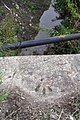 Benchmark on Hanney Road culvert - geograph.org.uk - 2756441.jpg 683 × 1,024; 256 KB
-

-
 Benchmark on Mill House, Mill Orchard - geograph.org.uk - 2421174.jpg 683 × 1,024; 264 KB
-

-
 Benchmark on wooden gatepost beside Cow Lane - geograph.org.uk - 2420524.jpg 683 × 1,024; 159 KB
-
 Benchmark on ^1 Steventon Road - geograph.org.uk - 2592133.jpg 683 × 1,024; 307 KB
-
 Bend in the Roman Road - geograph.org.uk - 6133067.jpg 5,002 × 3,190; 2.5 MB
-
 Blenheim Avenue, East Hanney - geograph.org.uk - 2651726.jpg 3,552 × 2,532; 1.83 MB
-
 Bridge by the canal - geograph.org.uk - 1192209.jpg 640 × 426; 109 KB
-
 Bridge over a farm track - geograph.org.uk - 1539380.jpg 640 × 427; 77 KB
-
 Bridge over the ditch - geograph.org.uk - 1192161.jpg 640 × 426; 64 KB
-
 Bridge over the old canal - geograph.org.uk - 1539395.jpg 640 × 427; 63 KB
-
 Bridge taking Hanney Road over Portobello Ditch - geograph.org.uk - 2756446.jpg 1,024 × 683; 153 KB
-
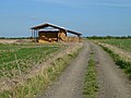
 Bridleway (concrete road) leading to Common Barn - geograph.org.uk - 2628285.jpg 1,024 × 683; 213 KB
-
 Bridleway next to ploughed field - geograph.org.uk - 4883199.jpg 1,500 × 1,109; 307 KB
-
 Bridleway to Drayton - geograph.org.uk - 4883210.jpg 1,125 × 1,500; 448 KB
-
 Bridleway to Landmead Farm - geograph.org.uk - 4883200.jpg 1,500 × 1,125; 204 KB
-
 Bridleway, Landmead Farm - geograph.org.uk - 4444080.jpg 3,900 × 3,000; 2.72 MB
-
 Brookside, East Hanney - geograph.org.uk - 6269872.jpg 4,920 × 3,316; 3.37 MB
-
 Building by the canal - geograph.org.uk - 1197131.jpg 640 × 426; 116 KB
-
 Bullrushes in the Brook - geograph.org.uk - 3812233.jpg 1,600 × 1,153; 535 KB
-
 Butterfly Lane Crossing near Grove - geograph.org.uk - 1539398.jpg 640 × 427; 88 KB
-
 Cattle in a field near East Hanney - geograph.org.uk - 3020822.jpg 1,500 × 1,000; 170 KB
-
 Cereal crop off the A338 - geograph.org.uk - 6269067.jpg 800 × 600; 109 KB
-
 Childrey Brook near Marcham - geograph.org.uk - 5032129.jpg 1,125 × 1,500; 304 KB
-
 Childrey Brook near Marcham - geograph.org.uk - 5032132.jpg 1,500 × 1,125; 271 KB
-
 Cottage garden - geograph.org.uk - 1197154.jpg 640 × 426; 105 KB
-
 Cottages on Steventon Road - geograph.org.uk - 113746.jpg 640 × 481; 50 KB
-
 Cottages, East Hanney - geograph.org.uk - 2653992.jpg 3,648 × 2,736; 1.38 MB
-
 Cow Common Brook - geograph.org.uk - 3812348.jpg 1,024 × 768; 281 KB
-
 Cow Lane on the approach to West Hanney - geograph.org.uk - 2424875.jpg 1,024 × 683; 292 KB
-

-
 Culvert for ditch under path E of Landmead Farm - geograph.org.uk - 3340862.jpg 1,024 × 683; 320 KB
-
 Culvert over drain at Landmead Farm - geograph.org.uk - 3340526.jpg 1,024 × 683; 327 KB
-
 Culvert parapet on south side of Steventon Road - geograph.org.uk - 2592044.jpg 1,024 × 683; 150 KB
-
 Cut silage field near Common Barn - geograph.org.uk - 6269077.jpg 800 × 600; 91 KB
-
 Debris in the drain - geograph.org.uk - 1197937.jpg 400 × 600; 70 KB
-
 Derelict Shed, East Hanney - geograph.org.uk - 3808643.jpg 1,600 × 1,200; 880 KB
-
 Ditch and culvert top near Landmead Farm - geograph.org.uk - 3340809.jpg 1,024 × 683; 391 KB
-
 Ditch by the canal - geograph.org.uk - 1192213.jpg 640 × 426; 111 KB
-
 Ditch or spillway - geograph.org.uk - 1194174.jpg 400 × 600; 100 KB
-
 Letcombe Brook in East Hanney - geograph.org.uk - 1472256.jpg 640 × 427; 103 KB
-
 Philberds Manor in East Hanney - geograph.org.uk - 1472241.jpg 640 × 411; 75 KB
-
 The War Memorial Hall in East Hanney - geograph.org.uk - 1472216.jpg 640 × 427; 48 KB
-
 East Hanney School - geograph.org.uk - 2428795.jpg 1,024 × 683; 161 KB
-
 East Hanney.jpg 640 × 479; 141 KB
-
 Edge of the field - geograph.org.uk - 1192155.jpg 640 × 426; 38 KB
-
 Electric fence round the field - geograph.org.uk - 3020815.jpg 1,500 × 1,000; 338 KB
-
 Elizabeth II postbox on Brookside, East Hanney - geograph.org.uk - 6269871.jpg 2,567 × 4,645; 2.38 MB
-
 Farm buildings in the distance - geograph.org.uk - 1191729.jpg 640 × 426; 46 KB
-
-
 Farmland, East Hanney - geograph.org.uk - 2678841.jpg 640 × 480; 131 KB
-
 Farmland, East Hanney - geograph.org.uk - 6185684.jpg 1,024 × 683; 240 KB
-
 Farmland, East Hanney - geograph.org.uk - 6185686.jpg 1,024 × 683; 202 KB
-
 Field edge by Landmead Farm - geograph.org.uk - 4883202.jpg 1,500 × 1,125; 222 KB
-
 Field of Reeds - geograph.org.uk - 3808672.jpg 1,024 × 740; 247 KB
-
 Field of wheat at East Hanney - geograph.org.uk - 3020802.jpg 1,500 × 1,000; 221 KB
-
 Footpath by the barn - geograph.org.uk - 3020817.jpg 1,500 × 1,000; 173 KB
-
 Footpath to East Hanney - geograph.org.uk - 3020813.jpg 1,500 × 992; 151 KB
-
 Footpath to East Hanney - geograph.org.uk - 3020819.jpg 1,500 × 1,000; 254 KB
-
 Footpath to the A338 - geograph.org.uk - 3019568.jpg 1,500 × 1,000; 355 KB
-
 Footpath to the A338 - geograph.org.uk - 3019569.jpg 1,500 × 1,000; 394 KB
-
 Footpath to the A338 - geograph.org.uk - 3019570.jpg 1,500 × 1,000; 346 KB
-
 Footpath to the former Wilts & Berks Canal - geograph.org.uk - 3020800.jpg 1,500 × 1,000; 180 KB
-
 Footpath to the former Wilts & Berks Canal - geograph.org.uk - 3020801.jpg 1,500 × 1,000; 162 KB
-
 Footpath to the former Wilts & Berks Canal - geograph.org.uk - 3020808.jpg 1,500 × 1,000; 283 KB
-
 Gap in the Hedge - geograph.org.uk - 3812353.jpg 1,024 × 723; 275 KB
-
 Gate on a track - geograph.org.uk - 6133069.jpg 5,160 × 3,271; 3.08 MB
-
 Gate on the footpath - geograph.org.uk - 3020798.jpg 1,500 × 1,000; 234 KB
-
 Gate to Dews Meadow Farm - geograph.org.uk - 3020826.jpg 1,500 × 1,000; 333 KB
-
 Gated farm track (footpath) off the A338 - geograph.org.uk - 6269058.jpg 800 × 600; 111 KB
-
 Gated farm track off the A338 - geograph.org.uk - 6269070.jpg 800 × 600; 106 KB
-
 Hanney War Memorial Hall - geograph.org.uk - 6268587.jpg 800 × 456; 57 KB
-
 Former Church of St James, East Hanney - geograph.org.uk - 1543437.jpg 640 × 403; 101 KB
-

-

-
 La Fontana restaurant - geograph.org.uk - 2628315.jpg 1,024 × 683; 190 KB
-
 Landmead Lane and bridleway - geograph.org.uk - 1472290.jpg 640 × 427; 58 KB
-
 Letcombe Brook at East Hanney - geograph.org.uk - 2655588.jpg 3,520 × 2,664; 2.49 MB
-
 Looking out - geograph.org.uk - 1192227.jpg 400 × 600; 106 KB
-
 Main Street in East Hanney - geograph.org.uk - 1472206.jpg 640 × 403; 61 KB
-
 Mast by the canal - geograph.org.uk - 1197104.jpg 400 × 600; 50 KB
-
 Milestone on the A338 near East Hanney - geograph.org.uk - 6269055.jpg 5,147 × 3,617; 4.18 MB
-
 Mill House, Mill Orchard - geograph.org.uk - 2428808.jpg 1,024 × 683; 259 KB
-
 Mill House, Mill Orchard - geograph.org.uk - 6268597.jpg 800 × 494; 98 KB
-
 Mill Orchard junction with Main Street and Summertown - geograph.org.uk - 3066375.jpg 3,402 × 2,565; 1.32 MB
-
 Monitoring Borehole, East Hanney - geograph.org.uk - 3808657.jpg 1,600 × 1,200; 680 KB
-
 My Place - geograph.org.uk - 1191717.jpg 640 × 426; 70 KB
-
 Old Barns and sheep in field - geograph.org.uk - 2756351.jpg 1,024 × 683; 163 KB
-
 Outside The Pub, East Hanney - geograph.org.uk - 2651747.jpg 3,608 × 2,580; 1.26 MB
-
 Power lines over the track - geograph.org.uk - 3020810.jpg 1,500 × 1,000; 134 KB
-
 Reeds beside ditch - geograph.org.uk - 3338797.jpg 683 × 1,024; 267 KB
-

-
 Road, East Hanney - geograph.org.uk - 2678827.jpg 640 × 480; 102 KB
-
 Rollers in the grass - geograph.org.uk - 1192145.jpg 640 × 426; 71 KB
-
 Sign along the footpath - geograph.org.uk - 1191731.jpg 640 × 426; 65 KB
-
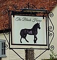 Sign for the Black Horse, East Hanney - geograph.org.uk - 6268604.jpg 763 × 800; 152 KB
-
 Snuggs Barn, East Hanney - geograph.org.uk - 3244932.jpg 2,560 × 1,920; 1.07 MB
-
 Snuggs Lane, East Hanney - geograph.org.uk - 2664678.jpg 3,648 × 2,736; 2.97 MB
-
 Steventon Road near East Hanney - geograph.org.uk - 1469563.jpg 640 × 427; 78 KB
-
 Steventon Road near East Hanney - geograph.org.uk - 1469566.jpg 640 × 427; 81 KB
-
 Steventon Road near East Hanney - geograph.org.uk - 1469593.jpg 640 × 415; 82 KB
-
 Steventon Road near East Hanney - geograph.org.uk - 1472182.jpg 640 × 414; 74 KB
-
 Tanks ^ Ploughshares - geograph.org.uk - 4443379.jpg 3,936 × 2,892; 2.2 MB
-

-

-

-
 The A338 at East Hanney - geograph.org.uk - 1876191.jpg 640 × 480; 71 KB
-
 The A338 out of East Hanney - geograph.org.uk - 1876210.jpg 640 × 480; 93 KB
-
 The Black Horse at East Hanney - geograph.org.uk - 1472189.jpg 640 × 410; 72 KB
-
 The Black Horse, East Hanney - geograph.org.uk - 6268601.jpg 800 × 534; 80 KB
-
 The canal bed - geograph.org.uk - 1192221.jpg 400 × 600; 104 KB
-
 The Causeway enters East Hanney - geograph.org.uk - 3066371.jpg 3,273 × 2,469; 1.02 MB
-
 The Cow Common Brook - geograph.org.uk - 3812204.jpg 1,600 × 1,200; 576 KB
-
 The Green, East Hanney - geograph.org.uk - 6268661.jpg 800 × 600; 124 KB
-
 The Royal British Legion Hanney - geograph.org.uk - 6268598.jpg 800 × 586; 99 KB
-
 The start - geograph.org.uk - 1191709.jpg 400 × 600; 97 KB
-
 The way in - geograph.org.uk - 1197159.jpg 640 × 426; 108 KB
-
 Through the bridge - geograph.org.uk - 1192289.jpg 640 × 426; 80 KB
-
 Towards Bradfield barn - geograph.org.uk - 1191751.jpg 640 × 426; 55 KB
-
 Towards cow common - geograph.org.uk - 1191745.jpg 640 × 426; 55 KB
-
 Track along the edge of the field - geograph.org.uk - 1469515.jpg 640 × 414; 79 KB
-
 Track approaching Landmead Farm - geograph.org.uk - 3340803.jpg 1,024 × 683; 213 KB
-
 Track at East Hanney - geograph.org.uk - 3020804.jpg 1,500 × 1,000; 196 KB
-
 Turning to Steventon - geograph.org.uk - 1876200.jpg 640 × 480; 52 KB
-

-
 View across A338 including milestone - geograph.org.uk - 2626101.jpg 1,024 × 683; 204 KB
-
 View NE along the A338 - geograph.org.uk - 2428830.jpg 1,024 × 683; 205 KB
-
 Water in this part - geograph.org.uk - 1192246.jpg 400 × 600; 105 KB
-
 Wrong turning - geograph.org.uk - 1191771.jpg 400 × 600; 132 KB
-
 Ye Olde Housen - geograph.org.uk - 2658155.jpg 3,560 × 2,556; 1.81 MB
-
-
 Along the avenue - geograph.org.uk - 1192275.jpg 640 × 426; 99 KB
-
 Arable field near East Hanney - geograph.org.uk - 1469554.jpg 640 × 427; 95 KB
-
 Arable field near East Hanney - geograph.org.uk - 1469560.jpg 640 × 419; 105 KB
-
 Arable field near East Hanney - geograph.org.uk - 1472284.jpg 640 × 427; 87 KB
-
 Brick houses in East Hanney - geograph.org.uk - 309207.jpg 640 × 480; 78 KB
-
 Bridleway to Marcham - geograph.org.uk - 1469572.jpg 640 × 407; 81 KB
-
 Bridleway to the Wilts and Berks Canal - geograph.org.uk - 1469580.jpg 640 × 404; 108 KB
-
 Cow Common - geograph.org.uk - 8906.jpg 640 × 448; 121 KB
-
 Farm at Ardington Wick - geograph.org.uk - 66625.jpg 640 × 480; 74 KB
-

-
 Fields north of Ardington Wick - geograph.org.uk - 66627.jpg 640 × 480; 112 KB
-
 Neville's Farm - geograph.org.uk - 57833.jpg 640 × 480; 131 KB
-
 Railway bridge over farm track - geograph.org.uk - 66629.jpg 640 × 480; 102 KB
-
 Tulwick Farm near Grove - geograph.org.uk - 57829.jpg 640 × 480; 147 KB
-
 Vale Housing Association offices - geograph.org.uk - 309167.jpg 640 × 480; 92 KB
-
 Vale of the White Horse - geograph.org.uk - 8659.jpg 640 × 426; 77 KB
-
 ^1 and ^2 Steventon Road - geograph.org.uk - 2590813.jpg 1,024 × 683; 185 KB


_leading_to_Common_Barn_-_geograph.org.uk_-_2628285.jpg)


_off_the_A338_-_geograph.org.uk_-_6269058.jpg)


_towards_Landmead_Farm_-_geograph.org.uk_-_6269079.jpg)


