Category:East Malling
village in Kent, England .JPG) | |||||
| Upload media | |||||
| Instance of | |||||
|---|---|---|---|---|---|
| Location | East Malling and Larkfield, Tonbridge and Malling, Kent, South East England, England | ||||
 | |||||
Subcategories
This category has the following 9 subcategories, out of 9 total.
E
- East Malling railway station (4 F)
- East Malling War Memorial (1 F)
G
- Gravesend War Memorial (1 F)
K
- King and Queen, East Malling (4 F)
L
- Leybourne War Memorial (1 F)
O
Media in category "East Malling"
The following 34 files are in this category, out of 34 total.
-
 A shady arch - geograph.org.uk - 1222262.jpg 640 × 480; 246 KB
-
 Blacklands footpath, East Malling - geograph.org.uk - 2084733.jpg 640 × 430; 131 KB
-
 Blacklands, East Malling - geograph.org.uk - 2084850.jpg 640 × 430; 124 KB
-
 Bone Alley - geograph.org.uk - 2084726.jpg 640 × 430; 104 KB
-
 Bone Alley, East Malling - geograph.org.uk - 2084724.jpg 640 × 430; 113 KB
-
 Bridleway Not Far From East Malling - geograph.org.uk - 194960.jpg 640 × 480; 58 KB
-
 Converted Mill - geograph.org.uk - 1175844.jpg 481 × 640; 126 KB
-
 East Malling Research Logo.jpg 179 × 182; 10 KB
-
 East Malling Research Station - geograph.org.uk - 147095.jpg 640 × 427; 222 KB
-

-

-
 Footpath on Kiln Barn Road - geograph.org.uk - 1144103.jpg 640 × 481; 110 KB
-
 Four Acres, East Malling - geograph.org.uk - 2111358.jpg 3,448 × 2,125; 2.6 MB
-
 Invicta Works - geograph.org.uk - 2084435.jpg 640 × 430; 112 KB
-

-
 Larch Tree on footpath - geograph.org.uk - 1145573.jpg 481 × 640; 127 KB
-
 Level Crossing on East Malling footpath - geograph.org.uk - 1144112.jpg 640 × 481; 133 KB
-
 Mill Street, East Malling - geograph.org.uk - 1306894.jpg 640 × 480; 87 KB
-
 Orchard at East Malling - geograph.org.uk - 1228239.jpg 640 × 480; 183 KB
-
 Railbridge over Kiln Barn Road - geograph.org.uk - 1144093.jpg 640 × 481; 115 KB
-
 Railway bridge, East Malling - geograph.org.uk - 1306916.jpg 640 × 480; 89 KB
-
 Railway east of East Malling - geograph.org.uk - 1222277.jpg 640 × 480; 274 KB
-
 The Barracks, East Malling 01.jpg 5,152 × 3,864; 4.51 MB
-
 The Barracks, East Malling 02.jpg 5,152 × 3,864; 4.38 MB
-
 The Barracks, East Malling 03.jpg 5,152 × 3,864; 9.82 MB
-
 The Rocks Road, East Malling - geograph.org.uk - 1306901.jpg 640 × 480; 78 KB
-
 Triangular footpath junction - geograph.org.uk - 1144140.jpg 640 × 481; 134 KB
-
-

-

-
 Weir Mill, Mill St - geograph.org.uk - 2084520.jpg 640 × 430; 155 KB
-
 Weir Mill, Mill St - geograph.org.uk - 2084524.jpg 640 × 430; 129 KB
-
 Well Street - geograph.org.uk - 25870.jpg 640 × 480; 205 KB
-
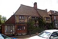
 Yeoman's Hall, East Malling, Kent - geograph.org.uk - 145726.jpg 640 × 480; 76 KB


,_New_Road,_East_Malling_(July_2012).JPG)


