Category:East Pleasanton
Collection of photos of the East Pleasanton Specific Plan area.
Media in category "East Pleasanton"
The following 27 files are in this category, out of 27 total.
-
 Arroyo Mocho with Pleasanton Ridge and Hangar One Blimp.jpg 3,264 × 1,836; 1,021 KB
-
 Behind the Pleasanton Garbage Transfer Station.jpg 3,264 × 1,836; 1.24 MB
-
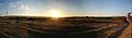
 East Pleasanton Sunset Panorama.jpg 1,396 × 464; 242 KB
-
 Kaiser Sand & Gravel Building and Office.jpg 3,264 × 1,836; 1.38 MB
-
 Kaiser Sand & Gravel Building Crane.jpg 3,264 × 1,836; 1.36 MB
-
 Kaiser Sand & Gravel Building Panorama.jpg 1,020 × 460; 332 KB
-
 Kaiser Sand & Gravel Property Buildings.jpg 3,264 × 1,836; 1.2 MB
-
 Kaiser Sand & Gravel Sunset Panorama.jpg 1,580 × 464; 489 KB
-
 Kiewit Property Buildings.jpg 3,264 × 1,836; 1.67 MB
-
 Kiewit Property Panorama with Pleasanton Garbage Transfer Station.jpg 1,958 × 468; 744 KB
-
 Looking North on El Charro Rd..jpg 3,264 × 1,836; 1.35 MB
-
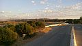
 Mt. Diablo from end of Busch Rd..jpg 3,264 × 1,836; 1.38 MB
-
 Paragon Outlets Construction at Dusk.jpg 3,264 × 1,836; 1.08 MB
-
 Pleasanton Garbage Old Gas Pump.jpg 1,836 × 3,264; 1.19 MB
-
 Pleasanton Garbage Service Front-loader.jpg 3,264 × 1,840; 1.49 MB
-
 Pleasanton Garbage Service Trucks.jpg 3,264 × 1,836; 1.63 MB
-
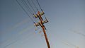 Power Pole Along El Charro Rd..jpg 3,264 × 1,836; 1.13 MB
-
 Southeast Pleasanton Hills in Distance.jpg 3,264 × 1,836; 1.46 MB
-
 Southeast Pleasanton Hills with Kaiser Sand & Gravel Property.jpg 3,264 × 1,836; 1.45 MB
-
 Vehicle Springs.jpg 3,264 × 1,840; 1.32 MB
-
 Zone 7 Building off El Charro Rd..jpg 3,264 × 1,836; 1.27 MB
-
 Zone 7 Lake "H" with Zone 7 Building.jpg 3,264 × 1,836; 1.03 MB
-
 Zone 7 Lake "I" Panorama.jpg 1,686 × 466; 625 KB
-
 Zone 7 Lake "I" Sunset.jpg 638 × 480; 214 KB
-
 Zone 7 Lake "I" with Pleasanton Ridge.jpg 3,264 × 1,836; 1.41 MB
-
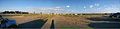
 Zone 7 Property Panorama.jpg 2,066 × 468; 694 KB
-
 Zonen 7 Property with Bushy Peak.jpg 3,264 × 1,836; 1.32 MB


