Category:Eastrington
English: Eastrington is a small village and civil parish in the East Riding of Yorkshire, England. It is situated approximately 3 miles (4.8 km) to the east of Howden.
village in the United Kingdom  | |||||
| Upload media | |||||
| Instance of | |||||
|---|---|---|---|---|---|
| Location | East Riding of Yorkshire, Yorkshire and the Humber, England | ||||
 | |||||
Subcategories
This category has the following 6 subcategories, out of 6 total.
Media in category "Eastrington"
The following 200 files are in this category, out of 353 total.
(previous page) (next page)-
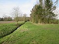
 "New Drain" - geograph.org.uk - 217787.jpg 640 × 480; 98 KB
-
 A Bridleway To Saltmarshe Grange - geograph.org.uk - 217788.jpg 640 × 479; 100 KB
-
 A Bridleway towards Manor Farm - geograph.org.uk - 2112341.jpg 800 × 600; 344 KB
-
 A farm track near Common Wood - geograph.org.uk - 2112344.jpg 800 × 600; 302 KB
-

-
 A record breaker - geograph.org.uk - 2392834.jpg 800 × 600; 308 KB
-
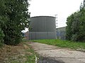 A Storage Tank - geograph.org.uk - 248005.jpg 640 × 480; 105 KB
-
 A614 and access road to Burland Farm on the right - geograph.org.uk - 6102948.jpg 4,608 × 3,456; 5.86 MB
-
 A614 Burland Common - geograph.org.uk - 1299040.jpg 640 × 480; 59 KB
-
 A614 Caville Bridge - geograph.org.uk - 1299037.jpg 640 × 441; 58 KB
-
 A614 closed by sinkhole - geograph.org.uk - 4921529.jpg 1,024 × 768; 212 KB
-

-
 A614 near Caville Bridge - geograph.org.uk - 5922721.jpg 1,024 × 758; 110 KB
-
 A614 near Poplar Farm - geograph.org.uk - 5922726.jpg 1,024 × 774; 132 KB
-
 A614 Railway Bridge Near Cavil - geograph.org.uk - 235977.jpg 640 × 426; 139 KB
-
 A614 Thorpe Road leaving Howden - geograph.org.uk - 5922717.jpg 1,024 × 777; 125 KB
-
 A614 towards Howden - geograph.org.uk - 2024112.jpg 640 × 480; 68 KB
-
 A614 towards Howden, Caville Bridge - geograph.org.uk - 2024117.jpg 640 × 480; 65 KB
-
 Access road and footpath to Burland Farm - geograph.org.uk - 6102953.jpg 4,608 × 3,456; 3.81 MB
-
 Access to a wind turbine - geograph.org.uk - 4623179.jpg 1,024 × 768; 158 KB
-
 Approaching Manor Farm - geograph.org.uk - 3699733.jpg 1,024 × 768; 345 KB
-
 Approaching the junction with B1230 Main Road - geograph.org.uk - 6102978.jpg 4,608 × 3,456; 2.93 MB
-

-

-
 Autumn bounty - geograph.org.uk - 3692915.jpg 1,024 × 768; 282 KB
-
 B1230 towards Howden - geograph.org.uk - 5662990.jpg 640 × 480; 50 KB
-
 Balkholme common Layby on the B1230 heading West - geograph.org.uk - 4486102.jpg 1,024 × 768; 207 KB
-

-
 Below the embankment - geograph.org.uk - 3692877.jpg 1,024 × 768; 272 KB
-
 Bend in driveway to Burland - geograph.org.uk - 4921532.jpg 1,024 × 768; 151 KB
-
 Between the motorway and the railway - geograph.org.uk - 4623163.jpg 1,024 × 768; 164 KB
-
 Beware of bees^ - geograph.org.uk - 4623150.jpg 1,024 × 768; 237 KB
-
 Boothferry and Airmyn, aerial 2016 - geograph.org.uk - 5085085.jpg 640 × 427; 45 KB
-
 Boothferry, aerial 2016 - geograph.org.uk - 5085106.jpg 640 × 427; 53 KB
-
 Borrow pit - geograph.org.uk - 3692943.jpg 1,024 × 768; 230 KB
-
 Bridleway from Manor Farm - geograph.org.uk - 3699728.jpg 1,024 × 768; 187 KB
-
 Bridleway towards Ings Wood - geograph.org.uk - 2325051.jpg 1,600 × 1,200; 507 KB
-
 Burland Common - geograph.org.uk - 593025.jpg 478 × 640; 141 KB
-
 Burland Lane (track) - geograph.org.uk - 2024108.jpg 640 × 480; 102 KB
-
 Burland Lane (track) and dismantled railway - geograph.org.uk - 6102968.jpg 4,608 × 3,456; 6.65 MB
-
 Burland Lane - geograph.org.uk - 1247226.jpg 640 × 480; 118 KB
-
 Burland Lane - geograph.org.uk - 593003.jpg 640 × 477; 144 KB
-
 Burland Lane - geograph.org.uk - 593026.jpg 451 × 640; 142 KB
-
 Burland Lane Crossing - geograph.org.uk - 593009.jpg 523 × 640; 138 KB
-
 By the A614, Portington - geograph.org.uk - 5435873.jpg 640 × 425; 31 KB
-
-
 Carr Lane - geograph.org.uk - 5663376.jpg 640 × 480; 39 KB
-
 Carr Lane - geograph.org.uk - 6079215.jpg 1,024 × 768; 232 KB
-
 Carr Lane leaving Eastrington - geograph.org.uk - 6100222.jpg 4,608 × 3,456; 4.9 MB
-
 Caville Bridge - geograph.org.uk - 593032.jpg 461 × 640; 85 KB
-
 Caville Hall Farm - geograph.org.uk - 4922697.jpg 1,024 × 768; 206 KB
-
 Caville Hall Farm and Cottages - geograph.org.uk - 1299311.jpg 640 × 480; 41 KB
-
 Church View from Pinfold Street Eastrington - geograph.org.uk - 6100171.jpg 4,608 × 3,456; 3.25 MB
-
 Close up, Elizabeth II postbox on Station Road, Newland - geograph.org.uk - 5663094.jpg 1,456 × 2,786; 737 KB
-
 Common end Drain - geograph.org.uk - 6079240.jpg 1,024 × 768; 245 KB
-
 Crates at Manor Farm, Owsthorpe - geograph.org.uk - 5039991.jpg 640 × 427; 64 KB
-

-
 Crop field towards strip woodland - geograph.org.uk - 5663386.jpg 640 × 480; 101 KB
-
 Crop field towards woodland - geograph.org.uk - 5663373.jpg 640 × 480; 63 KB
-
 Crossing Skelton Common - geograph.org.uk - 248014.jpg 640 × 480; 101 KB
-
 Crossing the railway - geograph.org.uk - 3692881.jpg 1,024 × 768; 270 KB
-
 Dead Straight - geograph.org.uk - 218670.jpg 640 × 480; 98 KB
-
 Dead tree beside Carr Lane - geograph.org.uk - 5663411.jpg 640 × 587; 91 KB
-
 Deer in Gilberdyke Field - geograph.org.uk - 5053866.jpg 1,200 × 799; 362 KB
-
 Derelict farm buildings, Filbert Grove Farm - geograph.org.uk - 2325013.jpg 1,600 × 1,200; 264 KB
-
 Derelict muck-spreader on Rudding Lane - geograph.org.uk - 3692891.jpg 1,024 × 768; 312 KB
-
 Dismantled railway line Eastrington - geograph.org.uk - 6100238.jpg 4,608 × 3,456; 4.6 MB
-
 Dismantled railway now a track through fields - geograph.org.uk - 6100245.jpg 4,608 × 3,456; 4.3 MB
-
-
 Drain beside Carr Lane - geograph.org.uk - 5663393.jpg 640 × 480; 69 KB
-
 Drain beside Milkingstile Lane - geograph.org.uk - 5663413.jpg 640 × 480; 89 KB
-

-
 Drain Lane (track) joins the A614 at Caville Bridge - geograph.org.uk - 6102921.jpg 4,608 × 3,456; 4.99 MB
-
 Drain Lane (track) toward North Howden - geograph.org.uk - 6102608.jpg 4,608 × 3,456; 5.79 MB
-
 Drain Lane - geograph.org.uk - 593169.jpg 640 × 501; 134 KB
-
 Drain near Hive Lane Cottage - geograph.org.uk - 5663446.jpg 640 × 480; 80 KB
-
 Duckingham Palace - geograph.org.uk - 6079305.jpg 1,024 × 768; 354 KB
-
 Duckingham Palace at Eastrington - geograph.org.uk - 1364836.jpg 640 × 480; 105 KB
-
 Eastbound M62 at Newland - geograph.org.uk - 6187168.jpg 1,024 × 768; 143 KB
-
 Eastrington - geograph.org.uk - 2653747.jpg 640 × 426; 49 KB
-
 Eastrington Bridge - geograph.org.uk - 592996.jpg 640 × 474; 121 KB
-
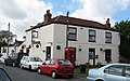
 Eastrington High Street.jpg 640 × 412; 181 KB
-
 Eastrington level crossing - geograph.org.uk - 1317580.jpg 640 × 420; 203 KB
-
 Eastrington Methodist Church - geograph.org.uk - 224352.jpg 432 × 285; 15 KB
-
 Eastrington Methodist Church - geograph.org.uk - 5663081.jpg 640 × 480; 58 KB
-
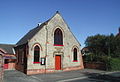 Eastrington Methodist Church.jpg 640 × 436; 73 KB
-
 Eastrington Pond Nature Reserve - geograph.org.uk - 6207127.jpg 1,024 × 768; 134 KB
-
 Eastrington Ponds Nature Reserve - geograph.org.uk - 6100142.jpg 4,608 × 3,456; 5.89 MB
-
 Eastrington Railway Station - geograph.org.uk - 5663037.jpg 640 × 480; 62 KB
-
 Eastrington railway station, Yorkshire - geograph.org.uk - 3258724.jpg 1,024 × 768; 183 KB
-
 Eastrington Station from Station Road level crossing - geograph.org.uk - 6100201.jpg 4,608 × 3,456; 3.61 MB
-
 Eastrington to Sandholme Road - geograph.org.uk - 173948.jpg 640 × 480; 49 KB
-
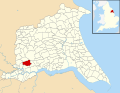 Eastrington UK parish locator map.svg 1,425 × 1,107; 1.68 MB
-

-
 Elizabeth II postbox on High Street, Eastrington - geograph.org.uk - 5663103.jpg 1,123 × 2,045; 451 KB
-

-
 Elm Villa - geograph.org.uk - 5662996.jpg 640 × 480; 57 KB
-
 Entering Eastrington - geograph.org.uk - 1248428.jpg 640 × 480; 63 KB
-
 Entering Howden, A614 - geograph.org.uk - 5435880.jpg 640 × 361; 64 KB
-
 Entrance to Home Farm on Long Lane - geograph.org.uk - 4158283.jpg 1,600 × 1,064; 590 KB
-
 Entrance to Seven Acres and track going south - geograph.org.uk - 6100161.jpg 4,608 × 3,456; 4.6 MB
-
 Farm building - geograph.org.uk - 1978264.jpg 800 × 600; 97 KB
-
 Farm buildings down Sleights Lane - geograph.org.uk - 2112328.jpg 800 × 600; 318 KB
-
 Farm buildings, Newland Farm - geograph.org.uk - 5663007.jpg 640 × 480; 72 KB
-
 Farm buildings, Saltmarshe Grange - geograph.org.uk - 3692906.jpg 1,024 × 768; 127 KB
-
 Farm by Portington Road - geograph.org.uk - 5037337.jpg 640 × 427; 59 KB
-

-
 Farm track - geograph.org.uk - 6079222.jpg 1,024 × 768; 186 KB
-
 Farm track - geograph.org.uk - 6079229.jpg 1,024 × 768; 187 KB
-
 Farm track beside drain - geograph.org.uk - 5663454.jpg 640 × 480; 61 KB
-
 Farm track leading to a M62 farm underpass - geograph.org.uk - 5053831.jpg 1,200 × 799; 421 KB
-
 Farm track leading to a M62 farm underpass - geograph.org.uk - 5053837.jpg 1,200 × 799; 365 KB
-
 Farm track leading to Carter's Plantation - geograph.org.uk - 5053744.jpg 1,200 × 799; 392 KB
-
 Farm track leading to Carter's Plantation - geograph.org.uk - 5053751.jpg 1,200 × 799; 374 KB
-
 Farm track leading to Carter's Plantation - geograph.org.uk - 5053759.jpg 1,200 × 799; 423 KB
-
 Farm track leading to Carter's Plantation - geograph.org.uk - 5053765.jpg 1,200 × 799; 454 KB
-
 Farm track near Eastrington - geograph.org.uk - 3692935.jpg 1,024 × 768; 159 KB
-
 Farm track near Eastrington Station - geograph.org.uk - 1477208.jpg 640 × 480; 86 KB
-
 Farm track, Eastrington - geograph.org.uk - 2325020.jpg 1,600 × 1,200; 493 KB
-

-
 Farmland near Eastrington - geograph.org.uk - 2325046.jpg 1,600 × 1,200; 521 KB
-
 Farmland near Owsthorpe - geograph.org.uk - 2325061.jpg 1,600 × 1,200; 542 KB
-
 Farmland near Portington - geograph.org.uk - 2024045.jpg 640 × 480; 92 KB
-
 Farmland, Eastrington - geograph.org.uk - 2325029.jpg 1,600 × 1,200; 256 KB
-
 Farmland, Portington Common - geograph.org.uk - 2024035.jpg 640 × 480; 111 KB
-
 Featherbed Lane (track) (geograph 6101782).jpg 4,608 × 3,456; 5.08 MB
-
 Featherbed Lane (track) toward A614 - geograph.org.uk - 6101770.jpg 4,608 × 3,456; 6.05 MB
-
 Featherbed Lane (track) toward Wood Lane - geograph.org.uk - 6101773.jpg 4,608 × 3,456; 6.26 MB
-
 Featherbed Lane - geograph.org.uk - 4917145.jpg 1,024 × 768; 326 KB
-
 Featherbed Lane off Wood Lane (geograph 5486551).jpg 1,600 × 1,065; 895 KB
-
 Featherbed Lane off Wood Lane - geograph.org.uk - 5486553.jpg 1,600 × 1,065; 904 KB
-
 Featherbed Lane off Wood Lane - geograph.org.uk - 5486555.jpg 1,600 × 1,065; 964 KB
-

-
 Field boundary near Eastrington - geograph.org.uk - 3690045.jpg 1,024 × 768; 189 KB
-
 Field drain off Long Lane - geograph.org.uk - 2325004.jpg 1,600 × 1,200; 475 KB
-
 Field drain, Eastrington - geograph.org.uk - 2325023.jpg 1,600 × 1,200; 687 KB
-
 Field, Filbert Farm - geograph.org.uk - 4561886.jpg 464 × 640; 41 KB
-
 Fields of Wheat and Oilseed Rape - geograph.org.uk - 174060.jpg 640 × 480; 80 KB
-
 Fields to Assleby Grange - geograph.org.uk - 1364858.jpg 640 × 480; 56 KB
-

-
 Fishing platform at Eastrington Pond - geograph.org.uk - 6202835.jpg 640 × 480; 161 KB
-
-
 Flat farmland - geograph.org.uk - 4561880.jpg 640 × 426; 32 KB
-
 Flat farmland towards Grange Court - geograph.org.uk - 5663390.jpg 640 × 480; 69 KB
-
 Flood defence bank and River Foulness - geograph.org.uk - 6100649.jpg 4,608 × 3,456; 4.25 MB
-
 Footbridge off Featherbed Lane - geograph.org.uk - 5486795.jpg 1,600 × 1,065; 966 KB
-
 Footbridge over Bishopsoil Drain - geograph.org.uk - 6101517.jpg 4,608 × 3,456; 4.79 MB
-
 Footbridge over Featherbed Drain - geograph.org.uk - 6101512.jpg 4,608 × 3,456; 5.62 MB
-
 Footpath alongside Westfield Drain - geograph.org.uk - 3692886.jpg 1,024 × 768; 172 KB
-
 Footpath alongside Westfield Drain - geograph.org.uk - 3692901.jpg 1,024 × 768; 164 KB
-
 Footpath at Sandholme - geograph.org.uk - 4623183.jpg 1,024 × 768; 230 KB
-
 Footpath leading to Carter's Plantation - geograph.org.uk - 5053846.jpg 1,200 × 799; 455 KB
-
 Footpath to Newland - geograph.org.uk - 173939.jpg 640 × 480; 59 KB
-
 Footpath to Sandholme Road - geograph.org.uk - 4623175.jpg 1,024 × 768; 156 KB
-
 Footpath toward fenced off pond - geograph.org.uk - 6101478.jpg 4,608 × 3,456; 4.1 MB
-
 Footpath under the M62 at Carter's Plantation - geograph.org.uk - 5053839.jpg 1,200 × 799; 414 KB
-
 Former Board School Eastrington.jpg 595 × 640; 85 KB
-
 Former Post Office on High Street, Eastrington - geograph.org.uk - 5663106.jpg 2,848 × 2,136; 1.31 MB
-

-
 Former railway, Eastrington - geograph.org.uk - 1319559.jpg 640 × 426; 226 KB
-
 Gap in hedge - geograph.org.uk - 4561873.jpg 640 × 610; 43 KB
-
 Gate on a permissive path - geograph.org.uk - 3692921.jpg 1,024 × 768; 207 KB
-

-
 Gates into Station Road Cemetery Eastrington - geograph.org.uk - 6100214.jpg 4,608 × 3,456; 4.44 MB
-
 Glasshouses at Crystal Heart - geograph.org.uk - 2112370.jpg 800 × 600; 279 KB
-
 Grass track Owsthorpe - geograph.org.uk - 6100603.jpg 4,608 × 3,456; 5.3 MB
-

-
 Grazing towards Asselby Grange - geograph.org.uk - 5663426.jpg 640 × 480; 35 KB
-
 Grazing towards Bloomhill Farm - geograph.org.uk - 5663430.jpg 640 × 480; 66 KB
-
 Grove Farm, Portington - geograph.org.uk - 3690118.jpg 1,024 × 768; 162 KB
-
 Hard times^ - geograph.org.uk - 1333993.jpg 640 × 401; 57 KB
-

-
 Heading east along Sleights Lane - geograph.org.uk - 2112338.jpg 800 × 600; 294 KB
-
 Heading For Howden - geograph.org.uk - 219618.jpg 640 × 480; 97 KB
-
 Hedge by the railway - geograph.org.uk - 4561876.jpg 640 × 426; 53 KB
-

-
 High Street towards Pinfold Street, Eastrington - geograph.org.uk - 5053561.jpg 1,200 × 799; 267 KB
-
 High Street, Eastrington - geograph.org.uk - 5663109.jpg 2,848 × 2,136; 1.25 MB
-
 Hive Lane Cottage - geograph.org.uk - 6079291.jpg 1,024 × 768; 265 KB
-
 Hive Lane towards Hive - geograph.org.uk - 2112353.jpg 800 × 600; 251 KB
-
 Home Farm - geograph.org.uk - 1247198.jpg 640 × 480; 39 KB
-
 House on Station Road, Eastrington - geograph.org.uk - 5663046.jpg 640 × 480; 83 KB
-
 House on Station Road, Newland - geograph.org.uk - 5663010.jpg 640 × 480; 58 KB
-
 Houses on Pinfold Street, Eastrington - geograph.org.uk - 5053570.jpg 1,200 × 799; 409 KB
-
 Houses, High Street, Eastrington - geograph.org.uk - 3690133.jpg 1,024 × 689; 124 KB
-
 Howden Common - geograph.org.uk - 4561902.jpg 640 × 426; 38 KB
-
 Howden Road leaving Eastrington - geograph.org.uk - 6100150.jpg 4,608 × 3,456; 4.35 MB
-

-
 In the heart of Eastrington - geograph.org.uk - 3260983.jpg 4,357 × 2,905; 2.6 MB
-
 Ings Drain - geograph.org.uk - 4623151.jpg 1,024 × 768; 191 KB
-
 Junction of High Street with Station Road, Eastrington - geograph.org.uk - 2325038.jpg 1,600 × 1,200; 382 KB
-

-
 K6 telephone box, Eastrington - geograph.org.uk - 5663079.jpg 480 × 640; 67 KB
-

-
 Lane to the church - geograph.org.uk - 1334037.jpg 480 × 640; 81 KB
-
 Lanegarth on Sandholme Road, Eastrington - geograph.org.uk - 5053680.jpg 1,200 × 799; 305 KB
-
 Large pond alongside the River Foulness - geograph.org.uk - 6100641.jpg 4,608 × 3,456; 7.39 MB
-

-
 Level crossing, Newland - geograph.org.uk - 6079207.jpg 1,024 × 768; 112 KB
-
 Lichen and moss - geograph.org.uk - 1121775.jpg 640 × 480; 97 KB


_-_geograph.org.uk_-_2024108.jpg)
_and_dismantled_railway_-_geograph.org.uk_-_6102968.jpg)


_joins_the_A614_at_Caville_Bridge_-_geograph.org.uk_-_6102921.jpg)
_toward_North_Howden_-_geograph.org.uk_-_6102608.jpg)


_(geograph_6101782).jpg)
_toward_A614_-_geograph.org.uk_-_6101770.jpg)
_toward_Wood_Lane_-_geograph.org.uk_-_6101773.jpg)

.jpg)


