Category:Edenham
village and civil parish in South Kesteven, Lincolnshire, England  | |||||
| Upload media | |||||
| Instance of | |||||
|---|---|---|---|---|---|
| Location | South Kesteven, Lincolnshire, East Midlands, England | ||||
| Has part(s) | |||||
| official website | |||||
 | |||||
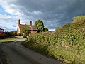
English: Edenham is a village and civil parish in Lincolnshire, England situated about three miles north-west of Bourne on the A151. The parish council is called Edenham, Grimsthorpe, Elsthorpe & Scottlethorpe Parish Council.

Subcategories
This category has the following 6 subcategories, out of 6 total.
Media in category "Edenham"
The following 200 files are in this category, out of 303 total.
(previous page) (next page)-
 7 ½ From Colsterworth - geograph.org.uk - 3652551.jpg 1,024 × 768; 296 KB
-
 8 ½ From Colsterworth - geograph.org.uk - 3652532.jpg 1,024 × 768; 327 KB
-
 A beautiful view - geograph.org.uk - 4941306.jpg 5,700 × 3,800; 7.96 MB
-
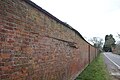
 A crack in the wall - geograph.org.uk - 5721178.jpg 4,014 × 6,032; 5.67 MB
-
 A glimpse of the castle - geograph.org.uk - 5609192.jpg 4,896 × 3,672; 6.95 MB
-
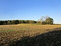
 A quiet meadow - geograph.org.uk - 5606034.jpg 7,100 × 3,088; 7.73 MB
-
 A trimmed oak - geograph.org.uk - 5604424.jpg 8,000 × 5,984; 7.78 MB
-
 A victim of the weather - geograph.org.uk - 3037920.jpg 640 × 427; 123 KB
-
 A151 Approaching Edenham - geograph.org.uk - 4210755.jpg 640 × 480; 313 KB
-
 A151 at Pillar Wood Farm - geograph.org.uk - 3608245.jpg 640 × 480; 61 KB
-
 A151 eastbound - geograph.org.uk - 6018831.jpg 640 × 480; 55 KB
-
 A151 eastbound at Gravel Bridge - geograph.org.uk - 3608249.jpg 640 × 481; 82 KB
-
 A151 eastbound near Winswood - geograph.org.uk - 3608253.jpg 640 × 481; 59 KB
-
 A151 near Copy Lawn Farm - geograph.org.uk - 3608240.jpg 640 × 480; 95 KB
-
 A151 near Edenham - geograph.org.uk - 4210740.jpg 640 × 480; 274 KB
-
 A151 near Oaks Cottages - geograph.org.uk - 3608182.jpg 640 × 481; 77 KB
-
 A151 northbound - geograph.org.uk - 5608811.jpg 640 × 480; 86 KB
-
 A151 South of Edenham - geograph.org.uk - 4210771.jpg 640 × 480; 346 KB
-
 A151 towards Corby Glen - geograph.org.uk - 3697828.jpg 640 × 480; 87 KB
-
 A151 towards Corby Glen - geograph.org.uk - 3697873.jpg 640 × 480; 76 KB
-
 A151 towards Corby Glen - geograph.org.uk - 3697882.jpg 640 × 480; 83 KB
-
 A151 towards Corby Glen - geograph.org.uk - 3697892.jpg 640 × 480; 96 KB
-
 Across Fields to Featherwell Farm - geograph.org.uk - 2850074.jpg 1,024 × 768; 229 KB
-
 Alvis Silver Eagle - geograph.org.uk - 6246194.jpg 4,500 × 3,000; 7.24 MB
-
 An Inclusion - geograph.org.uk - 5605669.jpg 6,032 × 4,014; 6.59 MB
-
 Approaching Elsea Wood - geograph.org.uk - 6237506.jpg 1,024 × 768; 218 KB
-
 Aspen tree - geograph.org.uk - 4201795.jpg 3,240 × 4,320; 5.53 MB
-
 At the start line - geograph.org.uk - 6246295.jpg 4,500 × 3,000; 7.12 MB
-
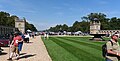
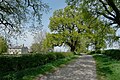
 At the top of the avenue - geograph.org.uk - 5589982.jpg 6,000 × 4,000; 5.32 MB
-
 Auster Wood - geograph.org.uk - 1290138.jpg 640 × 427; 94 KB
-
 Autumn Leaves - geograph.org.uk - 5605703.jpg 6,032 × 4,014; 3.05 MB
-
 Avenue of horse chestnut trees on Bytham Riding - geograph.org.uk - 5463332.jpg 3,776 × 2,520; 4.18 MB
-
 Balloon and Birds - geograph.org.uk - 5409516.jpg 3,756 × 1,620; 1.47 MB
-
 Bare trees at Edenham - geograph.org.uk - 5605695.jpg 6,032 × 4,014; 4.52 MB
-
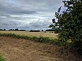
 Barley fields north of Edenham - geograph.org.uk - 176393.jpg 640 × 480; 85 KB
-
 Barn at Tumblerow Cottage, Scottlethorpe - geograph.org.uk - 6237557.jpg 1,024 × 768; 218 KB
-
 Barn conversion - geograph.org.uk - 4201774.jpg 4,320 × 3,240; 5.36 MB
-
 Barn Conversion - geograph.org.uk - 4230768.jpg 4,896 × 3,672; 6.96 MB
-
 Base of the new gates - geograph.org.uk - 5589961.jpg 6,000 × 4,000; 4.81 MB
-
 Beast at Scoth Farm - geograph.org.uk - 4201976.jpg 4,320 × 3,240; 5.7 MB
-
 Beech Leaves - geograph.org.uk - 5605702.jpg 6,032 × 4,014; 3.29 MB
-
 Beech Tree - geograph.org.uk - 5605699.jpg 4,014 × 6,032; 5.19 MB
-
 Beware of Children - geograph.org.uk - 4230665.jpg 4,896 × 3,672; 5.26 MB
-
 Blue paint - geograph.org.uk - 5605628.jpg 6,032 × 4,014; 2.67 MB
-
 Bourne South, aerial 2014 - geograph.org.uk - 4058401.jpg 1,024 × 683; 194 KB
-
 Bourne Wood entrance, on the right - geograph.org.uk - 307143.jpg 640 × 480; 89 KB
-
 Bourne Woods off the A151 road - geograph.org.uk - 1290154.jpg 640 × 427; 83 KB
-
 Bridge at Edenham - geograph.org.uk - 4210767.jpg 640 × 480; 338 KB
-
 Bridleway to Cawthorpe - geograph.org.uk - 4202019.jpg 4,320 × 3,240; 5.25 MB
-
 Bullock at Scoth Farm - geograph.org.uk - 4201987.jpg 4,320 × 3,240; 5.81 MB
-
 Bytham Riding - geograph.org.uk - 5463325.jpg 3,776 × 2,520; 4.17 MB
-
 Castle, Cars, and People - geograph.org.uk - 6246103.jpg 8,139 × 4,115; 7.09 MB
-
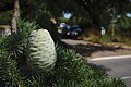 Cedrus libani - female cone - geograph.org.uk - 5859418.jpg 6,032 × 4,014; 2.91 MB
-
 Cedrus libani - geograph.org.uk - 5857124.jpg 6,357 × 5,379; 7.82 MB
-
 Cedrus libani - male cones - geograph.org.uk - 5859431.jpg 3,964 × 2,992; 1.72 MB
-
 Chain gate - geograph.org.uk - 5609643.jpg 6,032 × 4,014; 3.91 MB
-
 Chestnut Avenue - geograph.org.uk - 3036996.jpg 640 × 427; 84 KB
-
 Chestnut Avenue - geograph.org.uk - 3036997.jpg 640 × 427; 99 KB
-
 Chestnut Avenue - geograph.org.uk - 3037094.jpg 640 × 427; 117 KB
-
 Chestnut Avenue - geograph.org.uk - 3037097.jpg 640 × 427; 96 KB
-
 Chestnut Avenue - geograph.org.uk - 3037122.jpg 640 × 427; 105 KB
-
 Chestnut Avenue - geograph.org.uk - 3037128.jpg 640 × 427; 115 KB
-
 Chestnut Avenue - geograph.org.uk - 6236682.jpg 1,024 × 768; 148 KB
-
 Coal Merchants - geograph.org.uk - 4230721.jpg 4,896 × 3,672; 6.8 MB
-
 Corner of School Lane - geograph.org.uk - 4237518.jpg 4,896 × 3,672; 6.71 MB
-
 Cottage in Church Lane - geograph.org.uk - 4230702.jpg 4,896 × 3,672; 7.11 MB
-
 Cottages, Main Street, Edenham - geograph.org.uk - 6223152.jpg 1,024 × 768; 130 KB
-
 Country road - geograph.org.uk - 5608840.jpg 640 × 480; 60 KB
-
 Countryside between Edenham and Lound - geograph.org.uk - 312131.jpg 640 × 427; 101 KB
-
 Crossing the East Glen River - geograph.org.uk - 420192.jpg 640 × 427; 106 KB
-
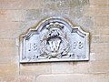 Datestone - geograph.org.uk - 4230735.jpg 4,896 × 3,672; 6.6 MB
-
 Dead oak tree - geograph.org.uk - 6237527.jpg 1,024 × 768; 251 KB
-
 Defibrillator at the Village Hall - geograph.org.uk - 5934833.jpg 4,014 × 6,032; 3.26 MB
-
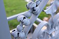 Detail of the gate - geograph.org.uk - 5589970.jpg 6,000 × 4,000; 2.75 MB
-
 Distant Mistletoe - geograph.org.uk - 5606009.jpg 16,001 × 3,007; 7.91 MB
-
 Disused quarry - geograph.org.uk - 3036987.jpg 640 × 427; 83 KB
-
 Disused quarry near Scottlethorpe - geograph.org.uk - 6237551.jpg 1,024 × 768; 199 KB
-
 Dot in the sky - geograph.org.uk - 5409512.jpg 4,896 × 3,672; 6.77 MB
-
 Double fired brick - geograph.org.uk - 5605672.jpg 6,032 × 4,014; 6.71 MB
-
 Down toward Edenham - geograph.org.uk - 4201822.jpg 4,320 × 3,240; 6.15 MB
-
 Drainage - geograph.org.uk - 5608816.jpg 640 × 480; 66 KB
-
 Dried up pond - geograph.org.uk - 4201802.jpg 4,320 × 3,240; 5.72 MB
-
 East Glen River - geograph.org.uk - 3036848.jpg 640 × 427; 113 KB
-
 East Glen River - geograph.org.uk - 312126.jpg 640 × 427; 111 KB
-
 East Glen River - geograph.org.uk - 312129.jpg 640 × 427; 70 KB
-
 East Glen River - geograph.org.uk - 3697832.jpg 480 × 640; 85 KB
-
 Edenham from the north - geograph.org.uk - 176395.jpg 640 × 480; 69 KB
-
 Edenham Grimsthorpe Elsthorpe & Scottlethorpe UK parish locator map.svg 1,086 × 1,305; 3.7 MB
-
 Edenham Village Hall - geograph.org.uk - 5934835.jpg 7,748 × 3,977; 7.37 MB
-
 Electricity pylon at Scottlethorpe - geograph.org.uk - 6236652.jpg 1,024 × 768; 159 KB
-
 Elm Terrace, Scottlethorpe - geograph.org.uk - 6236650.jpg 1,024 × 768; 176 KB
-
 Elsthorpe Road - geograph.org.uk - 3697879.jpg 640 × 480; 90 KB
-
 Entering Edenham - geograph.org.uk - 3697840.jpg 640 × 480; 77 KB
-
 Escaped Livestock - geograph.org.uk - 4941303.jpg 5,800 × 3,867; 7.78 MB
-
 Failed pond - geograph.org.uk - 4201862.jpg 4,320 × 3,240; 5.36 MB
-
 Fallow deer in a stubble field - geograph.org.uk - 6236679.jpg 1,024 × 768; 182 KB
-
 Farm Ford on East Glen River at Edenham - geograph.org.uk - 1987817.jpg 3,872 × 2,592; 2.35 MB
-
 Farmland - geograph.org.uk - 5608820.jpg 640 × 480; 57 KB
-
 Farmland and a Stream - geograph.org.uk - 2851442.jpg 1,024 × 768; 306 KB
-
 Farmland and woodland - geograph.org.uk - 3697884.jpg 640 × 480; 68 KB
-
 Farmland north of the A151 - geograph.org.uk - 3697889.jpg 640 × 480; 102 KB
-
 Farmland, Edenham - geograph.org.uk - 3697849.jpg 640 × 480; 79 KB
-
 Farmland, Featherwell farm - geograph.org.uk - 3697876.jpg 640 × 480; 62 KB
-
 Farmland, Home Farm - geograph.org.uk - 3697886.jpg 640 × 480; 59 KB
-
 Farmland, Pasture Hill Farm - geograph.org.uk - 3697054.jpg 640 × 480; 64 KB
-
 Farmwork - geograph.org.uk - 4201835.jpg 4,320 × 3,240; 5.65 MB
-
 Field edge - geograph.org.uk - 5605943.jpg 8,560 × 6,209; 7.52 MB
-
 Finger post - geograph.org.uk - 5608839.jpg 640 × 480; 124 KB
-
 Flooded field by River Glen - geograph.org.uk - 4859287.jpg 6,000 × 4,000; 7.54 MB
-
 Fly tipping - geograph.org.uk - 5264058.jpg 4,000 × 2,992; 3.11 MB
-
 Fly tipping in Hangman's Lane - geograph.org.uk - 5538212.jpg 4,032 × 3,024; 5.53 MB
-
 Footpath closed - geograph.org.uk - 4201880.jpg 4,320 × 3,240; 5.55 MB
-
 Footpath from Creeton - geograph.org.uk - 6237499.jpg 1,024 × 768; 221 KB
-
 Footpath to Creeton - geograph.org.uk - 6236660.jpg 1,024 × 768; 245 KB
-
 Footpath to Halehouse Road - geograph.org.uk - 6237547.jpg 1,024 × 768; 219 KB
-
 Ford & footbridge - geograph.org.uk - 3037409.jpg 640 × 427; 133 KB
-
 Ford & footbridge - geograph.org.uk - 3037450.jpg 427 × 640; 135 KB
-
 Ford & footbridge - geograph.org.uk - 3037454.jpg 640 × 427; 117 KB
-
 Ford on East Glen River near Auster Lodge - geograph.org.uk - 1836522.jpg 3,872 × 2,592; 2.41 MB
-
 Former permissive path - geograph.org.uk - 4201889.jpg 4,320 × 3,240; 5.52 MB
-
 Fraxinus in hedgerow - geograph.org.uk - 4201844.jpg 4,320 × 3,240; 5.63 MB
-
 Fraxinus in hedgerow - geograph.org.uk - 4201851.jpg 4,320 × 3,240; 5.65 MB
-
 Free-range chickens - geograph.org.uk - 4201965.jpg 4,320 × 3,240; 5.19 MB
-
 Free-range chickens - geograph.org.uk - 4202008.jpg 4,320 × 3,240; 6.04 MB
-
 Free-range hens - geograph.org.uk - 4201970.jpg 4,320 × 3,240; 5.49 MB
-
 Glebe Meadow - geograph.org.uk - 4237592.jpg 4,896 × 3,672; 6.79 MB
-
 Grand house - geograph.org.uk - 4237561.jpg 4,896 × 3,672; 7.12 MB
-
 Grass field at Grimsthorpe - geograph.org.uk - 6309498.jpg 1,024 × 768; 135 KB
-
 Grassland on the edge of Grimsthorpe Park - geograph.org.uk - 6237544.jpg 1,024 × 768; 171 KB
-
 Gravel Bridge - geograph.org.uk - 6181268.jpg 4,896 × 3,672; 6.64 MB
-
 Gravel Bridge and flooded field - geograph.org.uk - 6181275.jpg 4,896 × 3,672; 6.74 MB
-
 Grazing, Copy Lawn Farm - geograph.org.uk - 3697868.jpg 640 × 480; 68 KB
-
 Grazing, Edenham - geograph.org.uk - 3697867.jpg 640 × 509; 58 KB
-
 Green lane off Scottlethorpe Road near Edenham, Lincolnshire - geograph.org.uk - 4893166.jpg 4,320 × 3,240; 5.54 MB
-
 Green verges - geograph.org.uk - 1290173.jpg 427 × 640; 88 KB
-
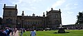 Grimsthorpe Castle - geograph.org.uk - 6246101.jpg 9,313 × 4,136; 7.88 MB
-
 Hangman's Lane - geograph.org.uk - 3036650.jpg 640 × 427; 141 KB
-
 Harrowed field and Spring Wood - geograph.org.uk - 6308097.jpg 1,024 × 768; 214 KB
-
 Harvested Field and Hedgerow near the A151 - geograph.org.uk - 3145287.jpg 2,256 × 1,504; 1.07 MB
-
 Haws in Autumn - geograph.org.uk - 5609675.jpg 6,032 × 4,014; 3.87 MB
-
 Hawthorn and Ivy - geograph.org.uk - 4230783.jpg 4,896 × 3,672; 6.9 MB
-
 Hidden pool - geograph.org.uk - 3869219.jpg 4,896 × 3,672; 6.79 MB
-
 Hillside, with Lake beyond - geograph.org.uk - 6246112.jpg 12,536 × 4,237; 7.34 MB
-
 Houses in School Lane - geograph.org.uk - 4230748.jpg 4,896 × 3,672; 6.67 MB
-
 Houses in School Lane - geograph.org.uk - 4230754.jpg 4,896 × 3,672; 6.79 MB
-
 Impending failure - geograph.org.uk - 5721184.jpg 6,032 × 4,014; 5.52 MB
-
 In Spate - geograph.org.uk - 6181265.jpg 4,896 × 3,672; 6.82 MB
-
 Ivy Scars - geograph.org.uk - 5605660.jpg 6,032 × 4,014; 6.92 MB
-
 Jaguar C-Type - geograph.org.uk - 6246300.jpg 4,500 × 3,000; 6.37 MB
-
 Jaguar XK120 - geograph.org.uk - 6246186.jpg 4,500 × 3,000; 6.85 MB
-
 K6 Telephone Kiosk in Edenham, Lincolnshire.jpg 4,000 × 3,000; 4.76 MB
-
 KCC fingerpost - geograph.org.uk - 4201755.jpg 3,018 × 4,041; 5.74 MB
-
 Lane heading north out of Edenham - geograph.org.uk - 3697852.jpg 640 × 480; 59 KB
-
 Lane near Auster Lodge - geograph.org.uk - 4941300.jpg 5,500 × 3,667; 7.9 MB
-
 Laundry Lorry - geograph.org.uk - 5605720.jpg 6,032 × 4,014; 7.14 MB
-
 Light and Shade at Grimsthorpe garden corner - geograph.org.uk - 5606004.jpg 6,500 × 6,918; 7.83 MB
-
 Lincolnshire countryside - geograph.org.uk - 5539615.jpg 4,032 × 3,024; 5.46 MB
-
 Looking towards Edenham - geograph.org.uk - 5608838.jpg 640 × 480; 68 KB
-
 Lost glove - geograph.org.uk - 5609662.jpg 6,032 × 4,014; 6.61 MB
-
 Loyalty Me Oblige - geograph.org.uk - 6246166.jpg 4,405 × 2,606; 1.3 MB
-
 Main Street, Grimsthorpe - geograph.org.uk - 5704713.jpg 3,776 × 2,520; 4.07 MB
-
 Maize Hill - geograph.org.uk - 3036979.jpg 640 × 427; 88 KB
-
 Marking the line - geograph.org.uk - 5605730.jpg 6,032 × 4,014; 4.48 MB
-
 Mature trees - geograph.org.uk - 4764716.jpg 3,333 × 5,000; 6.58 MB
-
 Mill Leys farmhouse from Church Lane - geograph.org.uk - 4201761.jpg 4,320 × 3,240; 5.9 MB
-
 Mill Leys house - geograph.org.uk - 4202017.jpg 4,320 × 3,240; 5.63 MB
-
 Minor road to Edenham crossing the East Glen River - geograph.org.uk - 5706723.jpg 3,306 × 2,166; 1.89 MB
-
 Minor road to Edenham past Auster Lodge - geograph.org.uk - 5706782.jpg 3,776 × 2,520; 3.66 MB
-
 Motorcycle rolling road - geograph.org.uk - 6246169.jpg 4,613 × 3,212; 3.1 MB
-
 Moulded joint - geograph.org.uk - 5609653.jpg 4,014 × 6,032; 5.19 MB
-
 Mr Bradley's straw - geograph.org.uk - 4202009.jpg 4,320 × 3,240; 5.55 MB
-
 Nearly finished - geograph.org.uk - 5605635.jpg 6,032 × 4,014; 3.66 MB
-
 New roadside trees planted - geograph.org.uk - 5390445.jpg 4,896 × 3,672; 6.5 MB
-
 No longer dry - geograph.org.uk - 4230785.jpg 4,896 × 3,672; 6.74 MB
-
 NTS pipeline marker - geograph.org.uk - 6181272.jpg 3,672 × 4,896; 5.9 MB
-
 Oaks Cottages - geograph.org.uk - 3036878.jpg 640 × 427; 129 KB
-

-

-
 Over the Field to Spring Wood - geograph.org.uk - 2850053.jpg 1,024 × 768; 350 KB
-
 Panorama of flooded fields south of Edenham - geograph.org.uk - 4859277.jpg 4,592 × 1,040; 1.52 MB
-
 Parasitic foliage - geograph.org.uk - 3869232.jpg 4,896 × 3,672; 6.85 MB
-
 Parasitised tree - geograph.org.uk - 5609638.jpg 4,896 × 3,672; 6.89 MB
-
 Parish boundary - geograph.org.uk - 3036645.jpg 640 × 427; 126 KB
-
 Pasture - geograph.org.uk - 5604429.jpg 15,441 × 3,085; 7.83 MB
-
 Pasture Hill - geograph.org.uk - 4779580.jpg 6,480 × 1,906; 3.92 MB
-
 Path into the quarry - geograph.org.uk - 5609639.jpg 6,032 × 4,014; 6.27 MB
-
 Pillar wood - geograph.org.uk - 4820937.jpg 5,000 × 3,333; 6.5 MB
-
 Pillar Wood - geograph.org.uk - 5608819.jpg 640 × 480; 95 KB
-
 Plaque - geograph.org.uk - 4230762.jpg 4,896 × 3,672; 7.01 MB
-
 Pole ID - geograph.org.uk - 5609656.jpg 6,032 × 4,014; 4.56 MB
-
 Pots and Pans - geograph.org.uk - 3036999.jpg 640 × 427; 94 KB
-
 Pots and Pans and sheep - geograph.org.uk - 3037001.jpg 640 × 427; 106 KB
-
 Potting sheds - geograph.org.uk - 5605691.jpg 6,032 × 4,014; 6.38 MB
-
 Power line - geograph.org.uk - 5609658.jpg 4,014 × 6,032; 5.17 MB
-
 Power lines near Auster Lodge - geograph.org.uk - 6236641.jpg 1,024 × 768; 189 KB
-
 Power pole - geograph.org.uk - 5609650.jpg 3,379 × 5,078; 3.85 MB
-
 Pub and Coal Merchants - geograph.org.uk - 4237522.jpg 4,896 × 3,672; 6.91 MB
-
 Public footpath? - geograph.org.uk - 420275.jpg 640 × 427; 104 KB
-
 Quercus robur - geograph.org.uk - 4201811.jpg 4,320 × 3,240; 5.85 MB
-
 Ridge and Furrow - geograph.org.uk - 4201869.jpg 4,320 × 3,240; 5.65 MB


