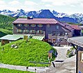
Category:Edmund-Probst-Haus
| Object location | | View all coordinates using: OpenStreetMap |
|---|
building in Oberstdorf, Swabia, Germany  .jpg) | |||||
| Upload media | |||||
| Instance of |
| ||||
|---|---|---|---|---|---|
| Location | Oberstdorf, Oberallgäu, Swabia, Bavaria, Germany | ||||
| Owned by | |||||
| Date of official opening |
| ||||
| Mountain range | |||||
| Elevation above sea level |
| ||||
| official website | |||||
 | |||||
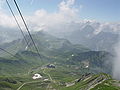
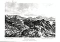
Media in category "Edmund-Probst-Haus"
The following 12 files are in this category, out of 12 total.
-
 Berggasthof Höfatsblick Edmung-Probst-Haus GeißalpHütte am Nebelhorn Oberstdorf.jpg 4,608 × 3,456; 9.28 MB
-
 Berggottesdienst am Edmund-Probst-Haus - panoramio.jpg 1,590 × 1,193; 523 KB
-
 Descent from Nebelhorn.jpg 2,560 × 1,920; 2.2 MB
-
 Edmund - Probst- Haus, Nebelhorn - panoramio.jpg 2,481 × 2,118; 1.03 MB
-
 Edmund Probst Haus - panoramio.jpg 2,816 × 2,120; 1.39 MB
-
 Edmund-Probst-Haus Nebelhorn Oberstorf.jpg 4,928 × 3,264; 11.69 MB
-
 Edmund-Probst-Haus.jpg 1,338 × 1,166; 1.62 MB
-
 Nebelhorn aussicht.JPG 2,560 × 1,920; 1.94 MB
-
 Nebelhorn Edmund Probst Haus (Winter).jpg 3,648 × 2,736; 5.31 MB
-
 Nebelhorn-Haus.jpg 2,823 × 1,970; 732 KB
-
 Station Hoefatsblick - geo.hlipp.de - 24886.jpg 640 × 427; 99 KB
-
 Westlicher Wengenkopf Summitview to South.JPG 4,000 × 3,000; 2.65 MB


