Category:Egginton
village and civil parish in South Derbyshire, England  | |||||
| Upload media | |||||
| Instance of | |||||
|---|---|---|---|---|---|
| Location | South Derbyshire, Derbyshire, East Midlands, England | ||||
| official website | |||||
 | |||||
Subcategories
This category has the following 7 subcategories, out of 7 total.
Media in category "Egginton"
The following 200 files are in this category, out of 222 total.
(previous page) (next page)-
 'Black Magic' workshop at Derby Airfield - geograph.org.uk - 3179610.jpg 3,264 × 2,448; 3.93 MB
-
 'OK' Diner by to the A38 Road - geograph.org.uk - 2877192.jpg 3,072 × 2,150; 1.06 MB
-
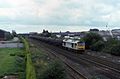
 09.08.93 Egginton 56092 (32590114403).jpg 1,511 × 987; 1.61 MB
-
 09.08.93 Egginton 60007 (6089336456).jpg 1,529 × 1,005; 264 KB
-
 A country walk - geograph.org.uk - 5465569.jpg 2,000 × 1,333; 2.02 MB
-
 A field of Barley - geograph.org.uk - 5444882.jpg 2,000 × 1,333; 2.93 MB
-
 A footpath from Eggington - geograph.org.uk - 5465538.jpg 2,000 × 1,333; 1.91 MB
-
 A single carriage train - geograph.org.uk - 5444796.jpg 2,000 × 1,333; 1.94 MB
-
 A wet A5132 - geograph.org.uk - 5444879.jpg 2,000 × 1,333; 1.66 MB
-
 A38 between Burton and Derby - geograph.org.uk - 403009.jpg 640 × 480; 136 KB
-
 A38 from Egginton Cottage - geograph.org.uk - 4323776.jpg 640 × 386; 40 KB
-

-
 A38 services at A3152 junction - geograph.org.uk - 4323777.jpg 640 × 282; 37 KB
-
 A38 towards Derby - geograph.org.uk - 3424068.jpg 640 × 454; 51 KB
-
 A50, Hilton and Derby airfield, aerial 2014 - geograph.org.uk - 3926135.jpg 1,024 × 683; 105 KB
-
 A5132 Carriers Road near Egginton - geograph.org.uk - 381041.jpg 640 × 480; 82 KB
-
 A5132 heading east - geograph.org.uk - 3424056.jpg 640 × 480; 70 KB
-
 A5132 heading east - geograph.org.uk - 3424061.jpg 640 × 480; 53 KB
-
 Across the A38 - geograph.org.uk - 5019382.jpg 1,600 × 1,199; 257 KB
-
 Amy Johnson Comet Racer Restoration Centre - geograph.org.uk - 3179585.jpg 3,264 × 2,448; 3.46 MB
-
 Amy Johnson's 'Black Magic' - geograph.org.uk - 3179592.jpg 3,264 × 2,448; 4.25 MB
-
 Amy Johnson's 'Black Magic' - geograph.org.uk - 3179603.jpg 3,264 × 2,448; 3.63 MB
-
 Aqueduct carrying the Trent and Mersey Canal - geograph.org.uk - 3216602.jpg 4,000 × 3,000; 4.6 MB
-
 Aqueduct with pillbox near Stretton in Staffordshire - geograph.org.uk - 6006643.jpg 1,280 × 960; 1.37 MB
-
 Bales in the flood - geograph.org.uk - 955077.jpg 640 × 346; 87 KB
-
 Barriers rise on Etwall Road - geograph.org.uk - 4610668.jpg 1,200 × 900; 313 KB
-
 Bench mark, Egginton Church - geograph.org.uk - 3860689.jpg 1,280 × 960; 393 KB
-
 Bench mark, Egginton level crossing house - geograph.org.uk - 3860562.jpg 1,280 × 960; 335 KB
-
 Bench mark, Egginton Pinfold - geograph.org.uk - 3860635.jpg 960 × 1,280; 471 KB
-
 Bench mark, High Bridge, Egginton - geograph.org.uk - 3872752.jpg 1,280 × 915; 678 KB
-
 Beyond the runway - geograph.org.uk - 5465616.jpg 2,000 × 1,333; 2.24 MB
-

-
 Blacksmith's Lane Allotments - geograph.org.uk - 5428368.jpg 1,280 × 960; 436 KB
-
 Bridleway Crossing Hilton Brook - geograph.org.uk - 3792250.jpg 3,926 × 2,900; 1.65 MB
-
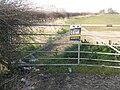
 Bridleway gate - geograph.org.uk - 5428397.jpg 1,280 × 960; 374 KB
-
 Bridleway marker on a fence post - geograph.org.uk - 6209470.jpg 1,280 × 960; 581 KB
-
 Brook south of St Wilfred's Church - geograph.org.uk - 376959.jpg 640 × 480; 101 KB
-
 Bus Stop at Egginton Junction - geograph.org.uk - 4447969.jpg 3,922 × 2,895; 2.77 MB
-
 Canal near Egginton - geograph.org.uk - 3960544.jpg 1,600 × 1,200; 822 KB
-
 Canal near Egginton Cottage - geograph.org.uk - 3960553.jpg 1,600 × 1,200; 658 KB
-
 Church of St Wilfrid, Egginton - geograph.org.uk - 3860698.jpg 1,280 × 1,280; 528 KB
-
 Church of St Wilfrid, Egginton - geograph.org.uk - 3860730.jpg 1,280 × 919; 215 KB
-
 Church Road, Egginton - geograph.org.uk - 4866135.jpg 3,264 × 2,448; 4.1 MB
-
 Churchyard wall, Egginton - geograph.org.uk - 3860712.jpg 1,280 × 960; 387 KB
-

-
 Claymills Victorian Pumping Station - geograph.org.uk - 364925.jpg 640 × 427; 74 KB
-

-
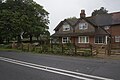
 Cottages at Egginton - geograph.org.uk - 3860645.jpg 1,280 × 909; 321 KB
-
 Cottages by the line - geograph.org.uk - 5444831.jpg 2,000 × 1,333; 2.23 MB
-
 Cottages on Fishpond Lane, Egginton - geograph.org.uk - 377010.jpg 640 × 480; 83 KB
-
 Crop field near Eggington - geograph.org.uk - 3200809.jpg 640 × 495; 54 KB
-
 Crossing the Dove Aqueduct - geograph.org.uk - 955051.jpg 640 × 480; 112 KB
-
 Crossing the River Dove - geograph.org.uk - 451823.jpg 640 × 474; 134 KB
-

-
 Derby Aero Club and Flying School - geograph.org.uk - 3180742.jpg 3,264 × 2,448; 3.27 MB
-
 Derby Airfield - geograph.org.uk - 3180718.jpg 3,264 × 2,448; 3.61 MB
-
 Derby Airfield - geograph.org.uk - 3180729.jpg 3,264 × 2,448; 3.89 MB
-
 Derby Airport - geograph.org.uk - 5363027.jpg 2,000 × 1,500; 2.28 MB
-
 Derbyshire UK parish map highlighting Egginton.svg 888 × 1,308; 2.35 MB
-
 Details of mile post on A38 near Egginton - geograph.org.uk - 2660929.jpg 1,024 × 768; 357 KB
-
 Dove Aqueduct, near Stretton - geograph.org.uk - 451817.jpg 640 × 474; 159 KB
-
 Dove Aqueduct, near Stretton - geograph.org.uk - 451821.jpg 640 × 480; 152 KB
-
 Driveway to Peartree Farm, Egginton - geograph.org.uk - 377063.jpg 640 × 433; 80 KB
-
 Duck Street, Egginton - geograph.org.uk - 3568848.jpg 640 × 480; 100 KB
-
 Duck Street, Egginton - geograph.org.uk - 377030.jpg 640 × 480; 98 KB
-
 Duck Street, Egginton - geograph.org.uk - 3860667.jpg 1,280 × 960; 359 KB
-
 EARLY MORNING MOUNTAIN BIKING - panoramio.jpg 2,048 × 1,536; 1.11 MB
-
 Eggington Brook - geograph.org.uk - 3424041.jpg 480 × 640; 126 KB
-
 Eggington Hall gatehouse - geograph.org.uk - 5465544.jpg 2,000 × 1,333; 2.84 MB
-
 Egginton Bridge - geograph.org.uk - 2397959.jpg 640 × 418; 73 KB
-
 Egginton Brook - geograph.org.uk - 3967961.jpg 1,200 × 900; 360 KB
-
 Egginton Brook in winter - geograph.org.uk - 4331791.jpg 1,200 × 900; 286 KB
-
 Egginton Common from Carriers Road - geograph.org.uk - 3792287.jpg 4,000 × 3,000; 2.05 MB
-
 Egginton Common, crossroads - geograph.org.uk - 3860616.jpg 1,280 × 960; 326 KB
-
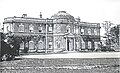 Egginton Hall.jpg 1,810 × 1,104; 378 KB
-
 Egginton Junction Bridge - geograph.org.uk - 3860592.jpg 1,280 × 945; 424 KB
-
 Egginton Junction Bridge, Derbyshire - geograph.org.uk - 1659986.jpg 640 × 480; 25 KB
-
 Egginton Junction Bridge, Derbyshire - geograph.org.uk - 1659996.jpg 640 × 480; 38 KB
-
 Egginton Junction Signal Box - geograph.org.uk - 2655096.jpg 2,600 × 2,020; 646 KB
-
 Egginton level crossing - geograph.org.uk - 3860559.jpg 1,280 × 960; 252 KB
-
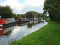 Egginton Moorings - geograph.org.uk - 955042.jpg 640 × 480; 141 KB
-
 Egginton Moorings from High Bridge - geograph.org.uk - 3960546.jpg 1,600 × 1,200; 562 KB
-
 Egginton postbox ref DE65 757 - geograph.org.uk - 3860675.jpg 1,280 × 971; 241 KB
-
 Egginton School 377019 90152808.jpg 640 × 408; 78 KB
-
 Egginton Sewage Farm. - geograph.org.uk - 403007.jpg 640 × 480; 126 KB
-
 Etwall Brook from A5132 bridge - geograph.org.uk - 381107.jpg 640 × 480; 102 KB
-
 Etwall Road - geograph.org.uk - 3424049.jpg 640 × 480; 72 KB
-
 Etwall Road, near Egginton - geograph.org.uk - 381071.jpg 640 × 480; 79 KB
-
 Farm track and bridleway near Egginton - geograph.org.uk - 377128.jpg 640 × 480; 100 KB
-
 Farm Track on the Approach to Egginton - geograph.org.uk - 3792253.jpg 3,806 × 2,722; 1.52 MB
-
 Farmland at Egginton - geograph.org.uk - 4864056.jpg 3,264 × 2,448; 4.43 MB
-
 Farmland near Eggington - geograph.org.uk - 3424047.jpg 640 × 480; 67 KB
-
 Farmland near Eggington - geograph.org.uk - 3424059.jpg 640 × 480; 67 KB
-
 Farmland off Ash Grove Lane - geograph.org.uk - 5398521.jpg 1,600 × 1,200; 481 KB
-
 Farmland, Eggington Common - geograph.org.uk - 3424053.jpg 640 × 480; 101 KB
-
 Field entrance on Carriers Road - geograph.org.uk - 4864043.jpg 3,264 × 2,448; 5.21 MB
-
 Field northeast of Egginton - geograph.org.uk - 2660828.jpg 1,024 × 768; 318 KB
-
 Field of oilseed rape near Egginton - geograph.org.uk - 381062.jpg 640 × 480; 93 KB
-
 Fields alongside the River Dove - geograph.org.uk - 955093.jpg 640 × 470; 66 KB
-
 Fishpond Lane in Egginton - geograph.org.uk - 2660817.jpg 1,024 × 768; 344 KB
-
 Fishpond Lane, Eggington - geograph.org.uk - 3182079.jpg 3,264 × 2,448; 3.9 MB
-
 Flood bank at Egginton - geograph.org.uk - 4866161.jpg 3,264 × 2,448; 3.98 MB
-
 Flood bank at Egginton - geograph.org.uk - 5398508.jpg 1,600 × 1,200; 524 KB
-
 Flooded gravel pit near Willington - geograph.org.uk - 3200817.jpg 640 × 459; 49 KB
-
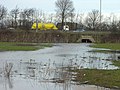
 Floods near Egginton - geograph.org.uk - 955048.jpg 640 × 480; 141 KB
-
 Floods near Egginton - geograph.org.uk - 955049.jpg 640 × 480; 161 KB
-
 Footpath Near Egginton Church - geograph.org.uk - 2158713.jpg 1,496 × 1,122; 693 KB
-
 Footpath to Eggington - geograph.org.uk - 5465563.jpg 2,000 × 1,333; 2.16 MB
-
 Footpath to Monk's Bridge - geograph.org.uk - 3860704.jpg 1,280 × 960; 414 KB
-
 Fuel Filling Station - A38 - geograph.org.uk - 3880728.jpg 3,966 × 1,920; 3.29 MB
-
 Gatehouse at the Egginton Hall Estate - geograph.org.uk - 5398514.jpg 1,600 × 1,200; 731 KB
-
 Grass field at Egginton - geograph.org.uk - 4866148.jpg 3,264 × 2,448; 3.45 MB
-
 Grass runways - geograph.org.uk - 5465578.jpg 2,000 × 1,333; 1.65 MB
-
 Gravel Pit - geograph.org.uk - 252256.jpg 640 × 426; 108 KB
-
 Gravelpit Plantation - geograph.org.uk - 4333256.jpg 1,200 × 900; 217 KB
-
 Green Plantation - geograph.org.uk - 3356822.jpg 1,200 × 900; 215 KB
-
 Hargate Bridge - geograph.org.uk - 3967958.jpg 1,200 × 900; 146 KB
-
 Hargate Lane - geograph.org.uk - 4331838.jpg 1,200 × 900; 277 KB
-
 High Bridge (1) - geograph.org.uk - 252247.jpg 640 × 426; 251 KB
-
 High Bridge and High Bridge House, Egginton - geograph.org.uk - 3872750.jpg 1,280 × 1,280; 418 KB
-

-
 High water - geograph.org.uk - 664119.jpg 640 × 480; 85 KB
-
 High water on the Dove - geograph.org.uk - 664111.jpg 640 × 434; 81 KB
-
 Hilton Road (A5132) - geograph.org.uk - 3424045.jpg 640 × 480; 60 KB
-
 House along the Trent ^ Mersey Canal - geograph.org.uk - 4620835.jpg 800 × 514; 135 KB
-
 Houses at Egginton - geograph.org.uk - 3182072.jpg 3,264 × 2,448; 3.3 MB
-
 Just landing - geograph.org.uk - 5465596.jpg 2,000 × 1,333; 1.73 MB
-
 Lane to High Bridge - geograph.org.uk - 287079.jpg 426 × 640; 135 KB
-
 Lay by on bend near Egginton - geograph.org.uk - 4566331.jpg 640 × 395; 44 KB
-
 Leaving Eggington - geograph.org.uk - 5465530.jpg 2,000 × 1,333; 2.26 MB
-
 Level Crossing on Etwall Road - geograph.org.uk - 3792294.jpg 3,916 × 2,888; 1.7 MB
-
 Level crossing, Etwall Road - geograph.org.uk - 381069.jpg 640 × 480; 82 KB
-
 Looking down the line - geograph.org.uk - 5444807.jpg 2,000 × 1,333; 2.29 MB
-
 Looking south along the River Dove - geograph.org.uk - 4620862.jpg 800 × 630; 201 KB
-
 Looking south from Carriers Road - geograph.org.uk - 4864065.jpg 3,029 × 2,274; 2.67 MB
-
 Machinery at Willington Quarry - geograph.org.uk - 4331806.jpg 1,200 × 900; 135 KB
-
 Manor Farm Cottages - geograph.org.uk - 3860654.jpg 1,280 × 945; 394 KB
-
 Marlpit Plantation - geograph.org.uk - 381054.jpg 640 × 480; 106 KB
-
 Marlpit Plantation - geograph.org.uk - 3860624.jpg 1,280 × 960; 377 KB
-
 Marlpit Plantation, Egginton - geograph.org.uk - 4864091.jpg 3,264 × 2,448; 6.03 MB
-
 Mile post on A38 near Egginton - geograph.org.uk - 2660916.jpg 768 × 1,024; 598 KB
-
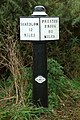 Milepost 12 - geograph.org.uk - 252243.jpg 426 × 640; 151 KB
-
 Minor Road to the A38 - geograph.org.uk - 6005084.jpg 4,160 × 3,120; 4.44 MB
-
 Minor road towards Eggington - geograph.org.uk - 3424065.jpg 640 × 480; 64 KB
-
 Monk's Bridge from the canal aqueduct - geograph.org.uk - 3960378.jpg 1,600 × 1,200; 366 KB
-

-
 Moorings by High Bridge near Egginton, Derbyshire - geograph.org.uk - 5595743.jpg 1,280 × 877; 1.39 MB
-
 Moorings, Egginton - geograph.org.uk - 252257.jpg 640 × 426; 113 KB
-

-
 Narrowboat on the Trent ^ Mersey Canal - geograph.org.uk - 4620829.jpg 800 × 599; 182 KB
-

-
 Near the A38 - geograph.org.uk - 5465553.jpg 2,000 × 1,333; 2.06 MB
-
 New canalside house south of Egginton, Derbyshire - geograph.org.uk - 6006627.jpg 1,280 × 960; 1.33 MB
-
 New Year's Day Daffodils - geograph.org.uk - 4779569.jpg 3,264 × 2,448; 5.33 MB
-
 Nissen hut barn at Peartree Farm - geograph.org.uk - 3860663.jpg 1,280 × 932; 287 KB
-
 No entry and no tipping^ - geograph.org.uk - 4337397.jpg 1,200 × 900; 154 KB
-
 Old loop of the river Dove - geograph.org.uk - 6209482.jpg 1,280 × 960; 424 KB
-
 Paddock at Peartree Farm - geograph.org.uk - 3860658.jpg 1,280 × 782; 162 KB
-
 Park Hill - geograph.org.uk - 381081.jpg 640 × 480; 94 KB
-
 Parked planes - geograph.org.uk - 5465613.jpg 2,000 × 1,333; 1.9 MB
-
 Peartree Farm Egginton - geograph.org.uk - 3860649.jpg 1,280 × 960; 281 KB
-
 Petrol station on the A38 - geograph.org.uk - 2920763.jpg 1,024 × 768; 149 KB
-
 Plantation at Willington Gravel Pits - geograph.org.uk - 3745030.jpg 4,000 × 3,000; 3.19 MB
-
 Ports Farmhouse - geograph.org.uk - 3860669.jpg 1,280 × 926; 334 KB
-
 Primitive Methodist Chapel 1894 - geograph.org.uk - 4779704.jpg 3,264 × 2,448; 3.31 MB
-
 Burton, Dove, Egginton & Willington RJD 22.jpg 1,888 × 2,861; 877 KB
-
 Railway Cottages at Egginton Old Station - geograph.org.uk - 5398545.jpg 1,600 × 1,200; 564 KB
-
 Railway Cottages, Etwall Road - geograph.org.uk - 3860553.jpg 1,280 × 960; 285 KB
-
 Ridge and flooded furrow field - geograph.org.uk - 5271033.jpg 1,280 × 960; 297 KB
-
 Ridge and furrow near Egginton - geograph.org.uk - 664151.jpg 640 × 480; 81 KB
-

-
 River Dove crossing from A38 - geograph.org.uk - 4564738.jpg 640 × 334; 48 KB
-
 River Dove from the canal aqueduct - geograph.org.uk - 3960379.jpg 1,600 × 1,200; 549 KB
-
 River Dove in flood - geograph.org.uk - 664138.jpg 640 × 480; 99 KB
-
 River Dove in flood - geograph.org.uk - 955069.jpg 640 × 477; 134 KB
-
 River Dove in flood near Rolleston - geograph.org.uk - 954982.jpg 640 × 426; 134 KB
-

-
 River Dove near Egginton - geograph.org.uk - 377097.jpg 640 × 480; 92 KB
-

-

-
 Service station on the A38 - geograph.org.uk - 4618219.jpg 640 × 480; 120 KB
-
 Service stop, A38, south of the A50 junction - geograph.org.uk - 5019392.jpg 1,600 × 1,134; 279 KB
-
 South side of the Dove Aqueduct - geograph.org.uk - 955066.jpg 480 × 640; 157 KB
-
 St Wilfrid's, Egginton - geograph.org.uk - 4866128.jpg 3,264 × 2,448; 4.18 MB
-
 Submerged Woodland by Carriers Road - geograph.org.uk - 3792291.jpg 4,000 × 3,000; 2.44 MB
-
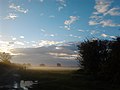
 Sunset over Egginton Village - geograph.org.uk - 3792255.jpg 4,000 × 3,000; 1.72 MB
-
 The A38 towards Burton - geograph.org.uk - 5465519.jpg 2,000 × 1,333; 2.09 MB
-
 The control tower - geograph.org.uk - 5465603.jpg 2,000 × 1,333; 1.32 MB
-
 The Gatehouse, Egginton Hall Estate - geograph.org.uk - 4866175.jpg 3,264 × 2,448; 3.01 MB
-
 The level crossing house - geograph.org.uk - 5444802.jpg 2,000 × 1,333; 1.86 MB
-
 The march of the Robins at Egginton - geograph.org.uk - 4783560.jpg 3,264 × 2,448; 2.71 MB
-
 The old Dove bridge near Rolleston - geograph.org.uk - 955075.jpg 640 × 480; 127 KB
-
 The Parish Church of St.Wilfrid, Egginton - geograph.org.uk - 2660874.jpg 1,024 × 768; 424 KB
-
 The River Dove - geograph.org.uk - 3200828.jpg 640 × 501; 64 KB
-
 The Trent and Mersey Canal - geograph.org.uk - 3745013.jpg 4,000 × 3,000; 2.76 MB
-
 Track beside Gravelpit Plantation - geograph.org.uk - 5398531.jpg 1,600 × 1,200; 802 KB
-
 Trent and Mersey Canal - geograph.org.uk - 6005097.jpg 4,160 × 3,120; 4.67 MB
-
 Trent and Mersey Canal east of Eggington, Derbyshire - geograph.org.uk - 5595908.jpg 1,280 × 899; 1,007 KB
-
 Trent and Mersey Canal east of Eggington, Derbyshire - geograph.org.uk - 5595915.jpg 1,280 × 960; 1.32 MB
-


.jpg)
.jpg)


_-_geograph.org.uk_-_252247.jpg)


_-_geograph.org.uk_-_3424045.jpg)


