Category:Egmere

hamlet and former civil parish in Norfolk, UK  | |||||
| Upload media | |||||
| Instance of |
| ||||
|---|---|---|---|---|---|
| Location | Walsingham, North Norfolk, Norfolk, East of England, England | ||||
 | |||||
Subcategories
This category has the following 2 subcategories, out of 2 total.
P
- Pillbox, Egmere (5 F)
S
- St Edmund's, Egmere (13 F)
Media in category "Egmere"
The following 81 files are in this category, out of 81 total.
-
 Air raid shelter by the Watch office - geograph.org.uk - 4106843.jpg 640 × 480; 245 KB
-
 Airfield identification tablet - geograph.org.uk - 4159754.jpg 640 × 480; 131 KB
-
 Anaerobic digestion plant at Egmere - geograph.org.uk - 4160401.jpg 640 × 496; 125 KB
-
 Anaerobic digestion plant at Egmere - geograph.org.uk - 4160403.jpg 640 × 480; 146 KB
-
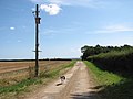
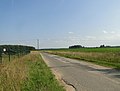
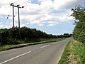 B1105 road past Egmere - geograph.org.uk - 2539138.jpg 640 × 480; 158 KB
-
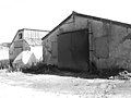
 Barn near Egmere - geograph.org.uk - 543756.jpg 640 × 478; 262 KB
-
 Converted RAF buildings - geograph.org.uk - 4106871.jpg 640 × 490; 159 KB
-
 Cracked concrete surface - geograph.org.uk - 4106796.jpg 640 × 480; 180 KB
-
 Crew lockers and drying room - geograph.org.uk - 4160374.jpg 640 × 480; 141 KB
-
 Crew lockers and drying room - geograph.org.uk - 4160380.jpg 640 × 480; 163 KB
-

-
 Egmere - geograph.org.uk - 412999.jpg 640 × 480; 74 KB
-
 Egmere - geograph.org.uk - 543757.jpg 640 × 478; 264 KB
-
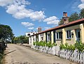
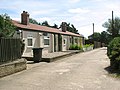
 Egmere Cottages, Egmere - geograph.org.uk - 2539170.jpg 640 × 480; 257 KB
-
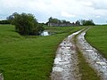
 Farm track into fields - geograph.org.uk - 4106770.jpg 640 × 480; 113 KB
-
 Farm track off the B1105 road - geograph.org.uk - 4106773.jpg 640 × 514; 171 KB
-
-

-
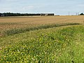
 Fields south of Egmere Cottages, Egmere - geograph.org.uk - 2539194.jpg 640 × 480; 223 KB
-
 Former RAF guardroom - geograph.org.uk - 4106726.jpg 640 × 480; 110 KB
-
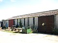
 Former RAF workshops - geograph.org.uk - 4106711.jpg 640 × 480; 127 KB
-

-
 Gas clothing and respirator store - geograph.org.uk - 4106698.jpg 640 × 480; 153 KB
-

-
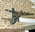 Jolly Roger mural - geograph.org.uk - 4135104.jpg 640 × 575; 122 KB
-
 Motor transport sheds - geograph.org.uk - 4160367.jpg 640 × 480; 133 KB
-
 Muddy track to Creake Buildings south of New Holkham - geograph.org.uk - 2934968.jpg 4,320 × 3,240; 5.37 MB
-
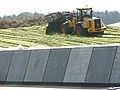
 New solar farm at Egmere - geograph.org.uk - 4160409.jpg 640 × 516; 179 KB
-

-

-

-
 Old concreted road - geograph.org.uk - 4106728.jpg 640 × 480; 243 KB
-
 Old concreted road - geograph.org.uk - 4106781.jpg 640 × 480; 252 KB
-
 Old RAF building in the woods - geograph.org.uk - 4135028.jpg 640 × 480; 276 KB
-
 Old RAF buildings - geograph.org.uk - 4106703.jpg 640 × 458; 164 KB
-
 Old RAF buildings - geograph.org.uk - 4106719.jpg 640 × 480; 109 KB
-
 Old RAF buildings beside the B1105 road - geograph.org.uk - 4106712.jpg 640 × 480; 146 KB
-
 Old RAF workshop - geograph.org.uk - 4106700.jpg 640 × 480; 126 KB
-
 Old RAF workshop - geograph.org.uk - 4106701.jpg 640 × 480; 146 KB
-

-
-
 Old water tower - geograph.org.uk - 4106792.jpg 640 × 480; 283 KB
-
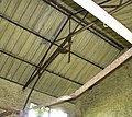
 One of the former main workshops - geograph.org.uk - 4106709.jpg 640 × 506; 163 KB
-
 Pillbox by Egmere Cottages, Egmere - geograph.org.uk - 2539150.jpg 640 × 480; 260 KB
-
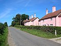
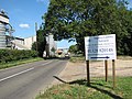
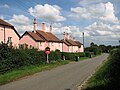 Pink cottages in Egmere - geograph.org.uk - 2539187.jpg 640 × 480; 158 KB
-

-
 Private track over a medieval village site - geograph.org.uk - 2934992.jpg 4,320 × 3,240; 5.45 MB
-
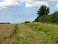
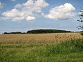
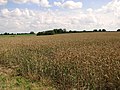 Ripening crops by Egmere - geograph.org.uk - 2539195.jpg 640 × 480; 223 KB
-
-
 Ripening wheat by Egmere Farm, Egmere - geograph.org.uk - 2539127.jpg 640 × 480; 210 KB
-
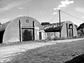
 Ruined building in the woods - geograph.org.uk - 4106802.jpg 640 × 577; 334 KB
-
 Rustic charm or rural neglect^ - West of Little Walsingham - geograph.org.uk - 3231893.jpg 2,848 × 2,136; 3.23 MB
-
 Silos on North Creake Business Park - geograph.org.uk - 4102594.jpg 640 × 480; 177 KB
-
 Solar farm at Egmere - geograph.org.uk - 4160407.jpg 640 × 480; 188 KB
-
 Solar panels at Egmere - geograph.org.uk - 4160410.jpg 640 × 480; 184 KB
-

-

-

-
 The AML Bombing teacher - geograph.org.uk - 4135052.jpg 640 × 480; 302 KB
-
 The B1105 road past Bunker's Hill - geograph.org.uk - 4102575.jpg 640 × 480; 200 KB
-

-
 The Control Tower B^B - geograph.org.uk - 4106835.jpg 640 × 543; 174 KB
-
 The Control Tower B^B - geograph.org.uk - 4106839.jpg 640 × 590; 247 KB
-
 The former Flight office - geograph.org.uk - 4106858.jpg 640 × 480; 146 KB
-
 The gun turret trainer (interior) - geograph.org.uk - 4135035.jpg 640 × 570; 211 KB
-
 The gun turret trainer (interior) - geograph.org.uk - 4135036.jpg 640 × 480; 131 KB
-
 The hamlet of Egmere - geograph.org.uk - 3454393.jpg 1,600 × 1,154; 490 KB
-
 The Motor transport shed - geograph.org.uk - 4160360.jpg 640 × 480; 128 KB
-
 The Motor transport shed - geograph.org.uk - 4160370.jpg 640 × 508; 130 KB
-
 The old Parachute store - geograph.org.uk - 4106725.jpg 640 × 480; 150 KB
-
 The old range - geograph.org.uk - 4135053.jpg 640 × 549; 274 KB
-
 The old Standby set house - geograph.org.uk - 4106789.jpg 640 × 480; 229 KB
-
 The Speech broadcasting building - geograph.org.uk - 4106849.jpg 640 × 526; 264 KB
-
 Tree lined drive to Egmere Farm - geograph.org.uk - 2935173.jpg 4,320 × 3,240; 5.45 MB
-
-

-
 View inside the turret trainer - geograph.org.uk - 4135032.jpg 640 × 480; 163 KB
-

-

-

-


_-_geograph.org.uk_-_4135035.jpg)
_-_geograph.org.uk_-_4135036.jpg)


