Category:Ehemaliges Schulhaus Mühlebach (Weinfelderstrasse 127, Amriswil)
| Object location | | View all coordinates using: OpenStreetMap |
|---|
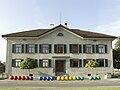
former school building in Amriswil in the canton of Thurgau, Switzerland  | |||||
| Upload media | |||||
| Instance of |
| ||||
|---|---|---|---|---|---|
| Part of | |||||
| Location |
| ||||
| Street address |
| ||||
| Occupant |
| ||||
| Heritage designation | |||||
 | |||||
Media in category "Ehemaliges Schulhaus Mühlebach (Weinfelderstrasse 127, Amriswil)"
This category contains only the following file.
-
 SM-Strassenansicht.jpg 680 × 510; 353 KB