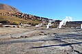
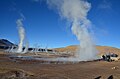
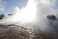
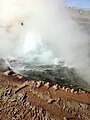
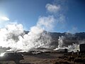
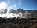
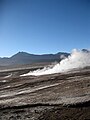
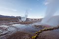
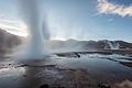
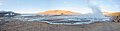
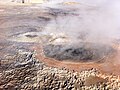
Category:El Tatio
Geyser field located in the Andes Mountains, Chile  | |||||
| Upload media | |||||
| Instance of | |||||
|---|---|---|---|---|---|
| Location | Antofagasta Province, Antofagasta Region, Chile | ||||
| Heritage designation |
| ||||
| Mountain range | |||||
| Elevation above sea level |
| ||||
 | |||||

Subcategories
This category has the following 13 subcategories, out of 13 total.
Media in category "El Tatio"
The following 200 files are in this category, out of 260 total.
(previous page) (next page)-
 2012-01-09 2558 Atacama (6800092949).jpg 3,339 × 2,226; 2.89 MB
-
 20120618 Chile 3352 Tatio (7704028054).jpg 3,648 × 2,736; 1.77 MB
-
 20120618 Chile 3372 Tatio (7704032470).jpg 3,648 × 2,736; 3.48 MB
-
 20120618 Chile 3384 Tatio (7704034922).jpg 3,648 × 2,736; 3.54 MB
-
 Action! (2672038525).jpg 856 × 1,280; 163 KB
-
 Agua sulfatada (4366481215).jpg 2,048 × 1,536; 743 KB
-
 Amanece en el Tatio (4366776064).jpg 1,536 × 2,048; 229 KB
-
 Amanecer en Geyser del Tatio.JPG 1,936 × 2,592; 1.18 MB
-
 Andean Gull El Tatio.jpg 817 × 778; 398 KB
-
 Atacama geisers El Tatio (467067076).jpg 1,120 × 668; 606 KB
-
 Atacama geisers El Tatio II (500867044).jpg 2,229 × 1,429; 3.82 MB
-
 Atacama. Txile 2019 iraila. 06.jpg 3,408 × 1,744; 2.15 MB
-
 Atacama. Txile 2019 iraila. 07.jpg 4,608 × 2,240; 7.58 MB
-
 Atacama. Txile 2019 iraila. 08.jpg 4,608 × 2,240; 4.5 MB
-
 Atacama. Txile 2019 iraila. Geiserra 2.jpg 4,608 × 2,240; 2.88 MB
-
 Atacama. Txile 2019 iraila. Geiserra.jpg 2,240 × 4,608; 3.68 MB
-
 Atacamako basamortua 2019ko iraila 02.jpg 4,608 × 2,240; 4.56 MB
-

-
 Bird at El Tatio Geysers (2043100105).jpg 2,048 × 1,536; 1.7 MB
-
 Bird at El Tatio Geysers (2043896816).jpg 2,048 × 1,536; 2.23 MB
-
 Calama, Región de Antofagasta, Chile - panoramio.jpg 2,048 × 1,536; 640 KB
-
 Canyon along hike path.jpg 1,024 × 680; 195 KB
-
 Chile 2012 - 8207562812.jpg 2,816 × 2,112; 1.15 MB
-
 Chile-Tatio-Geyser.jpg 578 × 480; 46 KB
-
 Comienza a salir el sol (4366772544).jpg 2,048 × 1,536; 215 KB
-
 Copia IMG 0772 (5896959845).jpg 2,592 × 1,936; 2.68 MB
-
 Cordillera del Tatio (32979166766).jpg 6,016 × 4,000; 6.83 MB
-
 Eduardo Frei en géisers de "El Tatio (3972127625).jpg 980 × 1,470; 190 KB
-
 El gran géiser (4366461269).jpg 2,048 × 1,536; 372 KB
-
 El Tatio - panoramio.jpg 2,576 × 1,932; 966 KB
-
 El Tatio 14.jpg 1,745 × 878; 639 KB
-
 El Tatio 32.jpg 2,144 × 1,424; 3.22 MB
-
 El Tatio 33.jpg 2,144 × 1,424; 3.18 MB
-
 El Tatio geyser - panoramio.jpg 2,576 × 1,932; 627 KB
-
 El Tatio geyser field - panoramio.jpg 2,576 × 1,932; 711 KB
-
 El Tatio Geysers (2043080243).jpg 2,048 × 1,536; 564 KB
-
 El Tatio Geysers (2043088679).jpg 2,048 × 1,536; 534 KB
-
 El Tatio Geysers (2043089269).jpg 1,536 × 2,048; 657 KB
-
 El Tatio Geysers (2043091021).jpg 2,048 × 1,536; 651 KB
-
 El Tatio Geysers (2043092801).jpg 2,048 × 1,536; 1.12 MB
-
 El Tatio Geysers (2043094391).jpg 2,048 × 1,536; 999 KB
-
 El Tatio Geysers (2043102439).jpg 1,536 × 2,048; 585 KB
-
 El Tatio Geysers (2043880602).jpg 2,048 × 1,536; 1.09 MB
-
 El Tatio Geysers (2043891534).jpg 2,048 × 1,536; 1.04 MB
-
 El Tatio Geysers (2043910432).jpg 2,048 × 1,536; 1,024 KB
-
 El Tatio Geysers (2051929659).jpg 2,048 × 1,536; 657 KB
-
 El Tatio landscape (2672856204).jpg 859 × 1,280; 229 KB
-
 El Tatio San Pedro de Atacama.jpg 1,439 × 2,028; 1.5 MB
-
 El Tatio, (possibly) Cerro El Vólcan.jpg 6,016 × 4,000; 12.58 MB
-
 El Tatio, Chile 2012.jpg 2,816 × 1,584; 986 KB
-
 ElTatio-CerroSoquete-2004.jpg 1,600 × 899; 468 KB
-
 ElTatio8.jpg 2,048 × 1,536; 636 KB
-
ElTatioMovie.ogv 9.2 s, 320 × 240; 894 KB
-

-
 Flare at Geyser del Tatio (32676047908).jpg 4,256 × 2,832; 4.41 MB
-
 Fumerolles and more... (2672038149).jpg 1,280 × 859; 291 KB
-
 Geiser del Tatio - San Pedro de Atacama.jpg 3,008 × 2,000; 2.2 MB
-
 Geiser del Tatio 01.jpg 6,000 × 3,375; 12.9 MB
-
 Geiser del Tatio 02.jpg 6,000 × 3,375; 14.08 MB
-
 Geiser del Tatio 03.jpg 6,000 × 4,000; 14.53 MB
-
 Geiser del Tatio 04.jpg 6,000 × 4,000; 11.26 MB
-
 Geiser del Tatio.jpg 1,476 × 1,057; 693 KB
-
 Geiser en el Tatio.JPG 2,272 × 1,704; 1.99 MB
-
 Geiseres del Tatio, San Pedro de Atacama.jpg 960 × 638; 520 KB
-
 Geisers del Tatio.JPG 1,600 × 1,200; 543 KB
-
 Geisers voor zonsopkomst (5523878386).jpg 5,616 × 3,744; 7.43 MB
-
 Geyser del Tatio (13341196974).jpg 3,872 × 2,592; 3.66 MB
-
 Geyser del Tatio (16528574904).jpg 4,491 × 2,994; 1.3 MB
-
 Geyser del Tatio (16528575134).jpg 3,747 × 2,498; 921 KB
-
 Geyser del Tatio (16964817219).jpg 4,418 × 2,945; 1.24 MB
-
 Geyser del Tatio (32865593192).jpg 6,016 × 4,000; 8.81 MB
-
 Geyser del Tatio (32894702621).jpg 6,016 × 4,000; 9.27 MB
-
 Geyser del Tatio (32894711831).jpg 6,016 × 4,000; 8.6 MB
-
 Geyser del Tatio - panoramio.jpg 2,592 × 1,944; 926 KB
-
 Geyser del Tatio, II Región, Chile - Flickr - FcoPintoB.jpg 2,848 × 4,288; 3.97 MB
-
 Geyser del Tatio, Norte de Chile.jpg 960 × 720; 90 KB
-
 Geyser del tatio.jpg 1,818 × 1,228; 455 KB
-
 Geyser el Tatio - Flickr - Carochups (1).jpg 4,608 × 3,456; 2.54 MB
-
 Geyser el Tatio - Flickr - Carochups.jpg 4,608 × 3,456; 5.07 MB
-
 Geyser El Tatio In Atacama Desert (215307417).jpeg 2,048 × 1,366; 766 KB
-
 Geyser El Tatio In Atacama Desert Chile (215307549).jpeg 2,048 × 1,366; 717 KB
-
 Geyser en San Pedro de Atacama.jpg 960 × 638; 63 KB
-
 Geyser Field - Flickr - Dick Culbert.jpg 720 × 486; 86 KB
-
 Geyseres del Tatio, Atacama.JPG 2,750 × 4,124; 4.02 MB
-
 Geyseres del Tatio.JPG 4,608 × 3,072; 6.32 MB
-
 Geysers - panoramio (1).jpg 1,536 × 2,048; 649 KB
-
 Geysers - panoramio.jpg 2,048 × 1,536; 652 KB
-
 Geysers de Tatio - Atacama - Chile 01.jpg 3,514 × 2,498; 1.07 MB
-
 Geysers del Tatio (8200988717).jpg 1,944 × 2,896; 1,004 KB
-
 Geysers del Tatio 2 - Atacama - Chile.jpg 3,888 × 2,592; 2.82 MB
-
 Geysers del Tatio at the break of dawn (8202073452).jpg 1,812 × 438; 220 KB
-
 Geysers Del Tatio, Atacama Desert Chile 01.JPG 4,928 × 3,264; 3.81 MB
-
 Geysers Del Tatio, Atacama Desert Chile 02.JPG 4,928 × 3,264; 4.35 MB
-
 Geysers Del Tatio, Atacama Desert Chile 03.JPG 3,264 × 4,928; 5.28 MB
-
 Geysers Del Tatio, Atacama Desert Chile 04.JPG 4,928 × 3,264; 5.76 MB
-
 Geysers Del Tatio, Atacama Desert Chile 05.JPG 4,928 × 3,264; 8.16 MB
-
 Geysers del Tatio, Atacama Desert, Chile.JPG 4,928 × 3,264; 4.91 MB
-
 Geysers del Tatio, Atacama Desert.JPG 4,928 × 3,264; 5.12 MB
-
 Geysers del Tatio, San Pedro de Atacama (5515215617).jpg 5,616 × 3,744; 4.13 MB
-
 Geysers del Tatio, San Pedro de Atacama (5515835232).jpg 5,616 × 3,744; 8.42 MB
-
 Geysers del Tatio.JPG 4,608 × 3,456; 2.45 MB
-
 Geysers del Tatio.jpg 3,264 × 2,448; 2.38 MB
-
 Geysers El Tatio.jpg 1,280 × 960; 152 KB
-
 Geysir (6768329559).jpg 3,888 × 2,592; 2.67 MB
-
 Geysir (6768331297).jpg 3,888 × 2,592; 2.5 MB
-
 Geysir (6768332579).jpg 2,522 × 3,784; 1.94 MB
-
 Geysir (6768355041).jpg 3,888 × 2,592; 3 MB
-
 Geysir (6800096657).jpg 2,592 × 3,888; 2.26 MB
-
 Geysir and steam at El Tatio (5897589862).jpg 2,592 × 1,936; 1.62 MB
-
 Geysir at El Tatio (5897017965).jpg 1,936 × 2,592; 2.18 MB
-
 Ghostly Silhouette (32676044858).jpg 4,256 × 2,832; 2.93 MB
-
 Golden Grass and Rising Steam (32676048688).jpg 4,256 × 2,832; 4.79 MB
-
 Géiser Cónico del Tatio (26439197452).jpg 4,608 × 2,592; 9.29 MB
-
 Géiser del Tatio - Atacama - panoramio (1).jpg 5,992 × 1,300; 1.24 MB
-
 Géiser del Tatio - Atacama - panoramio (2).jpg 3,927 × 1,300; 808 KB
-
 Géiser del Tatio - Atacama - panoramio (3).jpg 960 × 720; 265 KB
-
 Géiser del Tatio - Atacama - panoramio.jpg 2,772 × 1,300; 600 KB
-
 Géiser del Tatio - Deserto Atacama - Chile - panoramio (1).jpg 4,960 × 2,510; 7.93 MB
-
 Géiser del Tatio - Deserto Atacama - Chile - panoramio (2).jpg 5,984 × 2,556; 9.73 MB
-
 Géiser del Tatio - Deserto Atacama - Chile - panoramio (3).jpg 3,264 × 2,448; 1.52 MB
-
 Géiser del Tatio - Deserto Atacama - Chile - panoramio (4).jpg 3,264 × 2,448; 2.78 MB
-
 Géiser del Tatio - Deserto Atacama - Chile - panoramio (5).jpg 3,264 × 2,448; 1.84 MB
-
 Géiser del Tatio - Deserto Atacama - Chile - panoramio (6).jpg 4,880 × 2,534; 7.87 MB
-
 Géiser del Tatio - Deserto Atacama - Chile - panoramio (7).jpg 3,264 × 2,448; 3.3 MB
-
 Géiser del Tatio - Deserto Atacama - Chile - panoramio (8).jpg 3,264 × 2,448; 2.09 MB
-
 Géiser del Tatio - Deserto Atacama - Chile - panoramio (9).jpg 3,264 × 2,448; 3.83 MB
-
 Géiser del Tatio - Deserto Atacama - Chile - panoramio.jpg 3,264 × 2,448; 2.43 MB
-
 Géiser del Tatio-CTJ-IMG 5930.jpg 5,308 × 3,538; 10.77 MB
-
 Géiser del Tatio-CTJ-IMG 5936.jpg 5,309 × 3,539; 8.9 MB
-
 Géiser del Tatio-CTJ-IMG 5939.jpg 5,309 × 3,539; 8.94 MB
-
 Géiser del Tatio-CTJ-IMG 5945.jpg 5,309 × 3,539; 8.79 MB
-
 Géiser del Tatio-CTJ-IMG 5948.jpg 5,319 × 3,546; 14.08 MB
-
 Géiser del Tatio-CTJ-IMG 5951.jpg 5,319 × 3,546; 12.61 MB
-
 Géiser del Tatio-CTJ-IMG 5960.jpg 5,309 × 3,539; 9.13 MB
-
 Géiser del Tatio-CTJ-IMG 5966.jpg 5,308 × 3,538; 10.17 MB
-
 Géiser del Tatio-CTJ-IMG 5987.jpg 5,472 × 3,648; 8.45 MB
-
 Géiser del Tatio-CTJ-IMG 6032.jpg 5,309 × 3,539; 11.7 MB
-
 Géiser del Tatio-CTJ-IMG 6038.jpg 5,472 × 3,648; 16.41 MB
-
 Géiser del Tatio-CTJ-IMG 6053.jpg 3,648 × 3,648; 8.67 MB
-
 Géiser del Tatio-CTJ-IMG 6059.jpg 5,319 × 3,546; 11.86 MB
-
 Géiser del Tatio-CTJ-IMG 6065.jpg 5,309 × 3,539; 12.33 MB
-
 Géiser del Tatio-CTJ-IMG 6068.jpg 5,309 × 3,539; 12.5 MB
-
 Géiser del Tatio-CTJ-IMG 6083.jpg 1,024 × 682; 766 KB
-
 Géiser del Tatio-CTJ-IMG 6129.jpg 4,718 × 3,538; 11.64 MB
-
 Géiseres Del Tatio (158152629).jpeg 2,048 × 1,387; 305 KB
-
 Géiseres del Tatio (4366024119).jpg 1,536 × 2,048; 257 KB
-
 Géiseres del Tatio (4366024467).jpg 2,048 × 1,536; 254 KB
-
 Géiseres del Tatio (4366026665).jpg 1,536 × 2,048; 204 KB
-
 Géiseres del Tatio (4366454367).jpg 2,048 × 1,536; 245 KB
-
 Géiseres del Tatio (4366454671).jpg 2,048 × 1,536; 224 KB
-
 Géiseres del Tatio (4366456957).jpg 2,048 × 1,536; 177 KB
-
 Géiseres del Tatio (4366457615).jpg 2,048 × 1,536; 353 KB
-
 Géiseres del Tatio (4366458519).jpg 2,048 × 1,536; 462 KB
-
 Géiseres del Tatio (4366458759).jpg 2,048 × 1,536; 359 KB
-
 Géiseres del Tatio (4366459591).jpg 2,048 × 1,536; 494 KB
-
 Géiseres del Tatio (4366479289).jpg 2,048 × 1,536; 330 KB
-
 Géiseres del Tatio (4366764704).jpg 2,048 × 1,536; 195 KB
-
 Géiseres del Tatio (4366764828).jpg 1,536 × 2,048; 160 KB
-
 Géiseres del Tatio (4366769562).jpg 2,048 × 1,536; 210 KB
-
 Géiseres del Tatio (4366774804).jpg 2,048 × 1,536; 176 KB
-
 Géiseres del Tatio (4367201232).jpg 1,536 × 2,048; 276 KB
-
 Géiseres del Tatio (4367201554).jpg 2,048 × 1,536; 254 KB
-
 Géiseres del Tatio (4367201714).jpg 2,048 × 1,536; 288 KB
-
 Géiseres del Tatio (4367202788).jpg 2,048 × 1,536; 164 KB
-
 Géiseres del Tatio (4367203276).jpg 2,048 × 1,536; 219 KB
-
 Géiseres del Tatio (4367203416).jpg 2,048 × 1,536; 188 KB
-
 Géiseres del Tatio (4367203776).jpg 2,048 × 1,536; 257 KB
-
 Géiseres del Tatio (4367204068).jpg 2,048 × 1,536; 222 KB
-
 Géiseres del Tatio (4367204670).jpg 1,536 × 2,048; 318 KB
-
 Géiseres del Tatio (4367204848).jpg 2,048 × 1,536; 275 KB
-
 Géiseres del Tatio (4367206932).jpg 2,048 × 1,536; 370 KB
-
 Géiseres del Tatio (4368647387).jpg 2,048 × 1,536; 335 KB
-
 Géiseres del Tatio (4369397010).jpg 2,048 × 1,536; 502 KB
-
 Géiseres del Tatio, Atacama, Chile, 2016-02-01, DD 01-02 HDR.JPG 8,686 × 5,791; 11.01 MB
-
 Géiseres del Tatio, Atacama, Chile, 2016-02-01, DD 03-05 HDR.JPG 8,564 × 5,610; 9.06 MB
-
 Géiseres del Tatio, Atacama, Chile, 2016-02-01, DD 24-26 HDR.JPG 8,688 × 5,792; 10.1 MB
-
 Géiseres del Tatio, Atacama, Chile, 2016-02-01, DD 36-38 HDR.JPG 8,688 × 5,792; 11.51 MB
-
 Géiseres del Tatio, Atacama, Chile, 2016-02-01, DD 39-41 HDR.JPG 8,688 × 5,792; 9.03 MB
-
 Géiseres del Tatio, Atacama, Chile, 2016-02-01, DD 42-44 HDR.JPG 8,358 × 4,925; 9.65 MB
-
 Géiseres del Tatio, Atacama, Chile, 2016-02-01, DD 51-53 HDR.JPG 8,688 × 5,792; 8.85 MB
-
 Géiseres del Tatio, Atacama, Chile, 2016-02-01, DD 54-55 HDR.JPG 8,688 × 5,792; 11.17 MB
-
 Géiseres del Tatio, Atacama, Chile, 2016-02-01, DD 56-57 HDR.JPG 5,215 × 7,822; 7.12 MB
-
 Géiseres del Tatio, Atacama, Chile, 2016-02-01, DD 58-69 HDR PAN.JPG 14,327 × 3,645; 18.23 MB
-
 Géiseres del Tatio, Atacama, Chile, 2016-02-01, DD 70-72 HDR.JPG 8,682 × 5,789; 10.38 MB
-
 Géiseres del Tatio, Atacama, Chile, 2016-02-01, DD 73.JPG 8,688 × 5,792; 9.98 MB
-
 Géiseres del Tatio, Atacama, Chile, 2016-02-01, DD 74-77 PAN.JPG 16,952 × 3,816; 26.35 MB
-
 Géiseres Tatio.jpg 4,320 × 3,240; 3.27 MB
-
 Géisers del Tatio (26465484801).jpg 4,608 × 2,592; 7.45 MB
-
 Hike along Copacoya.jpg 1,024 × 680; 165 KB
-
 Hot pond at El Tatio (5897531410).jpg 2,592 × 1,936; 2.6 MB
-
 La fumarola! (4366765688).jpg 2,048 × 1,536; 493 KB
-
 Llamitas D (4369639908).jpg 2,048 × 1,536; 630 KB
-
 Llamitas D (4369640506).jpg 2,048 × 1,536; 629 KB
-
 Los Geiser Del Tatio.JPG 2,272 × 1,704; 1.74 MB
-
 Los Geisers del Tatio, Atacama, Chile.JPG 5,184 × 3,456; 10.14 MB
-
 Makeshift Camp Near Geyser del Tatio (46395478752).jpg 4,256 × 2,832; 4.4 MB
-
 Medidads de seguridad en los Geisers del Tatio 01.JPG 800 × 532; 241 KB
-
 Medidads de seguridad en los Geisers del Tatio 02.JPG 800 × 532; 216 KB
-
 Medidads de seguridad en los Geisers del Tatio 03.JPG 800 × 532; 280 KB
-
 Medidads de seguridad en los Geisers del Tatio 04.JPG 800 × 532; 175 KB
.jpg)
.jpg)
.jpg)
.jpg)
.jpg)
.jpg)
.jpg)


.jpg)
.jpg)


.jpg)
.jpg)
.jpg)


.jpg)
.jpg)
.jpg)
.jpg)
.jpg)


.jpg)
.jpg)
.jpg)
.jpg)
.jpg)
.jpg)
.jpg)
.jpg)
.jpg)
.jpg)
.jpg)
.jpg)

_Cerro_El_V%C3%B3lcan.jpg)


.jpg)
.jpg)


.jpg)
.jpg)
.jpg)
.jpg)
.jpg)
.jpg)
.jpg)
.jpg)


.jpg)

.jpeg)
.jpeg)


.jpg)


.jpg)


.jpg)
.jpg)


.jpg)
.jpg)
.jpg)
.jpg)
.jpg)
.jpg)
.jpg)
.jpg)
.jpg)
.jpg)
.jpg)

.jpg)
.jpg)
.jpg)
.jpg)
.jpg)
.jpg)
.jpg)
.jpg)
.jpg)


.jpeg)
.jpg)
.jpg)
.jpg)
.jpg)
.jpg)
.jpg)
.jpg)
.jpg)
.jpg)
.jpg)
.jpg)
.jpg)
.jpg)
.jpg)
.jpg)
.jpg)
.jpg)
.jpg)
.jpg)
.jpg)
.jpg)
.jpg)
.jpg)
.jpg)
.jpg)
.jpg)
.jpg)
.jpg)


.jpg)

.jpg)
.jpg)
.jpg)
.jpg)


.jpg)


.jpg)
.jpg)
.jpg)