Category:Election maps of Dundee
Council areas (municipalities) of Scotland: Aberdeen · Aberdeenshire · Angus · Dundee · East Lothian · East Renfrewshire · Edinburgh · Fife · Glasgow · North Lanarkshire · Outer Hebrides · Orkney Islands · Shetland Islands · West Lothian
Media in category "Election maps of Dundee"
The following 15 files are in this category, out of 15 total.
-
 City of Dundee Council 1999 results by ward.png 3,824 × 2,001; 1.3 MB
-
 City of Dundee Council 2003 results by ward.png 3,840 × 2,348; 1.45 MB
-
 DCC1995ElectionMapNew.png 3,879 × 2,094; 1.27 MB
-
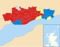
 Dundee City Council 2007 results by ward.png 3,997 × 1,988; 656 KB
-
 Dundee City Council 2012 results by ward.png 4,014 × 1,996; 666 KB
-
 Dundee City Council 2017 results by ward.png 3,996 × 1,988; 658 KB
-
 Dundee City Council election 2012.svg 1,572 × 518; 130 KB
-
 Dundee City Council election 2017.svg 1,572 × 518; 130 KB
-
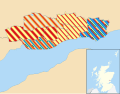
 Dundee City Council election 2022 results by ward.png 721 × 346; 66 KB
-
 Dundee City Council election, 1988.svg 692 × 464; 91 KB
-
 Dundee City Council election, 1992.svg 692 × 464; 91 KB
-
 Dundee City Council election, 1995.svg 1,425 × 1,112; 705 KB
-
 Dundee City Council election, 1999.svg 1,425 × 1,112; 708 KB
-
 Dundee City Council election, 2003.svg 1,425 × 1,112; 708 KB
-
 Dundee City Council election, 2007.svg 1,425 × 1,112; 764 KB


