Category:Election maps of France
Countries of Europe: Albania · Andorra · Armenia‡ · Austria · Azerbaijan‡ · Belarus · Belgium · Bosnia and Herzegovina · Bulgaria · Croatia · Cyprus‡ · Czech Republic · Denmark · Estonia · Finland · France‡ · Georgia‡ · Germany · Greece · Hungary · Iceland · Republic of Ireland · Italy · Kazakhstan‡ · Latvia · Liechtenstein · Lithuania · Luxembourg · Malta · Moldova · Montenegro · Netherlands‡ · North Macedonia · Norway · Poland · Portugal‡ · Romania · Russia‡ · San Marino · Serbia · Slovakia · Slovenia · Spain‡ · Sweden · Switzerland · Turkey‡ · Ukraine · United Kingdom
Specific status: Faroe Islands · Gibraltar · Isle of Man · Jersey – Limited recognition: Kosovo · Northern Cyprus‡
‡: partly located in Europe
Specific status: Faroe Islands · Gibraltar · Isle of Man · Jersey – Limited recognition: Kosovo · Northern Cyprus‡
‡: partly located in Europe
Administrative regions and territorial collectivity of Metropolitan France (‡ since start of 2016):
Auvergne-Rhône-Alpes‡ · Bourgogne-Franche-Comté‡ · Bretagne · Centre-Val de Loire · Corsica · Grand Est‡ · Hauts-de-France‡ · Île-de-France · Normandie‡ · Nouvelle-Aquitaine‡ · Occitanie‡ · Pays de la Loire · Provence-Alpes-Côte d'Azur
Former administrative regions of Metropolitan France (until end of 2015):
Alsace · Aquitaine · Auvergne · Bourgogne · Champagne-Ardenne · Franche-Comté · Languedoc-Roussillon · Limousin · Lorraine · Midi-Pyrénées · Nord-Pas-de-Calais · Basse-Normandie · Haute-Normandie · Picardie · Poitou-Charentes · Rhône-Alpes
Overseas departments and regions: Guadeloupe · Martinique · French Guiana · Réunion · Mayotte
Overseas collectivities: Saint-Barthélemy · Saint-Martin (France) · Saint-Pierre and Miquelon · French Polynesia · Wallis and Futuna · the French Southern and Antarctic Lands+ ≈ French Southern and Antarctic Lands+
Sui generis territories: New Caledonia · Clipperton Island+
Departments of Metropolitan France: Ain [01] · Aisne [02] · Allier [03] · Alpes-de-Haute-Provence [04] · Hautes-Alpes [05] · Alpes-Maritimes [06] · Ardèche [07] · Ardennes (department) [08] · Ariège (department) [09] · Aube (department) [10] · Aude [11] · Aveyron [12] · Bouches-du-Rhône [13] · Calvados [14] · Cantal [15] · Charente [16] · Charente-Maritime [17] · Cher (department) [18] · Corrèze [19] · Corse-du-Sud [2A]† · Haute-Corse [2B]† · Côte-d'Or [21] · Côtes-d'Armor [22] · Creuse (department) [23] · Dordogne [24] · Doubs [25] · Drôme [26] · Eure [27] · Eure-et-Loir [28] · Finistère [29] · Gard [30] · Haute-Garonne [31] · Gers (department) [32] · Gironde [33] · Hérault [34] · Ille-et-Vilaine [35] · Indre (department) [36] · Indre-et-Loire [37] · Isère (department) [38] · Jura (department) [39] · Landes (department) [40] · Loir-et-Cher [41] · Loire (department) [42] · Haute-Loire [43] · Loire-Atlantique [44] · Loiret [45] · Lot (department) [46] · Lot-et-Garonne [47] · Lozère [48] · Maine-et-Loire [49] · Manche [50] · Marne (department) [51] · Haute-Marne [52] · Mayenne [53] · Meurthe-et-Moselle [54] · Meuse (department) [55] · Morbihan [56] · Moselle (department) [57] · Nièvre [58] · Nord (French department) [59] · Oise (department) [60] · Orne [61] · Pas-de-Calais [62] · Puy-de-Dôme [63] · Pyrénées-Atlantiques [64] · Hautes-Pyrénées [65] · Pyrénées-Orientales [66] · Bas-Rhin [67] · Haut-Rhin [68] · Rhône [69] · Rhône (department) [69D]‡ · Métropole de Lyon [69M]‡ · Haute-Saône [70] · Saône-et-Loire [71] · Sarthe [72] · Savoie [73] · Haute-Savoie [74] · Paris [75] · Seine-Maritime [76] · Seine-et-Marne [77] · Yvelines [78] · Deux-Sèvres [79] · Somme (department) [80] · Tarn (department) [81] · Tarn-et-Garonne [82] · Var (department) [83] · Vaucluse [84] · Vendée (department) [85] · Vienne [86] · Haute-Vienne [87] · Vosges (department) [88] · Yonne [89] · Territoire de Belfort [90] · Essonne (department) [91] · Hauts-de-Seine [92] · Seine-Saint-Denis [93] · Val-de-Marne [94] · Val-d'Oise [95]
Overseas departments and regions: Guadeloupe [971] · Martinique [972] · French Guiana [973] · Réunion [974] · Mayotte [976]
Overseas collectivities: Saint-Pierre and Miquelon [975] · Saint-Barthélemy [977] · Saint-Martin (France) [978] · Wallis and Futuna [986] · French Polynesia [987] · the French Southern and Antarctic Lands [984]+ ≈ French Southern and Antarctic Lands [984]+
Sui generis territories: New Caledonia [988] · Clipperton Island [989]+
Subcategories
This category has the following 11 subcategories, out of 11 total.
Media in category "Election maps of France"
The following 38 files are in this category, out of 38 total.
-
 2007-2012 French Presidential Swing.svg 588 × 550; 197 KB
-
 2012 French Legislative Election Results Map First Round.svg 2,100 × 1,600; 3.25 MB
-
 2012 French Legislative Election Results Map Second Round.svg 2,100 × 1,600; 3.29 MB
-
 2014 European Parliamentary Election in France.svg 2,500 × 1,900; 1.24 MB
-
 Carte des Cantons français 2015.svg 1,000 × 900; 3.92 MB
-
 Centre 2021.png 582 × 587; 57 KB
-
 Democ-soc2.svg 1,052 × 744; 1.11 MB
-
 Droite 1986.png 582 × 587; 59 KB
-
 Droite 1992.png 582 × 587; 59 KB
-
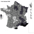
 Droite 1998.png 582 × 587; 59 KB
-
 Droite 2004.png 582 × 587; 59 KB
-
 Droite 2010.png 582 × 587; 59 KB
-
 Droite 2015.png 582 × 587; 58 KB
-
 Droite 2021.png 582 × 587; 57 KB
-
 Elections européennes de 2019.svg 512 × 389; 535 KB
-
 FN 1986.png 582 × 587; 58 KB
-
 FN 1992.png 582 × 587; 59 KB
-
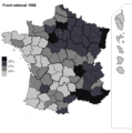 FN 1998.png 582 × 587; 59 KB
-
 FN 2004.png 582 × 587; 59 KB
-
 FN 2010.png 582 × 587; 59 KB
-
 FN 2015.png 582 × 587; 58 KB
-
 France par Elections - btv1b53227211d (1 of 2).jpg 5,328 × 4,854; 3.26 MB
-
 Gauche 1986.png 582 × 587; 59 KB
-
 Gauche 1992.png 582 × 587; 60 KB
-
 Gauche 1998.png 582 × 587; 59 KB
-
 Gauche 2004.png 582 × 587; 59 KB
-
 Gauche 2010.png 582 × 587; 59 KB
-
 Gauche 2015.png 582 × 587; 58 KB
-
 Gauche 2021.png 582 × 587; 58 KB
-
 RN 2021.png 582 × 587; 58 KB
-
 Référendum français de 1992 sur le traité de Maastricht.svg 512 × 453; 1.58 MB
-

-
 Élection 1958.png 1,749 × 2,048; 205 KB
-
 Élection présidentielle française de 1995 T1.png 10,000 × 11,008; 38.83 MB
-
 Élections européennes de 1994 en France.svg 512 × 413; 755 KB
-
 Élections européennes de 1999 en France.svg 512 × 413; 756 KB
-
 Élections européennes de 2004 en France.svg 512 × 393; 631 KB
-
 Élections sénatoriales 2023 - Circonscriptions renouvelables avec mode de scrutin.svg 2,054 × 1,940; 2.53 MB


.jpg)


