Category:Electricity pylons in New Zealand
Main category: Electricity pylons
Media in category "Electricity pylons in New Zealand"
The following 49 files are in this category, out of 49 total.
-
 110,000 volt insulators being tested for faults (3307743989).jpg 574 × 776; 74 KB
-

-
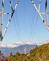
 Arthur's Pass powerline.png 1,733 × 1,370; 1.93 MB
-
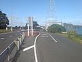
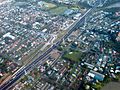 Auckland State Highway One.jpg 1,600 × 1,200; 598 KB
-
 Avondale Stream Auckland Waitakere.jpg 1,600 × 1,200; 1.3 MB
-
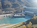 Clutha River Dam In Clyde, From NE.jpg 1,600 × 1,200; 375 KB
-
 Cyclists Crossing Refuge Crossing Onehunga.jpg 1,600 × 800; 345 KB
-
 Electricity transmission lines in New Zealand.jpg 1,024 × 768; 211 KB
-
 Haywards Electrical Substation.jpg 3,900 × 2,613; 1.53 MB
-
 HVDC Inter-Island pylon with great view - panoramio.jpg 1,880 × 2,816; 2.25 MB
-
 Idyll With Several Power Lines.jpg 1,600 × 1,200; 1.42 MB
-
 Interchange In Way Of Coastal Cycleway.jpg 1,600 × 1,200; 368 KB
-
 Island Saddle 007.jpg 3,648 × 5,472; 5.32 MB
-
 Island Saddle 029.jpg 5,472 × 3,648; 7.72 MB
-
 Island Saddle 111.jpg 3,648 × 5,472; 4.53 MB
-
 Island Saddle 112.jpg 3,648 × 5,472; 5.82 MB
-
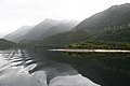 Lake Manpouri West Arm.jpg 1,280 × 853; 277 KB
-
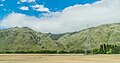 Landscape of Canterbury 03.jpg 3,236 × 1,712; 3.96 MB
-
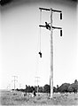 MA I010222 Mangahao - Wellington City transmission line 1925.jpg 475 × 649; 129 KB
-
 Mangere Bridge Construction South Site I.jpg 1,600 × 1,200; 1.03 MB
-
 Molesworth Station Fence Gate.jpg 3,072 × 2,304; 2.03 MB
-
 New Railway Bridge Between ACC, WCC.jpg 1,600 × 1,200; 1.15 MB
-
 NIGU monopoles.JPG 4,752 × 3,168; 4.66 MB
-
 NIGU Strain tower.JPG 3,168 × 4,752; 5.87 MB
-
 NIGU tower near Morrinsville.JPG 3,168 × 4,752; 5.1 MB
-
 NIGU transmision line near Te Kauwhata.JPG 4,752 × 3,168; 4.32 MB
-
 Northwestern Cycleway Clip-On Bridge III.jpg 1,600 × 1,200; 1.03 MB
-
 Onehunga Foreshore Western Side.jpg 1,600 × 1,200; 1.02 MB
-
 Onehunga Lagoon, Looks Like High Tide.jpg 1,600 × 1,200; 1.11 MB
-
 Onehunga Train Station Done I.jpg 1,600 × 1,200; 1.01 MB
-
 Part of the 500kVdc connection between Nth & Sth Islands (pole 1) - panoramio.jpg 2,592 × 3,888; 3.12 MB
-
 Port Of Onehunga Silos And Quays III.jpg 1,200 × 1,600; 1.01 MB
-
 Power pylon 0442 (9782312526).jpg 800 × 1,200; 611 KB
-
 Power pylon 0446 (9782110391).jpg 1,600 × 1,067; 1.25 MB
-
 Power pylon 0453 (9782289575).jpg 800 × 1,200; 716 KB
-
 Power pylon 0460 (9782112171) (2).jpg 1,600 × 1,067; 1.23 MB
-
 Power pylon 0461 (9782300414) (2).jpg 1,600 × 1,067; 1.24 MB
-
 Power pylon 0462 (9782305856) (2).jpg 800 × 1,200; 820 KB
-
 Power Pylon on the Port Hills.jpg 2,592 × 3,888; 4.61 MB
-
 Power pylon, Bryant Range, New Zealand.jpg 5,117 × 3,363; 6.78 MB
-
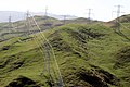
 Power pylons, Bryant Range, New Zealand.jpg 3,436 × 4,219; 6.44 MB
-
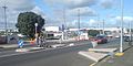
 Queenstown Road Roundabout North II.jpg 1,600 × 1,200; 494 KB
-
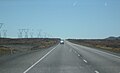 SH 1 Desert Road looking north.jpg 3,072 × 1,857; 450 KB
-
 South-Eastern Side Mangere Bridge.jpg 1,600 × 1,200; 1.21 MB
-
 State Highway 73 near Castle Hill.jpg 4,240 × 2,790; 6.76 MB
-
 Steep climb to the transmitter - panoramio.jpg 2,816 × 1,880; 2.38 MB
-
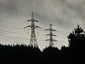
 Transmission lines and rolling hills - panoramio.jpg 2,816 × 1,880; 519 KB
-
 Vines and wires - panoramio.jpg 3,888 × 2,592; 5.2 MB
-
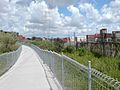 Waikaraka Cycleway Southdown.jpg 1,600 × 1,200; 1.08 MB
.jpg)


_-_panoramio.jpg)

.jpg)
.jpg)
.jpg)
_(2).jpg)
_(2).jpg)
_(2).jpg)


