Category:Elland Upper Edge
human settlement in United Kingdom | |||||
| Upload media | |||||
| Instance of | |||||
|---|---|---|---|---|---|
| Location |
| ||||
 | |||||
Media in category "Elland Upper Edge"
The following 35 files are in this category, out of 35 total.
-
 Baptist Church at Elland Upper Edge - geograph.org.uk - 1024206.jpg 640 × 480; 183 KB
-

-
 Brighouse FP109, Rastrick - geograph.org.uk - 4693011.jpg 2,048 × 1,536; 740 KB
-

-
 Connection between branches of Elland FP17 - geograph.org.uk - 4693001.jpg 2,048 × 1,536; 746 KB
-
 Dewsbury Road from Banks End Road, Elland - geograph.org.uk - 715475.jpg 640 × 480; 113 KB
-
 Dewsbury Road, Elland - geograph.org.uk - 711805.jpg 640 × 480; 87 KB
-
 Dewsbury Road, Elland - geograph.org.uk - 715487.jpg 640 × 480; 72 KB
-
 East View, off Dewsbury Road, Elland - geograph.org.uk - 715496.jpg 640 × 455; 62 KB
-
 Elland FP17 looking towards Upper Edge - geograph.org.uk - 4692993.jpg 2,048 × 1,536; 729 KB
-
 Elland Upper Edge - geograph.org.uk - 38939.jpg 640 × 419; 87 KB
-
 Excavation at Elland Upper Edge - geograph.org.uk - 1841836.jpg 2,000 × 1,442; 892 KB
-
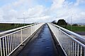
 Footbridge over M62 at New Hey Road - geograph.org.uk - 6052898.jpg 800 × 600; 121 KB
-
 Footbridge over the M62 near Ainley Top - geograph.org.uk - 5756283.jpg 1,600 × 1,065; 484 KB
-
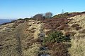 Footpath across 'The Rough' - geograph.org.uk - 693079.jpg 640 × 427; 91 KB
-

-
 Footpath towards Moor Hey - geograph.org.uk - 5756293.jpg 1,600 × 1,065; 482 KB
-
 Footpath towards Moor Hey - geograph.org.uk - 5756296.jpg 1,600 × 1,065; 537 KB
-
-
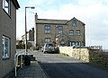
 Houses at the end of Banks End Road - geograph.org.uk - 4159614.jpg 2,000 × 1,228; 736 KB
-
 Houses, Dewsbury Road, Elland - geograph.org.uk - 711799.jpg 640 × 480; 94 KB
-
 Lower Moor Hey Farm, Fixby Ridge - geograph.org.uk - 6064453.jpg 1,024 × 768; 139 KB
-
 M62 near Ainley Top - geograph.org.uk - 5756286.jpg 1,600 × 1,065; 555 KB
-
 Old lamp post, Elland Upper Edge - geograph.org.uk - 1188568.jpg 640 × 480; 280 KB
-
 Overlooking Elland - geograph.org.uk - 5757508.jpg 1,600 × 1,065; 689 KB
-

-
 Path leading to Dewsbury Road, Elland - geograph.org.uk - 5757373.jpg 1,600 × 1,065; 1,013 KB
-
 Path towards Pinfold Lane - geograph.org.uk - 5756290.jpg 1,600 × 1,065; 541 KB
-
 Pinfold B ^ B, Upper Edge - geograph.org.uk - 3000533.jpg 2,048 × 1,536; 543 KB
-
 Pinfold Lane at Ridge End Farm - geograph.org.uk - 5756291.jpg 1,600 × 1,065; 515 KB
-
 The big wall, Upper Edge, Elland - geograph.org.uk - 74211.jpg 640 × 395; 81 KB
-
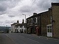
 The Rock Tavern, Dewsbury Road, Elland - geograph.org.uk - 1008113.jpg 602 × 450; 144 KB
-
 The Rock Tavern, Upper Edge - geograph.org.uk - 3000535.jpg 2,048 × 1,536; 543 KB
-
 The Rock, Upper Edge, Elland (8151414305).jpg 2,410 × 2,132; 3.8 MB
-
 Wilderness Road, Upper Edge, Elland - geograph.org.uk - 715555.jpg 640 × 412; 76 KB


.jpg)
