Category:Enceinte de La Réole
| Object location | | View all coordinates using: OpenStreetMap |
|---|
|
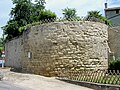
This building is inscrit au titre des monuments historiques de la France. It is indexed in the base Mérimée, a database of architectural heritage maintained by the French Ministry of Culture, under the reference PA00083696
|

 | |||||
| Upload media | |||||
| Instance of | |||||
|---|---|---|---|---|---|
| Location | La Réole, canton of La Réole | ||||
| Architectural style | |||||
| Heritage designation |
| ||||
 | |||||
Media in category "Enceinte de La Réole"
The following 5 files are in this category, out of 5 total.
-
 La Réole Porte du Sault.jpg 1,932 × 2,576; 1.21 MB
-
 La Réole Remparts01.jpg 2,576 × 1,932; 1.17 MB
-
 La Réole Remparts02.jpg 1,932 × 2,576; 1.28 MB
-
 La Réole Remparts03.jpg 2,576 × 1,932; 1.59 MB
-
 La Réole Sault-1861-0730.png 800 × 598; 111 KB


