Category:Enciclopedia Treccani - Maps
Media in category "Enciclopedia Treccani - Maps"
The following 76 files are in this category, out of 76 total.
-
 Map Africa 1928 - Touring Club Italiano CART-TRC-11.jpg 8,498 × 7,270; 27.59 MB
-
 Map Albania 1930 - Touring Club Italiano CART-TRC-05.jpg 5,562 × 7,384; 5.79 MB
-
 Map Algeria 1929 - Touring Club Italiano CART-TRC-09.jpg 6,461 × 4,919; 20.41 MB
-
 Map Alpi 1937 - Touring Club Italiano CART-TRC-04 (cropped).jpg 1,775 × 1,020; 2.46 MB
-
 Map Alpi 1937 - Touring Club Italiano CART-TRC-04.jpg 3,000 × 1,898; 5.68 MB
-
 Map Ancient Egypt 1928-1940 - Touring Club Italiano CART-TRC-34.jpg 4,551 × 6,298; 2.78 MB
-
 Map Antarctica 1929 - Touring Club Italiano CART-TRC-21.jpg 7,168 × 5,607; 4.87 MB
-
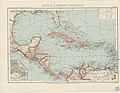 Map Antilles and Central America 1929 - Touring Club Italiano CART-TRC-14.jpg 7,252 × 5,597; 4.81 MB
-
 Map Arabia 1929 - Touring Club Italiano CART-TRC-10.jpg 4,605 × 6,198; 19.7 MB
-
 Map Arctic regions 1929 - Touring Club Italiano CART-TRC-20.jpg 5,611 × 7,502; 5.69 MB
-
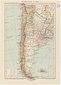 Map Argentina and Chile 1937 - Touring Club Italiano CART-TRC-18.jpg 5,390 × 7,479; 4.81 MB
-
 Map Asia 1937 - Touring Club Italiano CART-TRC-13.jpg 8,495 × 7,103; 29.48 MB
-
 Map Atlantic Sea 1929 - Touring Club Italiano CART-TRC-15.jpg 7,102 × 8,832; 8.17 MB
-
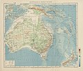 Map Australia and Pacific islands 1928-1940 - Touring Club Italiano CART-TRC-19.jpg 8,333 × 7,157; 26.44 MB
-
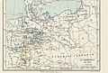
 Map Austria and the spartitions of Poland 1928-1940 - Touring Club Italiano CART-TRC-60.jpg 6,290 × 6,846; 4.53 MB
-
 Map Austria in the napoleonic age 1928-1940 - Touring Club Italiano CART-TRC-61.jpg 5,056 × 6,579; 3.63 MB
-
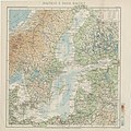 Map Baltic and Baltic countries 1930 - Touring Club Italiano CART-TRC-08.jpg 7,096 × 7,122; 16.92 MB
-
 Map Basilicata 1930 - Touring Club Italiano CART-TRC-02.jpg 7,485 × 5,562; 18.92 MB
-
 Map Belgio 1930 - Touring Club Italiano CART-TRC-06.jpg 5,478 × 4,490; 16.89 MB
-
 Map Brasil, Bolivia and Guyana 1930 - Touring Club Italiano CART-TRC-17.jpg 7,105 × 8,922; 8.87 MB
-
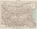 Map Bulgaria 1930 - Touring Club Italiano CART-TRC-07.jpg 6,482 × 5,074; 23.64 MB
-
 Map Calabria 1930 - Touring Club Italiano CART-TRC-03.jpg 4,612 × 6,254; 3.86 MB
-

-
 Map Ethnographic map of North America 1928-1940 - Touring Club Italiano CART-TRC-30.jpg 6,611 × 7,997; 6.1 MB
-
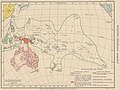 Map Ethnographic map of Oceania 1928-1940 - Touring Club Italiano CART-TRC-33.jpg 6,292 × 4,730; 15.14 MB
-
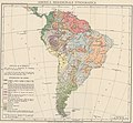 Map Ethnographic map of South America 1928-1940 - Touring Club Italiano CART-TRC-31.jpg 7,302 × 6,736; 21.52 MB
-
 Map Europe around 560 AD - Touring Club Italiano CART-TRC-50 01.jpg 3,873 × 3,205; 1.52 MB
-
 Map Europe in 1660- Touring Club Italiano CART-TRC-51 01.jpg 3,853 × 3,195; 1.58 MB
-
 Map Europe in 1789- Touring Club Italiano CART-TRC-51 02.jpg 3,836 × 3,065; 1.53 MB
-
 Map Europe in 1810- Touring Club Italiano CART-TRC-52 01.jpg 3,787 × 3,209; 1.56 MB
-
 Map Europe in 1815- Touring Club Italiano CART-TRC-52 02.jpg 3,871 × 3,094; 1.56 MB
-
 Map Europe in 1878 1928-1940 - Touring Club Italiano CART-TRC-58 01.jpg 3,909 × 3,145; 1.6 MB
-
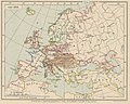
 Map Europe in 1914 1928-1940 - Touring Club Italiano CART-TRC-58 02.jpg 3,863 × 3,050; 1.58 MB
-
 Map Europe in 814- Touring Club Italiano CART-TRC-50 02.jpg 3,826 × 3,086; 1.51 MB
-
 Map Geological Map of Africa 1928-1940 - Touring Club Italiano CART-TRC-24.jpg 6,669 × 6,776; 25.4 MB
-
 Map Geological Map of Asia 1928-1940 - Touring Club Italiano CART-TRC-25.jpg 6,103 × 6,825; 5.15 MB
-
 Map Geological Map of Europe 1928-1940 - Touring Club Italiano CART-TRC-23.jpg 7,613 × 6,403; 32.32 MB
-
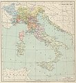
 Map Geological Map of Italy 1933 - Touring Club Italiano CART-TRC-22.jpg 7,004 × 10,092; 7.65 MB
-
 Map Geological Map of North America 1928-1940 - Touring Club Italiano CART-TRC-26.jpg 6,781 × 8,037; 6.41 MB
-
 Map Geological Map of South America 1928-1940 - Touring Club Italiano CART-TRC-27.jpg 8,213 × 7,176; 9.59 MB
-

-
-

-
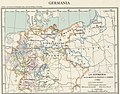
 Map Germany in 1520 1928-1940 - Touring Club Italiano CART-TRC-54 02.jpg 4,147 × 3,028; 1.63 MB
-
 Map Germany in 1815 1928-1940 - Touring Club Italiano CART-TRC-57 01.jpg 4,161 × 3,281; 1.68 MB
-
 Map Germany in 1870 1928-1940 - Touring Club Italiano CART-TRC-57 02.jpg 4,507 × 3,040; 1.75 MB
-
 Map Greece 1928-1940 - Touring Club Italiano CART-TRC-38.jpg 7,501 × 6,414; 29.05 MB
-
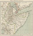 Map Italian East Africa 1938 - Touring Club Italiano CART-TRC-12.jpg 5,822 × 6,319; 5.2 MB
-
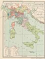
 Map Italy around 1300- Touring Club Italiano CART-TRC-47.jpg 6,052 × 6,640; 4.72 MB
-
 Map Italy around 500 b.C. - Touring Club Italiano CART-TRC-40.jpg 6,046 × 6,651; 4.22 MB
-
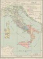
 Map Italy at the time of Augustus- Touring Club Italiano CART-TRC-44.jpg 6,034 × 6,689; 4.97 MB
-
 Map Italy in 1454- Touring Club Italiano CART-TRC-46.jpg 6,135 × 6,668; 4.74 MB
-
 Map Italy in 1559 - Touring Club Italiano CART-TRC-48 01.jpg 3,189 × 4,222; 3 MB
-
 Map Italy in 1748- Touring Club Italiano CART-TRC-48 02.jpg 3,010 × 4,139; 2.91 MB
-
 Map Italy in 1815- Touring Club Italiano CART-TRC-49 01.jpg 3,230 × 4,205; 1.65 MB
-
 Map Italy in the second half of 10th century- Touring Club Italiano CART-TRC-43 02.jpg 3,013 × 4,100; 1.46 MB
-
 Map Linguistic map of Europe 1928-1940 - Touring Club Italiano CART-TRC-29.jpg 7,491 × 6,356; 27.8 MB
-
 Map Longobard-Byzantine Italy- Touring Club Italiano CART-TRC-43 01.jpg 2,999 × 4,224; 1.48 MB
-
 Map Map of the Persian Empire 1928-1940 - Touring Club Italiano CART-TRC-35.jpg 6,528 × 4,485; 3.45 MB
-
 Map North America 1929 - Touring Club Italiano CART-TRC-16.jpg 7,310 × 8,626; 8.27 MB
-

-

-
 Map of Italy in 1861 - Touring Club Italiano CART-TRC-49 02.jpg 3,030 × 4,159; 1.53 MB
-
 Map Political map of Africa 1928 - Touring Club Italiano CART-TRC-11 01.jpg 2,459 × 2,616; 3.12 MB
-
 Map Political map of Asia 1937 - Touring Club Italiano CART-TRC-13 01.jpg 2,094 × 2,176; 2.67 MB
-
 Map Political map of North America 1929 - Touring Club Italiano CART-TRC-16 01.jpg 2,165 × 2,448; 826 KB
-
 Map Rome in the Imperial Era- Touring Club Italiano CART-TRC-41.jpg 6,646 × 6,366; 3.82 MB
-
 Map Svalbard islands 1929 - Touring Club Italiano CART-TRC-20 01.jpg 1,499 × 1,500; 376 KB
-
 Map The Acropolis of Athens and its slopes 1928-1940 - Touring Club Italiano CART-TRC-37.jpg 8,279 × 6,007; 31.78 MB
-
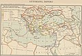
 Map The decadence of the Ottoman Empire- Touring Club Italiano CART-TRC-45 02.jpg 4,874 × 3,102; 1.82 MB
-

-

-

-
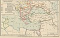
 Map The Ottoman Empire- Touring Club Italiano CART-TRC-45 01.jpg 4,877 × 3,317; 1.94 MB
-
 Map The Roman Empire under Trajan and Adrian- Touring Club Italiano CART-TRC-42.jpg 6,816 × 5,069; 4.02 MB
-
 Map Victoria Land 1929 - Touring Club Italiano CART-TRC-21 02.jpg 1,829 × 3,305; 892 KB


.jpg)


