Category:Erosion in New Zealand
Subcategories
This category has the following 13 subcategories, out of 13 total.
A
B
C
D
E
F
K
L
M
R
Media in category "Erosion in New Zealand"
The following 28 files are in this category, out of 28 total.
-
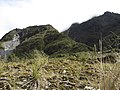 Alpine fell field & rainforest (6709539403).jpg 4,000 × 3,000; 3.97 MB
-
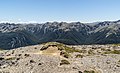
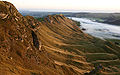
 Ben Ohau Range 05.jpg 3,732 × 2,604; 5.39 MB
-
 Buried fence posts alongside Lake Tutira due to Cyclone Bola.JPG 2,816 × 2,112; 1.95 MB
-
 Coromandel Peninsula.jpg 800 × 553; 110 KB
-
 Deforestation NZ Levin early 20th Century.jpg 582 × 744; 450 KB
-
 East Coast erosion, Poverty Bay, New Zealand, 13th. Dec. 2010 - Flickr - PhillipC.jpg 4,288 × 2,848; 4.48 MB
-
 Eroded Road at Whatarangi Bluff, Palliser Bay-2.jpg 3,872 × 2,592; 2.31 MB
-
 Eroded Road at Whatarangi Bluff, Palliser Bay.jpg 3,872 × 2,592; 2.37 MB
-
 Erosion in the Upper Awatere Valley.jpg 3,872 × 2,592; 6.41 MB
-
 ErosionStClair beach.jpg 1,800 × 1,243; 503 KB
-
 Freyberg Range 09.jpg 4,259 × 2,585; 9.64 MB
-
 Hutt Valley from Belmont.jpg 2,592 × 1,944; 4.05 MB
-
 Landscape in Tongariro National Park 12.jpg 2,914 × 1,943; 3.83 MB
-
 Landscape in Tongariro National Park 13.jpg 3,745 × 2,497; 7.46 MB
-
 Landscape in Tongariro National Park 14.jpg 4,020 × 2,680; 7.11 MB
-
 Landscape in Tongariro National Park 16.jpg 3,825 × 2,673; 7.37 MB
-
 Larch planted on a scree slope.JPG 2,816 × 2,112; 2.65 MB
-
 Mangere Mountain Central Crater Cone I.jpg 1,600 × 1,200; 1.46 MB
-
 MtEdenCrater.1.jpg 2,304 × 1,728; 1.21 MB
-
 Near Eltham - Taranaki.jpg 2,846 × 2,017; 4.89 MB
-
 Taranaki hills.jpg 2,832 × 2,128; 1.92 MB
-
 Te Mata Range.jpg 2,048 × 1,280; 1.46 MB
-
 TerracingonOneTreeHill.JPG 2,592 × 1,944; 2.57 MB
-
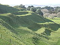
 Waikato hills.jpg 2,048 × 1,536; 669 KB
-
 Waikato Waitomo Area Stream.jpg 1,600 × 1,200; 548 KB
-
 Whangaehu River at Tangiwai 2007 lahar.jpg 2,560 × 1,920; 1.23 MB
-
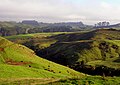
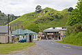 Whangamomona.jpg 3,072 × 2,048; 4.88 MB
-
 Wild & Rugged The Chatham Islands.jpg 1,000 × 667; 442 KB
.jpg)


