Category:Estuaries in Cumbria

Subcategories
This category has only the following subcategory.
K
Media in category "Estuaries in Cumbria"
The following 28 files are in this category, out of 28 total.
-
-
 Dow Crag from Brim Fell - geograph.org.uk - 1761244.jpg 2,272 × 1,712; 863 KB
-

-
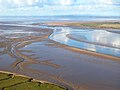
 Leven estuary.JPG 2,848 × 967; 620 KB
-
 Rainbow at Grange-Over-Sands 3 - geograph.org.uk - 630104.jpg 640 × 430; 55 KB
-
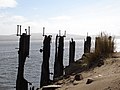 Remains of Pier at Salterhouse Pool - geograph.org.uk - 285807.jpg 640 × 480; 79 KB
-
-
 The Esk Estuary at Ravenglass - geograph.org.uk - 104125.jpg 640 × 480; 62 KB
-
 Beach - geograph.org.uk - 1405517.jpg 640 × 425; 77 KB
-

-
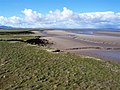
 Dunnerholme - geograph.org.uk - 190415.jpg 640 × 480; 130 KB
-
 Estuary of the River Leven - geograph.org.uk - 84139.jpg 640 × 480; 77 KB
-
 From Buckbarrow - geograph.org.uk - 441977.jpg 640 × 480; 71 KB
-
 Grass on the Solway - geograph.org.uk - 643071.jpg 640 × 501; 44 KB
-
 Greenodd Estuary Footbridge - geograph.org.uk - 98207.jpg 640 × 480; 57 KB
-
 High tide, Esk estuary - geograph.org.uk - 573345.jpg 640 × 381; 46 KB
-
 Land Ahoy^ - geograph.org.uk - 119822.jpg 640 × 426; 71 KB
-
 Leven estuary at Greenodd - geograph.org.uk - 310381.jpg 640 × 424; 85 KB
-
 Milnthorpe Sands - geograph.org.uk - 608383.jpg 640 × 472; 42 KB
-
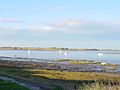
 Plumpton Bight at high tide - geograph.org.uk - 612917.jpg 640 × 429; 74 KB
-
 Ravenglass - geograph.org.uk - 58494.jpg 640 × 480; 144 KB
-
 River Esk and Salt Marsh - geograph.org.uk - 127928.jpg 640 × 426; 100 KB
-
 River Irt estuary. - geograph.org.uk - 156848.jpg 640 × 402; 27 KB
-
 Solway Firth and Criffel - geograph.org.uk - 573103.jpg 640 × 480; 120 KB
-
 The Esk Estuary near Newbiggin - geograph.org.uk - 104131.jpg 640 × 480; 58 KB
-
 The Leven Estuary - geograph.org.uk - 210418.jpg 640 × 480; 144 KB
-
 The shore west of Port Carlisle - geograph.org.uk - 40512.jpg 640 × 480; 100 KB
-
 The Solway Firth - geograph.org.uk - 573123.jpg 640 × 480; 94 KB


