Category:Evangelisch-reformiertes Pfarrhaus (Kirchgasse 2, Langenbruck)
| Object location | | View all coordinates using: OpenStreetMap |
|---|
church residential building in Langenbruck in the canton of Basel-Landschaft, Switzerland .JPG) | |||||
| Upload media | |||||
| Instance of | |||||
|---|---|---|---|---|---|
| Part of | |||||
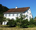
| Location | Langenbruck, Waldenburg District, Basel-Landschaft, Switzerland | ||||
| Street address |
| ||||
| Heritage designation | |||||
 | |||||
Media in category "Evangelisch-reformiertes Pfarrhaus (Kirchgasse 2, Langenbruck)"
The following 2 files are in this category, out of 2 total.
-
 Langenbruck04 (cropped).JPG 792 × 668; 242 KB
-
 Langenbruck04.JPG 1,195 × 1,008; 452 KB
