Category:Eye and Dunsden
civil parish in South Oxfordshire district, Oxfordshire, England | |||||
| Upload media | |||||
| Instance of | |||||
|---|---|---|---|---|---|
| Location | South Oxfordshire, Oxfordshire, South East England, England | ||||
 | |||||
Subcategories
This category has the following 5 subcategories, out of 5 total.
Media in category "Eye and Dunsden"
The following 200 files are in this category, out of 260 total.
(previous page) (next page)-
 "The Dawn Mist" at Sonning - geograph.org.uk - 3760820.jpg 2,463 × 1,788; 1.49 MB
-
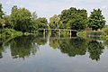
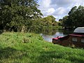
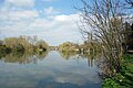
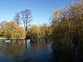
 A lake, Sonning Eye - geograph.org.uk - 5989576.jpg 1,024 × 768; 146 KB
-
 A plaque on a well on Dunsden Green - geograph.org.uk - 3533401.jpg 2,775 × 1,645; 2.42 MB
-
 A4155 approaches Hampstead Bottom - geograph.org.uk - 2818876.jpg 3,648 × 2,531; 1.51 MB
-
 A4155 climbs Span Hill - geograph.org.uk - 2818874.jpg 3,511 × 2,634; 1.41 MB
-
 A4155 on Hampstead Hill - geograph.org.uk - 2818875.jpg 3,497 × 2,449; 1.25 MB
-
 A4155 skirts the lakes - geograph.org.uk - 2818872.jpg 3,395 × 2,542; 1.49 MB
-
 Above the flood plain, Binfield Heath, Playhatch - geograph.org.uk - 3668456.jpg 3,264 × 2,448; 2.39 MB
-
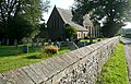
 All Saints Church at Dunsden - geograph.org.uk - 3894012.jpg 4,000 × 3,000; 3.36 MB
-
 All Saints, Dunsden - geograph.org.uk - 2578103.jpg 640 × 413; 222 KB
-
 All Saints, Dunsden - geograph.org.uk - 2578106.jpg 640 × 417; 236 KB
-
 Apparatus at gravel quarry - geograph.org.uk - 3590673.jpg 800 × 600; 135 KB
-
 Ash Copse - geograph.org.uk - 170391.jpg 640 × 480; 558 KB
-
 Bend on the B478 - geograph.org.uk - 2346018.jpg 480 × 640; 113 KB
-
 Berry Brook - geograph.org.uk - 697056.jpg 640 × 480; 186 KB
-
 Bishoplands Farm - geograph.org.uk - 5295362.jpg 3,264 × 2,448; 1.7 MB
-
 Blade of Mutton. - geograph.org.uk - 3657971.jpg 1,840 × 3,264; 1.31 MB
-

-
 Building at Comp Farm - geograph.org.uk - 2578084.jpg 640 × 427; 186 KB
-
 Buildings at Comp Farm - geograph.org.uk - 2578085.jpg 640 × 407; 235 KB
-
 Buildings at Sonning Eye - geograph.org.uk - 2346515.jpg 640 × 446; 69 KB
-
 Bus ^ Crown - geograph.org.uk - 3789031.jpg 1,024 × 710; 197 KB
-
 Can you dig it^ - geograph.org.uk - 3657979.jpg 1,840 × 3,264; 2.62 MB
-
 Caversham Lakes - geograph.org.uk - 65910.jpg 640 × 480; 54 KB
-
 Church Lane, Dunsden - geograph.org.uk - 4458864.jpg 2,560 × 1,920; 2.02 MB
-
 Church Lane, Dunsden Green - geograph.org.uk - 4458887.jpg 2,560 × 1,920; 1.9 MB
-
 Colonel Hastings' House - geograph.org.uk - 3514222.jpg 3,576 × 2,160; 1.3 MB
-
 Conveyor, Lafarge works, Play Hatch - geograph.org.uk - 2345994.jpg 640 × 480; 95 KB
-
 Cottage on the Corner - geograph.org.uk - 3820019.jpg 1,600 × 1,088; 263 KB
-
 Cottages at Sonning Eye - geograph.org.uk - 2346211.jpg 640 × 480; 90 KB
-
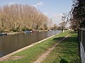
 Country beside the River Thames - geograph.org.uk - 4440792.jpg 2,592 × 1,944; 1.61 MB
-
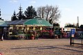 Country Gardens garden centre at Play Hatch - geograph.org.uk - 2297132.jpg 1,500 × 1,000; 321 KB
-

-
 Dunsden Green - geograph.org.uk - 3533388.jpg 1,600 × 1,200; 698 KB
-
 Dunsden Green - geograph.org.uk - 3533391.jpg 1,600 × 1,200; 604 KB
-
 Dunsden Green - geograph.org.uk - 5647409.jpg 2,304 × 1,728; 835 KB
-
 Early morning mist above Sonning Lock - geograph.org.uk - 3713551.jpg 1,024 × 768; 116 KB
-
 Easy as she goes... - geograph.org.uk - 2510694.jpg 1,024 × 680; 241 KB
-
 Entering Play Hatch - geograph.org.uk - 3344670.jpg 2,048 × 1,536; 1.56 MB
-

-
 Farmland and oak, Dunsden - geograph.org.uk - 1059295.jpg 640 × 480; 129 KB
-
 Farm road off Henley Road - geograph.org.uk - 3590686.jpg 668 × 800; 101 KB
-
 Farm Track, Sonning Eye - geograph.org.uk - 3760863.jpg 1,600 × 1,180; 562 KB
-
 Farmland near Bishopsland - geograph.org.uk - 2578027.jpg 640 × 411; 226 KB
-
 Farmland seen from Foxhill Lane - geograph.org.uk - 5295356.jpg 3,264 × 2,448; 2.25 MB
-
 Farmland View - geograph.org.uk - 5295383.jpg 3,264 × 2,448; 3.57 MB
-
 Farmland, Dunsden - geograph.org.uk - 1059251.jpg 640 × 480; 201 KB
-
 Farmland, Dunsden - geograph.org.uk - 1059255.jpg 480 × 640; 158 KB
-
 Farmland, Dunsden - geograph.org.uk - 1059288.jpg 640 × 480; 177 KB
-
 Farmland, Shiplake - geograph.org.uk - 1006797.jpg 640 × 480; 158 KB
-
 Fence by the Thames - geograph.org.uk - 2347149.jpg 640 × 469; 103 KB
-
 Feral Lass - geograph.org.uk - 2264240.jpg 640 × 480; 117 KB
-
 Field by Dunsden Way, Binfield Heath - geograph.org.uk - 5647408.jpg 2,304 × 1,728; 1.51 MB
-
 Field by Row Lane, Emmer Green - geograph.org.uk - 4458610.jpg 2,560 × 1,920; 2.01 MB
-
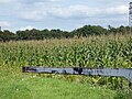 Field of maize - geograph.org.uk - 5512890.jpg 640 × 480; 168 KB
-
 Fields by Play Hatch - geograph.org.uk - 3344684.jpg 2,048 × 1,536; 1.46 MB
-
 Five-barred gate bird's eye view, Playhatch - geograph.org.uk - 3668458.jpg 2,448 × 3,264; 3.05 MB
-
 Flood Plain turns to Chilterns - geograph.org.uk - 3767001.jpg 1,600 × 1,097; 365 KB
-
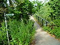
 Footbridge at Sonning - geograph.org.uk - 5491085.jpg 845 × 546; 197 KB
-
 Footbridge over Sonning Backwater - geograph.org.uk - 2810505.jpg 1,500 × 1,000; 183 KB
-
 Footbridge over the Thames - geograph.org.uk - 2510662.jpg 1,024 × 680; 175 KB
-
 Footpath at Lady's Shaw - geograph.org.uk - 5295366.jpg 3,264 × 2,448; 4.1 MB
-
 Footpath from Bishopsland Farm - geograph.org.uk - 2578030.jpg 557 × 640; 246 KB
-
 Footpath from Bishopsland Farm - geograph.org.uk - 2578034.jpg 474 × 640; 251 KB
-
 Footpath from Bishopsland Farm - geograph.org.uk - 2578036.jpg 640 × 420; 224 KB
-
 Footpath towards Comp Farm - geograph.org.uk - 2578095.jpg 640 × 469; 282 KB
-
 Former gravel pits, Sonning - geograph.org.uk - 503392.jpg 640 × 480; 87 KB
-
 Foxhill Lane - geograph.org.uk - 2578112.jpg 640 × 427; 221 KB
-
 Frizer's Farm, Sonning Eye - geograph.org.uk - 2346387.jpg 640 × 427; 63 KB
-
 Full to the brim - geograph.org.uk - 1977163.jpg 640 × 480; 92 KB
-
 Furleigh Cottages, Sonning Eye - geograph.org.uk - 3760782.jpg 1,600 × 1,200; 776 KB
-
 Gate by Playhatch Road - geograph.org.uk - 2346084.jpg 640 × 480; 109 KB
-
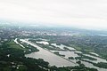
 Gravel Pits - geograph.org.uk - 5171074.jpg 3,264 × 2,448; 1.7 MB
-
 Hallsmead Ait - geograph.org.uk - 3684652.jpg 640 × 430; 95 KB
-
 Hampstead Bottom - geograph.org.uk - 5144779.jpg 1,600 × 1,200; 359 KB
-
 Henley Road, Caversham - geograph.org.uk - 4460860.jpg 2,470 × 1,794; 1.26 MB
-
 Henley Road, Caversham - geograph.org.uk - 4460862.jpg 2,482 × 1,812; 1.29 MB
-
 Heron and Jogger on the Thames Path - geograph.org.uk - 3760841.jpg 640 × 445; 148 KB
-
 Hops in the Hedge - geograph.org.uk - 5144737.jpg 3,788 × 2,824; 2.89 MB
-
 House by Dunsden Green - geograph.org.uk - 5647780.jpg 2,304 × 1,728; 860 KB
-
 House on Playhatch - geograph.org.uk - 4458966.jpg 2,560 × 1,920; 2.1 MB
-
 Houses by Sonning Bridge - geograph.org.uk - 5647783.jpg 2,304 × 1,728; 904 KB
-
 Houses by Sonning Bridge - geograph.org.uk - 5647784.jpg 2,304 × 1,728; 887 KB
-
 Houses on Playhatch - geograph.org.uk - 3346733.jpg 2,048 × 1,536; 1.51 MB
-

-
 Junction, Sonning Eye - geograph.org.uk - 2346296.jpg 640 × 385; 52 KB
-
 Kennylands Road at the junction of Peppard Road - geograph.org.uk - 4458496.jpg 2,560 × 1,920; 1.97 MB
-
 Lafarge concrete works, Sonning - geograph.org.uk - 497774.jpg 640 × 480; 126 KB
-
 Lake by the Henley Road - geograph.org.uk - 2377563.jpg 1,500 × 1,000; 188 KB
-
 Lane towards Sonning Common and Peppard - geograph.org.uk - 5512870.jpg 640 × 480; 133 KB
-
 Lane towards Sonning Common and Peppard - geograph.org.uk - 5512880.jpg 640 × 480; 122 KB
-
 Lane, Sonning Eye - geograph.org.uk - 2346363.jpg 640 × 480; 74 KB
-
 Large lake at Sonning - geograph.org.uk - 2495202.jpg 480 × 640; 111 KB
-
 Lone narrowboat - geograph.org.uk - 1977165.jpg 640 × 480; 91 KB
-
 Looking across one of the Caversham Lakes - geograph.org.uk - 2377623.jpg 1,500 × 1,000; 171 KB
-
 Looking west on the B478 - geograph.org.uk - 3590659.jpg 800 × 600; 140 KB
-
 Maize at Comp Farm - geograph.org.uk - 2578092.jpg 640 × 427; 244 KB
-
 Marina entrance - geograph.org.uk - 5922065.jpg 1,024 × 681; 94 KB
-
 Marina entrance off the Thames - geograph.org.uk - 3954404.jpg 640 × 430; 57 KB
-
 Meadows by the Thames - geograph.org.uk - 2347177.jpg 640 × 480; 85 KB
-
 Mellow yellow Playhatch- Binfield Heath - geograph.org.uk - 3668455.jpg 3,264 × 2,448; 5.59 MB
-
 Memorial and Bits of the Well - geograph.org.uk - 3719636.jpg 1,600 × 1,200; 915 KB
-

-

-
 NB 'Hannah' at the boatyard - geograph.org.uk - 5901740.jpg 3,323 × 2,209; 1.79 MB
-
 NB 'Hannah' at the boatyard - II - geograph.org.uk - 5901891.jpg 3,443 × 2,132; 1.65 MB
-
 NB 'Hannah' at the boatyard - III - geograph.org.uk - 5902986.jpg 3,323 × 2,209; 1.68 MB
-
 NB 'Hannah' on the boat lift at Thames and Kennet Marina - geograph.org.uk - 5901675.jpg 3,323 × 2,209; 1.69 MB
-
 No postbox here - geograph.org.uk - 3609307.jpg 800 × 414; 79 KB
-
 Not as tranquil as it appears - geograph.org.uk - 3438388.jpg 640 × 480; 114 KB
-
 Oak trees on a field edge - geograph.org.uk - 2086101.jpg 1,600 × 1,071; 637 KB
-
 Old Iron Gate - geograph.org.uk - 3760919.jpg 1,200 × 1,600; 821 KB
-
 On Sonning Bridge - geograph.org.uk - 2512691.jpg 1,024 × 680; 244 KB
-
 One of the Caversham Lakes - geograph.org.uk - 2377617.jpg 1,500 × 1,000; 180 KB
-
 One of the Caversham Lakes - geograph.org.uk - 2377631.jpg 1,500 × 1,000; 230 KB
-
 Orange Way after Wiltshire (337) - geograph.org.uk - 3592541.jpg 800 × 378; 113 KB
-
 Orange Way after Wiltshire (339) - geograph.org.uk - 3592688.jpg 800 × 600; 102 KB
-
 Orange Way after Wiltshire (347) - geograph.org.uk - 3593091.jpg 800 × 600; 247 KB
-
 Orange Way after Wiltshire (348) - geograph.org.uk - 3609263.jpg 800 × 600; 115 KB
-
 Orange Way after Wiltshire (349) - geograph.org.uk - 3609381.jpg 800 × 600; 168 KB
-
 Orange Way after Wiltshire (350) - geograph.org.uk - 3609407.jpg 800 × 600; 137 KB
-
 Orange Way after Wiltshire (351) - geograph.org.uk - 3609414.jpg 800 × 600; 146 KB
-
 Orange Way after Wiltshire (352) - geograph.org.uk - 3609425.jpg 800 × 600; 160 KB
-
 Orange Way after Wiltshire (353) - geograph.org.uk - 3609533.jpg 800 × 600; 124 KB
-
 Ordnance Survey Cut Mark - geograph.org.uk - 3894015.jpg 4,000 × 3,000; 3.35 MB
-
 Ovaltine delivery - perhaps - geograph.org.uk - 3438398.jpg 640 × 480; 124 KB
-
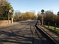
 Overbridge, Playhatch Road - geograph.org.uk - 2345947.jpg 640 × 480; 102 KB
-
 Overbridge, Playhatch Road - geograph.org.uk - 2345963.jpg 640 × 471; 97 KB
-
 Oxfordshire begins here - geograph.org.uk - 2345572.jpg 640 × 464; 88 KB
-
 Pasture at Littlestead Green - geograph.org.uk - 1407359.jpg 640 × 486; 64 KB
-
 Path beside the A4155 - geograph.org.uk - 3590690.jpg 800 × 600; 111 KB
-
 Peppard Road to Reading - geograph.org.uk - 4780296.jpg 1,500 × 1,125; 177 KB
-
 Peppard Road to Reading - geograph.org.uk - 4780297.jpg 1,500 × 1,125; 133 KB
-
 Pit in Blackhouse Wood - geograph.org.uk - 2577864.jpg 640 × 427; 271 KB
-
 Play Hatch Garden Centre - geograph.org.uk - 3710368.jpg 1,600 × 1,108; 563 KB
-
 Playhatch Garden Centre - geograph.org.uk - 3367333.jpg 1,600 × 1,200; 420 KB
-
 Playhatch Garden Centre Flood - geograph.org.uk - 3367339.jpg 1,600 × 1,200; 305 KB
-
 Playhatch Road - geograph.org.uk - 2345772.jpg 640 × 480; 128 KB
-
 Playhatch Road - geograph.org.uk - 2345793.jpg 640 × 480; 123 KB
-
 Playhatch Road entering Sonning Eye - geograph.org.uk - 3346553.jpg 2,048 × 1,536; 1.38 MB
-
 Playhatch, Play Hatch - geograph.org.uk - 4458967.jpg 2,560 × 1,920; 2.22 MB
-

-
 Reflections of Sonning Bridge (Berkshire side) - geograph.org.uk - 3713542.jpg 1,024 × 768; 154 KB
-
 River Thames - geograph.org.uk - 2202754.jpg 640 × 480; 111 KB
-
 River Thames - geograph.org.uk - 2202887.jpg 640 × 480; 76 KB
-
 River Thames - geograph.org.uk - 4897392.jpg 640 × 454; 69 KB
-
 River Thames above Sonning Weir - geograph.org.uk - 6145204.jpg 5,472 × 3,648; 2.77 MB
-
 River Thames, Sonning - geograph.org.uk - 5635620.jpg 640 × 480; 100 KB
-
 Riverside house near Charvil - geograph.org.uk - 2184201.jpg 640 × 426; 76 KB
-
 Riverside Meadow near Shiplake - geograph.org.uk - 5144727.jpg 1,600 × 1,200; 527 KB
-
 Road to Caversham from the marina - geograph.org.uk - 2377566.jpg 1,500 × 1,000; 203 KB
-
 Road to Caversham from the marina - geograph.org.uk - 2377599.jpg 1,500 × 1,000; 219 KB
-
 Road to the Redgrave Pinsent Rowing Lake - geograph.org.uk - 5450609.jpg 640 × 480; 303 KB
-
 Road to water works - geograph.org.uk - 2345687.jpg 640 × 417; 93 KB
-
 Roundabout at Play Hatch - geograph.org.uk - 2345755.jpg 640 × 389; 49 KB
-
 Roundabout on the A 4155, Play Hatch - geograph.org.uk - 3345476.jpg 2,048 × 1,536; 1.38 MB
-
 Roundabout on the B478 - geograph.org.uk - 3590647.jpg 800 × 554; 96 KB
-
 Roundabout on the B478, Sonning Eye - geograph.org.uk - 3345178.jpg 2,048 × 1,536; 1.46 MB
-
 Row Lane (geograph 5295354).jpg 2,176 × 1,632; 789 KB
-
 Row Lane at the junction of Kiln Road - geograph.org.uk - 4458522.jpg 2,560 × 1,920; 2 MB
-
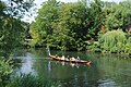 Rowers approaching Sonning Bridge - geograph.org.uk - 5267978.jpg 1,024 × 680; 373 KB
-
 Ruins To Go - geograph.org.uk - 3710367.jpg 1,595 × 1,099; 402 KB
-
 Rusty Name in the Ivy - geograph.org.uk - 3760905.jpg 1,024 × 698; 226 KB
-
 Same Management for 2000 Years - geograph.org.uk - 3722132.jpg 1,600 × 1,196; 874 KB
-
 Shoulder of Mutton, Playhatch - geograph.org.uk - 1934695.jpg 640 × 480; 314 KB
-
 Sign for All Saints Church, Dunsden - geograph.org.uk - 4458870.jpg 2,560 × 1,920; 1.94 MB
-
 Snow melt waters at Sonning Lock - geograph.org.uk - 1977075.jpg 640 × 480; 88 KB
-
 Sonning Backwater Bridges - geograph.org.uk - 2346541.jpg 640 × 480; 85 KB
-
 Sonning Backwater by the bridge - geograph.org.uk - 2801888.jpg 1,500 × 1,000; 149 KB
-
 Sonning Backwater Footbridge - geograph.org.uk - 2862528.jpg 4,288 × 3,216; 7.07 MB
-
 Sonning Backwater from the footbridge - geograph.org.uk - 2810507.jpg 1,500 × 1,000; 179 KB
-
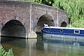
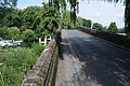
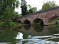
 Sonning Bridge - geograph.org.uk - 2346598.jpg 640 × 480; 100 KB
-
 Sonning Bridge - geograph.org.uk - 2510645.jpg 1,024 × 680; 182 KB
-
 Sonning Bridge - geograph.org.uk - 2810511.jpg 1,500 × 1,000; 191 KB
-
 Sonning Bridge - geograph.org.uk - 4442147.jpg 2,592 × 1,944; 2.46 MB
-
 Sonning Bridge carries the B478 over the River Thames - geograph.org.uk - 5194117.jpg 2,000 × 1,500; 559 KB
-
 Sonning Bridge from the Thames Path National Trail - geograph.org.uk - 5891915.jpg 4,608 × 3,456; 5.19 MB
-
 Sonning Bridge over the R. Thames - geograph.org.uk - 2214257.jpg 2,560 × 1,920; 2.91 MB
-
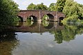
 Sonning Eye Bridge - geograph.org.uk - 2346121.jpg 640 × 480; 125 KB
-
 Sonning Eye Bridge - geograph.org.uk - 2346276.jpg 640 × 480; 127 KB
-
 Sonning Mill - geograph.org.uk - 2813800.jpg 1,500 × 1,000; 271 KB
-
 Sonning Reach, River Thames - geograph.org.uk - 2862522.jpg 4,288 × 3,216; 6.98 MB
-

-
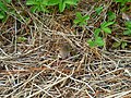 Spot the vole under the hedgerow - geograph.org.uk - 3590717.jpg 800 × 600; 216 KB
-
 Spring Lane Sonning - geograph.org.uk - 2495188.jpg 640 × 480; 101 KB
-
 Sunset over Sonning Backwater - geograph.org.uk - 2810540.jpg 1,500 × 1,000; 120 KB
-
 Tagg Lane, Dunsden Green - geograph.org.uk - 4458891.jpg 2,560 × 1,920; 1.93 MB
-
-
 Thames and Kennet Marina, Caversham Lakes - geograph.org.uk - 5906984.jpg 3,835 × 1,914; 1.49 MB
-
 Thames at Hallsmead Ait - geograph.org.uk - 2347898.jpg 640 × 480; 112 KB
-
 Thames at Long Ait - geograph.org.uk - 2347157.jpg 640 × 480; 111 KB
-
 Thames at Sonning - geograph.org.uk - 2264138.jpg 640 × 480; 73 KB
-
 Thames at Sonning - geograph.org.uk - 2264226.jpg 480 × 640; 87 KB
-
 Thames at Sonning - geograph.org.uk - 2346764.jpg 640 × 480; 132 KB
-
 Thames at Sonning Reach - geograph.org.uk - 2346802.jpg 640 × 430; 65 KB
-
 Thames backwater - geograph.org.uk - 2347387.jpg 640 × 480; 137 KB
-
 Thames backwater at Sonning - geograph.org.uk - 2801886.jpg 1,500 × 1,000; 155 KB
-
 Thames below Sonning - geograph.org.uk - 2264249.jpg 640 × 480; 97 KB
-
 Thames below Sonning - geograph.org.uk - 2346783.jpg 640 × 457; 132 KB
-
 Thames below Sonning - geograph.org.uk - 2346790.jpg 640 × 452; 102 KB


_-_geograph.org.uk_-_3592541.jpg)
_-_geograph.org.uk_-_3592688.jpg)
_-_geograph.org.uk_-_3593091.jpg)
_-_geograph.org.uk_-_3609263.jpg)
_-_geograph.org.uk_-_3609381.jpg)
_-_geograph.org.uk_-_3609407.jpg)
_-_geograph.org.uk_-_3609414.jpg)
_-_geograph.org.uk_-_3609425.jpg)
_-_geograph.org.uk_-_3609533.jpg)


_-_geograph.org.uk_-_3713542.jpg)


.jpg)


