Category:Farm buildings in County Leitrim
Media in category "Farm buildings in County Leitrim"
The following 12 files are in this category, out of 12 total.
-
 Barn at Tully - geograph.org.uk - 1310983.jpg 640 × 480; 90 KB
-
 Barns at Lisgrudy - geograph.org.uk - 1309558.jpg 640 × 480; 106 KB
-
 Drungan Townland - geograph.org.uk - 1178528.jpg 640 × 479; 53 KB
-
 Farm building, Gubnacurrafore - geograph.org.uk - 1504510.jpg 640 × 479; 67 KB
-
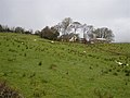
 Farm building, Tully - geograph.org.uk - 1482748.jpg 640 × 479; 68 KB
-
 Farm buildings at the summit of the R286 - geograph.org.uk - 1618385.jpg 640 × 480; 115 KB
-
 Farm buildings, Carrownoona - geograph.org.uk - 1482552.jpg 640 × 321; 50 KB
-
 Farm buildings, Tawley - geograph.org.uk - 1482227.jpg 640 × 479; 62 KB
-
 Old farm building, Cornashamoge (geograph 3696682).jpg 640 × 480; 80 KB
-
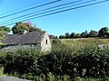
 Old farm building, Straduffy - geograph.org.uk - 1119070.jpg 640 × 479; 74 KB
-
 Ruin, Tullyderrin - geograph.org.uk - 1167621.jpg 640 × 479; 84 KB
-
 Stone barns at Aughrim - geograph.org.uk - 1586647.jpg 640 × 480; 112 KB


.jpg)


