Category:Farm buildings in Perth and Kinross
Subcategories
This category has only the following subcategory.
*
- Farmhouses in Perth and Kinross (33 F)
Media in category "Farm buildings in Perth and Kinross"
The following 132 files are in this category, out of 132 total.
-
 Abandoned house, Balnald - geograph.org.uk - 31252.jpg 640 × 439; 54 KB
-
 Auchnacloich - geograph.org.uk - 353591.jpg 640 × 480; 191 KB
-
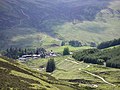 Auchnafree from the north east - geograph.org.uk - 18400.jpg 640 × 480; 154 KB
-
 Auchnafree Millennium Circle - geograph.org.uk - 598211.jpg 640 × 480; 95 KB
-
 Baiglie Farm - geograph.org.uk - 159031.jpg 640 × 480; 63 KB
-
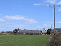
 Bardrill Farm - geograph.org.uk - 489338.jpg 640 × 466; 93 KB
-
 Braco Castle Farm - geograph.org.uk - 348047.jpg 640 × 480; 88 KB
-
 Burngrange Farm - geograph.org.uk - 138759.jpg 640 × 480; 54 KB
-
 Carsegour - geograph.org.uk - 139227.jpg 640 × 419; 93 KB
-
 Derelict Bardrill Cottage - geograph.org.uk - 489588.jpg 640 × 478; 70 KB
-

-
 Dereliction at Nether Braco - geograph.org.uk - 348002.jpg 640 × 480; 110 KB
-
 Disused farm buildings at Corb - geograph.org.uk - 576507.jpg 640 × 480; 71 KB
-
 Drummond Hall - geograph.org.uk - 101518.jpg 472 × 640; 108 KB
-
 East Hill Farm - geograph.org.uk - 396585.jpg 640 × 480; 61 KB
-
 East Hill Farm - geograph.org.uk - 396596.jpg 640 × 480; 59 KB
-
 East Third Farm - geograph.org.uk - 396619.jpg 640 × 480; 122 KB
-
 Easterton Farm Building - geograph.org.uk - 489178.jpg 640 × 458; 77 KB
-
 Farm - geograph.org.uk - 143738.jpg 640 × 480; 132 KB
-
 Farm at Easter Greenwells - geograph.org.uk - 396670.jpg 640 × 480; 66 KB
-
 Farm at Lower Borland Park - geograph.org.uk - 397831.jpg 640 × 320; 71 KB
-
 Farm buildings at Charlesfield - geograph.org.uk - 93422.jpg 640 × 480; 109 KB
-
 Farm Outbuildings - geograph.org.uk - 380811.jpg 640 × 480; 93 KB
-
 Garrick Farm near Braco - geograph.org.uk - 140098.jpg 640 × 480; 106 KB
-
 Glenbran Farm - geograph.org.uk - 286351.jpg 640 × 480; 76 KB
-
 Greenhead of Arnot - geograph.org.uk - 223902.jpg 640 × 480; 76 KB
-
 Hay shed - geograph.org.uk - 582771.jpg 640 × 424; 55 KB
-
 Kincraigie Farm - geograph.org.uk - 598201.jpg 640 × 480; 75 KB
-
 Kinneston Farm - geograph.org.uk - 223884.jpg 640 × 480; 94 KB
-
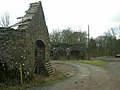
 Millhill Steading - geograph.org.uk - 558375.jpg 640 × 480; 110 KB
-
 Milton of Collace - geograph.org.uk - 138741.jpg 640 × 480; 75 KB
-
 Old barn - geograph.org.uk - 963283.jpg 640 × 400; 98 KB
-
 Old Tractor at Rhynd - geograph.org.uk - 465909.jpg 640 × 480; 107 KB
-
 Port Allen - geograph.org.uk - 511320.jpg 640 × 427; 245 KB
-
 Powgavie - geograph.org.uk - 514858.jpg 640 × 426; 115 KB
-
 Roundlaw farm - geograph.org.uk - 94589.jpg 640 × 480; 102 KB
-
 South Corston - geograph.org.uk - 426230.jpg 640 × 480; 51 KB
-
 Taymount Mains - geograph.org.uk - 101503.jpg 640 × 248; 64 KB
-
 Whitemyre Farm - geograph.org.uk - 138752.jpg 640 × 480; 81 KB
-
 Auchinglen Farm - geograph.org.uk - 539438.jpg 640 × 485; 64 KB
-
 Balchalum Farm - geograph.org.uk - 113234.jpg 640 × 480; 82 KB
-
 Balgersho Home Farm entrance - geograph.org.uk - 352709.jpg 640 × 480; 68 KB
-
 Ballindean Farm - geograph.org.uk - 104319.jpg 640 × 480; 117 KB
-
 Blairnathort farm buildings - geograph.org.uk - 197810.jpg 640 × 480; 64 KB
-
 Blueton Farm House - geograph.org.uk - 489761.jpg 640 × 474; 67 KB
-
 Braefordie - geograph.org.uk - 703133.jpg 640 × 482; 82 KB
-
 Brickhall Farm - geograph.org.uk - 111587.jpg 640 × 480; 107 KB
-
 Broomhall Farm - geograph.org.uk - 52449.jpg 640 × 427; 263 KB
-
 Byre, Methven - geograph.org.uk - 278233.jpg 640 × 480; 119 KB
-
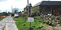
 Cairnbo Stewart - geograph.org.uk - 286755.jpg 640 × 480; 120 KB
-
 Calfward Farm - geograph.org.uk - 103018.jpg 640 × 480; 86 KB
-
 Carrum - geograph.org.uk - 171103.jpg 640 × 515; 55 KB
-
 Charlestown Farm - geograph.org.uk - 113257.jpg 640 × 451; 77 KB
-
 Clockmaden Farm - geograph.org.uk - 118592.jpg 640 × 480; 62 KB
-
 Coulshill - geograph.org.uk - 128001.jpg 640 × 480; 90 KB
-
 Coupar Farm - geograph.org.uk - 278831.jpg 640 × 480; 48 KB
-
 Cows at Acharn - geograph.org.uk - 75141.jpg 640 × 480; 143 KB
-
 Dalchruinn - geograph.org.uk - 271238.jpg 640 × 480; 88 KB
-
 Destroyed barn - geograph.org.uk - 117026.jpg 640 × 480; 67 KB
-
 Drummick Farm - geograph.org.uk - 586952.jpg 640 × 480; 62 KB
-
 Dubheads - geograph.org.uk - 171106.jpg 640 × 480; 71 KB
-
 East towards East Kirkton - geograph.org.uk - 556978.jpg 640 × 480; 74 KB
-
 Easter Fordel - geograph.org.uk - 197825.jpg 640 × 480; 50 KB
-
 Easter Parkhead - geograph.org.uk - 278678.jpg 640 × 480; 69 KB
-
 Fairygreen Farm - geograph.org.uk - 286322.jpg 640 × 480; 59 KB
-
 Farm building and enclosure - geograph.org.uk - 50644.jpg 640 × 480; 161 KB
-
 Farm Building at Turrerich - geograph.org.uk - 157458.jpg 640 × 479; 154 KB
-
 Farm buildings at Braefordie - geograph.org.uk - 703137.jpg 640 × 482; 105 KB
-
 Farm buildings at Colen - geograph.org.uk - 117006.jpg 640 × 480; 121 KB
-
 Farm Buildings near Glenalmond House - geograph.org.uk - 727233.jpg 640 × 425; 134 KB
-
 Farm buildings near Inchyra - geograph.org.uk - 84547.jpg 640 × 480; 57 KB
-
 Farm Buildings on Balgowan Home Farm - geograph.org.uk - 730302.jpg 640 × 425; 148 KB
-
 Farm buildings on Dalreichmoor - geograph.org.uk - 104267.jpg 640 × 480; 112 KB
-
 Farm on the hill - geograph.org.uk - 107952.jpg 640 × 480; 76 KB
-
 Flawcraig Farm - geograph.org.uk - 113251.jpg 640 × 480; 115 KB
-
 Gathering pens, Dalriech - geograph.org.uk - 601545.jpg 640 × 480; 99 KB
-
 Glenalbert Farm, Dalguise - geograph.org.uk - 60729.jpg 640 × 480; 115 KB
-
 Glenearn Farm - geograph.org.uk - 197782.jpg 640 × 480; 107 KB
-
 Glenuchorn Farm - geograph.org.uk - 50638.jpg 640 × 480; 88 KB
-
 Gloagburn farm - geograph.org.uk - 171302.jpg 640 × 480; 77 KB
-
 Greenhill Farm - geograph.org.uk - 359872.jpg 640 × 399; 96 KB
-
 Help Ma Boab - geograph.org.uk - 512864.jpg 640 × 480; 111 KB
-
 Horselea - geograph.org.uk - 197767.jpg 640 × 480; 71 KB
-
 Innerdunning - geograph.org.uk - 369057.jpg 640 × 480; 103 KB
-
 Kinburn - geograph.org.uk - 493789.jpg 640 × 453; 44 KB
-
 Kingston Farm - geograph.org.uk - 104353.jpg 640 × 480; 70 KB
-
 Kinnon Park Farm - geograph.org.uk - 586997.jpg 640 × 480; 61 KB
-
 Loan Head of Duchally Farm - geograph.org.uk - 411637.jpg 640 × 480; 70 KB
-
 Looking North East from Mid Rottearns - geograph.org.uk - 493192.jpg 640 × 461; 53 KB
-
 Lurg Farm near Muthill - geograph.org.uk - 140097.jpg 640 × 396; 121 KB
-
 Mains of Balthayock - geograph.org.uk - 81853.jpg 640 × 355; 57 KB
-
 Mains of Castle Huntly - geograph.org.uk - 105785.jpg 640 × 480; 87 KB
-
 Mains of Kinmonth - geograph.org.uk - 26901.jpg 640 × 480; 61 KB
-
 Mains of Tippermallo - geograph.org.uk - 586993.jpg 640 × 480; 100 KB
-
 Mid Rottearns Farm - geograph.org.uk - 493197.jpg 640 × 473; 49 KB
-
 Middle Third - geograph.org.uk - 369062.jpg 640 × 480; 105 KB
-
 Mill Farm, Bandirran - geograph.org.uk - 104272.jpg 640 × 480; 125 KB
-
 Milton Farm - geograph.org.uk - 117501.jpg 640 × 480; 116 KB
-
 Moreland farm - geograph.org.uk - 164149.jpg 640 × 480; 94 KB
-
 Muddy farmyard - geograph.org.uk - 107949.jpg 640 × 480; 59 KB
-
 New Craig - geograph.org.uk - 558869.jpg 640 × 480; 74 KB
-
 New shed near Braco Castle - geograph.org.uk - 348014.jpg 640 × 480; 89 KB
-
 Newrow Farm - geograph.org.uk - 586963.jpg 640 × 480; 53 KB
-
 North East towards Carsebreck - geograph.org.uk - 496978.jpg 640 × 481; 49 KB
-
 North East towards Clatteringford - geograph.org.uk - 488884.jpg 640 × 459; 56 KB
-
 North towards Newbigging - geograph.org.uk - 556965.jpg 640 × 480; 103 KB
-
 North West to Clatteringford. - geograph.org.uk - 493891.jpg 640 × 480; 66 KB
-
 Old Sheepfold - geograph.org.uk - 306128.jpg 640 × 480; 107 KB
-
 Orchill Farm - geograph.org.uk - 489168.jpg 640 × 464; 81 KB
-
 Out building at Glenalbert farm - geograph.org.uk - 598229.jpg 640 × 480; 120 KB
-
 Plaistow Farm - geograph.org.uk - 104290.jpg 640 × 480; 80 KB
-

-
 Powgavie Farm - geograph.org.uk - 104342.jpg 640 × 480; 73 KB
-
 Ratha Centre at Upper Ardoch - geograph.org.uk - 50625.jpg 640 × 480; 99 KB
-
 Rear view of Head-dykes - geograph.org.uk - 512855.jpg 640 × 469; 97 KB
-
 Remains of Head-dykes - geograph.org.uk - 512846.jpg 640 × 474; 63 KB
-

-
 Ryehill Farm - geograph.org.uk - 278859.jpg 640 × 480; 65 KB
-
 Sheep shed - geograph.org.uk - 379113.jpg 640 × 480; 85 KB
-
 Soft fruit tunnels near Longforgan - geograph.org.uk - 558394.jpg 640 × 480; 68 KB
-
 South East to East Third - geograph.org.uk - 539504.jpg 640 × 483; 84 KB
-
 South Hillhead Farm - geograph.org.uk - 539396.jpg 640 × 480; 110 KB
-
 South Latch Farm - geograph.org.uk - 105559.jpg 640 × 480; 130 KB
-
 South To West Third - geograph.org.uk - 539509.jpg 640 × 479; 109 KB
-
 South West from South Hillhead - geograph.org.uk - 539413.jpg 640 × 485; 88 KB
-
 South West to Milton of Panholes - geograph.org.uk - 489232.jpg 640 × 460; 77 KB
-
 Southfield Farm - geograph.org.uk - 104323.jpg 640 × 480; 80 KB
-
 The Ford - geograph.org.uk - 118602.jpg 640 × 480; 67 KB
-
 The Ford farm - geograph.org.uk - 118606.jpg 640 × 480; 111 KB
-
 Tofthill Farm - geograph.org.uk - 117550.jpg 640 × 480; 51 KB
-
 Upper Cairnie - geograph.org.uk - 369053.jpg 640 × 480; 88 KB
-
 Wooden farm shed - geograph.org.uk - 117445.jpg 640 × 480; 110 KB


