Category:Farms in County Donegal
Subcategories
This category has the following 2 subcategories, out of 2 total.
F
- Farmhouses in County Donegal (20 F)
Media in category "Farms in County Donegal"
The following 113 files are in this category, out of 113 total.
-
 A farm track - geograph.org.uk - 3190698.jpg 640 × 480; 256 KB
-
 A pair of goats - geograph.org.uk - 773056.jpg 640 × 480; 123 KB
-
 Abandoned farm, Hill Side - geograph.org.uk - 1390751.jpg 640 × 479; 74 KB
-
 Ballyholey Far - geograph.org.uk - 999673.jpg 640 × 479; 77 KB
-
 Ballymacahill Farmhouse - geograph.org.uk - 1132548.jpg 640 × 360; 95 KB
-
 Barnesmore Farm - geograph.org.uk - 1001623.jpg 427 × 640; 98 KB
-
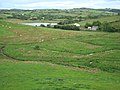 Birra Lake and Farmland - geograph.org.uk - 922388.jpg 640 × 480; 92 KB
-
 Church Manse - geograph.org.uk - 775941.jpg 640 × 360; 77 KB
-
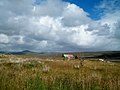
 Coastal Farm - geograph.org.uk - 861597.jpg 480 × 640; 75 KB
-
 Cockerel, Lurgybrack Open Farm - geograph.org.uk - 3401512.jpg 640 × 343; 100 KB
-
 Derelict farm stead at Glashbeggan - geograph.org.uk - 3268500.jpg 1,024 × 756; 131 KB
-
-
 Disused Farmyard - geograph.org.uk - 911000.jpg 640 × 480; 148 KB
-

-
 Farm at Alla - geograph.org.uk - 1212347.jpg 640 × 360; 104 KB
-
 Farm at Ardagh - geograph.org.uk - 1006987.jpg 640 × 479; 53 KB
-
 Farm at Aught - geograph.org.uk - 953463.jpg 640 × 479; 47 KB
-
 Farm at Ballymagroarty - geograph.org.uk - 884162.jpg 640 × 479; 85 KB
-
 Farm at Ballynally - geograph.org.uk - 1955802.jpg 640 × 480; 95 KB
-
 Farm at Casheloogary - geograph.org.uk - 2491753.jpg 4,320 × 3,240; 4.74 MB
-
 Farm at Drumcarn - geograph.org.uk - 1007063.jpg 640 × 479; 69 KB
-
 Farm at Drumfree - geograph.org.uk - 1380316.jpg 640 × 479; 63 KB
-
 Farm at Glebe - geograph.org.uk - 2436935.jpg 640 × 480; 65 KB
-
 Farm at Roughan - geograph.org.uk - 1017972.jpg 640 × 479; 65 KB
-
 Farm building - geograph.org.uk - 1940222.jpg 640 × 480; 87 KB
-
 Farm building, Carmoney - geograph.org.uk - 1952491.jpg 640 × 480; 55 KB
-
 Farm building, Carnatreantagh - geograph.org.uk - 1807374.jpg 640 × 480; 50 KB
-
 Farm building, Croragh - geograph.org.uk - 2597068.jpg 640 × 480; 62 KB
-
 Farm building, Meenasrona - geograph.org.uk - 1985209.jpg 640 × 480; 59 KB
-
 Farm building, Summy - geograph.org.uk - 2517798.jpg 640 × 480; 41 KB
-
 Farm buildings at Cill Mhic N-Eanian - geograph.org.uk - 1960634.jpg 640 × 480; 283 KB
-

-
 Farm buildings north-west of the N15 - geograph.org.uk - 3247152.jpg 1,024 × 663; 73 KB
-
 Farm buildings, Baile an Gheta - geograph.org.uk - 2437374.jpg 640 × 480; 89 KB
-
 Farm buildings, Brockagh - geograph.org.uk - 1985205.jpg 640 × 480; 52 KB
-
 Farm buildings, Carnisk - geograph.org.uk - 1757249.jpg 640 × 480; 88 KB
-
 Farm buildings, Garryport - geograph.org.uk - 1909244.jpg 640 × 480; 68 KB
-
 Farm buildings, Garryport - geograph.org.uk - 1909253.jpg 640 × 480; 81 KB
-
 Farm buildings, Lettercran - geograph.org.uk - 2100337.jpg 640 × 480; 62 KB
-
 Farm buildings, Meenacung - geograph.org.uk - 2462724.jpg 640 × 480; 54 KB
-
 Farm gate at Crislamore - geograph.org.uk - 889324.jpg 640 × 480; 98 KB
-
 Farm in Drumboe Lower - geograph.org.uk - 1367934.jpg 640 × 480; 94 KB
-
 Farm near Cashel Hill - geograph.org.uk - 1037878.jpg 640 × 479; 63 KB
-
 Farm near Laghey - geograph.org.uk - 2071541.jpg 640 × 480; 62 KB
-
 Farm north of Pettigo - geograph.org.uk - 3264107.jpg 640 × 360; 200 KB
-

-
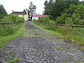
 Farm road - geograph.org.uk - 3956361.jpg 640 × 480; 311 KB
-
 Farm Road, Co. Donegal - panoramio.jpg 6,786 × 2,733; 5.12 MB
-
 Farm ruin - geograph.org.uk - 2565815.jpg 640 × 480; 98 KB
-
 Farm track - geograph.org.uk - 2534862.jpg 640 × 480; 93 KB
-
 Farm track, Blackland - geograph.org.uk - 3956336.jpg 640 × 480; 282 KB
-
 Farm track, Drumman - geograph.org.uk - 3956266.jpg 640 × 480; 271 KB
-
 Farm, Aghaveagh - geograph.org.uk - 1749302.jpg 640 × 480; 55 KB
-
 Farm, Cloughroe - geograph.org.uk - 1771661.jpg 640 × 480; 68 KB
-
 Farm, Dunwiley - geograph.org.uk - 1750577.jpg 640 × 480; 89 KB
-
 Farm, Magheracorran - geograph.org.uk - 1762315.jpg 640 × 480; 48 KB
-
 Farm, Magheranappan - geograph.org.uk - 1762384.jpg 640 × 480; 75 KB
-
 Farm, Rann - geograph.org.uk - 1764853.jpg 640 × 480; 70 KB
-
 Farmer at work, Kindroyhead - geograph.org.uk - 1348334.jpg 640 × 479; 74 KB
-
 Farmhouse in Leitir Beara - geograph.org.uk - 844911.jpg 640 × 480; 70 KB
-
 Farmhouse near Cashel - geograph.org.uk - 825090.jpg 480 × 640; 115 KB
-
 Farmhouse Stravalley Ardara. - geograph.org.uk - 1094846.jpg 640 × 480; 68 KB
-
 Farmhouse, Creeve - geograph.org.uk - 1911111.jpg 640 × 480; 79 KB
-
 Farmhouse, Lurganboy - geograph.org.uk - 1909990.jpg 640 × 480; 74 KB
-
 Farmhouse, Magheracorran - geograph.org.uk - 1762313.jpg 2,560 × 1,920; 813 KB
-
 Farmhouse, Stranakirk - geograph.org.uk - 2523010.jpg 640 × 480; 55 KB
-
 Farmhouse, Tommyscroft - geograph.org.uk - 1763454.jpg 640 × 480; 47 KB
-

-
 Farmland above Gortalia - geograph.org.uk - 1939601.jpg 640 × 480; 100 KB
-
 Farmland near Pettigo - geograph.org.uk - 3396075.jpg 640 × 360; 218 KB
-
 Farmland, Carrick - geograph.org.uk - 3969008.jpg 640 × 480; 294 KB
-
 Farmland, Knockbrack - geograph.org.uk - 3195987.jpg 640 × 480; 286 KB
-
 Farmland, Pettigo - geograph.org.uk - 3396114.jpg 640 × 480; 260 KB
-
 Farmyard near Dooish - geograph.org.uk - 1366498.jpg 640 × 480; 81 KB
-
 Field walls and pasture - geograph.org.uk - 2534871.jpg 640 × 480; 99 KB
-
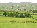
 Fields and mountains at Ballymore - geograph.org.uk - 2390971.jpg 640 × 480; 116 KB
-
 Fields and Teelin Bay - geograph.org.uk - 2550091.jpg 640 × 480; 90 KB
-
 Fields and walls, Horn Head - geograph.org.uk - 1992422.jpg 480 × 640; 125 KB
-
 Fields and walls, Horn Head - geograph.org.uk - 1992438.jpg 512 × 640; 124 KB
-
 Fields near Kilcasey - geograph.org.uk - 2549569.jpg 640 × 480; 80 KB
-
 Fields with ditch - geograph.org.uk - 2560162.jpg 640 × 480; 96 KB
-
 Fields, Ballymacphadin - geograph.org.uk - 2549880.jpg 640 × 480; 91 KB
-
 Fields, Coguish - geograph.org.uk - 2549970.jpg 640 × 480; 95 KB
-
 Gathering pen, Machaire an Chlaí - geograph.org.uk - 3188806.jpg 640 × 480; 225 KB
-
 Grassland, Lismulladuff - geograph.org.uk - 3194922.jpg 640 × 480; 266 KB
-

-

-
 Mondooey Townland - geograph.org.uk - 999602.jpg 640 × 479; 79 KB
-
 Muddy gateway, Ballynacor - geograph.org.uk - 3193228.jpg 640 × 480; 272 KB
-
 Murray's Town - geograph.org.uk - 1805841.jpg 640 × 480; 73 KB
-
 Murray's Town - geograph.org.uk - 1805842.jpg 640 × 480; 69 KB
-
 Old farm - geograph.org.uk - 890872.jpg 640 × 480; 87 KB
-
 Old Farm at Kildoney - geograph.org.uk - 1241734.jpg 640 × 427; 120 KB
-
 Old farm track - geograph.org.uk - 3190334.jpg 640 × 480; 350 KB
-
 Old machinery near Dunfanaghy - geograph.org.uk - 3469294.jpg 640 × 585; 272 KB
-
 Path, Lurgybrack Open Farm - geograph.org.uk - 3401468.jpg 640 × 438; 184 KB
-
 Pollnaranny farms - geograph.org.uk - 1031867.jpg 640 × 427; 114 KB
-
 Riding at Dean's Farm on Darney Hill - geograph.org.uk - 938715.jpg 640 × 480; 85 KB
-
 Road at Castletorrison - geograph.org.uk - 1763446.jpg 2,560 × 1,920; 1.23 MB
-
 Road at Lusticle - geograph.org.uk - 1018438.jpg 640 × 479; 62 KB
-
 Road at Murray's Town - geograph.org.uk - 1805833.jpg 640 × 480; 72 KB
-
 Road junction, Carn View - geograph.org.uk - 3441522.jpg 640 × 480; 309 KB
-
 Road to Edenoughill - geograph.org.uk - 3190695.jpg 640 × 480; 248 KB
-
 Sheep dip, Edergole - geograph.org.uk - 3454591.jpg 640 × 480; 259 KB
-
 Sheep, Carrygawley - geograph.org.uk - 1764895.jpg 640 × 480; 54 KB
-
 Stables at Dean's Farm, Darney - geograph.org.uk - 938705.jpg 640 × 480; 84 KB
-
 Tractor ride, Lurgybrack Open Farm - geograph.org.uk - 3403528.jpg 640 × 632; 197 KB
-
 Tractor, Lurgybrack Open Farm - geograph.org.uk - 3401476.jpg 640 × 629; 188 KB
-
 Tullyhonwar Hillside Farm 2014 09 03.jpg 3,503 × 1,948; 4.86 MB
-
 Turkey, Lurgybrack Open Farm - geograph.org.uk - 3401508.jpg 640 × 640; 157 KB
-
 Upper Illes - geograph.org.uk - 1359970.jpg 640 × 479; 81 KB
-
 Valley of Eglish River - geograph.org.uk - 872769.jpg 480 × 640; 89 KB
-
 White Hill - geograph.org.uk - 861561.jpg 480 × 640; 55 KB


