Category:Farms in the Isle of Man
Countries of Europe: Austria · Belarus · Belgium · Bulgaria · Croatia · Czech Republic · Denmark · Estonia · Finland · France‡ · Georgia‡ · Germany · Greece · Hungary · Iceland · Republic of Ireland · Italy · Latvia · Lithuania · Luxembourg · Malta · Netherlands‡ · Norway · Poland · Portugal‡ · Romania · Russia‡ · Slovakia · Slovenia · Spain‡ · Sweden · Switzerland · Turkey‡ · Ukraine · United Kingdom
Specific status: Isle of Man
‡: partly located in Europe
Specific status: Isle of Man
‡: partly located in Europe
Subcategories
This category has the following 3 subcategories, out of 3 total.
- Barns in the Isle of Man (6 F)
F
Media in category "Farms in the Isle of Man"
The following 46 files are in this category, out of 46 total.
-
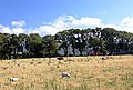
 Ballacharry farm - geograph.org.uk - 102022.jpg 640 × 480; 53 KB
-
 Ballaheaney - geograph.org.uk - 38106.jpg 640 × 431; 108 KB
-
 Block Eary. Isle of Man - geograph.org.uk - 34280.jpg 640 × 480; 145 KB
-

-
 Sulby Glen - Isle of Man - geograph.org.uk - 32011.jpg 640 × 481; 125 KB
-
 Uplands Entrance - geograph.org.uk - 489989.jpg 640 × 480; 150 KB
-

-
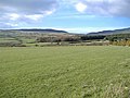
 View towards Ballacooley, Kirk Michael - geograph.org.uk - 59781.jpg 640 × 350; 51 KB
-
 Ballacamain - geograph.org.uk - 570655.jpg 640 × 398; 84 KB
-
 Ballachrine Farm - Isle of Man - geograph.org.uk - 31722.jpg 640 × 449; 92 KB
-
 Ballafadda farm, Isle of Man - geograph.org.uk - 117373.jpg 640 × 480; 60 KB
-
 Ballagunnell Farm - geograph.org.uk - 513721.jpg 640 × 480; 71 KB
-

-
 Ballakerka, Sulby. Isle of Man. - geograph.org.uk - 48932.jpg 640 × 480; 208 KB
-
 Ballamenaugh Beg farmhouse - geograph.org.uk - 447691.jpg 640 × 480; 70 KB
-

-
 Bulrenny. Isle of Man - geograph.org.uk - 32418.jpg 640 × 429; 118 KB
-
 Bulrenny. Isle of Man - geograph.org.uk - 32419.jpg 640 × 480; 138 KB
-
 Converted farm building on Ballaragh Road - geograph.org.uk - 475129.jpg 640 × 480; 133 KB
-
 Cronk Doo - Isle of Man - geograph.org.uk - 32039.jpg 640 × 448; 154 KB
-
 Cronkedooney - geograph.org.uk - 128017.jpg 640 × 480; 68 KB
-
 Entrance and yard at Ballavitchel Farm - geograph.org.uk - 482047.jpg 640 × 480; 139 KB
-
 Farm - Rhullick Road. Isle of Man. - geograph.org.uk - 35257.jpg 640 × 480; 145 KB
-
 Farmland - Ballatrollag - geograph.org.uk - 57473.jpg 640 × 480; 55 KB
-
 Farmland at Ballagick - geograph.org.uk - 120186.jpg 640 × 480; 62 KB
-
 Farmland in Ballasalla - geograph.org.uk - 115093.jpg 640 × 480; 51 KB
-
 Farmland near Ballamodha - geograph.org.uk - 103924.jpg 640 × 480; 74 KB
-
 Farmland, Maughold - geograph.org.uk - 777766.jpg 640 × 480; 128 KB
-
 Fields above Ballacurn Mooar - geograph.org.uk - 59120.jpg 640 × 480; 83 KB
-
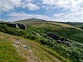
 Fields near Barrule - geograph.org.uk - 118680.jpg 640 × 480; 70 KB
-

-
 Gibdale - geograph.org.uk - 103920.jpg 640 × 480; 115 KB
-
 Goats in the hay near The Dog Mills - geograph.org.uk - 65720.jpg 640 × 412; 142 KB
-
 House, Glen Dhoo. Isle of Man - geograph.org.uk - 32897.jpg 640 × 480; 177 KB
-
 Kerrowkeil Farm - geograph.org.uk - 121973.jpg 640 × 480; 73 KB
-

-
 Lower Ballavarkish - geograph.org.uk - 122018.jpg 640 × 480; 67 KB
-
 North of Glen Maye - geograph.org.uk - 119789.jpg 640 × 427; 82 KB
-
 On Corrins Hill, Isle of Man - geograph.org.uk - 196607.jpg 640 × 480; 65 KB
-
 Park Mooar. Isle of Man. - geograph.org.uk - 35176.jpg 640 × 430; 137 KB
-
 Regaby Veg - geograph.org.uk - 110384.jpg 640 × 427; 114 KB
-
 Ruined Farm - Slieu Managh - geograph.org.uk - 46733.jpg 640 × 480; 158 KB
-
 Ruins of "Carnagrie." Isle of Man. - geograph.org.uk - 33530.jpg 640 × 439; 140 KB
-
 Rural View at Summerhill - geograph.org.uk - 469769.jpg 640 × 427; 115 KB
-
 The Clarum - geograph.org.uk - 463503.jpg 640 × 480; 67 KB
-


