Category:February 2008 in Argyll and Bute
Council areas (municipalities) of Scotland: Aberdeenshire · Argyll and Bute · Dumfries and Galloway · East Dunbartonshire · East Lothian · Edinburgh · Fife · Glasgow · Highland · Moray · North Ayrshire · Perth and Kinross · Scottish Borders · Stirling · West Dunbartonshire ·
Deutsch: Bilder, die im Februar 2008 in Argyll and Bute aufgenommen worden sind. Bitte beachten Sie, dass dies weder das Datum des Uploads noch das Datum des Scannens eines Fotos ist.
English: Images/pictures taken in Argyll and Bute during February 2008. Note this is not the date of the upload, nor the date a photo was scanned.
Español: Fotografías o imágenes tomadas en Argyll and Bute durante febrero 2008. No es la fecha de subida ni escaneo, sino la fecha en que las fotografías o imágenes se crearon.
Esperanto: Bildoj faritaj en Argyll and Bute en februaro 2008. Tio ne estas la dato, kiam la bildoj estis alŝutitaj aŭ skanitaj.
Français : Photographies ou images prises en Argyll and Bute durant février 2008. Ce n'est pas la date du téléchargement ou du scan.
Galego: Fotografías ou imaxes tomadas en Argyll and Bute durante febreiro 2008. Non é a data de subida nin escaneamento, senón a data na que se crearon as fotografías ou imaxes.
Italiano: Fotografie o immagini scattate a Argyll and Bute nel febbraio 2008. Nota bene: la data non si riferisce né a quella di upload né a quella in cui la foto è stata digitalizzata.
Norsk bokmål: Bilder tatt i Argyll and Bute i løpet av februar 2008. Merk at dette ikke er datoen for opplasting, eller når et bilde har blitt skannet.
Norsk nynorsk: Bilete teke i Argyll and Bute i løpet av februar 2008. Merk at dette ikkje er datoen for opplasting, eller når eit bilete har vorte skanna.
Русский: Изображения, сделанные в Argyll and Bute в течение февраль 2008 (не дата загрузки изображения).
Українська: Зображення, зроблені в Argyll and Bute протягом лютий 2008. Зауважте, що це не дата завантаження чи дата сканування фотографії.
| February 2007 | ← | February 2008 | → | February 2009 | |||||||
| Jan | Feb | Mar | Apr | May | Jun | Jul | Aug | Sep | Oct | Nov | Dec |
| 10 | 66 | 45 | 129 | 38 | 47 | 103 | 25 | 21 | 72 | 29 | 72 |
|---|---|---|---|---|---|---|---|---|---|---|---|
Media in category "February 2008 in Argyll and Bute"
The following 66 files are in this category, out of 66 total.
-
 Feolin Ferry, Isle of Jura.jpg 640 × 397; 41 KB
-
 Ardnave Farm Sign - geograph.org.uk - 705277.jpg 640 × 463; 81 KB
-
 Ardnave Point Information Board - geograph.org.uk - 705284.jpg 640 × 469; 75 KB
-
 Ardnave's Sand Dunes - geograph.org.uk - 705360.jpg 640 × 480; 75 KB
-

-
 Blairmore Pier - geograph.org.uk - 752266.jpg 640 × 480; 47 KB
-
 Blairmore Pier - geograph.org.uk - 752302.jpg 640 × 480; 61 KB
-
 Blairmore Pier - geograph.org.uk - 758676.jpg 640 × 480; 38 KB
-
 Borrow pit - geograph.org.uk - 702327.jpg 640 × 430; 95 KB
-
-
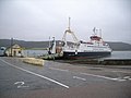
 CalMac Ferry at Rothesay Harbour - geograph.org.uk - 704723.jpg 640 × 480; 51 KB
-
 Cannon in grounds of Rothesay castle - geograph.org.uk - 704733.jpg 640 × 480; 92 KB
-

-
-
 Colintraive ferry crossing - geograph.org.uk - 705021.jpg 640 × 480; 60 KB
-

-
 Colintraive ferry crossing - signpost - geograph.org.uk - 705031.jpg 640 × 480; 78 KB
-
 Colintraive ferry crossing - slipway - geograph.org.uk - 705030.jpg 640 × 480; 41 KB
-

-
 Colintraive telephone box - geograph.org.uk - 705055.jpg 640 × 480; 83 KB
-
 Forest road - geograph.org.uk - 702318.jpg 640 × 430; 98 KB
-
 Highland Cow - geograph.org.uk - 700163.jpg 640 × 447; 113 KB
-

-
 Monarch of All He Surveys - geograph.org.uk - 912670.jpg 640 × 481; 61 KB
-
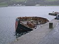 Port Bannatyne Pier and sinking boat - geograph.org.uk - 705014.jpg 640 × 480; 66 KB
-
 Port Bannatyne Post Office - geograph.org.uk - 704990.jpg 640 × 480; 64 KB
-
 Port Bannatyne Post Office postbox - geograph.org.uk - 705011.jpg 640 × 480; 62 KB
-
 Port Bannatyne Village.jpg 640 × 480; 61 KB
-
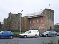 Rothesay Castle - geograph.org.uk - 704730.jpg 640 × 480; 73 KB
-
 Rothesay Castle grounds - geograph.org.uk - 704734.jpg 640 × 480; 91 KB
-
 Rothesay Castle keep - geograph.org.uk - 704736.jpg 640 × 480; 70 KB
-
 Rothesay Castle signpost - geograph.org.uk - 704749.jpg 640 × 480; 67 KB
-
 Rothesay town centre - geograph.org.uk - 704740.jpg 640 × 480; 79 KB
-
 Rothesay town centre - geograph.org.uk - 704742.jpg 640 × 480; 91 KB
-
 Shian Bay - geograph.org.uk - 869387.jpg 640 × 360; 41 KB
-
 Small Lochan and summit area of point 679 - geograph.org.uk - 690179.jpg 2,560 × 1,920; 2.42 MB
-
 Sunshine through the trees - geograph.org.uk - 686765.jpg 640 × 480; 132 KB
-
 Tea Time - geograph.org.uk - 705441.jpg 640 × 480; 69 KB
-
 The Jura Coast - geograph.org.uk - 706176.jpg 640 × 387; 40 KB
-
 Tobermory Waterfront - geograph.org.uk - 926858.jpg 640 × 331; 59 KB
-
 Workboats Tarbert Harbour - geograph.org.uk - 714372.jpg 640 × 480; 50 KB
-
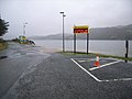
 Caledonia MacBrayne ferry sign - geograph.org.uk - 705029.jpg 640 × 480; 37 KB
-
 Camouflaged Cattle - geograph.org.uk - 700504.jpg 640 × 480; 82 KB
-
 Campbeltown Harbour - geograph.org.uk - 714366.jpg 640 × 480; 41 KB
-
 Cattle above Loch Gilp - geograph.org.uk - 702308.jpg 640 × 430; 97 KB
-
 Cattle At Aros Bay - geograph.org.uk - 698554.jpg 640 × 480; 76 KB
-
 Cattle Grazing Land - geograph.org.uk - 698473.jpg 640 × 480; 66 KB
-
 Houses On The A847 - geograph.org.uk - 700111.jpg 640 × 480; 68 KB
-
 Kilchattan Bay - geograph.org.uk - 704780.jpg 640 × 480; 74 KB
-
 Kilchattan Bay - geograph.org.uk - 704782.jpg 640 × 480; 77 KB
-

-

-

-
 Otter Ferry - geograph.org.uk - 705058.jpg 640 × 480; 73 KB
-
 Otter Ferry - the quay - geograph.org.uk - 705069.jpg 640 × 480; 65 KB
-
 Otter Ferry telephone kiosk - geograph.org.uk - 705062.jpg 640 × 480; 83 KB
-
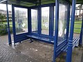
 Port Bannatyne bus shelter - geograph.org.uk - 705013.jpg 640 × 480; 54 KB
-
 Port Bannatyne telephone box - geograph.org.uk - 705017.jpg 640 × 480; 76 KB
-
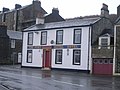 Port Royal Hotel, Port Bannatyne - geograph.org.uk - 704970.jpg 640 × 480; 64 KB
-
 Saltings At Loch Gruinart - geograph.org.uk - 704140.jpg 465 × 600; 60 KB
-
 The A847 at Uiskentuie - geograph.org.uk - 699361.jpg 640 × 446; 60 KB
-
 The Grapes Bar, Rothesay - geograph.org.uk - 704744.jpg 640 × 480; 89 KB
-
 The Oystercatcher Pub, Otter Ferry - geograph.org.uk - 705061.jpg 640 × 480; 72 KB
-
 The Port Inn, Port Bannatyne - geograph.org.uk - 704951.jpg 640 × 480; 69 KB
-
 Tower Street, Rothesay - geograph.org.uk - 704743.jpg 640 × 480; 71 KB
-
 Victoria Hotel, Rothesay - geograph.org.uk - 704755.jpg 640 × 480; 65 KB


