Category:February 2008 in Shropshire
Deutsch: Bilder, die im Februar 2008 in Shropshire aufgenommen worden sind. Bitte beachten Sie, dass dies weder das Datum des Uploads noch das Datum des Scannens eines Fotos ist.
English: Images/pictures taken in Shropshire during February 2008. Note this is not the date of the upload, nor the date a photo was scanned.
Español: Fotografías o imágenes tomadas en Shropshire durante febrero 2008. No es la fecha de subida ni escaneo, sino la fecha en que las fotografías o imágenes se crearon.
Esperanto: Bildoj faritaj en Shropshire en februaro 2008. Tio ne estas la dato, kiam la bildoj estis alŝutitaj aŭ skanitaj.
Français : Photographies ou images prises en Shropshire durant février 2008. Ce n'est pas la date du téléchargement ou du scan.
Galego: Fotografías ou imaxes tomadas en Shropshire durante febreiro 2008. Non é a data de subida nin escaneamento, senón a data na que se crearon as fotografías ou imaxes.
Italiano: Fotografie o immagini scattate a Shropshire nel febbraio 2008. Nota bene: la data non si riferisce né a quella di upload né a quella in cui la foto è stata digitalizzata.
Norsk bokmål: Bilder tatt i Shropshire i løpet av februar 2008. Merk at dette ikke er datoen for opplasting, eller når et bilde har blitt skannet.
Norsk nynorsk: Bilete teke i Shropshire i løpet av februar 2008. Merk at dette ikkje er datoen for opplasting, eller når eit bilete har vorte skanna.
Русский: Изображения, сделанные в Shropshire в течение февраль 2008 (не дата загрузки изображения).
Українська: Зображення, зроблені в Shropshire протягом лютий 2008. Зауважте, що це не дата завантаження чи дата сканування фотографії.
| February 2007 | ← | February 2008 | → | February 2009 | |||||||
| Jan | Feb | Mar | Apr | May | Jun | Jul | Aug | Sep | Oct | Nov | Dec |
| 45 | 52 | 33 | 35 | 57 | 26 | 46 | 18 | 11 | 125 | 23 | 36 |
|---|---|---|---|---|---|---|---|---|---|---|---|
Media in category "February 2008 in Shropshire"
The following 52 files are in this category, out of 52 total.
-
 "You're all the same, you Geographers" - geograph.org.uk - 679420.jpg 640 × 640; 184 KB
-
 'The Wilderness' - geograph.org.uk - 746346.jpg 640 × 426; 63 KB
-
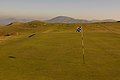 10th Green, Church Stretton Golf Club - geograph.org.uk - 696701.jpg 640 × 426; 48 KB
-
 Ford Crossing The River Rea - geograph.org.uk - 675361.jpg 640 × 425; 89 KB
-
 Eardington SVR Station - geograph.org.uk - 682362.jpg 640 × 480; 83 KB
-
 Forget the weekend - geograph.org.uk - 682359.jpg 640 × 480; 109 KB
-
 A Long Stone Wall - geograph.org.uk - 687927.jpg 480 × 640; 121 KB
-
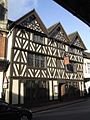
 Bell And Talbot, Bridgnorth - geograph.org.uk - 694924.jpg 640 × 480; 73 KB
-
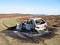 Blot on the landscape^^^^ - geograph.org.uk - 696161.jpg 640 × 480; 110 KB
-
 Bridgnorth SVR Signal Box - geograph.org.uk - 699807.jpg 480 × 640; 64 KB
-
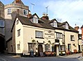
 Broad Gate and The Wheatsheaf Inn - geograph.org.uk - 704954.jpg 640 × 480; 100 KB
-
 Bromley at sunset - geograph.org.uk - 698703.jpg 640 × 480; 42 KB
-
 Cardingmill Antiques - geograph.org.uk - 715354.jpg 640 × 426; 91 KB
-
 Clock tower - geograph.org.uk - 705323.jpg 426 × 640; 67 KB
-
 Cutting in the dismantled railway - geograph.org.uk - 692425.jpg 640 × 480; 102 KB
-
 Drive to Stone House Farm - geograph.org.uk - 706167.jpg 640 × 480; 60 KB
-
 Driveway to Follybank - geograph.org.uk - 706180.jpg 640 × 480; 82 KB
-
 Footbridge leading out of Wyre Forest - geograph.org.uk - 870434.jpg 494 × 640; 190 KB
-
 Footpath to Castle Ring hill fort - geograph.org.uk - 686896.jpg 640 × 443; 156 KB
-

-
 Highland cattle on Rhos Fiddle - geograph.org.uk - 706193.jpg 640 × 480; 120 KB
-
 Hill Houses Bus Stop - geograph.org.uk - 675338.jpg 640 × 422; 94 KB
-
 Kings Head, Bridgnorth - geograph.org.uk - 694931.jpg 480 × 640; 91 KB
-
 Newport church - geograph.org.uk - 705306.jpg 426 × 640; 57 KB
-
 Playing Fields - geograph.org.uk - 688779.jpg 640 × 480; 102 KB
-
 RAF Helicopter at RAF Cosford. - geograph.org.uk - 707989.jpg 640 × 386; 40 KB
-
 Route of the dismantled railway - geograph.org.uk - 685283.jpg 640 × 480; 91 KB
-
 Sheds beside the lane - geograph.org.uk - 706207.jpg 640 × 480; 123 KB
-

-
 Smallholding - geograph.org.uk - 685444.jpg 640 × 480; 90 KB
-
 Someone is playing silly so-and-sos - geograph.org.uk - 706178.jpg 640 × 480; 72 KB
-

-
 St Leonards Church - geograph.org.uk - 695611.jpg 480 × 640; 70 KB
-
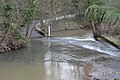
 Stableford Bridge - geograph.org.uk - 698612.jpg 640 × 480; 86 KB
-
 Staircase through the woods - geograph.org.uk - 695925.jpg 480 × 640; 144 KB
-
 Stile along the path past Lodge Hill - geograph.org.uk - 695932.jpg 640 × 480; 99 KB
-
 Stile and horses - geograph.org.uk - 697020.jpg 640 × 480; 113 KB
-
 Stile to a recently sown field - geograph.org.uk - 695888.jpg 640 × 480; 105 KB
-
 Still guarding the canal - geograph.org.uk - 743288.jpg 640 × 480; 115 KB
-
 Subsidence near Corndon Hill - geograph.org.uk - 696153.jpg 640 × 480; 142 KB
-

-
 Sunset - geograph.org.uk - 688171.jpg 640 × 480; 83 KB
-
 The 'old' Bridge at Bridgnorth - geograph.org.uk - 695639.jpg 640 × 480; 83 KB
-
 The Bus stop - geograph.org.uk - 687854.jpg 640 × 480; 45 KB
-
 The Harp, Bridgnorth - geograph.org.uk - 694939.jpg 480 × 640; 65 KB
-
 The Old Station - geograph.org.uk - 706859.jpg 640 × 480; 85 KB
-
 The Wheatsheaf Inn, Lower Broad Street - geograph.org.uk - 704936.jpg 640 × 468; 106 KB
-
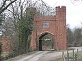 Wow, what an entrance^ - geograph.org.uk - 701882.jpg 640 × 480; 102 KB
-
 A stroll in the country - geograph.org.uk - 690173.jpg 640 × 480; 117 KB
-
 According to my map this is Slade Lane - geograph.org.uk - 682365.jpg 640 × 480; 102 KB
-
 Bicton Lane, Bicton, Shropshire - geograph.org.uk - 780591.jpg 640 × 480; 177 KB
-
 Farm land - geograph.org.uk - 691433.jpg 640 × 319; 58 KB


