Category:Fences in Greater Manchester
Subcategories
This category has the following 5 subcategories, out of 5 total.
Media in category "Fences in Greater Manchester"
The following 138 files are in this category, out of 138 total.
-
 3.10.16 Manchester 45 (29986490012).jpg 6,016 × 4,000; 4.88 MB
-
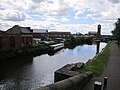
 Ancoats Brownsfield Lock 83- 4520.JPG 3,488 × 2,616; 2.2 MB
-
 Ancoats Brownsfield Lock 83- 4548.JPG 3,488 × 2,616; 2.14 MB
-
 Ancoats Brownsfield Locks 83- 4544.JPG 3,488 × 2,616; 2.14 MB
-
 Ancoats Brownsfield Locks 83- 4546.JPG 3,488 × 2,616; 2.16 MB
-
 Ancoats Cardroom estate from Miles Platting- 4564.JPG 3,488 × 2,616; 2.2 MB
-
 Ancoats- 4521.JPG 3,488 × 2,616; 2.18 MB
-
 Ancoats-Rochdale Canal 4568.JPG 3,488 × 2,616; 2.18 MB
-

-
 Ashton Canal - geograph.org.uk - 1141533.jpg 640 × 480; 130 KB
-
 Ashton Canal - geograph.org.uk - 1141790.jpg 640 × 480; 106 KB
-
 Ashton Canal - geograph.org.uk - 1312582.jpg 640 × 475; 139 KB
-
 Ashton Canal - geograph.org.uk - 1569378.jpg 400 × 600; 138 KB
-
 Ashton Canal -Piccadilly Village 5134.JPG 3,264 × 2,448; 3.25 MB
-
 Ashton Canal 5186.JPG 3,264 × 2,448; 4.31 MB
-
 Ashton Canal at Clayton Lane - geograph.org.uk - 1135207.jpg 640 × 480; 188 KB
-
 Ashton canal at Droylsden (1).JPG 4,320 × 3,240; 3.78 MB
-
 Ashton Canal Beswick Street Mill 5170.JPG 3,264 × 2,448; 4.19 MB
-
 Ashton Canal Bridge 1 Jutland St 5125.JPG 3,264 × 2,448; 2.52 MB
-
 Ashton Canal Bridge 1 Jutland St 5126.JPG 3,264 × 2,448; 2.97 MB
-
 Ashton Canal Bridge 1 Jutland St 5129.JPG 3,264 × 2,448; 2.49 MB
-
 Ashton Canal Bridge 1 Jutland St vista 5121.JPG 3,264 × 2,448; 3.02 MB
-
 Ashton Canal Bridge 1 Jutland St vista 5123.JPG 3,264 × 2,448; 3.26 MB
-
 Ashton Canal Bridge 5 Beswick St 5168.JPG 3,264 × 2,448; 3.36 MB
-
 Ashton Canal Bridge 5 Beswick St 5171.JPG 3,264 × 2,448; 3.44 MB
-
 Ashton Canal Bridge 5 Beswick St 5173.JPG 3,264 × 2,448; 3.28 MB
-
 Ashton Canal Bridge 5 Beswick St 5177.JPG 3,264 × 2,448; 4.31 MB
-
 Ashton Canal Bridge 5 north-east vista 5175.JPG 3,264 × 2,448; 3.45 MB
-
 Ashton Canal Bridge Joe Mercer Way 5197.JPG 3,264 × 2,448; 3.95 MB
-
 Ashton Canal Lock 2 5150.JPG 2,448 × 3,264; 2.95 MB
-
 Ashton Canal Lock 2 5153.JPG 3,264 × 2,448; 3.08 MB
-
 Ashton Canal Lock 3 5156.JPG 3,203 × 2,403; 1.56 MB
-
 Ashton Canal Lock 3 and Chips 5155.JPG 3,251 × 2,121; 1.57 MB
-
 Ashton Canal Lock 4 5191.JPG 3,264 × 2,448; 3.26 MB
-
 Ashton Canal Lock 4 5192.JPG 3,264 × 2,448; 3.84 MB
-
 Ashton Canal Lock 4 5193.JPG 3,264 × 2,448; 4.14 MB
-
 Ashton Canal Lock 5 5194.JPG 3,264 × 2,448; 3.69 MB
-
 Ashton Canal Lock 5 5195.JPG 3,264 × 2,448; 3.81 MB
-
 Ashton Canal Lock 5 5196.JPG 3,264 × 2,448; 3.63 MB
-
 Ashton Canal Lock 5 Sports City 5198.JPG 3,264 × 2,448; 3.26 MB
-
 Ashton Canal, Lock No 2 - geograph.org.uk - 1592767.jpg 640 × 513; 62 KB
-
 Ashton Canal- Sports City Lock 6 behind 5208.JPG 3,264 × 2,448; 4.26 MB
-
 Ashton Canal - geograph.org.uk - 1312611.jpg 640 × 480; 144 KB
-
 Ashton-under-Lyne - panoramio (1815).jpg 2,048 × 1,536; 712 KB
-
 Ashton-under-Lyne - panoramio (1817).jpg 2,048 × 1,536; 677 KB
-
 Ashtoncanal1.jpg 3,045 × 2,287; 2.09 MB
-
 Ashtoncanal10.jpg 2,918 × 2,191; 2.5 MB
-
 Ashtoncanal8.jpg 3,648 × 2,736; 4.63 MB
-
 Ashtoncanal9.jpg 3,648 × 2,736; 2.76 MB
-
 Barn Cottages, Dunham Massey-geograph-3973100.jpg 640 × 481; 330 KB
-
 Barton Basin - geograph.org.uk - 1500526.jpg 640 × 479; 100 KB
-
 Benkid77 Canal, Sale 250709.JPG 3,648 × 2,736; 3.78 MB
-
 Fencing round the Church - geograph.org.uk - 1523215.jpg 480 × 640; 53 KB
-
 North side - geograph.org.uk - 1523220.jpg 640 × 480; 70 KB
-
 Bridge to nowhere - geograph.org.uk - 1705562.jpg 1,024 × 768; 136 KB
-
 Bridgewater Canal - geograph.org.uk - 307605.jpg 640 × 480; 159 KB
-
 Bridgewater Canal - geograph.org.uk - 307613.jpg 640 × 480; 181 KB
-
 Bridgewater Canal - geograph.org.uk - 324957.jpg 634 × 429; 115 KB
-
 Bridgewater Canal at Timperley - geograph.org.uk - 1749679.jpg 2,816 × 2,112; 1 MB
-
 Bridgewater canal entrance to Manchester Ship Canal.jpg 2,048 × 1,536; 674 KB
-

-

-
 Canal at Stretford - geograph.org.uk - 385134.jpg 640 × 464; 101 KB
-
 Castlefield Bridgewater Deansgate end4646.JPG 960 × 1,280; 452 KB
-
 Castlefield Bridgewater Deansgate end4647.JPG 1,280 × 960; 472 KB
-
 Castlefield New Elm Road 12401.JPG 2,592 × 1,944; 1.22 MB
-
 Castlefield Potato Wharf 12402 cropped.jpg 1,984 × 1,223; 669 KB
-
 Castlefield Potato Wharf 12402.JPG 2,592 × 1,944; 1.26 MB
-
 Chips2.jpg 3,648 × 2,736; 2.9 MB
-
 First Manchester bus 60271 (W349 RJA) 6 May 2008.jpg 1,024 × 768; 549 KB
-
 Fletchers Canal towpath and industrial premises.jpg 2,048 × 1,536; 1.01 MB
-
 Flickr - ronsaunders47 - LEEDS-LIVERPOOL CANAL @ LEIGH .TOWPATH ^ NARROW-BOAT.jpg 3,008 × 2,000; 1.55 MB
-
 Flickr - ronsaunders47 - LEEDS-LIVERPOOL CANAL @ LEIGH. 12.jpg 3,008 × 2,000; 1.88 MB
-
 Flickr - ronsaunders47 - LEEDS-LIVERPOOL CANAL @ LEIGH.17.jpg 3,008 × 2,000; 1.66 MB
-
 Flickr - ronsaunders47 - LEEDS-LIVERPOOL CANAL @ LEIGH.18.jpg 3,008 × 2,000; 2.14 MB
-
 Flickr - ronsaunders47 - LONESOME ANGLER..jpg 3,008 × 2,000; 1.33 MB
-

-
 Flickr - ronsaunders47 - Moorings at the Inn..jpg 3,008 × 2,000; 1.37 MB
-
 Flickr - ronsaunders47 - Navigating the fishing poles -.jpg 3,008 × 2,000; 1.1 MB
-
 Flickr - ronsaunders47 - Old and New Along the Canal in Leigh..jpg 3,008 × 2,000; 1.61 MB
-
 Flickr - ronsaunders47 - Passing boats..jpg 2,941 × 1,851; 1.23 MB
-
 Flickr - ronsaunders47 - Play area by the side of the canal.2.jpg 3,008 × 2,000; 2.11 MB
-
 Flickr - ronsaunders47 - PROPERTY WITH WATER FRONTAGE..jpg 2,912 × 1,927; 1.54 MB
-
 Flickr - ronsaunders47 - REFLECTIONS ALONG THE TOWPATH...jpg 2,804 × 1,864; 1.45 MB
-
 Flickr - ronsaunders47 - REFLECTIONS DOWN ON THE CANAL. 2.jpg 2,934 × 1,859; 1.43 MB
-
 Flickr - ronsaunders47 - REFLECTIONS DOWN ON THE CANAL. 3.jpg 3,008 × 2,000; 1.89 MB
-
 Flickr - ronsaunders47 - Ripples on the canal..jpg 3,008 × 2,000; 1.09 MB
-
 Flickr - ronsaunders47 - Sitting on a bench watching the world go by...jpg 2,861 × 1,906; 5.16 MB
-
 Flickr - ronsaunders47 - SOLITARY TOWPATH WALK..jpg 2,592 × 1,944; 1.23 MB
-
 Flickr - ronsaunders47 - STROLL ALONG THE TOW-PATH..jpg 2,804 × 1,864; 1.83 MB
-
 Flickr - ronsaunders47 - The early morning jogger..jpg 3,008 × 2,000; 1.79 MB
-
 Flickr - ronsaunders47 - THE LONESOME ANGLER. 2.jpg 2,949 × 1,854; 1.13 MB
-
 Flickr - ronsaunders47 - THE MILL BY THE CANAL. LEIGH.NW ENGLAND..jpg 3,008 × 2,000; 1.46 MB
-
 Flickr - ronsaunders47 - There's an old mill by the stream.......jpg 2,853 × 1,896; 2.07 MB
-
 Flickr - ronsaunders47 - There's an old mill by the stream.....jpg 3,008 × 2,000; 1.93 MB
-
 Flickr - ronsaunders47 - Urban Decay Reflections.jpg 3,008 × 2,000; 1.67 MB
-
 Flickr - ronsaunders47 - VIEW FROM UNDER THE BRIDGE..jpg 2,951 × 1,873; 1.51 MB
-
 Flickr - ronsaunders47 - WATERSIDE PROPERTY REFLECTIONS. 3.jpg 3,008 × 2,000; 1.58 MB
-
 Fly tipped farmer's waste - geograph.org.uk - 885264.jpg 640 × 480; 94 KB
-
 Follow the fence - geograph.org.uk - 713337.jpg 640 × 425; 62 KB
-
 Footpath and fence in Rochdale, Greater Manchester.jpg 640 × 425; 143 KB
-
 Geese in a field - geograph.org.uk - 1231073.jpg 640 × 486; 130 KB
-
 Gulfstream G550 JIW Aircraft N528QS.jpg 1,024 × 768; 342 KB
-
 Holcombe Hey Fold farm - amusing signs - geograph.org.uk - 136353.jpg 640 × 480; 139 KB
-
 Towards Flowery Field Church - geograph.org.uk - 1610004.jpg 640 × 557; 128 KB
-
 Jet2.com B757-200 (G-LSAA) @ MAN, March 2010.jpg 640 × 480; 87 KB
-
 Leeds and Liverpool Canal - geograph.org.uk - 1737804.jpg 2,816 × 2,112; 1.23 MB
-
 Littleborough - geograph.org.uk - 4083.jpg 640 × 480; 59 KB
-
 Lock No 2, Ashton Canal, Manchester - geograph.org.uk - 592207.jpg 640 × 491; 88 KB
-
 Lock No 3, Ashton Canal, Manchester - geograph.org.uk - 592205.jpg 640 × 547; 80 KB
-
 Lock No 42, Rochdale Canal, Lancashire - geograph.org.uk - 499099.jpg 640 × 427; 103 KB
-
 Lonelady Manchester Autumn.jpg 3,600 × 2,400; 3.52 MB
-
 Manchester, Rochdale Canal, Tariff Street Lock No 83 - geograph.org.uk - 1700289.jpg 3,264 × 2,448; 2.38 MB
-

-
 Morning Jog. - geograph.org.uk - 59729.jpg 640 × 480; 152 KB
-
 New Bailey Street - geograph.org.uk - 1470715.jpg 640 × 480; 147 KB
-
 North Manchester Waste Treatment Plant - geograph.org.uk - 1185208.jpg 640 × 480; 188 KB
-
 Owls playing field fence.jpg 500 × 375; 90 KB
-
 Rakewood Road - geograph.org.uk - 1132157.jpg 640 × 480; 119 KB
-
 Ramsbottom Pentecostal Church - geograph.org.uk - 386632.jpg 640 × 480; 105 KB
-
 Reddish South artwork and flower-bed.JPG 6,000 × 4,000; 8.63 MB
-
 Richmond Street Bridge - geograph.org.uk - 1297817.jpg 640 × 514; 139 KB
-
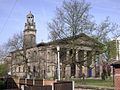
 St Saviour's Tower and Church - geograph.org.uk - 429227.jpg 480 × 640; 89 KB
-
 Rochdale Canal Waulk Mill 5270.JPG 3,264 × 2,448; 4.37 MB
-
 Church in Platt Fields Park. - geograph.org.uk - 122348.jpg 419 × 640; 80 KB
-

-
 Shaw's Mill, Diggle - geograph.org.uk - 1710669.jpg 640 × 419; 60 KB
-
 St. Thomas' Church, Stockport 03.jpg 3,072 × 2,304; 948 KB
-
 St Matthew, Stretford.jpg 1,280 × 1,007; 1.32 MB
-
 TameValley6097.JPG 2,048 × 1,536; 798 KB
-
 The other side ! (6861356927).jpg 3,050 × 4,050; 1.1 MB
-
 The Trafalgar - geograph.org.uk - 1691483.jpg 1,024 × 768; 352 KB
-
 Tram tracks alongside Ringway Road, Manchester.jpg 4,608 × 3,456; 3.35 MB
-
 Trencherfield Mill - geograph.org.uk - 675764.jpg 640 × 428; 68 KB
-
 Converted Church - geograph.org.uk - 1276031.jpg 640 × 480; 53 KB
-
 Whitelands Lock - geograph.org.uk - 586368.jpg 640 × 480; 88 KB
-
 Wigan Flight from Manchester Road, Higher Ince (1).JPG 4,320 × 3,240; 3.05 MB
-
 Wigan Flight from Manchester Road, Higher Ince (2).JPG 4,320 × 3,240; 2.87 MB
.jpg)


.JPG)


.jpg)
.jpg)


_6_May_2008.jpg)


_@_MAN,_March_2010.jpg)


.jpg)


.JPG)
.JPG)