Category:Fences in Hampshire
Ceremonial counties of England: Bedfordshire · Berkshire · Buckinghamshire · Cambridgeshire · Cheshire · Cornwall · Cumbria · Derbyshire · Devon · Dorset · Durham · East Riding of Yorkshire · East Sussex · Essex · Gloucestershire · Greater London · Greater Manchester · Hampshire · Herefordshire · Hertfordshire · Kent · Lancashire · Leicestershire · Lincolnshire · Merseyside · Norfolk · North Yorkshire · Northamptonshire · Northumberland · Nottinghamshire · Oxfordshire · Rutland · Shropshire · Somerset · South Yorkshire · Staffordshire · Suffolk · Surrey · Tyne and Wear · Warwickshire · West Midlands · West Sussex · West Yorkshire · Wiltshire · Worcestershire
City-counties: Bristol · City of London
Former historic counties:
Other former counties:
City-counties: Bristol · City of London
Former historic counties:
Other former counties:
Subcategories
This category has the following 3 subcategories, out of 3 total.
- Stiles in Hampshire (79 F)
W
Media in category "Fences in Hampshire"
The following 108 files are in this category, out of 108 total.
-
 A pleasing curve within Havant Park - geograph.org.uk - 1117656.jpg 480 × 640; 69 KB
-
 A Serious Fence - geograph.org.uk - 796621.jpg 640 × 455; 126 KB
-
 All Fenced In - geograph.org.uk - 843990.jpg 640 × 480; 142 KB
-
 Andover - decorative fence in Anton Road - geograph.org.uk - 811044.jpg 640 × 480; 136 KB
-
 Former Mission Church, Bartley - geograph.org.uk - 1508175.jpg 640 × 389; 75 KB
-
 Village hall, Bartley - geograph.org.uk - 1633775.jpg 640 × 482; 107 KB
-
 Bartley Tin Church - geograph.org.uk - 490941.jpg 640 × 480; 77 KB
-
-
 Bartley, village hall - geograph.org.uk - 1015985.jpg 640 × 480; 65 KB
-
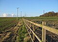
 Barton Stacey - Field Entrance - geograph.org.uk - 790939.jpg 640 × 480; 94 KB
-
 Bedhampton Gospel Hall P1010027.JPG 3,072 × 2,304; 2.82 MB
-
 St Peter's Church Beech - geograph.org.uk - 148398.jpg 640 × 480; 165 KB
-
 Blackwood Cottage - geograph.org.uk - 1772440.jpg 640 × 427; 179 KB
-

-
 Boundary Ditch - geograph.org.uk - 386147.jpg 640 × 480; 125 KB
-
 Boundary fence - former school site - geograph.org.uk - 781763.jpg 640 × 458; 51 KB
-

-
 Boundary fence to former sewage works - geograph.org.uk - 1240821.jpg 621 × 462; 135 KB
-
 Station Yard, Breamore - geograph.org.uk - 375504.jpg 640 × 480; 83 KB
-
 Bridleway, Whitsbury - geograph.org.uk - 1281430.jpg 640 × 480; 204 KB
-
 Offices to let- perhaps not today - geograph.org.uk - 754047.jpg 640 × 480; 38 KB
-

-
 Calleva roman town - geograph.org.uk - 1340674.jpg 640 × 471; 67 KB
-
 Caught On Camera - geograph.org.uk - 898281.jpg 640 × 480; 107 KB
-
 Church Moor, track - geograph.org.uk - 1530285.jpg 640 × 458; 89 KB
-
 Drift Road Evangelical Church - geograph.org.uk - 1613155.jpg 640 × 480; 73 KB
-
 Closedown House - geograph.org.uk - 1108850.jpg 640 × 467; 178 KB
-
 Cottage Farm stables from Yateley Common - geograph.org.uk - 724996.jpg 640 × 488; 244 KB
-
 Cows Grazing Farlington Marshes - geograph.org.uk - 422710.jpg 640 × 480; 120 KB
-
 Cranes Moor, bridge - geograph.org.uk - 1530372.jpg 640 × 480; 109 KB
-
 Deer fence - geograph.org.uk - 307035.jpg 640 × 480; 74 KB
-
 Delightful meadow in Hawkley Road - geograph.org.uk - 1321880.jpg 640 × 480; 122 KB
-
 Delightful paddock at Chawton Manor - geograph.org.uk - 936462.jpg 640 × 441; 74 KB
-
 South Farm, East Meon - geograph.org.uk - 2631.jpg 640 × 480; 106 KB
-
 End of the runway - geograph.org.uk - 1384077.jpg 640 × 427; 61 KB
-

-
 St Mary's Church, Ewshot.jpg 1,884 × 2,916; 4.82 MB
-
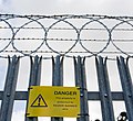
 Fence around Danger Area - geograph.org.uk - 1058821.jpg 360 × 640; 84 KB
-
 Fence crossing a Stubble Field - geograph.org.uk - 1201108.jpg 640 × 430; 66 KB
-

-
 Fence falling away - geograph.org.uk - 1304745.jpg 640 × 426; 99 KB
-

-
 Fenced in car park - Wade Road - geograph.org.uk - 854289.jpg 640 × 480; 80 KB
-
 Fenced land. - geograph.org.uk - 199732.jpg 640 × 426; 77 KB
-
 Fenced off vegetation - geograph.org.uk - 1040573.jpg 640 × 480; 158 KB
-
 Fences and Footpath - geograph.org.uk - 898303.jpg 640 × 480; 101 KB
-

-
 Field north of Steventon - geograph.org.uk - 234519.jpg 640 × 480; 263 KB
-
-
 Fields on Velmore Farm - geograph.org.uk - 803371.jpg 640 × 427; 99 KB
-
 Fishtail Lagoon - geograph.org.uk - 317499.jpg 640 × 480; 42 KB
-

-
 Footpath and sewage works, Cheriton - geograph.org.uk - 1196529.jpg 640 × 426; 198 KB
-
 Footpath towards Doles Farm - geograph.org.uk - 801651.jpg 637 × 425; 90 KB
-
 Fritham Free Church United 1904 - geograph.org.uk - 9829.jpg 640 × 481; 141 KB
-
 Frosty fence - geograph.org.uk - 1123026.jpg 640 × 480; 152 KB
-

-
 Grateley - St Leonards Church - geograph.org.uk - 572865.jpg 640 × 512; 148 KB
-

-
 Hartley Wespall - geograph.org.uk - 443.jpg 640 × 427; 51 KB
-
 Heathfield, Black Lane - geograph.org.uk - 1298341.jpg 640 × 480; 86 KB
-
 Hilltop Crescent - geograph.org.uk - 734789.jpg 640 × 480; 66 KB
-
 St James' Church, Hunton - geograph.org.uk - 345795.jpg 640 × 480; 224 KB
-

-
 Layby view - geograph.org.uk - 919513.jpg 640 × 427; 92 KB
-
 Looking up Woodlands Road - geograph.org.uk - 583607.jpg 640 × 480; 99 KB
-
 Lower Duncan Road - geograph.org.uk - 608643.jpg 640 × 480; 69 KB
-
 St Mary Sydmonton Geograph-3335338-by-Basher-Eyre.jpg 640 × 480; 109 KB
-
 Micheldever railway station 03.jpg 4,000 × 3,000; 3.08 MB
-
 Monument to the stupidity of lawyers - geograph.org.uk - 1462560.jpg 640 × 589; 168 KB
-
 Mount Down - geograph.org.uk - 1115258.jpg 480 × 640; 116 KB
-
 Narrow path above the railway - geograph.org.uk - 4912992.jpg 1,024 × 768; 371 KB
-
 Near Cheriton Mill - geograph.org.uk - 949418.jpg 640 × 455; 113 KB
-
 Neat fence boundary - geograph.org.uk - 1739975.jpg 640 × 480; 108 KB
-
 New fence around the balancing pond - geograph.org.uk - 782132.jpg 640 × 466; 76 KB
-

-

-
 Old Fence Line, Bunny Meadows - geograph.org.uk - 657936.jpg 427 × 640; 60 KB
-
 Path from East Leigh Farm to Bartons Road - geograph.org.uk - 736519.jpg 640 × 480; 123 KB
-
 Pathfinding Made Easy - geograph.org.uk - 1298322.jpg 480 × 640; 82 KB
-

-

-
 Portsdown Hill near Fort Purbrook - geograph.org.uk - 416587.jpg 640 × 480; 218 KB
-
 Practice fences near Wildhern - geograph.org.uk - 779854.jpg 640 × 441; 70 KB
-
 The other house at Priors Dean - geograph.org.uk - 1201535.jpg 640 × 430; 93 KB
-
 Pylons at Hare Warren - geograph.org.uk - 305510.jpg 640 × 480; 121 KB
-
 Railway fence - Reading line - geograph.org.uk - 1215473.jpg 640 × 480; 305 KB
-
 Refurbished field and shed, Crowdhill - geograph.org.uk - 1162749.jpg 640 × 427; 151 KB
-

-
 River Test - geograph.org.uk - 1767691.jpg 640 × 427; 173 KB
-

-

-
 Shell Beach, Fort Monkton - geograph.org.uk - 877637.jpg 640 × 424; 179 KB
-
-

-
 Stile, Game Fence and CCTV - geograph.org.uk - 818400.jpg 640 × 480; 160 KB
-
 Test Way leaving Ibthorpe - geograph.org.uk - 1067355.jpg 640 × 427; 173 KB
-
 The Park Pale - geograph.org.uk - 1237777.jpg 616 × 462; 214 KB
-
 Three Castles Path to Firgrove Road - geograph.org.uk - 1528167.jpg 640 × 480; 127 KB
-

-

-
 Under a Grey Sky - geograph.org.uk - 502344.jpg 640 × 480; 91 KB
-
 Church of the Blessed Mary, Upham - geograph.org.uk - 56420.jpg 640 × 480; 84 KB
-
 Water extraction point on Ibsley Water - geograph.org.uk - 836673.jpg 640 × 427; 125 KB
-
 Window in the deer fence - geograph.org.uk - 1128208.jpg 417 × 640; 111 KB
-
 Wire (258876860).jpg 2,407 × 1,600; 768 KB
-
 St Boniface, Woodgreen - geograph.org.uk - 1508934.jpg 640 × 464; 111 KB
-
 The Warren, White Hill - geograph.org.uk - 361212.jpg 640 × 477; 109 KB


.jpg)

