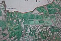
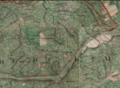
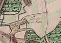
Category:Ferraris maps of Belgium
Subcategories
This category has the following 9 subcategories, out of 9 total.
A
- Maps of Antwerp by Ferraris (5 F)
B
- Maps of Bruges by Ferraris (2 F)
- Brussels on maps of Ferraris (24 F)
C
- Charleroi on maps of Ferraris (11 F)
F
- Ferraris maps of Harelbeke (6 F)
G
- Ghent on maps of Ferraris (23 F)
L
T
- Tumulus van Brustem (2 F)
Media in category "Ferraris maps of Belgium"
The following 200 files are in this category, out of 231 total.
(previous page) (next page)-
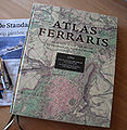 Ferraris (2009) - Lannoo - België.jpg 213 × 219; 103 KB
-
 189 - Mastricht - Maastricht (2) - Copy.jpg 4,972 × 4,044; 7.26 MB
-
 76 - Bruxelles - Brussel Bruxelles-fixed.jpg 21,466 × 14,450; 174.27 MB
-
 Aalst, Belgium ; Ferraris Map.jpg 652 × 564; 55 KB
-
 Abbaye de Florival Ferraris.jpg 3,577 × 2,645; 4.31 MB
-
 Abbaye de Solières - Carte de Ferraris.jpg 723 × 641; 191 KB
-
 Aiseau1777.jpg 1,757 × 1,200; 2.88 MB
-
 Antoing et le tertre du Trou de Billemont - Carte de Ferraris.jpg 750 × 633; 236 KB
-
 Antwerpse Heriweg Damme.png 3,046 × 758; 5.89 MB
-
 Anvaing 1770.png 1,280 × 800; 1.81 MB
-
 Arlon, Belgium, Ferraris, 1775.jpg 1,680 × 1,050; 289 KB
-
 Assenede, Belgium, Ferrariskaart, 1775.jpg 1,680 × 1,050; 304 KB
-
 Ath, Belgium, Ferraris Map, 1775.jpg 1,680 × 1,050; 325 KB
-

-
 Beisloven Egmontkasteel 1777.jpg 5,297 × 3,401; 5.6 MB
-
 Beke, Waarschoot, Ferraris map.jpg 1,612 × 1,078; 705 KB
-
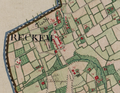 Belgique-Reckem.png 981 × 761; 1.78 MB
-
 Bellebargiebos Ferraris 02.jpg 5,472 × 3,648; 21.92 MB
-
 Bellebargiebos Ferraris.jpg 3,577 × 4,791; 7.2 MB
-
 Blankenberge, Belgium, Ferraris , 1775.jpg 1,680 × 1,050; 326 KB
-
 Blauw Kasteel Lange Munte Ferraris.jpg 5,472 × 3,648; 21.02 MB
-
 Boembekemolen - België.jpg 811 × 675; 280 KB
-
 Boembekemolen 1777.jpg 5,472 × 3,648; 18.28 MB
-
 Bois d'Houtaing, Bois d'Assoumont, Bois du Carmois Bois à Choques Ferraris.jpg 5,472 × 3,648; 16.15 MB
-
 Bois d'Hubermont Bois de Leuze Bois d'Antoing Ferraris.jpg 3,648 × 5,472; 20.34 MB
-
 Bois d'Hubermont Bois de Lezuze Bois d'Antoing Bois Lefèbvre Bois d'Hergies Ferraris.jpg 5,472 × 3,648; 15.66 MB
-
 Bois de La Louvière Livierenbos Hayesbos Ferraris.jpg 5,472 × 3,648; 21.17 MB
-
 Bois Lefèbvre Ferraris.jpg 5,472 × 3,648; 15.28 MB
-
 Bonne-Espérance Ferraris.png 861 × 599; 945 KB
-
 Bos Ferraris 01.jpg 3,648 × 5,472; 18.48 MB
-
 Bos Nieuwenhove Ferraris.jpg 5,472 × 3,648; 15.8 MB
-
 Bos t'Ename Ferraris 01.jpg 5,472 × 3,648; 18.86 MB
-
 Bos t'Ename Ferraris 02.jpg 3,648 × 5,472; 17.92 MB
-
 Bos van Houthulst Ferraris.jpg 5,297 × 3,481; 5.32 MB
-
 Bouvelobos Ferraris.jpg 5,472 × 3,648; 22.96 MB
-
 Brakelbos Ferraris.jpg 5,472 × 3,648; 19.85 MB
-
 Brakelbos Pottelbergbos Ferraris.jpg 5,472 × 3,648; 19.49 MB
-
 Kanaal Brugge-Oostende, Ferraris.jpg 1,684 × 958; 376 KB
-
 Buggenhoutbos Ferraris 01.jpg 2,193 × 3,577; 3.4 MB
-
 Buggenhoutbos Ferraris 02.jpg 2,585 × 4,353; 4.94 MB
-
 Bulskampveld, Ferraris, 1777.jpg 1,274 × 674; 206 KB
-
 Burg-Reuland Belgium Ferraris 1777.png 1,237 × 598; 1.33 MB
-
 Carte de Theux, montage à partir de quatre planches de la carte de Ferraris.jpg 2,772 × 2,079; 1.42 MB
-
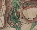 Carte Ferraris 1777 Château Grandvoir.tif 583 × 481; 849 KB
-
 Carte Ferraris Chateau Motte.jpg 1,717 × 1,262; 1.26 MB
-
 Carte Ferraris de Godinne.jpg 485 × 358; 62 KB
-
 Cense Rosieaux et tumulus de Hanret - Carte de Ferraris.jpg 750 × 642; 175 KB
-
 Charleroi - Broucheterre et Faubourg - Ferraris map (1770-1778).jpg 1,522 × 1,200; 1.95 MB
-
 Château de Jehay - Carte de Ferraris.jpg 1,034 × 717; 308 KB
-
 Clermont-sur-Berwinne1777(Ferraris212).jpg 1,200 × 675; 156 KB
-
 Cotthembos.jpg 5,472 × 3,648; 15.39 MB
-
 Damme, Belgium ; Ferraris Map.jpg 652 × 564; 50 KB
-
 Deinze, Belgium ; Ferraris map.jpg 760 × 648; 73 KB
-
 Dendermonde, Belgium ; Ferraris Map.jpg 652 × 564; 57 KB
-
 Dhuy - Les 6 Frères - Carte de Ferraris.jpg 860 × 596; 223 KB
-
 Diksmuide, Belgium, map, Ferraris, 1776.jpg 760 × 648; 63 KB
-
 Dinant, Belgium, Ferraris, 1775.jpg 1,680 × 1,050; 279 KB
-
 Doel, Lillo, Schelde, Ferraris, 1775.jpg 1,680 × 1,050; 345 KB
-
 Domein de Ghellinck - de Ferraris.jpg 793 × 673; 258 KB
-
 Doormansbos Ferraris.jpg 5,009 × 3,385; 5.15 MB
-
 Drongen, Ghent, Belgium, ferrariskaart.jpg 1,680 × 1,050; 320 KB
-
 Drongengoedhoeve, ferraris-kaart.jpg 1,280 × 1,024; 289 KB
-
 Eeklo, Belgium ; Ferraris Map.jpg 652 × 564; 64 KB
-
 Elene 01.jpg 5,472 × 3,648; 18.04 MB
-
 Enghien , Belgium, Ferraris Map, 1775.jpg 1,680 × 1,050; 362 KB
-
 Erwetegem.jpg 5,472 × 3,648; 16.99 MB
-
 Ettingebos Ferraris.jpg 5,472 × 3,648; 17.37 MB
-
 Evere-Ferraris.png 1,202 × 1,310; 3.08 MB
-
 Evergem Ferraris.TIF 733 × 606; 1.45 MB
-
 Ferraris kasteel de Ghellinck.jpg 785 × 699; 220 KB
-
 Ferraris Leval Blegny.jpg 1,417 × 1,811; 512 KB
-
 Ferraris Lokeren Kaart.png 4,824 × 3,072; 26.05 MB
-
 Ferraris map, De Pinte.jpg 646 × 479; 51 KB
-
 Ferraris map, Tournai.jpg 597 × 533; 41 KB
-
 Ferraris-Leuven.png 5,473 × 5,052; 47.61 MB
-
 Ferrarisbaasrode.jpg 596 × 480; 57 KB
-
 Ferrariskaart - 370729 - onroerenderfgoed.jpg 1,381 × 4,181; 6.29 MB
-
 Ferrariskaart Oudegem.jpg 952 × 976; 526 KB
-
 Forest - Abbaye de Forest - Carte de Ferraris.jpg 662 × 721; 262 KB
-
 Galgebossen Ferraris.jpg 5,472 × 3,648; 23.79 MB
-
 Gavere - Ferraris.jpg 687 × 605; 150 KB
-
 Geraardsbergen , Belgium, Ferraris Map, 1775.jpg 1,680 × 1,050; 371 KB
-
 Godveerdegem.jpg 5,472 × 3,648; 17.55 MB
-
 Groenhove Ferraris.jpg 5,472 × 3,648; 16.4 MB
-
 Grotenberge.jpg 5,472 × 3,648; 16.05 MB
-
 Gruuthusekasteel op ferrariskaart.JPG 841 × 526; 98 KB
-
 Guigoven Wintershoven en Vlierhoven.png 1,790 × 1,284; 4.19 MB
-
 Hasselt, Belgium ; Ferraris Map.jpg 652 × 564; 53 KB
-
 Heirweg Kortrijk-Gent, Ferrariskaart.jpg 1,680 × 1,050; 315 KB
-
 Herentals Ferraris map 18th century.png 702 × 769; 1.08 MB
-
 Het Leen Ferraris.jpg 5,472 × 3,648; 22.42 MB
-
 Het Leen-Lembeekse Bossen, Belgium, Ferraris, 1775.jpg 1,680 × 1,050; 555 KB
-
 Heynsdaelebos Ferraris.jpg 5,472 × 3,648; 17.88 MB
-
 Hof van Oranje Ferraris.jpg 5,472 × 3,648; 18.07 MB
-
 Honegem Ferraris.jpg 5,472 × 3,648; 18.5 MB
-
 Hooggoed Ferraris.jpg 5,472 × 3,648; 17.59 MB
-
 Huivelde in 1777.png 1,775 × 734; 1.9 MB
-
 Huwynsbossen Ferraris.jpg 5,472 × 3,648; 20.69 MB
-
 Ieper, Belgium ; Ferraris Map.jpg 652 × 564; 57 KB
-
 In Den Vos.jpg 2,953 × 2,215; 1,005 KB
-
 Infozuil Jan de Lichtepad 41.jpg 5,472 × 3,648; 9.45 MB
-
 Infozuil start Jan de Lichtepad 06.jpg 5,472 × 3,648; 16.22 MB
-
 Kalkense Meersen Ferraris.jpg 5,472 × 3,648; 17.29 MB
-
 Kalkense meersen, ferraris, 1775.jpg 1,680 × 1,050; 385 KB
-
 Kanaal Gent-Brugge , Belgium, Ferraris Map, 1775.jpg 1,680 × 1,050; 540 KB
-
 Kaprijke, Belgium ; Ferraris map.jpg 710 × 564; 63 KB
-
 Kasteel Oombergen uit Ferraris.jpg 819 × 773; 317 KB
-
 Kasteel Ten Bieze Ferraris.jpg 5,472 × 3,648; 20.96 MB
-
 Kasteel van Leeuwergem.jpg 3,648 × 5,472; 16.73 MB
-
 Kasteel van Lilare.jpg 5,472 × 3,648; 20.6 MB
-
 Kerkbrugge-Langerbrugge, Ghent, Belgium op de Ferrariskaart, 1775.jpg 1,680 × 1,050; 367 KB
-
 Kloosterbos, Ferraris, 1777.jpg 1,280 × 1,024; 358 KB
-
 Kluisbos Ferraris.jpg 5,472 × 3,648; 22.81 MB
-
 Kluizenbos Ferraris 01.jpg 3,648 × 5,472; 18.83 MB
-
 Kluizenbos Ferraris 02.jpg 5,472 × 3,648; 17.1 MB
-
 Koppenbergbos Ferraris.jpg 3,648 × 5,472; 18.34 MB
-
 Kortrijk, Belgium ; Ferraris Map.jpg 652 × 564; 58 KB
-
 Kravaalbos Ferraris.jpg 5,472 × 3,648; 20.71 MB
-
 La Tombe - Tumulus de Givry.jpg 623 × 502; 112 KB
-
 Leeuwergem.jpg 5,472 × 3,648; 21.17 MB
-
 Leuven, Belgium ; Ferraris Map.jpg 652 × 564; 54 KB
-
 Lier, Belgium ; Ferraris Map.jpg 652 × 564; 59 KB
-
 Lieve, Damme-Moerkerke, Belgium, Ferraris.jpg 1,680 × 1,050; 423 KB
-
 Map liege 3.jpg 4,222 × 3,330; 5.14 MB
-
 Lommersum Ferraris 1777.jpg 6,513 × 4,691; 7.94 MB
-
 Lompret(B)1777(Ferraris85).jpg 1,200 × 675; 156 KB
-
 Madegemveld, Ferraris, 1777.jpg 1,284 × 1,028; 284 KB
-
 Makegemse bossen Ferraris 01.jpg 5,440 × 2,976; 5.7 MB
-
 Map of Ferraris maps.png 928 × 608; 24 KB
-
 Mechelen, Belgium ; Ferraris Map.jpg 652 × 564; 171 KB
-
 Meerdaalwoud en Heverleebos, Ferrariskaart, Belgium, 1775.jpg 2,471 × 1,522; 701 KB
-
 Meetjeslandse kreken, Belgium, Ferrariskaart.png 1,680 × 1,050; 3.23 MB
-
 Moervaart, Mendonk, Belgium op de Ferrariskaart, 1775.jpg 1,680 × 1,050; 387 KB
-
 Munkbos Ferraris.jpg 3,648 × 5,472; 16.11 MB
-
 Munkebossen Ferraris.jpg 5,472 × 3,648; 21.52 MB
-
 Muziekbos Ferraris.jpg 5,472 × 3,648; 19.05 MB
-
 Muziekbos Sint-Pietersbos Ferraris.jpg 5,472 × 3,648; 17.84 MB
-
 Namur, Belgium, Ferraris, 1775.jpg 1,680 × 1,050; 352 KB
-
 Navagne ferraris.jpg 928 × 678; 110 KB
-
 Nazareth, Belgium, Ferrariskaart.jpg 1,680 × 1,050; 405 KB
-
 Neder.over.heembeek.14.10.11.009.jpg 1,920 × 1,200; 1.43 MB
-
 Nerenbos Makegemse bossen Ferraris.jpg 5,472 × 3,648; 21.14 MB
-
 Nieuwpoort, Belgium ; Ferraris Map.jpg 652 × 564; 49 KB
-
 Oignies - prieuré - Ferraris map (1771-1778) - 01.jpg 1,300 × 892; 1.15 MB
-
 Olne-ferraris.jpg 1,673 × 1,537; 5.72 MB
-
 Onze-Lieve-Vrouw-van-Deinsbekekapel.jpg 1,577 × 525; 384 KB
-
 Ooidonk castle, Belgium ; Ferraris Map.jpg 652 × 564; 49 KB
-
 Oombergen.jpg 5,472 × 3,648; 16.57 MB
-
 Ostend, Belgium ; Ferraris Map.jpg 652 × 564; 41 KB
-
 Oud-Moregembossen Ferraris.jpg 5,472 × 3,648; 18.13 MB
-
 Oudenaarde, Belgium ; Ferraris Map.jpg 652 × 564; 55 KB
-
 Oudenaarde, Belgium, map by Ferraris.jpg 851 × 1,028; 301 KB
-
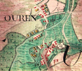 Ouren Belgium Ferraris 1777.png 598 × 520; 606 KB
-
 Papinglo, ferraris-kaart.jpg 1,680 × 1,050; 389 KB
-
 Parkbos.jpg 5,472 × 3,648; 18.06 MB
-
 Poperinge, Belgium ; Ferraris Map.jpg 652 × 564; 57 KB
-
 Puyenbroeck, belgium on ferraris map.jpg 2,247 × 1,996; 724 KB
-
 Raspaillebos Ferraris.jpg 3,648 × 5,472; 16.04 MB
-
 Ronse, Belgium, Ferraris.jpg 1,680 × 1,050; 326 KB
-
 RONSE.JPG 875 × 492; 113 KB
-
 Rue de meudon.1777.jpg 1,920 × 1,200; 1.43 MB
-
 Rupelmonde Ferraris.jpg 596 × 550; 71 KB
-
 Saint Pierre - Sint-Pieters-Kapelle - Ferraris map.png 701 × 449; 654 KB
-
 Schelde bij Merelbeke, Belgium, Ferraris, 1777.jpg 1,120 × 988; 325 KB
-
 Serskampse bossen Ferraris 01.jpg 5,472 × 3,648; 18.03 MB
-
 Sint-Denijs en Afsnee, Belgium, Ferraris 1775.jpg 1,680 × 1,050; 391 KB
-
 Sint-Goriks-Oudenhove 1777.jpg 5,081 × 3,537; 5.93 MB
-
 Sint-Maria-Oudenhove.jpg 5,472 × 3,648; 17.78 MB
-
 Sint-Niklaas, Belgium, Ferrariskaart, 1775.jpg 1,680 × 1,050; 370 KB
-
 Sint-Vincentiuskapel Ferraris.jpg 5,472 × 3,648; 15.67 MB
-
 Spijkerbos Ferraris.jpg 3,648 × 5,472; 15.57 MB
-
 Steenbergse bossen.jpg 3,648 × 5,472; 16.94 MB
-
 Stokkem op de Ferraris kaart (1771-75) KBR 27-8-2016 15-02-18.JPG 4,020 × 3,196; 8.76 MB
-
 Strijpen 1777.jpg 5,472 × 3,648; 18.47 MB
-
 Stropersbos Ferraris.jpg 5,472 × 3,648; 19.38 MB
-
 Ternath et Opalfene sur la carte de Ferraris.JPG 883 × 619; 111 KB
-
 Thimister-Clermont by Ferraris.png 1,031 × 760; 2.23 MB
-
 Tielt, Belgium, Ferraris, 1775.jpg 1,680 × 1,050; 332 KB
-
 Tombe d'Avene - Tumulus d'Avennes - Carte de Ferraris.jpg 843 × 598; 217 KB
-
 Tombe d'Avernas - Tumulus d'Avernas - Carte de Ferraris.jpg 751 × 642; 205 KB
-
 Tombe d'Hottomont - Tumulus d'Hottomont.jpg 860 × 598; 213 KB
-
 Tombe de Betz - Tumulus de Betz - Carte de Ferraris.jpg 861 × 582; 217 KB
-
 Tombe de Glimes - Tumulus de Glimes.jpg 660 × 720; 220 KB
-
 Tombe de Herbais - Tumulus de Piétrain - Carte de Ferraris.jpg 857 × 593; 226 KB
-
 Tombe de l'Empereur - Carte de Ferraris.jpg 857 × 592; 228 KB
-
 Tombe de Marcinelle - Tumulus de Marcinelle.jpg 850 × 593; 241 KB
-
 Tombe de Middelwinden - Tumulus de Middelwinden - Carte de Ferraris.jpg 798 × 865; 298 KB
-
 Tombe de Tilly - Tumulus de Tilly.jpg 861 × 596; 227 KB
-
 Tombe de Vissoulle - Tumulus de Vissoul - Carte de Ferraris.jpg 783 × 871; 243 KB
-
 Tombe de Waesmont - Tumulus de Waesmont - Carte de Ferraris.jpg 860 × 593; 209 KB
-
 Tombe à la Gate.jpg 853 × 597; 192 KB
-
 Tombes de Buhay - Tumuli de Seron - Carte de Ferraris.jpg 863 × 595; 205 KB
-
 Tombes de Grunde - Tumuli de Grimde - Carte de Ferraris.jpg 860 × 593; 271 KB
-
 Tombes de Libersart - Tumuli de Libersart.jpg 754 × 641; 184 KB
-
 Tombes de Mirteaux - Tumuli de Mirteaux - Carte de Ferraris.jpg 901 × 775; 299 KB
-
 Tombes de Noirmont - Tumuli de Noirmont.jpg 859 × 594; 224 KB
-
 Tombes du Soleil - Tumuli du Soleil - Carte de Ferraris.jpg 860 × 594; 222 KB
-
 Tombrouck - Ferraris map (1770-1778).png 600 × 600; 977 KB
-
 Tongeren, belgium, ferraris, 1775.jpg 1,680 × 1,050; 306 KB
-
 Tongeren, ferrariskaart.jpg 760 × 648; 67 KB
_-_Lannoo_-_Belgi%C3%AB.jpg)
_-_Copy.jpg)


.jpg)

.jpg)


1777(Ferraris85).jpg)


_-_01.jpg)


_KBR_27-8-2016_15-02-18.JPG)


.png)

