Category:Fictitious U.S. presidential election maps
Media in category "Fictitious U.S. presidential election maps"
The following 16 files are in this category, out of 16 total.
-
 1867 Confederate Election.png 785 × 332; 14 KB
-
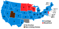
 1884 USA Election (Southern Victory).svg 1,020 × 460; 442 KB
-
 1916 USA Election (Southern Victory).svg 1,020 × 460; 442 KB
-
 1920 USA Election (Southern Victory) V2.svg 1,020 × 500; 442 KB
-
 1920 USA Election (Southern Victory).svg 1,020 × 500; 442 KB
-
 1924 USA Election (Southern Victory).svg 1,020 × 500; 442 KB
-
 1928 USA Election (Southern Victory).svg 1,020 × 500; 442 KB
-
 1932 USA Election (Southern Victory).svg 1,020 × 500; 442 KB
-
 1936 USA Election (Southern Victory).svg 1,020 × 500; 442 KB
-
 1940 USA Election (Southern Victory) V2.svg 1,020 × 490; 441 KB
-
 1940 USA Election (Southern Victory).svg 1,020 × 490; 441 KB
-
 1944 USA Election (Southern Victory) V2.svg 1,020 × 500; 442 KB
-
 1944 USA Election (Southern Victory).svg 1,020 × 500; 442 KB
-
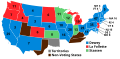
 Alt-1864 Union Election.png 989 × 460; 34 KB
-
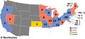
 Evan McMullin 2016 campaign objective.svg 1,020 × 593; 35 KB
-
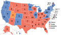
 TL-191 1920 US Election.svg 1,020 × 500; 442 KB

.svg)
.svg)
_V2.svg)
.svg)
.svg)
.svg)
.svg)
.svg)
_V2.svg)
.svg)
_V2.svg)
.svg)


