Category:Fife Coastal Path
Great Trail in Fife, Scotland, UK   | |||||
| Upload media | |||||
| Instance of |
| ||||
|---|---|---|---|---|---|
| Location | Fife, Scotland | ||||
| Length |
| ||||
| Terminus | |||||
| official website | |||||
 | |||||

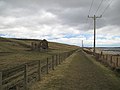
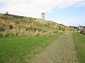
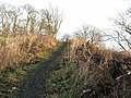
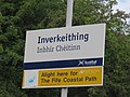
The Fife Coastal Path is a hiking footpath in Scotland which runs from the Forth Estuary to the Tay Estuary, and is 117 miles long.
Subcategories
This category has the following 10 subcategories, out of 10 total.
C
- Cambo Sands (27 F)
- Constantine's Cave (10 F)
D
- Donkey Brae (3 F)
E
- Elie chainwalk (14 F)
K
P
- Port Laing (4 F)
R
S
- Seafield Tower (32 F)
Media in category "Fife Coastal Path"
The following 200 files are in this category, out of 236 total.
(previous page) (next page)-
 "The Avenue" - geograph.org.uk - 41337.jpg 640 × 480; 179 KB
-
 A woodgatherer returns - geograph.org.uk - 1045576.jpg 640 × 486; 56 KB
-
 Along the Coastal Path near The Pans - geograph.org.uk - 3031367.jpg 1,142 × 857; 278 KB
-
 Ardross Castle - geograph.org.uk - 697649.jpg 640 × 425; 103 KB
-
 Bathing House Wood - geograph.org.uk - 431084.jpg 640 × 480; 173 KB
-
 Beach Access to Silversands, Aberdour - geograph.org.uk - 1154024.jpg 640 × 480; 113 KB
-
 Beach, Fife coast path - geograph.org.uk - 2143041.jpg 640 × 359; 87 KB
-
 Buddo Ness - geograph.org.uk - 165393.jpg 640 × 426; 243 KB
-
 Cave by the Coastal Path - geograph.org.uk - 2566094.jpg 427 × 640; 507 KB
-
 Coast path - geograph.org.uk - 2543611.jpg 640 × 480; 290 KB
-
 Coast path near Boarhills - geograph.org.uk - 956811.jpg 640 × 480; 120 KB
-
 Coastal Path - geograph.org.uk - 358784.jpg 640 × 424; 61 KB
-
 Coastal Path - geograph.org.uk - 750579.jpg 640 × 480; 87 KB
-
 Coastal path - geograph.org.uk - 870519.jpg 480 × 640; 103 KB
-
 Coastal path - geograph.org.uk - 870523.jpg 640 × 480; 87 KB
-
 Coastal Path - geograph.org.uk - 952281.jpg 640 × 480; 65 KB
-
 Coastal path approaching Crail - geograph.org.uk - 2153786.jpg 640 × 359; 91 KB
-
 Coastal Path Footbridge - geograph.org.uk - 3210353.jpg 640 × 425; 100 KB
-
 Coastal path near the Pans - geograph.org.uk - 4540840.jpg 750 × 480; 358 KB
-
 Coastal path stairway - geograph.org.uk - 1160009.jpg 480 × 640; 127 KB
-
 Coastal Path. - geograph.org.uk - 79003.jpg 640 × 480; 136 KB
-
 Coos sheltering on the Coastal Path - geograph.org.uk - 3031326.jpg 1,142 × 857; 304 KB
-
 Coves near Barnsmuir - geograph.org.uk - 95891.jpg 640 × 480; 154 KB
-
 Crossroads and Signpost, Dalgety Bay - geograph.org.uk - 112942.jpg 541 × 640; 131 KB
-

-
 David the First Street, Kinghorn - geograph.org.uk - 1154166.jpg 640 × 480; 66 KB
-
 Descent on the Chain Walk - geograph.org.uk - 537933.jpg 640 × 480; 101 KB
-
 Donibristle Gardens - geograph.org.uk - 578646.jpg 640 × 501; 93 KB
-
 Donibristle House and Donibristle Bay - geograph.org.uk - 38951.jpg 640 × 429; 63 KB
-
 Downing Point - geograph.org.uk - 578645.jpg 640 × 467; 104 KB
-
-
 Dysart Harbour from above.jpg 4,000 × 3,000; 2.1 MB
-
 Earlsferry from coastal path near Kincraig Point - geograph.org.uk - 1801016.jpg 1,600 × 1,200; 652 KB
-
 Earlsferry Links - geograph.org.uk - 1176099.jpg 640 × 480; 102 KB
-
 East Bay Forth Rail Bridge.jpg 882 × 661; 186 KB
-
 East Links - geograph.org.uk - 1719493.jpg 640 × 330; 62 KB
-
 Elevated Sea Cave - geograph.org.uk - 596583.jpg 640 × 480; 96 KB
-
 Elevated sea caves - geograph.org.uk - 55353.jpg 640 × 427; 101 KB
-
 FCP and Leven Bay - geograph.org.uk - 626773.jpg 640 × 399; 81 KB
-
 FCP bridge - geograph.org.uk - 626046.jpg 640 × 379; 51 KB
-
 FCP bridge by the burn - geograph.org.uk - 626767.jpg 640 × 424; 95 KB
-
 Fife coast path - geograph.org.uk - 1072768.jpg 480 × 640; 103 KB
-
 Fife coast path - geograph.org.uk - 1457417.jpg 480 × 640; 173 KB
-
 Fife coast path - geograph.org.uk - 1504559.jpg 640 × 480; 99 KB
-
 Fife coast path - geograph.org.uk - 1504662.jpg 640 × 480; 156 KB
-
 Fife coast path - geograph.org.uk - 1504665.jpg 640 × 480; 143 KB
-
 Fife coast path - geograph.org.uk - 1504689.jpg 640 × 480; 100 KB
-
 Fife Coast Path - geograph.org.uk - 1537664.jpg 640 × 480; 114 KB
-
 Fife Coast Path - geograph.org.uk - 1537971.jpg 640 × 480; 138 KB
-
 Fife Coast Path - geograph.org.uk - 1628803.jpg 640 × 480; 83 KB
-
 Fife Coast Path - geograph.org.uk - 1719548.jpg 640 × 359; 89 KB
-
 Fife Coast Path - geograph.org.uk - 1724667.jpg 640 × 359; 80 KB
-
 Fife Coast Path - geograph.org.uk - 1725871.jpg 640 × 359; 92 KB
-
 Fife Coast Path - geograph.org.uk - 1726224.jpg 640 × 359; 91 KB
-
 Fife Coast Path - geograph.org.uk - 2152219.jpg 640 × 480; 128 KB
-
 Fife Coast Path - geograph.org.uk - 2152281.jpg 640 × 359; 100 KB
-
 Fife Coast Path - geograph.org.uk - 2156845.jpg 640 × 480; 119 KB
-
 Fife Coast Path - geograph.org.uk - 2157182.jpg 640 × 359; 102 KB
-
 Fife Coast Path - geograph.org.uk - 2157192.jpg 640 × 359; 77 KB
-
 Fife Coast Path - geograph.org.uk - 2158959.jpg 640 × 359; 82 KB
-
 Fife Coast Path - geograph.org.uk - 2819644.jpg 640 × 360; 199 KB
-
 Fife Coast Path - geograph.org.uk - 5533804.jpg 1,024 × 576; 437 KB
-
 Fife Coast path at West Wemyss - geograph.org.uk - 1366601.jpg 640 × 480; 73 KB
-
 Fife Coast Path near Newark Castle - geograph.org.uk - 624561.jpg 640 × 480; 80 KB
-
 Fife coast path, Babbet Ness - geograph.org.uk - 2136715.jpg 640 × 359; 89 KB
-
 Fife Coast Path, Cambo - geograph.org.uk - 2159108.jpg 640 × 480; 133 KB
-
 Fife Coast Path, Dumbarnie Links - geograph.org.uk - 1537680.jpg 640 × 480; 120 KB
-
 Fife Coast Path, Dysart - geograph.org.uk - 1771289.jpg 640 × 480; 95 KB
-
 Fife coast path, Hawkcraig - geograph.org.uk - 1455298.jpg 480 × 640; 160 KB
-
 Fife coast path, Kingsbarns - geograph.org.uk - 2141843.jpg 640 × 359; 105 KB
-
 Fife coast path, North Queensferry - geograph.org.uk - 1072791.jpg 480 × 640; 78 KB
-
 Fife Coast Path, Pittenweem - geograph.org.uk - 1725883.jpg 640 × 359; 75 KB
-
 Fife Coast Path, Randerston - geograph.org.uk - 2158979.jpg 640 × 341; 91 KB
-
 Fife Coast Path, Seafield - geograph.org.uk - 1629177.jpg 640 × 480; 91 KB
-
 Fife Coast Path, Seafield - geograph.org.uk - 1629184.jpg 640 × 480; 103 KB
-
 Fife Coast Path, Shell Bay - geograph.org.uk - 1537946.jpg 640 × 480; 129 KB
-
 Fife coast path, Silver Sands Bay - geograph.org.uk - 1455350.jpg 640 × 480; 90 KB
-
 Fife Coastal Footpath - geograph.org.uk - 400520.jpg 640 × 480; 103 KB
-
 Fife Coastal Path (NCR1) - geograph.org.uk - 5437667.jpg 4,608 × 3,456; 3.14 MB
-
 Fife Coastal Path - geograph.org.uk - 1072802.jpg 640 × 480; 130 KB
-
 Fife Coastal Path - geograph.org.uk - 1076949.jpg 640 × 480; 112 KB
-
 Fife Coastal Path - geograph.org.uk - 1077816.jpg 640 × 480; 104 KB
-
 Fife Coastal Path - geograph.org.uk - 1078328.jpg 640 × 463; 94 KB
-
 Fife Coastal Path - geograph.org.uk - 1078975.jpg 640 × 480; 147 KB
-
 Fife Coastal Path - geograph.org.uk - 1141384.jpg 640 × 480; 62 KB
-
 Fife Coastal Path - geograph.org.uk - 1144516.jpg 640 × 480; 78 KB
-
 Fife Coastal Path - geograph.org.uk - 1154041.jpg 640 × 480; 139 KB
-
 Fife coastal path - geograph.org.uk - 1288009.jpg 640 × 480; 156 KB
-
 Fife Coastal Path - geograph.org.uk - 1316378.jpg 640 × 480; 115 KB
-
 Fife Coastal Path - geograph.org.uk - 1462780.jpg 640 × 480; 96 KB
-
 Fife Coastal Path - geograph.org.uk - 1462789.jpg 640 × 480; 61 KB
-
 Fife Coastal Path - geograph.org.uk - 171309.jpg 640 × 480; 65 KB
-
 Fife coastal path - geograph.org.uk - 2468880.jpg 1,600 × 1,063; 570 KB
-
 Fife Coastal Path - geograph.org.uk - 312559.jpg 640 × 424; 56 KB
-
 Fife coastal path - geograph.org.uk - 317051.jpg 640 × 424; 104 KB
-
 Fife coastal path - geograph.org.uk - 317063.jpg 640 × 424; 87 KB
-
 Fife coastal path - geograph.org.uk - 3358452.jpg 588 × 404; 344 KB
-
 Fife coastal path - geograph.org.uk - 3358471.jpg 475 × 640; 90 KB
-
 Fife Coastal Path - geograph.org.uk - 359499.jpg 640 × 424; 63 KB
-
 Fife Coastal Path - geograph.org.uk - 4107465.jpg 2,816 × 2,112; 1.15 MB
-
 Fife Coastal Path - geograph.org.uk - 4111316.jpg 2,816 × 2,112; 1.11 MB
-
 Fife Coastal Path - geograph.org.uk - 519592.jpg 640 × 424; 48 KB
-
 Fife Coastal Path - geograph.org.uk - 578641.jpg 480 × 640; 179 KB
-
 Fife Coastal Path - geograph.org.uk - 596596.jpg 640 × 480; 59 KB
-
 Fife Coastal Path - geograph.org.uk - 605157.jpg 640 × 480; 60 KB
-
 Fife coastal path - geograph.org.uk - 667536.jpg 480 × 640; 74 KB
-
 Fife Coastal Path - geograph.org.uk - 712120.jpg 640 × 480; 103 KB
-
 Fife Coastal Path - geograph.org.uk - 823937.jpg 640 × 426; 97 KB
-
 Fife Coastal Path - geograph.org.uk - 931745.jpg 640 × 426; 117 KB
-
 Fife Coastal Path - Largo to Shell Bay - geograph.org.uk - 400679.jpg 640 × 480; 144 KB
-
 Fife coastal path and Babbet Ness - geograph.org.uk - 51939.jpg 640 × 480; 126 KB
-

-
 Fife Coastal Path at Cocklemill Burn - geograph.org.uk - 936846.jpg 640 × 480; 79 KB
-
 Fife Coastal path at Dysart - geograph.org.uk - 1366595.jpg 640 × 480; 68 KB
-
 Fife Coastal Path at East Wemyss - geograph.org.uk - 1366632.jpg 568 × 640; 68 KB
-
 Fife Coastal Path at Roome Bay, Crail - geograph.org.uk - 3665061.jpg 678 × 1,024; 169 KB
-
 Fife Coastal path at Viewforth - geograph.org.uk - 1174855.jpg 640 × 480; 99 KB
-
 Fife Coastal Path bridges a burn - geograph.org.uk - 596570.jpg 640 × 480; 117 KB
-
 Fife Coastal Path by B946 - geograph.org.uk - 4549018.jpg 4,608 × 3,456; 3.14 MB
-
 Fife Coastal Path by St Monans - geograph.org.uk - 160868.jpg 640 × 426; 235 KB
-
 Fife Coastal Path by Wemyss - geograph.org.uk - 100200.jpg 640 × 480; 108 KB
-

-

-
 Fife coastal path map.jpg 954 × 790; 409 KB
-
 Fife coastal path near Crail - geograph.org.uk - 4540946.jpg 518 × 750; 480 KB
-
 Fife coastal path near seafield - geograph.org.uk - 3877374.jpg 640 × 427; 396 KB
-
 Fife Coastal Path near Tayport - geograph.org.uk - 5992620.jpg 640 × 435; 91 KB
-
 Fife Coastal Path Signpost and Beach - geograph.org.uk - 400492.jpg 640 × 480; 99 KB
-

-

-
 Fife Coastal Path towards Tayport - geograph.org.uk - 5992602.jpg 640 × 404; 72 KB
-

-
 Fife Coastal Path, Anstruther Wester - geograph.org.uk - 5126500.jpg 4,608 × 3,456; 5.61 MB
-
 Fife Coastal Path, Blair Point - geograph.org.uk - 100233.jpg 640 × 480; 199 KB
-
 Fife Coastal Path, Hopeward Wood - geograph.org.uk - 1077833.jpg 640 × 480; 137 KB
-
 Fife Coastal Path, Kinghorn - geograph.org.uk - 1154192.jpg 640 × 480; 74 KB
-
 Fife coastal path, Kinghorn - geograph.org.uk - 1479719.jpg 640 × 480; 119 KB
-
 Fife Coastal Path, West Wemyss - geograph.org.uk - 101216.jpg 640 × 480; 172 KB
-
 Fife Coastal Path.jpg 1,496 × 1,122; 537 KB
-
 Fife Cycle Path - geograph.org.uk - 575054.jpg 640 × 480; 117 KB
-
 Fisher Street - geograph.org.uk - 400872.jpg 640 × 480; 112 KB
-
 Footbridge at Burnside Farm - geograph.org.uk - 988996.jpg 640 × 484; 103 KB
-
 Footbridge in the trees - geograph.org.uk - 1316368.jpg 640 × 480; 148 KB
-
 Footbridge on the Coastal Path - geograph.org.uk - 1464108.jpg 640 × 480; 140 KB
-
 Gate and Pigeon - geograph.org.uk - 528870.jpg 640 × 480; 108 KB
-

-
 Grassy coastal path near Earlsferry - geograph.org.uk - 1369332.jpg 640 × 480; 90 KB
-
 Harbourmaster's House - geograph.org.uk - 1159578.jpg 640 × 480; 58 KB
-
 Harbourmaster's House Dysart - geograph.org.uk - 1203490.jpg 640 × 480; 71 KB
-

-
 High tide west of Buddo Ness - geograph.org.uk - 989024.jpg 640 × 482; 100 KB
-
 Hillside above Fife Coastal Path - geograph.org.uk - 3373050.jpg 1,600 × 1,200; 1.61 MB
-
 Hopeward Wood - geograph.org.uk - 1077836.jpg 640 × 480; 159 KB
-
 Impressive wall on the Fife Coastal Path - geograph.org.uk - 1366584.jpg 640 × 480; 110 KB
-
 Inclined igneous rock beds - geograph.org.uk - 95888.jpg 640 × 466; 115 KB
-
 Inclined path - geograph.org.uk - 1229037.jpg 640 × 480; 128 KB
-
 Inverkeithing - geograph.org.uk - 313853.jpg 640 × 424; 40 KB
-
 Inverkeithing01LB.jpg 3,264 × 2,448; 2.58 MB
-
 Ivy fStop Treatment - geograph.org.uk - 112894.jpg 640 × 480; 144 KB
-

-
 Late afternoon on the Fife coast - geograph.org.uk - 988957.jpg 640 × 480; 101 KB
-
 Looking back to Leven - geograph.org.uk - 1386850.jpg 640 × 488; 102 KB
-
 Looking back to Wormit - geograph.org.uk - 1316376.jpg 640 × 480; 115 KB
-
 Looking east at Craigforth - geograph.org.uk - 1367095.jpg 640 × 480; 93 KB
-

-
 NCR1 and B946 adjacent - geograph.org.uk - 4547452.jpg 4,608 × 3,456; 3.22 MB
-
 North Queensferry - geograph.org.uk - 326679.jpg 640 × 424; 54 KB
-
 North Queensferry north-east harbour - geograph.org.uk - 738899.jpg 640 × 480; 102 KB
-
 Old and new beside the coastal path - geograph.org.uk - 964825.jpg 640 × 480; 60 KB
-
 Old Nag Rock - geograph.org.uk - 1045585.jpg 640 × 480; 84 KB
-
 On the Fife Coast Path - geograph.org.uk - 625452.jpg 480 × 640; 118 KB
-
 On The Fife Coastal Path - geograph.org.uk - 953298.jpg 640 × 426; 100 KB
-

-

-
 Path - geograph.org.uk - 518671.jpg 640 × 424; 75 KB
-
 Path by the edge of the golf course - geograph.org.uk - 724780.jpg 640 × 480; 99 KB
-
 Pile of rubbish - geograph.org.uk - 1004829.jpg 640 × 480; 73 KB
-
 Politically Correct signage^ - geograph.org.uk - 1720929.jpg 640 × 480; 107 KB
-
 Raised beach at Fife Ness - geograph.org.uk - 965046.jpg 640 × 480; 79 KB
-
 Raised beach deposits beside the Coastal Path - geograph.org.uk - 3031316.jpg 1,142 × 857; 313 KB
-
 Red sandstone - geograph.org.uk - 1462766.jpg 640 × 480; 151 KB
-
 Relief, Fife Coast Path - geograph.org.uk - 1072780.jpg 640 × 480; 122 KB
-
 Rock formation at Carlingnose Point - geograph.org.uk - 768228.jpg 640 × 480; 88 KB
-
 Rocky shore by the Pans - geograph.org.uk - 103481.jpg 640 × 432; 103 KB
-
 Ruin in the forest - geograph.org.uk - 4105467.jpg 2,816 × 2,112; 988 KB
-
 Sand profile - geograph.org.uk - 626045.jpg 640 × 416; 77 KB
-
 Sandy section of the coastal path - geograph.org.uk - 1144225.jpg 640 × 480; 98 KB
-
 Scrapyard - geograph.org.uk - 313091.jpg 640 × 424; 58 KB
-
 Scrapyard - geograph.org.uk - 313378.jpg 640 × 424; 52 KB
-
 Sea wall at East Wemyss - geograph.org.uk - 1366848.jpg 640 × 480; 71 KB
-
 Section of Fife Coastal Path, within Inverkeithing.jpg 4,608 × 2,184; 3.05 MB
-
 Sewage treatment plant - geograph.org.uk - 1237214.jpg 640 × 480; 45 KB
-
 Shell Bay, on Fife Coastal Path - geograph.org.uk - 1008735.jpg 640 × 480; 61 KB
-
 Shoreline with golf course behind - geograph.org.uk - 966589.jpg 640 × 480; 66 KB
-
 Sow Thistle by NCR1 between Newport and Tayport - geograph.org.uk - 4547438.jpg 3,456 × 4,608; 4.2 MB
-
 St Monans Church - geograph.org.uk - 993218.jpg 640 × 426; 74 KB
-
 St Monans West End - geograph.org.uk - 324633.jpg 640 × 480; 161 KB
-
 Starleyburn - geograph.org.uk - 42942.jpg 480 × 640; 230 KB
-
 Still a working pier - geograph.org.uk - 769340.jpg 640 × 480; 58 KB
-
 Stone stairway - geograph.org.uk - 1222489.jpg 480 × 640; 129 KB


_-_geograph.org.uk_-_5437667.jpg)


