Category:Filey
town and civil parish in North Yorkshire, England, UK  | |||||
| Upload media | |||||
| Instance of | |||||
|---|---|---|---|---|---|
| Location |
| ||||
| Said to be the same as | Filey (Wikimedia duplicated page, civil parish) | ||||
| official website | |||||
 | |||||
Subcategories
This category has the following 15 subcategories, out of 15 total.
B
- Boats in Filey (7 F)
C
- Coble landing, Filey (10 F)
F
- Filey Lifeboat Station (7 F)
- Filey sailing club (3 F)
- Filey War Memorial Archway (2 F)
H
N
R
- Royal Oak, Filey (1 F)
S
T
V
- Views of Filey (11 F)
Media in category "Filey"
The following 200 files are in this category, out of 1,665 total.
(previous page) (next page)-
 "High tide in short wellies" - geograph.org.uk - 5713841.jpg 480 × 640; 208 KB
-
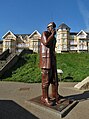 "High Tide in Short Wellies" by Ray Lonsdale - geograph.org.uk - 5565031.jpg 3,763 × 5,049; 4.41 MB
-

-
 'Filey Urban District Council' doorway - geograph.org.uk - 1929026.jpg 480 × 640; 166 KB
-
 'Steps to the Beach )' - geograph.org.uk - 1930041.jpg 640 × 480; 182 KB
-
 12 feet high sculpture, Coble Landing, Filey - geograph.org.uk - 2745893.jpg 728 × 1,024; 337 KB
-
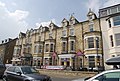
 15 - 21, The Crescent - geograph.org.uk - 5400833.jpg 640 × 426; 46 KB
-
 5 Leys, Beach Rd - geograph.org.uk - 1911862.jpg 640 × 430; 147 KB
-
 A Giant Lobster Sculpture on Filey Seafront.jpg 640 × 480; 88 KB
-
 A High Tide in Short Wellies - geograph.org.uk - 2745887.jpg 710 × 1,024; 203 KB
-
 A High Tide In Short Wellies - geograph.org.uk - 3835615.jpg 480 × 640; 82 KB
-
 A High Tide In Short Wellies - geograph.org.uk - 3835618.jpg 480 × 640; 87 KB
-

-
 A High Tide in Short Wellies, Filey - geograph.org.uk - 2811822.jpg 2,000 × 1,500; 673 KB
-
 A musical theme in the Crescent Gardens - geograph.org.uk - 5717363.jpg 640 × 480; 393 KB
-
 A public footpath across a golf course - geograph.org.uk - 2162094.jpg 800 × 600; 260 KB
-
 A ride up the beach - geograph.org.uk - 3619043.jpg 1,600 × 1,200; 525 KB
-
 A sea view from The Beach Road, Filey - geograph.org.uk - 1930292.jpg 640 × 480; 113 KB
-
-
 A wild day in Filey Bay - geograph.org.uk - 4783148.jpg 1,024 × 757; 418 KB
-
 A1039 Muston Road - geograph.org.uk - 2174493.jpg 640 × 427; 250 KB
-
 A1039 Muston Road - geograph.org.uk - 2174527.jpg 640 × 427; 256 KB
-
 A1039, Filey Crossing - geograph.org.uk - 5385896.jpg 640 × 426; 69 KB
-
 A165 at Primrose Valley - geograph.org.uk - 2204760.jpg 4,000 × 3,000; 2.51 MB
-
 A165 at Royal Oak Crossing - geograph.org.uk - 5385888.jpg 640 × 426; 50 KB
-
 A165 at Royal Oak Crossing - geograph.org.uk - 5403442.jpg 640 × 376; 29 KB
-
 A165 level crossing - geograph.org.uk - 5329110.jpg 3,008 × 2,000; 1.22 MB
-
 A165 Moor Road - geograph.org.uk - 5329098.jpg 1,600 × 978; 231 KB
-
 A165 Moor Road at Royal Oak - geograph.org.uk - 5970972.jpg 640 × 451; 84 KB
-
 A165 Roundabout - geograph.org.uk - 1355245.jpg 640 × 480; 62 KB
-
 A165 toward Filey - geograph.org.uk - 2203135.jpg 4,000 × 3,000; 2.41 MB
-
 Above Hunmamby Sands - geograph.org.uk - 3701415.jpg 2,560 × 1,920; 735 KB
-
 Access lane alongside ^30 West Avenue, Filey - geograph.org.uk - 6126094.jpg 1,600 × 1,200; 504 KB
-
 Access to Muston Sands at Mile Haven - geograph.org.uk - 5970939.jpg 640 × 434; 68 KB
-

-
 Aerial photographer at work - geograph.org.uk - 3110748.jpg 640 × 443; 85 KB
-
 Alleyway alongside ^21 Station Avenue, Filey - geograph.org.uk - 6126017.jpg 1,200 × 1,600; 564 KB
-
 Allotments by the railway - geograph.org.uk - 1915725.jpg 640 × 430; 118 KB
-
 Allotments by the railway - geograph.org.uk - 1915728.jpg 640 × 430; 113 KB
-
 Along the beach to Coble Landing - geograph.org.uk - 3386459.jpg 1,024 × 700; 337 KB
-
 Along the cliffs from Club Point - geograph.org.uk - 2782748.jpg 2,443 × 2,176; 1.02 MB
-
 An old sea mine - geograph.org.uk - 5400807.jpg 640 × 426; 53 KB
-
 Anchor and promenade in Filey - geograph.org.uk - 6000555.jpg 640 × 397; 58 KB
-
 Anchor feature on the Promenade, Filey - geograph.org.uk - 3709022.jpg 2,538 × 1,904; 1.27 MB
-
 Another chunk ready to fall - geograph.org.uk - 3386454.jpg 1,024 × 754; 377 KB
-
 Apartments, Flat Cliff - geograph.org.uk - 2624616.jpg 1,600 × 1,127; 193 KB
-
 Approaching Filey - geograph.org.uk - 3590688.jpg 1,024 × 768; 178 KB
-
 Approaching Hunmanby Gap - geograph.org.uk - 4035740.jpg 640 × 480; 43 KB
-

-
 Arable land in winter sunshine - geograph.org.uk - 5398205.jpg 640 × 426; 44 KB
-
 At Coble Landing, Filey looking to Filey Brigg - geograph.org.uk - 5564872.jpg 4,952 × 3,716; 2.51 MB
-

-
 Back street off Scarborough Rd - geograph.org.uk - 1912686.jpg 640 × 430; 143 KB
-
 Baker's Beach Chalets - geograph.org.uk - 2746163.jpg 1,024 × 726; 213 KB
-
 Bandstand in Crescent Gardens - geograph.org.uk - 1929536.jpg 640 × 480; 148 KB
-
 Bandstand, Crescent Gardens, Filey - geograph.org.uk - 4680463.jpg 640 × 440; 75 KB
-
 Bandstand, Filey - geograph.org.uk - 2624251.jpg 1,600 × 1,200; 417 KB
-
 Bandstand, The Crescent - geograph.org.uk - 1912000.jpg 640 × 430; 127 KB
-
 Base of the cliffs - geograph.org.uk - 3498900.jpg 640 × 480; 74 KB
-
 Base of the cliffs - geograph.org.uk - 3498901.jpg 640 × 480; 54 KB
-
 Base of the cliffs towards Filey - geograph.org.uk - 3498902.jpg 640 × 467; 55 KB
-
 Bay View Diner and Funland at Filey - geograph.org.uk - 2713547.jpg 3,264 × 2,448; 1.74 MB
-
 Beach access and sea wall, Filey - geograph.org.uk - 5249310.jpg 640 × 480; 51 KB
-
 Beach access path at Hunmanby Gap - geograph.org.uk - 3590606.jpg 1,024 × 751; 302 KB
-
 Beach and view of Carr Nase and Filey Brigg - geograph.org.uk - 2811867.jpg 1,966 × 1,454; 495 KB
-
 Beach at Filey - geograph.org.uk - 5314746.jpg 4,746 × 2,861; 5.59 MB
-
 Beach at Filey, low tide - geograph.org.uk - 3690482.jpg 640 × 480; 41 KB
-
 Beach at Hunmanby Gap - geograph.org.uk - 3590712.jpg 640 × 467; 115 KB
-
 Beach at Hunmanby Gap - geograph.org.uk - 3778493.jpg 1,600 × 1,067; 247 KB
-
 Beach at Hunmanby Gap - geograph.org.uk - 4183741.jpg 640 × 448; 90 KB
-
 Beach at Hunmanby Gap - geograph.org.uk - 4680327.jpg 640 × 480; 63 KB
-
 Beach at Hunmanby Gap - geograph.org.uk - 5970812.jpg 640 × 481; 64 KB
-
 Beach at Hunmanby Gap, Yorkshire - geograph.org.uk - 4623156.jpg 693 × 1,000; 748 KB
-
 Beach at Hunmanby Gap, Yorkshire - geograph.org.uk - 4623158.jpg 1,400 × 933; 1.03 MB
-
 Beach Cafe, Hunmanby Gap - geograph.org.uk - 5921008.jpg 640 × 480; 68 KB
-
 Beach Cafe, Hunmanby Gap - geograph.org.uk - 5921037.jpg 640 × 419; 113 KB
-
 Beach games Muston sands Filey - geograph.org.uk - 1946580.jpg 1,024 × 768; 124 KB
-
 Beach huts - geograph.org.uk - 5400781.jpg 640 × 426; 73 KB
-

-
 Beach huts at Filey - geograph.org.uk - 4613546.jpg 1,600 × 1,067; 1.27 MB
-
 Beach Huts, Coble Landing - geograph.org.uk - 1911746.jpg 640 × 430; 162 KB
-
 Beach huts, Filey - geograph.org.uk - 5705256.jpg 2,000 × 1,500; 355 KB
-
 Beach in Front of Hunmanby Gap - geograph.org.uk - 1231134.jpg 640 × 480; 54 KB
-
 Beach near Hunmanby Gap - geograph.org.uk - 2623825.jpg 1,600 × 1,200; 486 KB
-
 Beach near Hunmanby Gap - geograph.org.uk - 2624624.jpg 1,600 × 1,200; 350 KB
-
 Beach near Old Quay Rocks - geograph.org.uk - 4799876.jpg 480 × 640; 50 KB
-
 Beach stuff - geograph.org.uk - 3562961.jpg 1,024 × 1,024; 457 KB
-
 Beach View of Track to Hunmanby - geograph.org.uk - 4035723.jpg 640 × 480; 40 KB
-
 Beach Villa, Lower Flat Cliffs, Primrose Valley - geograph.org.uk - 5126694.jpg 4,594 × 2,643; 3.94 MB
-
 Beach, Filey Bay - geograph.org.uk - 4799878.jpg 640 × 480; 54 KB
-
 Beach, Filey Bay - geograph.org.uk - 5400778.jpg 640 × 426; 35 KB
-
 Beach, Hunmanby Gap - geograph.org.uk - 2623813.jpg 1,600 × 1,200; 188 KB
-
 Beach, Hunmanby Gap - geograph.org.uk - 2623818.jpg 1,600 × 1,200; 171 KB
-
 Beach, Hunmanby Gap - geograph.org.uk - 2624629.jpg 1,600 × 1,200; 316 KB
-
 Beach, Hunmanby Gap - geograph.org.uk - 4030285.jpg 640 × 461; 58 KB
-
 Beach, Mile Haven - geograph.org.uk - 5117809.jpg 640 × 480; 42 KB
-
 Beachcomber - geograph.org.uk - 5400849.jpg 640 × 426; 64 KB
-
 Beachcombing on Muston Sands (2001) - geograph.org.uk - 2658894.jpg 683 × 1,024; 141 KB
-
 Bear Sculpture at Hylands - geograph.org.uk - 5716865.jpg 480 × 640; 282 KB
-

-
 Belle Vue Crescent - geograph.org.uk - 1912654.jpg 640 × 430; 126 KB
-
 Belle Vue Crescent - geograph.org.uk - 5400859.jpg 640 × 407; 65 KB
-
 Belle Vue Hotel, Filey - geograph.org.uk - 3802792.jpg 1,200 × 798; 342 KB
-
 Belle Vue Hotel, Filey - geograph.org.uk - 3802800.jpg 798 × 1,200; 351 KB
-
 Belle Vue Rd - geograph.org.uk - 1912022.jpg 640 × 430; 140 KB
-
 Belle Vue Rd - geograph.org.uk - 1912046.jpg 640 × 430; 136 KB
-
 Belle Vue Street, Filey - geograph.org.uk - 1933705.jpg 640 × 480; 124 KB
-
 Belle Vue Street, Filey - geograph.org.uk - 6230753.jpg 1,892 × 1,236; 1.3 MB
-
 Below Filey Brigg looking to Filey Sands - geograph.org.uk - 2089998.jpg 1,600 × 1,200; 628 KB
-
 Below North Cliff, near Filey - geograph.org.uk - 5502488.jpg 427 × 640; 339 KB
-
 Bench mark on 88 Queen Street, Filey - geograph.org.uk - 1929043.jpg 480 × 640; 163 KB
-
 Bench mark on Filey Post Office - geograph.org.uk - 1928953.jpg 480 × 640; 147 KB
-
 Bench mark on FUDC office building - geograph.org.uk - 1929008.jpg 640 × 480; 156 KB
-
 Bench mark on Occupation Bridge, Filey - geograph.org.uk - 6126125.jpg 1,197 × 1,600; 707 KB
-
 Bench mark on ^1 Church Street, Filey - geograph.org.uk - 6125999.jpg 1,199 × 1,600; 584 KB
-
 Bench mark on ^21 Station Avenue, Filey - geograph.org.uk - 6126011.jpg 1,197 × 1,600; 690 KB
-
 Bench mark on ^30 West Avenue, Filey - geograph.org.uk - 6126091.jpg 1,201 × 1,600; 718 KB
-
 Benches, Filey Country Park - geograph.org.uk - 1911700.jpg 640 × 430; 132 KB
-
 Beware Dangerous Cliffs - geograph.org.uk - 1946506.jpg 1,600 × 1,200; 420 KB
-
 Bijou beach hut - geograph.org.uk - 3386499.jpg 799 × 1,024; 340 KB
-
 Billy Butlin's House at Flat Cliff - geograph.org.uk - 3778564.jpg 1,600 × 1,067; 181 KB
-
 Bird flying - geograph.org.uk - 3498914.jpg 640 × 478; 39 KB
-
 Bird flying from a rock - geograph.org.uk - 3498915.jpg 640 × 474; 45 KB
-
 Bird on a rock - geograph.org.uk - 3498916.jpg 640 × 480; 55 KB
-
 Black Cliff Head, Filey - geograph.org.uk - 3778619.jpg 1,600 × 1,164; 263 KB
-

-
 Black Hole and Spa Nab in a Southeasterly gale - geograph.org.uk - 4783114.jpg 1,024 × 768; 345 KB
-
 Black-headed gull, winter plumage - geograph.org.uk - 2709927.jpg 1,024 × 738; 212 KB
-
 Blue North Sea - geograph.org.uk - 3110779.jpg 1,024 × 768; 387 KB
-
 Blue plaque on Bronte Café, Filey - geograph.org.uk - 3778637.jpg 944 × 861; 192 KB
-
 Blue tit looking fierce - geograph.org.uk - 4240025.jpg 1,024 × 726; 186 KB
-
 Boating lake, Glen Gardens, Filey - geograph.org.uk - 4119120.jpg 640 × 480; 72 KB
-

-

-
 Boats anchored in Filey Bay - geograph.org.uk - 1911513.jpg 640 × 430; 74 KB
-
 Boats, Filey Sailing Club - geograph.org.uk - 1911697.jpg 640 × 430; 144 KB
-
 Bonhommies Bar - geograph.org.uk - 1911977.jpg 640 × 430; 121 KB
-
 Boulder clay cliff by the Cleveland Way - geograph.org.uk - 1911485.jpg 640 × 430; 120 KB
-
 Boulder clay Cliff near Filey Brigg - geograph.org.uk - 1911483.jpg 640 × 430; 130 KB
-
 Boulder Clay Cliffs - geograph.org.uk - 5398239.jpg 640 × 426; 61 KB
-
 Boulder clay erosion, Filey Brigg - geograph.org.uk - 2782723.jpg 3,200 × 2,360; 1.45 MB
-
 Boulder clay near Hunmanby Gap - geograph.org.uk - 4681600.jpg 480 × 640; 103 KB
-
 Bramwell's Tea Room, Filey - geograph.org.uk - 4680450.jpg 640 × 424; 97 KB
-
 Bridge Hole - geograph.org.uk - 4255780.jpg 1,024 × 768; 169 KB
-
 Bridge over Church Ravine - geograph.org.uk - 4255307.jpg 1,024 × 768; 323 KB
-
 Bridleway near Muston Grange - geograph.org.uk - 4806832.jpg 640 × 480; 98 KB
-
 Bridleway passing Filey Fields Farm - geograph.org.uk - 4812204.jpg 4,540 × 3,362; 5.66 MB
-
 Bridleway towards Filey - geograph.org.uk - 1310418.jpg 640 × 480; 121 KB
-
 Brigg End - geograph.org.uk - 4799939.jpg 640 × 454; 60 KB
-
 Brigg End - geograph.org.uk - 5398289.jpg 640 × 426; 86 KB
-
 Brigg End from Filey Brigg - geograph.org.uk - 2161967.jpg 800 × 600; 282 KB
-
 Brigg End, Filey Brigg - geograph.org.uk - 4613623.jpg 1,600 × 1,067; 1.32 MB
-
 Bringing in the catch - geograph.org.uk - 2089985.jpg 1,600 × 1,200; 324 KB
-
 Brooklands - geograph.org.uk - 5400840.jpg 640 × 426; 64 KB
-
 Brooklands, Filey - geograph.org.uk - 1911959.jpg 640 × 430; 111 KB
-
 Brooklands, Filey - geograph.org.uk - 1911985.jpg 640 × 430; 127 KB
-
 Building by Filey Brigg - geograph.org.uk - 3498917.jpg 640 × 487; 39 KB
-
 Building, Hunmanby Gap, Yorkshire - geograph.org.uk - 4622847.jpg 1,400 × 933; 1.31 MB
-
 Buildings on The Beach Road, Filey - geograph.org.uk - 3835858.jpg 640 × 480; 71 KB
-
 Burnet moths feeding on ragwort - geograph.org.uk - 4059495.jpg 1,600 × 1,600; 498 KB
-
-

-

-

-

-

-
 Bus stop on Moor Road (A165) - geograph.org.uk - 4821682.jpg 640 × 480; 54 KB
-
 Bus stop on Moor Road (A165) - geograph.org.uk - 4821690.jpg 640 × 411; 63 KB
-
 Bus stop on Moor Road, Hunmanby - geograph.org.uk - 6233893.jpg 1,918 × 1,076; 1.08 MB
-
 Bus stop on Muston Road (A1039) - geograph.org.uk - 4806853.jpg 640 × 473; 61 KB
-
 Bus stop on Muston Road (A1039) - geograph.org.uk - 4806856.jpg 640 × 480; 84 KB
-

-
 Bus stop on Muston Road, Filey - geograph.org.uk - 4835278.jpg 640 × 480; 68 KB
-
 Bus stop on Scarborough Road, Filey - geograph.org.uk - 4808182.jpg 640 × 480; 55 KB
-
 Bus stop on Scarborough Road, Filey - geograph.org.uk - 4834886.jpg 640 × 480; 55 KB
-
 Bus stop, Primrose Valley Caravan Park - geograph.org.uk - 4822268.jpg 640 × 480; 115 KB
-
 Busy August morning on Hunmanby Sands - geograph.org.uk - 3590665.jpg 1,600 × 1,200; 519 KB
-
 Busy beach at Muston Sands - geograph.org.uk - 5705241.jpg 2,000 × 1,500; 383 KB
-
 Busy day on the beach, Hunmanby Gap - geograph.org.uk - 4127401.jpg 640 × 427; 59 KB
-
 Butcher Haven - geograph.org.uk - 2623827.jpg 1,600 × 1,200; 614 KB
-
 Butcher Haven - geograph.org.uk - 3778566.jpg 1,600 × 1,061; 275 KB
-
 Butcher Haven - geograph.org.uk - 5123678.jpg 4,896 × 3,672; 6.85 MB
-
 Butcher Haven - geograph.org.uk - 5648980.jpg 2,000 × 1,500; 246 KB
-
 By the sea at Filey - geograph.org.uk - 5564912.jpg 5,044 × 3,458; 2.72 MB
-

-
 Cafe and takeaways, Coble Landing, Filey - geograph.org.uk - 3835628.jpg 3,272 × 1,967; 948 KB
-

-
 Cafe near Filey Brigg, Yorkshire - geograph.org.uk - 4621640.jpg 1,400 × 933; 908 KB
-
 Cafe, Glen Gardens, Filey - geograph.org.uk - 4119122.jpg 640 × 480; 77 KB
-
 Cafe, Hunmanby Gap - geograph.org.uk - 2623811.jpg 1,600 × 1,200; 379 KB
-
 Café in Glen Gardens, Filey - geograph.org.uk - 4788449.jpg 1,200 × 799; 363 KB
-
 Calm sea in Filey Bay - geograph.org.uk - 4082018.jpg 1,600 × 1,065; 440 KB
-
 Car park at Hunmanby Gap - geograph.org.uk - 3590600.jpg 1,024 × 677; 241 KB
-
 Car park, Filey Country Park - geograph.org.uk - 4801379.jpg 640 × 480; 36 KB
-
 Car park, Hunmanby Gap - geograph.org.uk - 4821388.jpg 640 × 480; 64 KB
-
 Caravan park - geograph.org.uk - 5403434.jpg 640 × 425; 35 KB
-
 Caravan park, Muston Grange - geograph.org.uk - 4806831.jpg 640 × 480; 101 KB
-
 Caravan park, Muston Grange - geograph.org.uk - 4806836.jpg 640 × 480; 69 KB
-
 Caravans, Primrose Valley - geograph.org.uk - 1231080.jpg 640 × 480; 57 KB
-
 Cargate Hill - geograph.org.uk - 1912068.jpg 640 × 430; 163 KB


%27_-_geograph.org.uk_-_1930041.jpg)


,_Filey_-_geograph.org.uk_-_4806862.jpg)


_-_geograph.org.uk_-_2658894.jpg)


_-_geograph.org.uk_-_4783119.jpg)


,_Filey_-_geograph.org.uk_-_4808213.jpg)
_-_geograph.org.uk_-_4494860.jpg)
,_Filey_-_geograph.org.uk_-_4808203.jpg)
,_Filey_-_geograph.org.uk_-_4808217.jpg)
,_Filey_-_geograph.org.uk_-_4808218.jpg)

_-_geograph.org.uk_-_4821682.jpg)
_-_geograph.org.uk_-_4821690.jpg)

_-_geograph.org.uk_-_4806853.jpg)
_-_geograph.org.uk_-_4806856.jpg)
,_Filey_-_geograph.org.uk_-_4806860.jpg)


