Category:Fillongley
village and civil parish in Warwickshire, England, United Kingdom  | |||||
| Upload media | |||||
| Instance of | |||||
|---|---|---|---|---|---|
| Location | North Warwickshire, Warwickshire, West Midlands, England | ||||
| Population |
| ||||
| Area |
| ||||
| official website | |||||
 | |||||
Subcategories
This category has the following 6 subcategories, out of 6 total.
Media in category "Fillongley"
The following 200 files are in this category, out of 201 total.
(previous page) (next page)-
 A field of beans - geograph.org.uk - 5447246.jpg 1,244 × 932; 524 KB
-
 A road between hedges - geograph.org.uk - 6012049.jpg 1,600 × 900; 503 KB
-
 Approach to Fillongley - geograph.org.uk - 6012029.jpg 1,600 × 900; 247 KB
-
 Arable and housing - geograph.org.uk - 5311396.jpg 1,600 × 901; 684 KB
-
 Arley & Fillongley station site geograph-3236454-by-Ben-Brooksbank.jpg 2,395 × 1,492; 3.78 MB
-
 At Hillside Farm - geograph.org.uk - 6012065.jpg 1,600 × 900; 329 KB
-
 B4102 at Hayes Hall Farm - geograph.org.uk - 2692870.jpg 640 × 480; 53 KB
-

-
 B4102 enters Fillongley - geograph.org.uk - 2692894.jpg 640 × 480; 60 KB
-
 B4102 Meriden Road - geograph.org.uk - 5285249.jpg 1,600 × 901; 737 KB
-

-
 Black Hall Lane - geograph.org.uk - 5311411.jpg 1,600 × 901; 682 KB
-
 Bridge across M6 - geograph.org.uk - 2311663.jpg 3,648 × 2,736; 1.51 MB
-
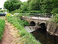 Bridge over the River Bourne - geograph.org.uk - 1865591.jpg 640 × 480; 142 KB
-
 Broad beans a-growin' - geograph.org.uk - 5450999.jpg 1,469 × 1,102; 716 KB
-
 Broad Lane - geograph.org.uk - 5286167.jpg 1,600 × 901; 649 KB
-
 Broad Lane by Stone House Farm - geograph.org.uk - 2387286.jpg 950 × 713; 445 KB
-
 Broad Lane, approaching Chapel House - geograph.org.uk - 5311392.jpg 1,600 × 901; 698 KB
-
 Broken oak - geograph.org.uk - 5285262.jpg 1,600 × 901; 686 KB
-
 Collier's Oak farmhouse - geograph.org.uk - 5451017.jpg 1,469 × 1,102; 627 KB
-
 Collier's Oak Farmhouse - geograph.org.uk - 5451023.jpg 1,958 × 1,469; 1.06 MB
-
 Cottage by Square Lane - geograph.org.uk - 5282587.jpg 1,600 × 1,600; 1.17 MB
-
 Cottages by Wall Hill Road - geograph.org.uk - 5282047.jpg 1,600 × 901; 682 KB
-
 Coventry Road, Fillongley, 1 - geograph.org.uk - 5311425.jpg 1,600 × 901; 703 KB
-
 Coventry Road, Fillongley, 2 - geograph.org.uk - 5311427.jpg 1,600 × 901; 689 KB
-
 Crop fields near the River Bourne - geograph.org.uk - 5297457.jpg 640 × 394; 37 KB
-
 Cross field - geograph.org.uk - 2311733.jpg 3,648 × 2,736; 1.3 MB
-
 Crossroads on the B4102 - geograph.org.uk - 2692968.jpg 640 × 480; 59 KB
-
 Crossways Farm at Woodend - geograph.org.uk - 2886432.jpg 640 × 425; 83 KB
-
 Curly Coated Sheep 224 365 (42187817870).jpg 3,648 × 2,736; 6.2 MB
-
 Dandy's Farm and pylon - geograph.org.uk - 4456056.jpg 640 × 426; 43 KB
-
 Detached country house - geograph.org.uk - 5963453.jpg 1,600 × 900; 447 KB
-
 Disused track to the Heart of England Adventure Park - geograph.org.uk - 6137635.jpg 1,469 × 1,102; 656 KB
-
 Dove House farmhouse - geograph.org.uk - 6128477.jpg 2,938 × 2,203; 2.18 MB
-
 Driveway to Brock Hall Farm - geograph.org.uk - 2884435.jpg 640 × 425; 100 KB
-
 Driveway to Springfield House - geograph.org.uk - 2884413.jpg 640 × 425; 127 KB
-
 End of Square Lane - geograph.org.uk - 5311445.jpg 1,600 × 900; 802 KB
-
 Entrance buildings at Dove House Farm - geograph.org.uk - 6128465.jpg 1,632 × 1,224; 740 KB
-
 Farmhouse, Collier's Oak Farm - geograph.org.uk - 2387280.jpg 950 × 713; 390 KB
-
 Farmland near The Elms - geograph.org.uk - 3168417.jpg 640 × 480; 65 KB
-
 Farmland near to Butler's Wood - geograph.org.uk - 5963421.jpg 1,600 × 900; 369 KB
-
 Field beside Wall Hill Road - geograph.org.uk - 6137638.jpg 1,469 × 1,102; 688 KB
-
 Field by Broad Lane - geograph.org.uk - 2387291.jpg 950 × 713; 447 KB
-
 Field entrance, Green End - geograph.org.uk - 5308956.jpg 640 × 480; 65 KB
-
 Field off the lane towards Green End - geograph.org.uk - 5308948.jpg 640 × 480; 52 KB
-
 Field path and bridge over stream - geograph.org.uk - 6192762.jpg 2,448 × 3,264; 4.15 MB
-
 Field path towards Hayes Hall Farm - geograph.org.uk - 2307886.jpg 1,600 × 1,200; 535 KB
-
 Field west of Dove House Farm - geograph.org.uk - 2386795.jpg 950 × 722; 399 KB
-
 Fields east of Meriden Road - geograph.org.uk - 5309046.jpg 640 × 480; 41 KB
-

-
 Fillongley - geograph.org.uk - 5311418.jpg 1,600 × 901; 741 KB
-
 Fillongley 1a07.JPG 2,592 × 1,944; 805 KB
-
 Fillongley cross roads 1a07.JPG 2,592 × 1,944; 842 KB
-
 Fillongley crossroads - geograph.org.uk - 2692897.jpg 640 × 480; 79 KB
-
 Fillongley Road - geograph.org.uk - 5311387.jpg 1,600 × 901; 669 KB
-
 Fillongley Road, Heart of England Way - geograph.org.uk - 2308981.jpg 1,200 × 1,600; 722 KB
-
 Fillongley-Bournebrook Primary School - geograph.org.uk - 5071293.jpg 1,600 × 1,200; 337 KB
-
 Fillongley-The Cottage Inn - geograph.org.uk - 5071296.jpg 1,600 × 1,200; 270 KB
-
 Footbridge over the M6 at Corley Moor - geograph.org.uk - 3677445.jpg 640 × 480; 242 KB
-
 Footpath and Track to Black Hall Farm - geograph.org.uk - 2884508.jpg 640 × 425; 114 KB
-
 Footpath by Shawbury Wood - geograph.org.uk - 2387276.jpg 950 × 713; 454 KB
-
 Footpath from Breach Oak Lane - geograph.org.uk - 5286177.jpg 1,600 × 901; 697 KB
-
 Footpath over the field - geograph.org.uk - 6013026.jpg 1,600 × 900; 348 KB
-

-
 Footpath, Kissing Gate and derelict Barn - geograph.org.uk - 2884494.jpg 640 × 425; 100 KB
-
 Grazing, Newhall Green - geograph.org.uk - 5308963.jpg 640 × 480; 47 KB
-
 Grazing, Newhall Green - geograph.org.uk - 5308971.jpg 640 × 480; 71 KB
-
 Green End Road - geograph.org.uk - 5285254.jpg 1,600 × 901; 715 KB
-

-
 Grey Faced Dartmoor sheep.jpg 1,747 × 1,310; 1.47 MB
-
 Grey Faced Dartmoor.jpg 2,736 × 2,052; 2.73 MB
-
 Hardingwood Lane passes Twin Gates - geograph.org.uk - 5447247.jpg 1,469 × 1,102; 693 KB
-
 Hayes Hall Farm and the B4102 - geograph.org.uk - 6137630.jpg 1,306 × 979; 415 KB
-
 Heart of England Way, Fillongley Road - geograph.org.uk - 2308954.jpg 1,600 × 1,200; 472 KB
-
 High House Farm - geograph.org.uk - 5451004.jpg 1,469 × 1,102; 751 KB
-
 House at the corner, Park Lane - geograph.org.uk - 2692970.jpg 640 × 480; 58 KB
-
 Junction with Tamworth Road - geograph.org.uk - 6013022.jpg 1,600 × 900; 491 KB
-
 Kinwalsey Lane - geograph.org.uk - 5308946.jpg 640 × 480; 107 KB
-
 Lane junction near Dove House Farm - geograph.org.uk - 2387264.jpg 899 × 625; 364 KB
-
 Lane near White House Farm - geograph.org.uk - 5309033.jpg 640 × 480; 117 KB
-
 Lane towards Fillongley - geograph.org.uk - 5308968.jpg 640 × 480; 77 KB
-
 Lane towards Green End - geograph.org.uk - 5308951.jpg 640 × 480; 99 KB
-
 Lane towards Newhall Green - geograph.org.uk - 5308960.jpg 640 × 480; 55 KB
-
 Listed stable block at Collier's Oak Farm - geograph.org.uk - 5451839.jpg 1,958 × 1,469; 1.34 MB
-
 M6 at 4 miles to junction 3A - geograph.org.uk - 4596024.jpg 2,256 × 1,496; 890 KB
-
 M6 bridge over Meriden Road at dusk - geograph.org.uk - 111775.jpg 640 × 524; 124 KB
-
 M6 gantry ahead - geograph.org.uk - 6216761.jpg 792 × 1,024; 105 KB
-

-

-

-
 M6 Northbound - geograph.org.uk - 3665141.jpg 640 × 480; 267 KB
-
 M6 overbridge, Meriden Road - geograph.org.uk - 2692874.jpg 640 × 480; 53 KB
-
 M6 Toll signage ahead - geograph.org.uk - 6216763.jpg 840 × 1,024; 109 KB
-
 M6 toll tariff sign - geograph.org.uk - 4596047.jpg 2,256 × 1,496; 892 KB
-
 M6 Toll Tariff, Chapel Green - geograph.org.uk - 3665133.jpg 640 × 480; 241 KB
-
 M6 traffic - geograph.org.uk - 111692.jpg 640 × 480; 80 KB
-
 M6 westbound - geograph.org.uk - 4597203.jpg 1,600 × 1,021; 314 KB
-
 M6 westbound Electronic Sign - geograph.org.uk - 4596036.jpg 2,256 × 1,496; 883 KB
-
 M6, Chapel Green - geograph.org.uk - 3677427.jpg 640 × 480; 259 KB
-
 Many ways to go - geograph.org.uk - 2311682.jpg 3,648 × 2,736; 1.41 MB
-
 Meadow north of Green End - geograph.org.uk - 2387296.jpg 950 × 713; 458 KB
-
 Meriden Road (B4102) - geograph.org.uk - 5309045.jpg 640 × 480; 93 KB
-
 Meriden Road (B4102) - geograph.org.uk - 5309047.jpg 640 × 480; 85 KB
-
 Meriden Road at Park House - geograph.org.uk - 2692892.jpg 640 × 480; 59 KB
-
 Meriden Road north of the M6 - geograph.org.uk - 2692878.jpg 640 × 480; 56 KB
-
 Meriden Road underpass - geograph.org.uk - 5282053.jpg 1,600 × 898; 882 KB
-
 Meriden Road winding northwards - geograph.org.uk - 2692888.jpg 640 × 480; 60 KB
-
 Meriden Road, B4102 - geograph.org.uk - 5285252.jpg 1,600 × 901; 715 KB
-
 Mill Lane-Tamworth Road junction - geograph.org.uk - 5457150.jpg 3,106 × 1,812; 1.46 MB
-
 Minor road junction, Newhall Green - geograph.org.uk - 5308965.jpg 640 × 480; 101 KB
-
 Minor road under the M6 - geograph.org.uk - 5963239.jpg 1,600 × 900; 367 KB
-
 Moor Farm and barn - geograph.org.uk - 6137652.jpg 2,774 × 2,081; 1.89 MB
-
 Mucky lane south of Rutters Hall - geograph.org.uk - 5685317.jpg 857 × 1,142; 518 KB
-
 Muddy farm track, Kinwalsey - geograph.org.uk - 5308943.jpg 640 × 480; 61 KB
-
 Muddy fields - geograph.org.uk - 2311642.jpg 1,200 × 1,600; 708 KB
-
 Near Kinwalsey - geograph.org.uk - 2311628.jpg 1,600 × 1,200; 636 KB
-
 Near to Newhall Green - geograph.org.uk - 5963233.jpg 1,600 × 900; 410 KB
-
 New gantry - M6 northbound - geograph.org.uk - 6216765.jpg 885 × 1,024; 107 KB
-
 North Warwickshire , The M6 Motorway - geograph.org.uk - 2795294.jpg 4,288 × 2,848; 4.18 MB
-
 North Warwickshire , The M6 Motorway - geograph.org.uk - 2795360.jpg 4,288 × 2,848; 4.43 MB
-
 North Warwickshire , The M6 Motorway - geograph.org.uk - 2795363.jpg 4,288 × 2,848; 4.49 MB
-
 Nuneaton Road at Church Lane - geograph.org.uk - 2692958.jpg 640 × 480; 75 KB
-
 Nuneaton Road at Sandy Lane - geograph.org.uk - 2692961.jpg 640 × 480; 59 KB
-
 Nuneaton Road, Fillongley - geograph.org.uk - 5963463.jpg 1,600 × 900; 260 KB
-
 Old Water Pump - geograph.org.uk - 2344240.jpg 2,736 × 3,648; 740 KB
-
 Open fields and pylons - geograph.org.uk - 2386790.jpg 950 × 713; 369 KB
-
 Ousterne Lane - geograph.org.uk - 5909024.jpg 2,000 × 1,333; 2.12 MB
-

-
 Pastoral scene east of Fillongley - geograph.org.uk - 5286174.jpg 1,600 × 901; 681 KB
-
 Pasture and woodland - geograph.org.uk - 5286164.jpg 1,600 × 901; 659 KB
-
 Pasture land opposite The Cottage Inn - geograph.org.uk - 5311407.jpg 1,600 × 901; 607 KB
-
 Path by The Metlins - geograph.org.uk - 2386788.jpg 950 × 704; 356 KB
-
 Pond at Hayes Hall Farm - geograph.org.uk - 6137627.jpg 1,306 × 979; 482 KB
-
 Pond by Moor House farm - geograph.org.uk - 6137641.jpg 1,632 × 1,224; 760 KB
-
 Pylon in the Bourne Valley - geograph.org.uk - 4456024.jpg 640 × 426; 43 KB
-
 Quaint footpath, Fillongley - geograph.org.uk - 6192760.jpg 2,448 × 3,264; 4.55 MB
-
 Road junction near Chapel Green - geograph.org.uk - 5963224.jpg 1,600 × 900; 454 KB
-
 Rolling Country - geograph.org.uk - 5459650.jpg 4,077 × 2,012; 1.53 MB
-
 Rural road junction - geograph.org.uk - 6013008.jpg 1,600 × 900; 335 KB
-
 Rural road junction - geograph.org.uk - 6013029.jpg 1,600 × 900; 371 KB
-
 Rutters Hall from the south - geograph.org.uk - 4176246.jpg 640 × 480; 86 KB
-
 Shawbury Lane - geograph.org.uk - 3168423.jpg 640 × 480; 81 KB
-
 Shawbury Lane - geograph.org.uk - 5311399.jpg 1,600 × 901; 732 KB
-
 Shawbury Lane near The Elms - geograph.org.uk - 6128487.jpg 1,632 × 1,224; 822 KB
-
 Shawbury Lane passing Hill View and Dayrona - geograph.org.uk - 6128483.jpg 1,632 × 1,224; 789 KB
-
 Sign for the Red Lion, Corley Moor - geograph.org.uk - 5309058.jpg 474 × 640; 48 KB
-
 Small patch of access woodland - geograph.org.uk - 1055144.jpg 640 × 480; 151 KB
-
 Snowdrops beside the lane at Rutters Hall - geograph.org.uk - 5685319.jpg 1,306 × 979; 730 KB
-
 Solomon's Temple Lane - geograph.org.uk - 5285277.jpg 1,600 × 901; 704 KB
-
 Solomon's Temple Lane, 1 - geograph.org.uk - 5285265.jpg 1,600 × 901; 733 KB
-
 Solomon's Temple Lane, 2 - geograph.org.uk - 5285268.jpg 1,600 × 901; 723 KB
-
 Telecoms mast - geograph.org.uk - 5311451.jpg 1,600 × 1,600; 1.08 MB
-

-
 The Cottage Inn - geograph.org.uk - 5311403.jpg 1,600 × 901; 632 KB
-
 The Cottage Inn - geograph.org.uk - 5963457.jpg 1,600 × 900; 265 KB
-

-
 The Gatehouse to Fillongley Hall - geograph.org.uk - 2884480.jpg 640 × 425; 91 KB
-
 The House with no Windows - geograph.org.uk - 2884457.jpg 640 × 425; 94 KB
-
 The M6 at Corley - geograph.org.uk - 70560.jpg 640 × 480; 123 KB
-

-
 The Red Lion, Corley Moor - geograph.org.uk - 5309056.jpg 640 × 480; 52 KB
-
 The road towards Corley Moor - geograph.org.uk - 5963211.jpg 1,600 × 900; 367 KB
-

-
 The Weavers Arms public house - geograph.org.uk - 2692963.jpg 640 × 480; 58 KB
-

-
 Track to Old Hall Farm Cottages - geograph.org.uk - 5309036.jpg 640 × 480; 51 KB
-
 Track to The Metlins - geograph.org.uk - 3168420.jpg 640 × 480; 88 KB
-
 Trees along the River Bourne - geograph.org.uk - 4456025.jpg 640 × 426; 52 KB
-
 Trotting.jpg 1,496 × 1,122; 713 KB
-
 View from Common Lane, Corley Moor - geograph.org.uk - 2054080.jpg 640 × 480; 81 KB
-
 Wall Hill Road - geograph.org.uk - 5285244.jpg 1,600 × 901; 620 KB
-
 Wall Hill Road - geograph.org.uk - 5309052.jpg 640 × 480; 87 KB
-
 Warwickshire countryside - geograph.org.uk - 5285259.jpg 1,600 × 901; 695 KB
-
 Warwickshire countryside, 1 - geograph.org.uk - 5285271.jpg 1,600 × 900; 706 KB
-
 Warwickshire countryside, 2 - geograph.org.uk - 5285272.jpg 1,600 × 901; 676 KB
-
 Warwickshire's Very Own Beach - geograph.org.uk - 2307900.jpg 3,648 × 2,736; 1.33 MB
-
 Welsh Cob.jpg 1,541 × 1,156; 819 KB
-
 West of Fillongley - geograph.org.uk - 6012033.jpg 1,600 × 900; 252 KB
-
 West to Birmingham - geograph.org.uk - 2311707.jpg 3,648 × 2,736; 602 KB
-
 Wild snowdrops by Square Lane - geograph.org.uk - 5282597.jpg 1,600 × 921; 772 KB
-
 Wood Corner Farm - geograph.org.uk - 5285281.jpg 1,600 × 901; 685 KB
-
 Woodland beside Meriden Road - geograph.org.uk - 5309042.jpg 640 × 480; 98 KB
-
 Woodland near Daw Mill Colliery - geograph.org.uk - 4456060.jpg 640 × 317; 35 KB
-
 Blackhall Lane - geograph.org.uk - 349397.jpg 640 × 292; 65 KB
-
 Brock Hall Farm - geograph.org.uk - 349421.jpg 640 × 227; 37 KB
-
 Common Lane, Corley Moor ... - geograph.org.uk - 232791.jpg 640 × 462; 109 KB
-

-
 Coventry Way at Breach Oak Farm - geograph.org.uk - 227267.jpg 640 × 480; 91 KB
-
 Farmland South of Corley Moor - geograph.org.uk - 98819.jpg 640 × 284; 33 KB
-
 Field and barn by Fillongley Road (B4102) - geograph.org.uk - 111681.jpg 640 × 480; 123 KB
-
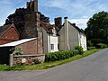
 Fillongley village and The Manor House - geograph.org.uk - 103758.jpg 480 × 640; 107 KB
-
 Footpath Through Farmland - geograph.org.uk - 98778.jpg 640 × 480; 147 KB
-
 Footpath to Taffs Farm - geograph.org.uk - 140900.jpg 640 × 480; 115 KB
-
 Hayes Hall Farm - geograph.org.uk - 111684.jpg 640 × 480; 108 KB
-
 Home Farm and Fillongley Mount - geograph.org.uk - 111762.jpg 640 × 420; 104 KB
-
 Pond excavations at Breach Oak Farm - geograph.org.uk - 227266.jpg 640 × 480; 98 KB
-
 Pump Lane - geograph.org.uk - 111781.jpg 640 × 480; 111 KB
-

-

-
 The Coventry Way - geograph.org.uk - 227067.jpg 640 × 480; 80 KB


.jpg)


_-_geograph.org.uk_-_5309049.jpg)


_-_geograph.org.uk_-_5309045.jpg)
_-_geograph.org.uk_-_5309047.jpg)


_-_geograph.org.uk_-_111681.jpg)


