Category:Film locations of Agatha Christie's Poirot in the United Kingdom
Countries of Europe: Belgium · France‡ · Greece · Malta · Spain‡ · Turkey‡ · United Kingdom
‡: partly located in Europe
‡: partly located in Europe
Of some of the buildings used in the episodes no free media are available so far, for instance High Canons in Hertfordshire, Joldwynds in Holmbury St Mary, Surrey and Marylands in Surrey.
Subcategories
This category has the following 122 subcategories, out of 122 total.
*
A
- Aveton Gifford Tidal Road (24 F)
B
- Beach of Morecambe (64 F)
- Beckley Park (12 F)
- 1-6 Brunswick Terrace, Hove (27 F)
- Byfleet Manor (5 F)
C
- Castern Hall (15 F)
- Chavenage House, Gloucestershire (17 F)
- Chilworth Manor, Surrey (13 F)
- The Colonnade, Bexhill-on-Sea (88 F)
D
E
- Englefield House (10 F)
F
G
H
- Hambledon Cricket Club (5 F)
- Station Approach, Horsted Keynes (10 F)
I
J
- Joyce Grove (4 F)
K
L
M
- Munden, Watford, Hertfordshire (11 F)
N
- Netherwylde Farm, Aldenham (3 F)
O
- Ye Olde Bell, Hurley, Berkshire (10 F)
P
- Peace Statue, Hove (68 F)
- Plumpton Racecourse (26 F)
R
- Reepham Town Hall (2 F)
S
- Sennowe Hall (7 F)
- Sharpthorne Tunnel (17 F)
- Shoreham Airport Building (24 F)
- Short Cliff, Sussex (9 F)
- Spring Cottage, Cliveden (15 F)
- St Ann's Court, Chertsey (2 F)
- Staines Old Town Hall (28 F)
T
- Tower Garage, Egham (5 F)
V
W
Pages in category "Film locations of Agatha Christie's Poirot in the United Kingdom"
The following 43 pages are in this category, out of 43 total.
A
C
D
M
T
Media in category "Film locations of Agatha Christie's Poirot in the United Kingdom"
The following 16 files are in this category, out of 16 total.
-
 Boots the Chemist - D10 building - geograph.org.uk - 678655.jpg 640 × 427; 97 KB
-
 Coast path near Pudcombe Cove - geograph.org.uk - 817427.jpg 480 × 640; 112 KB
-
 Farm access bridge, West Sussex-geograph-3399142-by-Stephen-Craven.jpg 1,024 × 768; 249 KB
-
 Fox Warren, Cobham, Surrey.jpg 1,333 × 985; 707 KB
-
 Hampton Lodge-geograph-3046413.jpg 640 × 480; 115 KB
-
 Harpsden Court-geograph-3370472.jpg 1,306 × 987; 583 KB
-
 Jordan Lane, Sedbergh-geograph-4500471-by-Peter-McDermott.jpg 4,945 × 3,370; 1.79 MB
-
 Manor Farm, Little Marlow - geograph.org.uk - 719509.jpg 640 × 479; 94 KB
-
 Marylands, Ewhurst, Surrey-15246584186.jpg 2,524 × 1,872; 1.83 MB
-
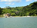 Maypool Boathouse-geograph-4180759-by-Tony-Atkin.jpg 1,024 × 768; 436 KB
-
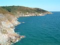 Pudcombe Cove - geograph.org.uk - 2138.jpg 640 × 480; 49 KB
-
 Shogmoor Lane, Frieth-geograph-2377093.jpg 640 × 444; 58 KB
-
 Shrubs Wood 2.jpg 644 × 225; 48 KB
-
 The Old School House, Windsor End, Beaconsfield-geograph-2196948.jpg 640 × 480; 78 KB
-
 Un-named lane leads to Colstrope Farm-geograph-3409961-by-Stuart-Logan.jpg 3,547 × 2,666; 1.89 MB
-
 Viewpoint, Channel View, Bexhill-on-Sea.jpg 4,608 × 2,592; 1.75 MB


