Category:Finstown
village in the Orkney Islands, Scotland, UK  | |||||
| Upload media | |||||
| Instance of | |||||
|---|---|---|---|---|---|
| Location |
| ||||
| Population |
| ||||
 | |||||
Refer to en:Finstown
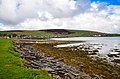
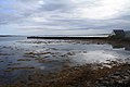
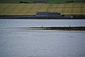
English: Finstown in the parish of Firth on Mainland, Orkney is the third largest settlement on the island. According to travel author Linklater, the homes in Finstown are tidy and well cared for. This settlement is situated along the Bay of Firth, whose fringe is a shallow intertidal mudflat. Prehistoric finds have been made in the form of ancient cists, somewhat west of the primary school. Finstown has a post office, Firth Primary School, two pubs (one closed at present), two shops and a garage. Most of these buildings are situated on the main Stromness to Kirkwall road.
Subcategories
This category has the following 2 subcategories, out of 2 total.
C
- Cuween Hill Chambered Cairn (15 F)
O
- Orkney Motocross Club (1 F)
Media in category "Finstown"
The following 95 files are in this category, out of 95 total.
-
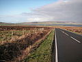
 A965 in Finstown - geograph.org.uk - 1080980.jpg 640 × 426; 57 KB
-
 A965 in Finstown. - geograph.org.uk - 1080977.jpg 640 × 426; 70 KB
-
 A965 near Finstown - geograph.org.uk - 1081149.jpg 640 × 426; 41 KB
-
 A966 junction - geograph.org.uk - 1081951.jpg 640 × 426; 57 KB
-
 A966 Junction - geograph.org.uk - 1082501.jpg 640 × 415; 43 KB
-
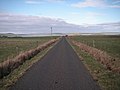
 A986 Cycle Route - geograph.org.uk - 1084160.jpg 640 × 445; 59 KB
-
 A986 looking northwards - geograph.org.uk - 1085044.jpg 640 × 411; 30 KB
-
 A986 looking southwards - geograph.org.uk - 1085038.jpg 640 × 417; 60 KB
-
 Abandoned car - geograph.org.uk - 180690.jpg 640 × 480; 79 KB
-
 Bay of Firth - geograph.org.uk - 3472804.jpg 424 × 640; 98 KB
-
 Bay of Firth - geograph.org.uk - 3592711.jpg 3,872 × 2,592; 3.29 MB
-
 Bay of Firth from North Liscups - geograph.org.uk - 236703.jpg 640 × 425; 92 KB
-

-
 Bridge and The Ouse, Finstown - geograph.org.uk - 492043.jpg 640 × 480; 131 KB
-
 Chapel in Finstown - geograph.org.uk - 1080986.jpg 640 × 426; 69 KB
-
 Crane fly on ragwort - geograph.org.uk - 237976.jpg 640 × 425; 180 KB
-
 Crannog in the Loch of Wasdale. - geograph.org.uk - 91196.jpg 640 × 412; 56 KB
-
 Cruise ship - geograph.org.uk - 283976.jpg 632 × 412; 73 KB
-
 Cursiter Quarry - geograph.org.uk - 857985.jpg 640 × 480; 80 KB
-
 Down Heddle Hill - geograph.org.uk - 1081010.jpg 640 × 426; 81 KB
-
 Farm of Cursiter, Grimbister - geograph.org.uk - 235363.jpg 640 × 480; 76 KB
-
 Finstown - geograph.org.uk - 3472733.jpg 640 × 424; 98 KB
-
 Finstown Pier - geograph.org.uk - 1363308.jpg 640 × 420; 72 KB
-
 Finstown Pier - geograph.org.uk - 2096954.jpg 3,888 × 2,592; 3.06 MB
-
 Finstown Pier - geograph.org.uk - 2936499.jpg 640 × 480; 77 KB
-
 Finstown pier - geograph.org.uk - 5922368.jpg 5,202 × 3,465; 3.04 MB
-
 Finstown shoreline - geograph.org.uk - 5402220.jpg 2,560 × 1,920; 3.11 MB
-
 Finstown, Dusk across the Bay of Firth - geograph.org.uk - 3743954.jpg 1,024 × 768; 119 KB
-
 Finstown, view across the bay - geograph.org.uk - 2631321.jpg 640 × 480; 51 KB
-
 Finstowngala.jpg 640 × 480; 121 KB
-
 Finstownwood.jpg 640 × 433; 113 KB
-
 Grimbister from Cuween Hill - geograph.org.uk - 53814.jpg 640 × 430; 81 KB
-
 Heddle Hill - geograph.org.uk - 1081019.jpg 640 × 426; 54 KB
-
 Heddle Hill Quarry - geograph.org.uk - 1081026.jpg 640 × 408; 46 KB
-
 Herons on Scarva Taing - geograph.org.uk - 3749132.jpg 3,872 × 2,592; 3.1 MB
-
 Houses on Heddle Hill - geograph.org.uk - 1080997.jpg 640 × 426; 105 KB
-
 Hoy Sound from Mid Hill - geograph.org.uk - 253341.jpg 500 × 375; 44 KB
-
 Lane from Heddle Quarry - geograph.org.uk - 1080876.jpg 640 × 408; 35 KB
-
 Lane to Heddle Hill, Finstown. - geograph.org.uk - 1080991.jpg 640 × 426; 86 KB
-
 Leigh's food trailer. Outside Finstown - geograph.org.uk - 5922389.jpg 4,352 × 2,764; 1.79 MB
-
 Lochan on top of Ward of Redland - geograph.org.uk - 234036.jpg 640 × 425; 114 KB
-
 Low Tide at Finstown - geograph.org.uk - 5890259.jpg 640 × 419; 313 KB
-
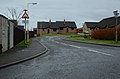
 Maitland Place - geograph.org.uk - 3472725.jpg 640 × 424; 94 KB
-
 Morning on the Bay of Firth - geograph.org.uk - 3593923.jpg 3,872 × 2,592; 3.12 MB
-
 New Housing - geograph.org.uk - 1081003.jpg 640 × 421; 58 KB
-
 North Liscups, Firth above old peat banks - geograph.org.uk - 234037.jpg 640 × 425; 120 KB
-
 Parish marker on the hillside at the Lyde - geograph.org.uk - 234626.jpg 425 × 640; 130 KB
-
 Pillbox on outskirts of Finstown - geograph.org.uk - 322415.jpg 640 × 437; 127 KB
-

-
 Shetland ponies near Binnaquoy - geograph.org.uk - 283975.jpg 640 × 480; 83 KB
-
 Shoreline of Bay of Firth - geograph.org.uk - 5397412.jpg 2,560 × 1,920; 3.23 MB
-
 Shorelines Gallery, Finstown - geograph.org.uk - 400971.jpg 640 × 394; 86 KB
-
 The A986 at Refuge corner - geograph.org.uk - 192000.jpg 640 × 480; 60 KB
-
 The Hill of Heddle - geograph.org.uk - 1081013.jpg 640 × 426; 48 KB
-
 The Old Finstown Road - geograph.org.uk - 325864.jpg 640 × 480; 130 KB
-
 The Ouse, just north of Finstown - geograph.org.uk - 191806.jpg 640 × 480; 54 KB
-
 View towards Thickbigging - geograph.org.uk - 5922374.jpg 5,202 × 3,465; 2.97 MB
-
 Yacht in Bay of Firth off Benziaroth, Finstown - geograph.org.uk - 3743833.jpg 1,024 × 768; 131 KB
-
 Abandoned Crofthouse - geograph.org.uk - 1080790.jpg 640 × 426; 47 KB
-
 Abandoned crofthouse - geograph.org.uk - 1082091.jpg 640 × 426; 60 KB
-
 Abandoned crofthouse. - geograph.org.uk - 1082170.jpg 640 × 426; 69 KB
-
 Abandoned peat cuttings - geograph.org.uk - 1136630.jpg 640 × 393; 89 KB
-
 Abandoned Peat Cuttings - geograph.org.uk - 1185630.jpg 640 × 426; 85 KB
-
 Abandoned peat cuttings - geograph.org.uk - 1187591.jpg 640 × 417; 119 KB
-
 Abandoned Peat Cuttings, Akla - geograph.org.uk - 1185634.jpg 640 × 393; 95 KB
-
 Along the coastline towards Burness - geograph.org.uk - 1082340.jpg 640 × 388; 47 KB
-
 Approaching North Quina - geograph.org.uk - 1080798.jpg 640 × 426; 51 KB
-
 Approaching the crossroads. - geograph.org.uk - 1080888.jpg 640 × 426; 68 KB
-
 Bigswell Road - geograph.org.uk - 357964.jpg 640 × 480; 117 KB
-
 Binscarth - geograph.org.uk - 90605.jpg 640 × 414; 93 KB
-
 Bring on the Dancing Girls^ - geograph.org.uk - 490155.jpg 640 × 480; 99 KB
-
 Cemetery, Finstown - geograph.org.uk - 235376.jpg 640 × 480; 81 KB
-
 Derelict cottages - geograph.org.uk - 235950.jpg 640 × 480; 85 KB
-
 Farm of Garth on Lyde road - geograph.org.uk - 520846.jpg 640 × 425; 129 KB
-
 Fibla Fiold Mast - geograph.org.uk - 322042.jpg 640 × 415; 47 KB
-
 Finstown - geograph.org.uk - 56222.jpg 312 × 640; 132 KB
-
 Graemshall - geograph.org.uk - 322001.jpg 640 × 427; 87 KB
-
 Happy Valley, Bigswell, Orkney - geograph.org.uk - 73426.jpg 422 × 640; 158 KB
-
 Heath House - geograph.org.uk - 314841.jpg 640 × 480; 101 KB
-
 Hill Road - geograph.org.uk - 318234.jpg 640 × 480; 98 KB
-
 Hill road - geograph.org.uk - 318242.jpg 640 × 480; 110 KB
-
 Hill Track - geograph.org.uk - 320408.jpg 640 × 480; 103 KB
-
 Holm of Grimbister - geograph.org.uk - 509975.jpg 640 × 480; 43 KB
-
 Keelylang Hill from the Old Finstown Road - geograph.org.uk - 325866.jpg 640 × 480; 133 KB
-

-
 Orphir Hills - geograph.org.uk - 320402.jpg 640 × 480; 121 KB
-
 Peat cuttings - geograph.org.uk - 180888.jpg 640 × 480; 178 KB
-
 Ruined cottage - geograph.org.uk - 320399.jpg 640 × 480; 127 KB
-
 Ruined cottage - geograph.org.uk - 320406.jpg 640 × 480; 131 KB
-
 Settiscarth - geograph.org.uk - 492006.jpg 640 × 480; 131 KB
-
 Standing Stone on the Chair of Lyde - geograph.org.uk - 491966.jpg 640 × 480; 147 KB
-
 The Quarry Garden at Binscarth - geograph.org.uk - 54192.jpg 640 × 480; 168 KB
-

-
 View northwards from Wideford Hill - geograph.org.uk - 447901.jpg 640 × 320; 29 KB
-
 View of Finstown from HY3615 - geograph.org.uk - 235398.jpg 640 × 480; 86 KB


