Category:Flood level signs in Japan
Countries of Asia: India · Japan · Philippines · Russia‡
Limited recognition: Taiwan
‡: partly located in Asia
Limited recognition: Taiwan
‡: partly located in Asia
Subcategories
This category has the following 3 subcategories, out of 3 total.
2
T
Media in category "Flood level signs in Japan"
The following 32 files are in this category, out of 32 total.
-
 1953 flood level sign in Miyaki, Saga.jpg 4,032 × 3,024; 3.09 MB
-
 1966 Tahara Inundation Height 20170121.jpg 3,648 × 5,472; 7.56 MB
-
 1972Matue flood 001.JPG 3,264 × 2,448; 3.07 MB
-
 1972Matue flood 002.JPG 2,448 × 3,264; 2.93 MB
-
 1972Matue flood 003.JPG 3,264 × 2,448; 2.1 MB
-
 1972Matue flood 004.JPG 3,264 × 2,448; 2.31 MB
-
 1972Matue flood 005.JPG 3,264 × 2,448; 1.78 MB
-
 1986 Motegi Flood Monument.JPG 2,048 × 1,536; 1.81 MB
-
 2005Typhoon14-Shimanto.jpg 2,592 × 1,944; 2.06 MB
-
 20200922 日吉ダム 06.jpg 1,280 × 720; 383 KB
-
 Chikuma-river-FloodSign-obuse.jpg 1,556 × 2,404; 654 KB
-
 Heavy Rain in Ebino, Miyazaki, Japan (July, 2006).jpg 998 × 1,331; 329 KB
-
 KurihashiSuiiKansokujo2005-6.jpg 1,280 × 960; 608 KB
-
 Monument of flood Fudōgawa river Yamashiro Town KYOTO JPN.jpg 1,200 × 1,800; 301 KB
-
 Shinkakuji temple.jpg 2,592 × 1,944; 2.07 MB
-
 Stele of Great Kanto Flood 1742.jpg 4,000 × 3,000; 2.77 MB
-
 Stele of Great Kanto Flood 1742b.jpg 4,000 × 3,000; 2.6 MB
-
 Stele of Great Kanto Flood 1742c.jpg 2,400 × 1,800; 1.22 MB
-
 Stele of Great Kanto Flood 1742d.jpg 4,000 × 3,000; 2.76 MB
-
 Takashio.jpg 240 × 320; 42 KB
-
 Tidemark of 1953 Fukuchiyama flood.jpg 1,228 × 921; 408 KB
-
 Unility Pole Aoi-Aso Shrine Hitoyoshi 2020.jpg 3,024 × 4,032; 4.29 MB
-
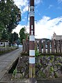 Unility Pole Aoi-Aso Shrine Hitoyoshi 2023.jpg 3,024 × 4,032; 3.02 MB
-
 Waterline Sign of Heavy Rain in September 30, 2001 at Kumano, Mie.jpg 2,736 × 3,648; 3.39 MB
-
 Zoujuin-hasira.jpg 2,592 × 1,936; 1.83 MB
-
 兵庫県豊岡市出石町鳥居の浸水時水位標柱.jpg 3,456 × 4,608; 3.76 MB
-
 分かりやすい洪水情報の提供 (4981679316).jpg 2,289 × 3,433; 5.76 MB
-
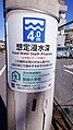 想定浸水深20201025 01.jpg 960 × 1,706; 206 KB
-
 想定浸水深20201025 02.jpg 960 × 1,706; 214 KB
-
 豊岡特別地域気象観測所.jpg 1,600 × 1,200; 770 KB
-
 長崎大水害の記憶 - panoramio.jpg 4,672 × 3,104; 1.16 MB
-
 阪神風水害浸水水位線.JPG 2,448 × 3,264; 1.81 MB


.jpg)


.jpg)


