Category:Flood level signs in Poland
Countries of Europe: Austria · Belgium · Bulgaria · Czech Republic · Denmark · Finland · France‡ · Germany · Hungary · Italy · Luxembourg · Netherlands‡ · Norway · Poland · Portugal‡ · Russia‡ · Slovenia · Spain‡ · Switzerland · United Kingdom
‡: partly located in Europe
‡: partly located in Europe
Subcategories
This category has the following 5 subcategories, out of 5 total.
F
- Flood level signs in Wrocław (5 F)
G
- Flood level signs in Gdańsk (6 F)
O
W
- Flood Post in Wilanów Park (4 F)
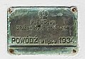
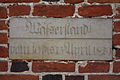
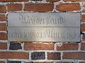
Media in category "Flood level signs in Poland"
The following 18 files are in this category, out of 18 total.
-
 2014 Kapliczka przydrożna w Przecławiu 05.JPG 2,868 × 2,017; 3.35 MB
-
 Biala Gora, high water mark, 1884.jpg 5,184 × 2,920; 6.33 MB
-
 Droga Pienińska - powódź 1934 (1).jpg 2,592 × 1,728; 3.41 MB
-
 Droga Pienińska - powódź 1934 (2).jpg 2,592 × 1,728; 2.82 MB
-
 Klodzko diluvia.jpg 683 × 1,014; 657 KB
-
 Korzeniewo - Wisła wylała w 2010.JPG 4,032 × 3,024; 5.98 MB
-
 Korzeniewo13.JPG 2,736 × 3,648; 3.03 MB
-
 Malczyce.znaki.powodziowe.jpg 3,072 × 2,048; 2.55 MB
-
 Old folld water signs, Toruń.jpg 3,872 × 2,592; 5.92 MB
-
 Our Lady of the Rosary church in Klodzko 2021 P18 flood level sign.jpg 3,456 × 5,184; 5.93 MB
-
 Pomnik Znak Wielkiej Wody.JPG 1,312 × 1,040; 697 KB
-
 Torun flood sings Mostowa.JPG 4,877 × 3,744; 8.05 MB
-
 Torun znaki powodziowe.jpg 3,648 × 2,736; 5.06 MB
-
 Toruń, historyczne stany wody na Wiśle, Brama Mostowa (OLA Z.).JPG 1,704 × 2,272; 981 KB
-
 Trutnowy 017.jpg 3,088 × 2,056; 1.74 MB
-
 Trutnowy kosciol 5.jpg 2,816 × 2,112; 3.87 MB
-
 Wegweiser Bielawa Dolna.JPG 3,456 × 5,184; 3.46 MB
-
 Włocławek-Kościół Św. Jana-Daty.JPG 3,264 × 2,448; 3.89 MB


.jpg)
.jpg)


.JPG)


