Category:Floods in the United States
Countries of the Americas: Argentina · The Bahamas · Bolivia · Brazil · Canada · Chile · Colombia · Costa Rica · Ecuador · El Salvador · Guatemala · Guyana · Haiti · Honduras · Jamaica · Mexico · Nicaragua · Panama · Paraguay · Peru · Suriname · United States of America · Uruguay · Venezuela
Other areas: Guadeloupe
Other areas: Guadeloupe
Wikimedia category | |||||
| Upload media | |||||
| Instance of | |||||
|---|---|---|---|---|---|
| Category combines topics | |||||
 | |||||
Subcategories
This category has the following 24 subcategories, out of 24 total.
Media in category "Floods in the United States"
The following 41 files are in this category, out of 41 total.
-

-

-
 412 DSP Runoff 072 - DPLA - 23f4ab6afdea3ffeb6f4b253859f1965.jpg 3,872 × 2,592; 1.94 MB
-
 Watershed work plan Lakin Watershed, Kearny County, Kansas (IA CAT30509504).pdf 1,195 × 1,558, 46 pages; 2.14 MB
-
 Centennial Bridge Over Mississippi River - April 1965 Flood Plaque (30453158808).jpg 1,600 × 2,400; 2.89 MB
-

-

-

-
 Christian River (Christiana to Christiana Acres vicinity). LOC gm69002795.tif 8,520 × 5,230; 127.49 MB
-
 Flood Damage in Caroline County (7790630464).jpg 5,550 × 4,350; 1.96 MB
-
 Flood, 4-30-23 LOC npcc.08379.tif 5,428 × 4,319; 22.36 MB
-
 Flooded community - NARA - 286170.jpg 3,000 × 2,041; 2.98 MB
-
 Flooded Pastures in Northeastern Novato.jpg 4,000 × 2,250; 3.24 MB
-
 Flooded pumpkin patch.jpg 1,170 × 820; 1.35 MB
-
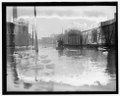
 Flooded section of a town, June 10, 1908 (INDOCC 1584).jpg 768 × 438; 55 KB
-
 Flooding along the Illinois River (After).jpg 3,840 × 2,880; 4.71 MB
-
 Floodwater over rail road tracks, Madison, Illinois. Commonwealth Steel in background.jpg 5,501 × 4,753; 4.31 MB
-

-
 High water LCCN89715873.jpg 799 × 1,024; 134 KB
-
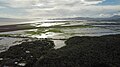
 McKenzie River (23198256611).jpg 4,608 × 3,456; 3.32 MB
-
 Mississippi Flood 1993.PNG 420 × 295; 18 KB
-
 Missouri-flood1.jpg 409 × 255; 98 KB
-
 National Guard flood response (9396).jpg 3,600 × 2,400; 1.71 MB
-

-
 Potomac flood & ice LCCN2016820408.tif 5,258 × 4,239; 21.26 MB
-
 Princeton Junction station flooding after Hurricane Irene, August 2011.jpg 3,000 × 4,000; 1.63 MB
-
 Raging Occoquan River (7790637830).jpg 5,496 × 3,760; 1.48 MB
-
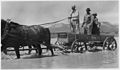 Rescue team drive a horse drawn wagon through a flooded area - NARA - 285524.jpg 3,000 × 1,758; 1.98 MB
-
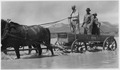 Rescue team drive a horse drawn wagon through a flooded area - NARA - 285524.tif 3,000 × 1,758; 5.03 MB
-
 River flooding in the United States, June 29, 2006 1530 UTC.png 409 × 255; 12 KB
-
 Road Closed in Occoquan (7790628858).jpg 5,550 × 4,350; 1.9 MB
-
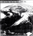 Satellite Image of January 1982 California floods 1745 UTC.png 650 × 712; 873 KB
-
 Storm system with flood and tornadoes 2017-04-30.png 1,920 × 1,080; 4.95 MB
-
 The Great Overflow of 1874.png 668 × 855; 1.17 MB
-
 The Rising Flood (15662089417).jpg 5,460 × 2,862; 6.27 MB
-
 Tops of buildings show above spring floodwaters - NARA - 285352.jpg 3,000 × 2,087; 1.13 MB
-
 Tops of buildings show above spring floodwaters - NARA - 285352.tif 3,000 × 2,087; 5.97 MB
-
Tracking Deluge and Drought through Soil Moisture- Part 2.webm 1 min 45 s, 3,840 × 2,160; 143.47 MB
-
 Us 169 flood.PNG 161 × 98; 38 KB
-
 USfloodmap8May2011.png 460 × 349; 51 KB
-
 Watersheds03 (38194468355).jpg 2,250 × 1,500; 4.06 MB


.jpg)
.jpg)


.jpg)
.jpg)


.jpg)


.jpg)


.jpg)


.jpg)


.jpg)


.jpg)
.jpg)
.jpg)
.jpg)