Category:Flora of Devon in May
Ceremonial counties of England: Bedfordshire · Berkshire · Buckinghamshire · Cambridgeshire · Cheshire · Cornwall · Cumbria · Derbyshire · Devon · Dorset · Durham · East Riding of Yorkshire · East Sussex · Essex · Gloucestershire · Greater London · Greater Manchester · Hampshire · Herefordshire · Hertfordshire · Kent · Lancashire · Leicestershire · Lincolnshire · Merseyside · Norfolk · North Yorkshire · Northamptonshire · Northumberland · Nottinghamshire · Oxfordshire · Rutland · Shropshire · Somerset · South Yorkshire · Staffordshire · Suffolk · Surrey · Warwickshire · West Midlands · West Sussex · West Yorkshire · Wiltshire · Worcestershire
City-counties:
Former historic counties:
Other former counties:
City-counties:
Former historic counties:
Other former counties:
| Flora of Devon by month: January February March April May June July August September October November |
Media in category "Flora of Devon in May"
The following 72 files are in this category, out of 72 total.
-
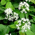 Allium ursinum - geograph.org.uk - 1301855.jpg 640 × 640; 131 KB
-
 Mully Brook - geograph.org.uk - 171323.jpg 640 × 426; 156 KB
-
 Wild garlic, near Lutton - geograph.org.uk - 1296092.jpg 640 × 480; 127 KB
-
 Broomrape, Cricketfield Road, Torquay - geograph.org.uk - 828455.jpg 480 × 640; 92 KB
-
 Coast path above Blackaller's Cove - geograph.org.uk - 1330516.jpg 480 × 640; 133 KB
-
 Hawthorn in flower on Smeardon Down.jpg 2,848 × 3,360; 5.4 MB
-
 May blossom, St Mary's Bay, Brixham - geograph.org.uk - 806700.jpg 640 × 480; 99 KB
-
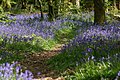
 Bluebell Carpet, Dartmoor.jpg 1,024 × 768; 284 KB
-

-
 Bluebells and bracken by the coast path - geograph.org.uk - 808229.jpg 640 × 493; 126 KB
-

-

-
 Bluebells by the Beadon Brook - geograph.org.uk - 1300076.jpg 640 × 443; 83 KB
-
 Bluebells by the Primrose Line - geograph.org.uk - 1294282.jpg 640 × 403; 132 KB
-
 Bluebells in Coleshill Copse - geograph.org.uk - 1323279.jpg 640 × 480; 160 KB
-
 Bluebells in May at Core Hill - geograph.org.uk - 797835.jpg 640 × 425; 111 KB
-
 Bluebells in Vollature Wood. - geograph.org.uk - 1302647.jpg 640 × 480; 155 KB
-
 Bluebells in Woodcock Wood (2) - geograph.org.uk - 1292367.jpg 640 × 488; 165 KB
-
 Bluebells in Woodcock Wood (3) - geograph.org.uk - 1292373.jpg 640 × 480; 141 KB
-
 Bluebells in Woodcock Wood - geograph.org.uk - 1292050.jpg 640 × 480; 154 KB
-
 Bluebells in Woodleigh Wood - geograph.org.uk - 1297187.jpg 640 × 480; 161 KB
-
 Bluebells in Woodleigh Wood - geograph.org.uk - 1297209.jpg 491 × 640; 164 KB
-
 Bluebells near Carswells Moor - geograph.org.uk - 422301.jpg 640 × 480; 128 KB
-
 Bluebells near Chillaton House - geograph.org.uk - 429339.jpg 640 × 480; 172 KB
-
 Bluebells near Great Rock - geograph.org.uk - 1299776.jpg 640 × 480; 129 KB
-
 Bluebells on banks near Hookney - geograph.org.uk - 1333750.jpg 640 × 435; 117 KB
-
 Bluebells on Cairn - geograph.org.uk - 73909.jpg 640 × 480; 82 KB
-
 Bluebells on Dyer's Hill - geograph.org.uk - 805370.jpg 480 × 640; 144 KB
-
 Bluebells on Dyer's Hill - geograph.org.uk - 805376.jpg 640 × 480; 151 KB
-
 Bluebells on Dyer's Hill - geograph.org.uk - 805384.jpg 472 × 640; 102 KB
-
 Bluebells on Easdon Down (2) - geograph.org.uk - 1333520.jpg 640 × 480; 164 KB
-
 Bluebells on Easdon Down (3) - geograph.org.uk - 1333569.jpg 640 × 480; 140 KB
-
 Bluebells on Easdon Down (4) - geograph.org.uk - 1333581.jpg 640 × 480; 158 KB
-
 Bluebells on Easdon Down (5) - geograph.org.uk - 1333593.jpg 640 × 480; 133 KB
-
 Bluebells on Easdon Down - geograph.org.uk - 1333506.jpg 640 × 480; 135 KB
-

-
 Bluebells up coach road - geograph.org.uk - 1279573.jpg 427 × 640; 106 KB
-
 Bluebells, Avon valley - geograph.org.uk - 1294245.jpg 640 × 432; 138 KB
-
 Bluebells, Foredown Plantation - geograph.org.uk - 1300289.jpg 640 × 480; 99 KB
-
 Bluebells, Foredown Plantation - geograph.org.uk - 1301971.jpg 480 × 640; 128 KB
-
 Bluebells, Foredown Plantation - geograph.org.uk - 1301987.jpg 640 × 480; 127 KB
-
 Bluebells, Greathill Copse - geograph.org.uk - 1290671.jpg 640 × 480; 136 KB
-
 Bluebells, Netton Cleave Wood - geograph.org.uk - 1299674.jpg 640 × 480; 153 KB
-
 Bluebells, Ramshorn Down - geograph.org.uk - 1302202.jpg 480 × 640; 165 KB
-
 Bluebells, Rora Down - geograph.org.uk - 1302786.jpg 640 × 480; 131 KB
-
 Bluebells, Rora Down - geograph.org.uk - 1302801.jpg 480 × 640; 157 KB
-
 Bluebells, Rora Wood - geograph.org.uk - 1302150.jpg 640 × 480; 54 KB
-
 Bluebells, Titcombe Wood - geograph.org.uk - 1297337.jpg 640 × 480; 153 KB
-
 Bluebells, Woodleigh Wood - geograph.org.uk - 1297099.jpg 640 × 480; 152 KB
-
 Chenson Woods Bluebells - geograph.org.uk - 1481879.jpg 640 × 480; 176 KB
-
 Dartmoor, Greator Rocks - geograph.org.uk - 435551.jpg 640 × 480; 142 KB
-
 Dartmoor, Holwell Lawn - geograph.org.uk - 435537.jpg 640 × 480; 103 KB
-
 In the bluebell wood at Blackbury Camp - geograph.org.uk - 1285603.jpg 640 × 480; 138 KB
-
 Kingston, in Wrinkle Wood - geograph.org.uk - 786531.jpg 640 × 427; 300 KB
-
 Kipscombe Enclosure - geograph.org.uk - 1329204.jpg 480 × 640; 140 KB
-
 Lundy bluebells - geograph.org.uk - 1322767.jpg 640 × 480; 155 KB
-
 Orley Common - bluebells - geograph.org.uk - 796794.jpg 640 × 480; 215 KB
-
 Sheltered east coast of Lundy - geograph.org.uk - 1340637.jpg 480 × 640; 190 KB
-
 Stokenham, above Great Mattiscombe Sand - geograph.org.uk - 812009.jpg 640 × 427; 129 KB
-
 View from church path, Stokeinteignhead - geograph.org.uk - 786223.jpg 640 × 480; 126 KB
-

-

-

-
 Widecombe in the Moor, Hutholes - geograph.org.uk - 1318586.jpg 640 × 427; 431 KB
-

-
 Widecombe in the Moor, towards Wind Tor - geograph.org.uk - 1318593.jpg 640 × 427; 479 KB
-
 Ragged Robin - geograph.org.uk - 441788.jpg 480 × 640; 67 KB
-

-

-
 Sorrel in a meadow - geograph.org.uk - 808373.jpg 640 × 480; 126 KB
-
 The coast path in spring - geograph.org.uk - 808215.jpg 480 × 640; 141 KB
-
 Guelder Rose, Holyford - geograph.org.uk - 441734.jpg 640 × 480; 95 KB


_-_geograph.org.uk_-_1292367.jpg)
_-_geograph.org.uk_-_1292373.jpg)


_-_geograph.org.uk_-_1333520.jpg)
_-_geograph.org.uk_-_1333569.jpg)
_-_geograph.org.uk_-_1333581.jpg)
_-_geograph.org.uk_-_1333593.jpg)


