Category:Forgan (civil parish)
civil parish in Fife, Scotland, UK | |||||
| Upload media | |||||
| Instance of | |||||
|---|---|---|---|---|---|
| Part of |
| ||||
| Location |
| ||||
| Population |
| ||||
| Area |
| ||||
 | |||||
Subcategories
This category has the following 2 subcategories, out of 2 total.
N
W
Media in category "Forgan (civil parish)"
The following 200 files are in this category, out of 402 total.
(previous page) (next page)-
 'Brig O'Tay Inn', Newport-on-Tay - geograph.org.uk - 4743940.jpg 4,313 × 3,235; 2.11 MB
-
 'The Newport' - geograph.org.uk - 4417525.jpg 4,608 × 3,456; 3.25 MB
-
 13 Whinfield Place, Newport-on-Tay - geograph.org.uk - 4349860.jpg 4,608 × 3,456; 3.24 MB
-
 A bench by Flass Lane, Wormit - geograph.org.uk - 4743932.jpg 4,608 × 2,976; 2.59 MB
-
 A garden pond - geograph.org.uk - 4349982.jpg 4,608 × 3,456; 3.11 MB
-
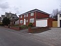
 A house at Riverview - geograph.org.uk - 4547260.jpg 4,608 × 3,456; 3.16 MB
-

-
 A pair of villas on Kilmany Road, Wormit - geograph.org.uk - 4743890.jpg 4,321 × 3,099; 1.74 MB
-
 A street junction in Newport-on-Tay - geograph.org.uk - 4349974.jpg 4,608 × 3,456; 3.26 MB
-
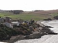
 A view over Wormit Bay - geograph.org.uk - 4611271.jpg 4,608 × 3,456; 3.14 MB
-
 A villa on Tay Street, Newport-on-Tay - geograph.org.uk - 4547005.jpg 4,608 × 3,456; 3.08 MB
-
 A workboat moored by the pier at Newport-on-Tay - geograph.org.uk - 4417816.jpg 4,608 × 3,456; 3.19 MB
-
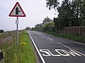
 A914 heading north - geograph.org.uk - 3713376.jpg 640 × 480; 69 KB
-
 A914 heading towards Dundee - geograph.org.uk - 3713957.jpg 640 × 480; 89 KB
-
 A914 heading towards Dundee - geograph.org.uk - 3713959.jpg 640 × 480; 63 KB
-
 A92 by the Causwayhead turning - geograph.org.uk - 2822299.jpg 640 × 531; 79 KB
-
 A92 central reservation - geograph.org.uk - 5554825.jpg 5,184 × 3,888; 5.54 MB
-
 A92 Towards Dundee - geograph.org.uk - 2679479.jpg 640 × 480; 185 KB
-
 A92, Newport bypass - geograph.org.uk - 2828871.jpg 640 × 360; 178 KB
-
 Access to B946 from Tay Road Bridge - geograph.org.uk - 4412046.jpg 3,758 × 2,421; 2.55 MB
-
 Access to Granary Lane - geograph.org.uk - 4417892.jpg 4,333 × 2,382; 1.95 MB
-
 Access track to Greenside Scalp TV relay station - geograph.org.uk - 4547295.jpg 4,608 × 3,456; 3.16 MB
-
 Across the fields to Morton - geograph.org.uk - 4643722.jpg 640 × 480; 56 KB
-
 Activity on the Newton Hill fishing lake - geograph.org.uk - 4611338.jpg 4,608 × 3,456; 3.06 MB
-
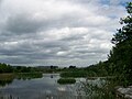
 All calm at Morton Lochs - geograph.org.uk - 4637869.jpg 640 × 480; 55 KB
-
 Another new build on a vacant lot - geograph.org.uk - 4418286.jpg 4,608 × 3,456; 3.14 MB
-
 Approach to an A92 roundabout - geograph.org.uk - 4746082.jpg 4,313 × 2,516; 3.04 MB
-
 Approach to B984 junction near Wormit - geograph.org.uk - 4743876.jpg 4,473 × 2,233; 1.99 MB
-
 Approaching SE end of Tay Road Bridge - geograph.org.uk - 4412018.jpg 4,608 × 3,456; 3.25 MB
-
 Arable land on the slopes of Tofts Law - geograph.org.uk - 2828211.jpg 640 × 360; 172 KB
-
 Arable land, Morton - geograph.org.uk - 4317254.jpg 800 × 533; 87 KB
-
 Art Work, Morton Lochs Nature Reserve - geograph.org.uk - 3422030.jpg 600 × 450; 114 KB
-
 B 946 road - geograph.org.uk - 3086743.jpg 2,816 × 2,112; 1.16 MB
-
 B946 and start of cycle path - geograph.org.uk - 4547221.jpg 3,456 × 4,608; 3.45 MB
-
 B946 beneath Tay Road Bridge - geograph.org.uk - 4412059.jpg 3,483 × 2,388; 2.98 MB
-
 B946 Boat Brae in Newport-on-Tay - geograph.org.uk - 5991315.jpg 640 × 396; 99 KB
-
 B946 junction near Wormit - geograph.org.uk - 5990908.jpg 640 × 403; 64 KB
-
 Bales and City - geograph.org.uk - 5554818.jpg 5,184 × 3,888; 6.09 MB
-
 Barley field - geograph.org.uk - 3845880.jpg 640 × 360; 190 KB
-
 Bay at Bay Road, Wormit - geograph.org.uk - 3900362.jpg 4,608 × 3,456; 3.16 MB
-
 Beautiful Railway Bridge - geograph.org.uk - 1997374.jpg 1,024 × 768; 243 KB
-
 Beneath the bridge - geograph.org.uk - 4339123.jpg 1,536 × 2,048; 771 KB
-
 Bird Hides, Morton Lochs Nature Reserve - geograph.org.uk - 3422043.jpg 600 × 450; 117 KB
-
 Birdwatchers' hide - geograph.org.uk - 3299308.jpg 2,048 × 1,536; 1.18 MB
-
 Blyth Hall on Blyth Street - geograph.org.uk - 4417901.jpg 3,058 × 3,325; 2.15 MB
-
 Blyth Hall with flagpole - geograph.org.uk - 4418217.jpg 4,608 × 3,456; 3.32 MB
-
 Blythbank pediment and escutcheon - geograph.org.uk - 4417860.jpg 4,608 × 3,456; 2.95 MB
-
 Boat Brae, Newport on Tay - geograph.org.uk - 3357144.jpg 640 × 478; 369 KB
-
 Boat Road, Newport-on-Tay - geograph.org.uk - 3713970.jpg 640 × 480; 50 KB
-
 Boats moored at Newport-on-Tay - geograph.org.uk - 5991127.jpg 640 × 499; 49 KB
-
 By the bonnie Tay in June - geograph.org.uk - 4546972.jpg 4,608 × 3,456; 3.21 MB
-
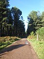
 Camp Wood - geograph.org.uk - 3845873.jpg 640 × 360; 267 KB
-
 Castle Brae in Newport-on-Tay - geograph.org.uk - 5991137.jpg 640 × 469; 67 KB
-
 Castle Brae, Newport on Tay - geograph.org.uk - 3357429.jpg 640 × 456; 305 KB
-

-
 City of Discovery - geograph.org.uk - 2676942.jpg 2,592 × 1,287; 1.37 MB
-

-
 Contorted colours - geograph.org.uk - 4339114.jpg 861 × 557; 176 KB
-
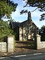 Converted church, Easter Friarton - geograph.org.uk - 3713393.jpg 480 × 640; 112 KB
-
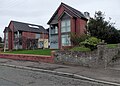
 Corner house on Linden Avenue - geograph.org.uk - 4414717.jpg 3,193 × 4,123; 3.11 MB
-
 Country road near Inverdovat - geograph.org.uk - 3971335.jpg 640 × 480; 54 KB
-
 Crop field west of the A914 - geograph.org.uk - 3713374.jpg 640 × 480; 110 KB
-
 Cupar Road (B995) - geograph.org.uk - 3713962.jpg 640 × 480; 90 KB
-
 Cupar Road - geograph.org.uk - 3553627.jpg 2,048 × 1,536; 1.57 MB
-
 Cupar Road in Newport-on-Tay - geograph.org.uk - 5991964.jpg 640 × 384; 59 KB
-
 Cupar Road, Newport-on-Tay - geograph.org.uk - 1937685.jpg 4,272 × 2,848; 3.93 MB
-
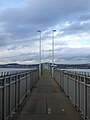
 Cycle and pedestrian walkway, Tay road bridge - geograph.org.uk - 1936942.jpg 4,272 × 2,848; 3.71 MB
-
 Cycleway one - geograph.org.uk - 1997030.jpg 1,024 × 768; 212 KB
-
 Darvel Lodge, Newport-on-Tay - geograph.org.uk - 4418226.jpg 4,608 × 3,456; 3.47 MB
-
 Dead trees by the Forgan Roundabout - geograph.org.uk - 5915114.jpg 2,730 × 2,047; 1.8 MB
-

-
 Dismantled railway line - geograph.org.uk - 3089011.jpg 2,816 × 2,112; 1.1 MB
-
 Dismantled railway line - geograph.org.uk - 3089061.jpg 2,816 × 2,112; 1.16 MB
-

-

-

-
 Doo'cot at St Fort Home Farm - geograph.org.uk - 5243740.jpg 640 × 480; 54 KB
-

-
 Drinking fountain in Newport-on-Tay - geograph.org.uk - 5991973.jpg 588 × 640; 92 KB
-
 Drinking fountain, Newport-on-Tay - geograph.org.uk - 3713973.jpg 480 × 640; 55 KB
-
 Driveway to St Fort Home Farm - geograph.org.uk - 4910308.jpg 640 × 480; 92 KB
-
 Dundee Harbour, from Fife - geograph.org.uk - 5488647.jpg 2,831 × 1,820; 3.97 MB
-
 Dundee on the other side - geograph.org.uk - 1997057.jpg 1,024 × 768; 205 KB
-
 Edge of the forest - geograph.org.uk - 4317261.jpg 800 × 533; 135 KB
-
 Edinburgh and Northern Railway - geograph.org.uk - 4317230.jpg 800 × 533; 155 KB
-
 Elaborate drinking fountain - geograph.org.uk - 3553396.jpg 2,048 × 1,536; 493 KB
-
 Entry into Newport on Tay from the east - geograph.org.uk - 4412078.jpg 3,789 × 2,465; 2.03 MB
-
 Episcopal church manse - geograph.org.uk - 4417847.jpg 4,608 × 3,456; 2.98 MB
-
 Exiting the Forgan Roundabout on to the A92 - geograph.org.uk - 2822275.jpg 1,600 × 1,150; 295 KB
-
 Farm at Easter Friarton - geograph.org.uk - 3928874.jpg 640 × 467; 77 KB
-
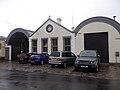
 Farm buildings at Peacehill - geograph.org.uk - 5990918.jpg 640 × 450; 67 KB
-
 Farm track - geograph.org.uk - 3089094.jpg 2,816 × 2,112; 1.31 MB
-
 Farmhouse cottages - geograph.org.uk - 4611579.jpg 4,608 × 3,456; 3.23 MB
-
 Farmland and bales near Newton Hill - geograph.org.uk - 5990900.jpg 640 × 422; 65 KB
-
 Farmland and poly tunnels - geograph.org.uk - 3713379.jpg 640 × 480; 81 KB
-
 Farmland below Knock Hill - geograph.org.uk - 4543078.jpg 640 × 480; 64 KB
-
 Farmland near Morton Lochs - geograph.org.uk - 3422075.jpg 600 × 450; 94 KB
-
 Farmland off the A914 - geograph.org.uk - 3713958.jpg 640 × 480; 91 KB
-
 Farmland on St Fort Hill - geograph.org.uk - 5243736.jpg 640 × 480; 67 KB
-

-
 Farmland, Easter Friarton - geograph.org.uk - 3713389.jpg 640 × 480; 82 KB
-
 Farmland, Newport-on-Tay - geograph.org.uk - 3713961.jpg 640 × 480; 63 KB
-
 Field and trees - geograph.org.uk - 3553299.jpg 2,048 × 1,536; 561 KB
-
 Field at Kirkton Barns - geograph.org.uk - 5197690.jpg 640 × 480; 42 KB
-
 Field at Knockhill - geograph.org.uk - 5243748.jpg 640 × 480; 53 KB
-
 Field at Shanwell Farm - geograph.org.uk - 4643715.jpg 640 × 480; 52 KB
-
 Field boundary wall - geograph.org.uk - 4338853.jpg 2,048 × 1,536; 1.55 MB
-
 Field entrance - geograph.org.uk - 4140077.jpg 2,048 × 1,536; 1.51 MB
-
 Field of barley - geograph.org.uk - 3089089.jpg 2,816 × 2,112; 1.1 MB
-
 Fields in front of Brownie Wood - geograph.org.uk - 3680809.jpg 2,048 × 1,536; 783 KB
-
 Fields of wheat - geograph.org.uk - 3553834.jpg 2,048 × 1,536; 1.57 MB
-
 Fields under Newton Hill - geograph.org.uk - 3354313.jpg 640 × 360; 204 KB
-
 Fife bound train crossing the Tay Bridge - geograph.org.uk - 5445587.jpg 800 × 683; 155 KB
-
 Fife coastal path at Wormit Bay - geograph.org.uk - 3357107.jpg 640 × 443; 216 KB
-
 Fife Coastal Path heading east - geograph.org.uk - 3713983.jpg 640 × 480; 68 KB
-
 Fife end of the Tay Road Bridge - geograph.org.uk - 2835493.jpg 640 × 360; 180 KB
-
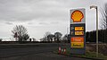
 Filling station - geograph.org.uk - 4062155.jpg 2,048 × 1,536; 655 KB
-
 Firth of Tay coast at Wormit - geograph.org.uk - 3407723.jpg 1,600 × 1,079; 193 KB
-
 Five roads roundabout - geograph.org.uk - 3553303.jpg 2,048 × 1,536; 776 KB
-
 Flooded sand and gravel pit - geograph.org.uk - 5990890.jpg 640 × 439; 81 KB
-
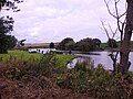
 Flooded sand and gravel pits - geograph.org.uk - 3407729.jpg 1,600 × 914; 120 KB
-
 Flowering cherry off Albert Crescent - geograph.org.uk - 4418937.jpg 4,608 × 3,456; 3.16 MB
-
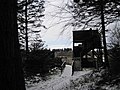
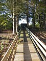 Footbridge to the Christie Hide - geograph.org.uk - 6298148.jpg 480 × 640; 393 KB
-
 Footpath along dismantled Railway Line - geograph.org.uk - 3422068.jpg 600 × 450; 102 KB
-
-
 Forest road and car park at Morton Lochs - geograph.org.uk - 6298150.jpg 640 × 480; 381 KB
-
 Forest road from Fetterdale to Morton - geograph.org.uk - 6298857.jpg 480 × 640; 327 KB
-
 Forgan Roundabout - geograph.org.uk - 5915119.jpg 3,264 × 2,448; 4.35 MB
-
 Former Ferry Terminal facade - geograph.org.uk - 4463555.jpg 4,608 × 3,456; 3.28 MB
-
 Fuel storage tank - geograph.org.uk - 3089071.jpg 2,816 × 2,112; 1.2 MB
-
 Garden pond, Newport-on-Tay - geograph.org.uk - 4445356.jpg 4,608 × 3,456; 3.19 MB
-
 Garden walls - geograph.org.uk - 4062165.jpg 2,048 × 1,536; 1.02 MB
-
 Gate on path to Balmerino - geograph.org.uk - 4245987.jpg 640 × 456; 118 KB
-
 Gated access to St Fort - geograph.org.uk - 4743873.jpg 4,441 × 2,979; 3.66 MB
-
 Gathering in the crops - geograph.org.uk - 3680797.jpg 2,048 × 1,536; 1.06 MB
-
 Gravestone, St Fillan's Church - geograph.org.uk - 3358893.jpg 640 × 887; 714 KB
-
 Groups of trees - geograph.org.uk - 4338838.jpg 2,048 × 1,536; 1.61 MB
-
 Heading back to Newport on Tay - geograph.org.uk - 1896613.jpg 640 × 480; 67 KB
-
-
 High Street, Newport-on-Tay - geograph.org.uk - 5235685.jpg 640 × 480; 67 KB
-
 Historic milepost at Newport Ferry Terminal - geograph.org.uk - 4463596.jpg 3,456 × 4,608; 3.91 MB
-
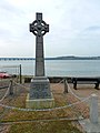
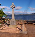 HMS Mars war memorial - geograph.org.uk - 5021329.jpg 3,456 × 3,611; 2.9 MB
-
 I was a gardener - geograph.org.uk - 3358883.jpg 640 × 797; 722 KB
-
 In Memory of - geograph.org.uk - 1997393.jpg 1,024 × 768; 283 KB
-
 Information Kiosk, Tay Road Bridge car park - geograph.org.uk - 4412133.jpg 4,608 × 3,456; 3.22 MB
-
 Information on the Nature trail - geograph.org.uk - 1997039.jpg 1,024 × 768; 228 KB
-
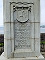 Inscribed plaque on Newport and Forgan war memorial - geograph.org.uk - 4546728.jpg 3,456 × 4,608; 4.28 MB
-
 Inscription on the Blyth-Martin drinking fountain - geograph.org.uk - 1937279.jpg 4,272 × 2,848; 3.52 MB
-
 Inverdovat Farm - geograph.org.uk - 3971333.jpg 640 × 429; 60 KB
-
 Inverdovat Farm - geograph.org.uk - 4062138.jpg 2,048 × 1,536; 1.56 MB
-
 Jetty and Tay Bridge - geograph.org.uk - 5576735.jpg 1,024 × 682; 126 KB
-
 Jetty at Newport-on-Tay - geograph.org.uk - 5991338.jpg 640 × 469; 65 KB
-
 Jetty at Newport-on-Tay - geograph.org.uk - 5991346.jpg 640 × 398; 54 KB
-
 Jetty, Newport-on-Tay - geograph.org.uk - 3713969.jpg 640 × 480; 53 KB
-
 Junction for Riverview houses - geograph.org.uk - 4547415.jpg 4,608 × 3,456; 3.1 MB
-
 Kilmany Road at Wormit - geograph.org.uk - 5990928.jpg 640 × 429; 69 KB
-
 Kilnburn, Newport on Tay - geograph.org.uk - 3357118.jpg 640 × 473; 335 KB
-
 Kiosk in the carpark - geograph.org.uk - 1997364.jpg 1,024 × 768; 122 KB
-
 Kirkton Barns Farm - geograph.org.uk - 3935068.jpg 640 × 480; 70 KB
-
 Knock Hill - geograph.org.uk - 4320251.jpg 800 × 600; 224 KB
-
 Knock Hill - geograph.org.uk - 4320267.jpg 800 × 600; 161 KB
-
 Knockhill Wood - geograph.org.uk - 4300114.jpg 1,600 × 1,091; 447 KB
-
 Lane at West Links Wood - geograph.org.uk - 5990884.jpg 640 × 459; 115 KB
-
 Lane through West Links Wood - geograph.org.uk - 5990858.jpg 640 × 447; 125 KB
-
 Large field in Fife - geograph.org.uk - 6183929.jpg 5,184 × 3,888; 5 MB
-
 Leaving the town centre - geograph.org.uk - 1896645.jpg 640 × 480; 67 KB
-
 Line of former railway near Morton Lochs - geograph.org.uk - 5162858.jpg 640 × 480; 111 KB
-
 Line of former railway near Morton Lochs - geograph.org.uk - 5162863.jpg 640 × 480; 115 KB
-
-
 Looking across the Tay - geograph.org.uk - 3713974.jpg 640 × 480; 77 KB
-

-

-
 Looking south from Norwood summit - geograph.org.uk - 4349950.jpg 4,608 × 3,456; 2.91 MB
-

-
 Masonic Lodge, Wormit, Fife - geograph.org.uk - 3006607.jpg 3,008 × 2,000; 2.49 MB
-
 Memorial by the bridge - geograph.org.uk - 1997389.jpg 600 × 800; 121 KB
-
 Memorial to the boys from Mars - geograph.org.uk - 3553821.jpg 1,536 × 2,048; 749 KB
-
 Memorials near the Bridge - geograph.org.uk - 1997381.jpg 1,024 × 768; 242 KB
-
 Minor road by Morendy Wood - geograph.org.uk - 4543071.jpg 640 × 480; 87 KB
-

-
 Minor road near Easter Friarton - geograph.org.uk - 3358854.jpg 640 × 480; 515 KB
-
 Minor road near Kirkton Barns - geograph.org.uk - 3358856.jpg 640 × 480; 260 KB
-
 Minor road towards Kirkton Barns - geograph.org.uk - 5198584.jpg 640 × 480; 58 KB
-
 Mobile bridge inspection gantry - geograph.org.uk - 4412105.jpg 4,608 × 3,456; 3.25 MB
-
 Monument, Tay Road Bridge - geograph.org.uk - 2920648.jpg 2,520 × 1,680; 263 KB
-
 Morendy Wood - geograph.org.uk - 3845883.jpg 640 × 360; 200 KB
-
 Morendy Wood in Fife - geograph.org.uk - 5990852.jpg 640 × 448; 64 KB
-
 Morton Links - geograph.org.uk - 4317389.jpg 800 × 600; 170 KB
-
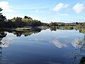
 Morton Lochs - geograph.org.uk - 4319547.jpg 800 × 533; 172 KB
-
 Morton Lochs - geograph.org.uk - 4319551.jpg 800 × 533; 196 KB
-
 Morton Lochs Nature Reserve - geograph.org.uk - 3422053.jpg 1,186 × 450; 87 KB
-
 Morton Lochs Nature Reserve - geograph.org.uk - 4602500.jpg 640 × 481; 54 KB
-
 Morton Lochs, Nature Reserve - geograph.org.uk - 3422022.jpg 600 × 450; 76 KB
-
 Morton North Loch - geograph.org.uk - 6298144.jpg 640 × 480; 211 KB
-
 Morton North Loch - geograph.org.uk - 6298145.jpg 640 × 480; 284 KB
-
 Muttonhole Wood - geograph.org.uk - 4300209.jpg 1,198 × 1,600; 831 KB
-
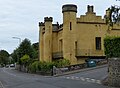
 My house is my castle - geograph.org.uk - 1896503.jpg 640 × 480; 75 KB
-
 New build on a vacant lot - geograph.org.uk - 4418275.jpg 2,839 × 3,725; 2.56 MB
-
 Newport -on -Tay - geograph.org.uk - 2626160.jpg 1,600 × 1,200; 325 KB
-
 Newport and Wormit Nature Trail - geograph.org.uk - 4412127.jpg 4,608 × 3,456; 3.3 MB


_-_geograph.org.uk_-_3713962.jpg)


&filefrom=Newport+on+Tay%2C+Fife+-+geograph.org.uk+-+1896680.jpg#mw-category-media)