Category:Former breweries in England
Subcategories
This category has the following 45 subcategories, out of 45 total.
B
- Brewers Quay, Weymouth (19 F)
C
- Cannon Brewery (20 F)
- Cannon Brewery Co. Ltd (2 F)
- Cape Hill Brewery (4 F)
- Clegg's Factory, Gateacre (3 F)
- Close Brewery, Hadlow (15 F)
D
- Derby Malt Vinegar Brewery (5 F)
F
- Fountain Head Brewery (2 F)
G
- Gale's Brewery (17 F)
- Guinness Brewery, Park Royal (4 F)
H
- Hope Brewery, Milton Malsor (2 F)
J
- J.B. Almond Brewery (2 F)
- John Hair & Son brewery (5 F)
K
- Kirkstall Brewery (37 F)
- Kresen Kernow (4 F)
L
- Langley Maltings (17 F)
M
- Mansfield Brewery (6 F)
- Modern Art Oxford (8 F)
P
- Phoenix Brewery Office, Brighton (18 F)
- Portslade Brewery (20 F)
- Prince of Wales Brewery (3 F)
R
- Rose Brewery, Wavertree (3 F)
S
- Shipstones Star Brewery (19 F)
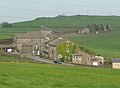
- Sileby brewery (5 F)
- Southwick Brewhouse (5 F)
- Stag Brewery, Mortlake (26 F)
T
- Taylor Walker (3 F)
W
Media in category "Former breweries in England"
The following 62 files are in this category, out of 62 total.
-
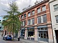 148-154 St John Street, Clerkenwell, April 2023.jpg 4,032 × 3,024; 4.93 MB
-
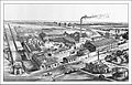
 Bass brewery square room Alfred Barnard.jpg 823 × 612; 208 KB
-
 Bentley's Eshald Well brewery Alfred Barnard.jpg 803 × 514; 86 KB
-
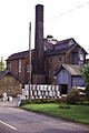
 Brewery buildings, Wiveliscombe - geograph.org.uk - 1519296.jpg 535 × 640; 57 KB
-
 Brewery gates on Ecclesall Road. - geograph.org.uk - 111476.jpg 480 × 640; 121 KB
-
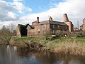
 Brewery House - geograph.org.uk - 552196.jpg 640 × 480; 64 KB
-
 Brewhouse, Christ Church, Oxford - geograph.org.uk - 187969.jpg 640 × 480; 104 KB
-
 Cannon Brewery Building, St John Street, Clerkenwell, April 2023.jpg 4,032 × 3,024; 3.96 MB
-
 Charrington brewery 2.jpg 1,200 × 1,600; 351 KB
-
 Cooks Tetbury Brewery - geograph.org.uk - 276249.jpg 640 × 480; 57 KB
-
 Ex-Wilderspool Brewery, Warrington - geograph.org.uk - 174865.jpg 640 × 419; 90 KB
-
 Explanatory plaque in Hyde Street - geograph.org.uk - 1167648.jpg 640 × 480; 64 KB
-
 Former brewery, Alston.jpg 640 × 480; 112 KB
-
 Former brewery, Wyke Road B3081, Wyke, Gillingham, Dorset.jpg 5,152 × 3,864; 4.18 MB
-
 Former hop and kiln, 7 Springfield Road, Chelmsford, July 2023.jpg 4,032 × 3,024; 4.21 MB
-
 Former Lynn's Brewery, Battle Road, Hailsham.JPG 2,500 × 1,600; 857 KB
-
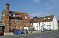
 Former Reeves & Co. Brewery, Hawley Street, Margate, November 2021.jpg 4,032 × 3,024; 3.72 MB
-
-

-
 GreatHaseley Plough IndCoope&Allsopp.JPG 1,900 × 2,850; 2.07 MB
-
 GreatHaseley Plough Halls.JPG 2,400 × 1,920; 1.49 MB
-
 Kidlington KingsArms Halls.jpg 671 × 839; 437 KB
-
 LowerHeyford BellInn Halls.jpg 1,026 × 1,280; 1.07 MB
-
 Hartford End Brewery - geograph.org.uk - 720409.jpg 428 × 640; 65 KB
-
 The Old Brewery in Harwell - geograph.org.uk - 1315547.jpg 640 × 333; 41 KB
-
 Hoist Loft - Southwold - geograph.org.uk - 371644.jpg 640 × 480; 105 KB
-
 Home Brewery buildings, Daybrook - geograph.org.uk - 18594.jpg 633 × 480; 284 KB
-

-
 Lloyd Roberts Buildings on Penn Common - geograph.org.uk - 287868.jpg 600 × 450; 220 KB
-
 Lockwood brewery Alfred Barnard.jpg 1,024 × 598; 187 KB
-
 Maidstone0035.JPG 2,048 × 1,536; 768 KB
-

-
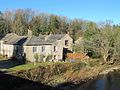
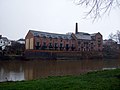 Old brewery beside the Severn - geograph.org.uk - 1726820.jpg 800 × 600; 132 KB
-
 Old brewery, Hailsham - geograph.org.uk - 393515.jpg 640 × 410; 278 KB
-
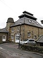 Old Brewery, Pateley Bridge - geograph.org.uk - 678191.jpg 480 × 640; 70 KB
-
 Old brewery, Wootton Bassett - geograph.org.uk - 303468.jpg 640 × 464; 72 KB
-
 Old Lupat Factory.jpg 390 × 343; 110 KB
-
 Old Ware Maltings - geograph.org.uk - 112072.jpg 640 × 480; 106 KB
-
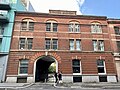
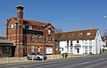
 Former Malthouse and Brewery, Drove Road, Portslade (NHLE Code 1280748).JPG 1,600 × 2,200; 1.05 MB
-
 Requiem for Ridleys (Hartford End) - geograph.org.uk - 48467.jpg 640 × 422; 63 KB
-
 Royal Oak Brewery, Stockport - geograph.org.uk - 558276.jpg 416 × 640; 87 KB
-
 Shrivenham TheCrown WestCountryAles CeramicSign.JPG 1,920 × 2,400; 1.92 MB
-
 Silvester Street, Hull - geograph.org.uk - 626502.jpg 640 × 426; 80 KB
-
 Slippery Lane, Hanley - geograph.org.uk - 343421.jpg 640 × 480; 58 KB
-
 Former brewery, Water Street, St. Martins, Stamford (geograph 2136995).jpg 1,600 × 1,200; 392 KB
-
 Tetbury Brewery Hampton Street - geograph.org.uk - 275023.jpg 639 × 445; 55 KB
-

-
 The former Kingsland Brewery - geograph.org.uk - 1708928.jpg 1,024 × 768; 185 KB
-
 The King William IV brewery - geograph.org.uk - 386493.jpg 640 × 479; 107 KB
-
 The Maltings, Silvester Street, Hull - geograph.org.uk - 626502.jpg 640 × 426; 194 KB
-
 The Mews, Mitcheldean - geograph.org.uk - 535569.jpg 640 × 480; 79 KB
-
 The old brewery at Langthorpe.jpg 640 × 480; 95 KB
-
 The Old Brewery, Appleby-in-Westmorland.jpg 4,000 × 3,000; 1.43 MB
-

-
 Thorne Brewery gates - geograph.org.uk - 954324.jpg 412 × 640; 102 KB
-
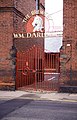
 Thorne, The Old Darley Brewery. - geograph.org.uk - 89350.jpg 640 × 427; 131 KB
-
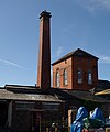
 Trent Brewery - geograph.org.uk - 702112.jpg 413 × 640; 90 KB
-
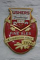 Ushers Fine Ales - geograph.org.uk - 608499.jpg 428 × 640; 71 KB
-
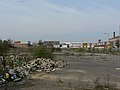 Waste ground by Armley Road - geograph.org.uk - 390197.jpg 640 × 480; 67 KB
-
-
 Converted Brewery, Oulton Broad - geograph.org.uk - 115620.jpg 640 × 480; 83 KB
-
 Curry Rivel, Hambridge Brewery - geograph.org.uk - 107171.jpg 428 × 640; 113 KB


.JPG)
_-_geograph.org.uk_-_48467.jpg)


.jpg)


