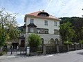
Category:Former widum, Landeck
| Object location | | View all coordinates using: OpenStreetMap |
|---|
| This category shows the protected monument with the number 64442 in Austria. (Commons, de, Wikidata) |
 | |||||
| Upload media | |||||
| Instance of | |||||
|---|---|---|---|---|---|
| Location | Landeck, Landeck District, Tyrol, Austria | ||||
| Street address |
| ||||
| Heritage designation | |||||
 | |||||
Media in category "Former widum, Landeck"
The following 3 files are in this category, out of 3 total.
-
 Ehem. Widum 1.JPG 3,088 × 2,056; 3.54 MB
-
 Ehem. Widum 2.JPG 3,088 × 2,056; 3.72 MB
-
 Landeck-EhemWidum.JPG 4,320 × 3,240; 5.74 MB

