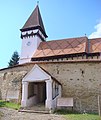
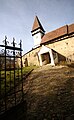
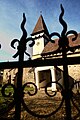
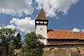
Category:Fortified church in Meșendorf, Brașov
| Object location | | View all coordinates using: OpenStreetMap |
|---|
heritage site in Braşov County, Romania  | |||||
| Upload media | |||||
| Instance of |
| ||||
|---|---|---|---|---|---|
| Location | Meșendorf, Bunești, Brașov County, Romania | ||||
| Heritage designation | |||||
 | |||||
| This is a category about a historic monument in județul Brașov, classified with number BV-II-a-A-11734. |
Subcategories
This category has only the following subcategory.
Media in category "Fortified church in Meșendorf, Brașov"
The following 102 files are in this category, out of 102 total.
-
 Ansamblul bisericii fortificate din Mesendorf.jpg 2,444 × 2,896; 1.56 MB
-
 Biserica din Mesendorf 1.jpg 1,455 × 2,362; 2.57 MB
-
 Biserica din Mesendorf 2.jpg 2,496 × 1,664; 2.63 MB
-
 Biserica din Mesendorf 3.jpg 2,912 × 4,368; 10.28 MB
-
 Biserica Fortificata Mesendorf - interior 1.jpg 3,168 × 4,752; 5.45 MB
-
 Biserica Fortificata Mesendorf - interior 2.jpg 4,752 × 3,168; 4.94 MB
-
 Biserica Fortificata Mesendorf - interior.jpg 3,168 × 4,752; 4.4 MB
-
 Biserica Fortificata Mesendorf.jpg 4,752 × 3,168; 6.46 MB
-
 Chiesa fortificata di Mesendorf.JPG 1,704 × 2,272; 1.09 MB
-
 Mesendorf - Ansamblul bisericii evanghelice fortificate 1.jpg 4,030 × 2,687; 4.97 MB
-
 Mesendorf - Ansamblul bisericii evanghelice fortificate 2.jpg 3,804 × 2,536; 6.3 MB
-
 Mesendorf - Biserica evanghelică - exterior.jpg 3,543 × 2,362; 4.28 MB
-
 Mesendorf - Biserica evanghelică - poarta intrare.jpg 4,046 × 2,697; 6.86 MB
-
 Mesendorf - Biserica evanghelică - vedere curte.jpg 4,256 × 2,832; 5.9 MB
-
 Mesendorf - fortificatia.jpg 3,264 × 2,301; 2.03 MB
-
 Mesendorf - Incintă fortificată - vedere din turnul bisericii evanghelice.jpg 3,716 × 2,477; 7.51 MB
-
 Mesendorf - turnul cu ceas.jpg 2,448 × 3,264; 1.68 MB
-
 RO BV Biserica fortificata din Mesendorf (100).jpg 2,448 × 3,264; 2.05 MB
-
 RO BV Biserica fortificata din Mesendorf (139).jpg 3,264 × 2,448; 2.49 MB
-
 Meșendorf - ansamblul bisericii evanghelice fortificate.jpg 3,376 × 4,432; 7.49 MB
-
 Meșendorf. Ansamblul bisericii evanghelice fortificate.jpg 4,958 × 3,069; 15.05 MB
-
 Meșendorf. Biserica evanghelică fortificată..JPG 5,760 × 3,840; 8.41 MB
-
 RO BV Biserica fortificata din Mesendorf (1).jpg 3,264 × 2,448; 2.14 MB
-
 RO BV Biserica fortificata din Mesendorf (101).jpg 2,448 × 3,264; 2.27 MB
-
 RO BV Biserica fortificata din Mesendorf (102).jpg 3,264 × 2,448; 2.09 MB
-
 RO BV Biserica fortificata din Mesendorf (103).jpg 2,448 × 3,264; 2.19 MB
-
 RO BV Biserica fortificata din Mesendorf (104).jpg 3,264 × 2,448; 2.02 MB
-
 RO BV Biserica fortificata din Mesendorf (105).jpg 2,448 × 3,264; 2.06 MB
-
 RO BV Biserica fortificata din Mesendorf (106).jpg 3,264 × 2,448; 2.21 MB
-
 RO BV Biserica fortificata din Mesendorf (107).jpg 2,448 × 3,264; 1.85 MB
-
 RO BV Biserica fortificata din Mesendorf (108).jpg 3,264 × 2,448; 2.35 MB
-
 RO BV Biserica fortificata din Mesendorf (109).jpg 3,264 × 2,448; 2.24 MB
-
 RO BV Biserica fortificata din Mesendorf (110).jpg 3,264 × 2,448; 2.06 MB
-
 RO BV Biserica fortificata din Mesendorf (111).jpg 3,264 × 2,448; 2.36 MB
-
 RO BV Biserica fortificata din Mesendorf (112).jpg 3,264 × 2,448; 2.47 MB
-
 RO BV Biserica fortificata din Mesendorf (113).jpg 3,264 × 2,448; 2.34 MB
-
 RO BV Biserica fortificata din Mesendorf (114).jpg 3,264 × 2,448; 2.25 MB
-
 RO BV Biserica fortificata din Mesendorf (115).jpg 2,448 × 3,264; 1.59 MB
-
 RO BV Biserica fortificata din Mesendorf (116).jpg 3,264 × 2,448; 2.33 MB
-
 RO BV Biserica fortificata din Mesendorf (117).jpg 3,264 × 2,448; 2.3 MB
-
 RO BV Biserica fortificata din Mesendorf (118).jpg 3,251 × 2,200; 2.28 MB
-
 RO BV Biserica fortificata din Mesendorf (119).jpg 2,448 × 3,264; 1.95 MB
-
 RO BV Biserica fortificata din Mesendorf (120).jpg 3,264 × 2,448; 1.98 MB
-
 RO BV Biserica fortificata din Mesendorf (121).jpg 3,264 × 2,448; 2.16 MB
-
 RO BV Biserica fortificata din Mesendorf (122).jpg 3,264 × 2,448; 1.94 MB
-
 RO BV Biserica fortificata din Mesendorf (123).jpg 2,448 × 3,264; 2.46 MB
-
 RO BV Biserica fortificata din Mesendorf (124).jpg 3,264 × 2,448; 2.44 MB
-
 RO BV Biserica fortificata din Mesendorf (125).jpg 3,264 × 2,448; 2.43 MB
-
 RO BV Biserica fortificata din Mesendorf (126).jpg 3,264 × 2,448; 2.02 MB
-
 RO BV Biserica fortificata din Mesendorf (127).jpg 3,264 × 2,448; 2.4 MB
-
 RO BV Biserica fortificata din Mesendorf (128).jpg 2,448 × 3,264; 1.99 MB
-
 RO BV Biserica fortificata din Mesendorf (129).jpg 3,264 × 2,448; 2.38 MB
-
 RO BV Biserica fortificata din Mesendorf (130).jpg 2,448 × 3,264; 2.02 MB
-
 RO BV Biserica fortificata din Mesendorf (131).jpg 3,264 × 2,448; 1.96 MB
-
 RO BV Biserica fortificata din Mesendorf (132).jpg 3,264 × 2,448; 2.08 MB
-
 RO BV Biserica fortificata din Mesendorf (133).jpg 3,264 × 2,448; 2.35 MB
-
 RO BV Biserica fortificata din Mesendorf (134).jpg 2,448 × 3,264; 1.87 MB
-
 RO BV Biserica fortificata din Mesendorf (135).jpg 2,448 × 3,264; 1.49 MB
-
 RO BV Biserica fortificata din Mesendorf (136).jpg 2,041 × 1,710; 835 KB
-
 RO BV Biserica fortificata din Mesendorf (137).jpg 3,264 × 2,448; 1.81 MB
-
 RO BV Biserica fortificata din Mesendorf (138).jpg 3,264 × 2,448; 2.52 MB
-
 RO BV Biserica fortificata din Mesendorf (140).jpg 3,264 × 2,448; 2.17 MB
-
 RO BV Biserica fortificata din Mesendorf (141).jpg 2,448 × 3,264; 1.94 MB
-
 RO BV Biserica fortificata din Mesendorf (142).jpg 2,448 × 3,264; 2.38 MB
-
 RO BV Biserica fortificata din Mesendorf (143).jpg 3,264 × 2,448; 2.44 MB
-
 RO BV Biserica fortificata din Mesendorf (144).jpg 3,264 × 2,448; 2.39 MB
-
 RO BV Biserica fortificata din Mesendorf (145).jpg 3,264 × 2,448; 2.48 MB
-
 RO BV Biserica fortificata din Mesendorf (146).jpg 3,264 × 2,448; 2.56 MB
-
 RO BV Biserica fortificata din Mesendorf (147).jpg 3,264 × 2,448; 2.02 MB
-
 RO BV Biserica fortificata din Mesendorf (148).jpg 3,264 × 2,448; 2.1 MB
-
 RO BV Biserica fortificata din Mesendorf (149).jpg 3,264 × 2,448; 2.1 MB
-
 RO BV Biserica fortificata din Mesendorf (2).jpg 3,264 × 2,448; 2.06 MB
-
 RO BV Biserica fortificata din Mesendorf (20).jpg 3,264 × 2,448; 2.46 MB
-
 RO BV Biserica fortificata din Mesendorf (3).jpg 2,448 × 3,264; 2.18 MB
-
 RO BV Biserica fortificata din Mesendorf (4).jpg 3,264 × 2,448; 2.04 MB
-
 RO BV Biserica fortificata din Mesendorf (71).jpg 3,264 × 2,448; 1.96 MB
-
 RO BV Biserica fortificata din Mesendorf (72).jpg 1,973 × 2,372; 1.33 MB
-
 RO BV Biserica fortificata din Mesendorf (73).jpg 2,448 × 3,264; 1.95 MB
-
 RO BV Biserica fortificata din Mesendorf (77).jpg 3,264 × 2,448; 2.34 MB
-
 RO BV Biserica fortificata din Mesendorf (78).jpg 3,264 × 2,448; 2.33 MB
-
 RO BV Biserica fortificata din Mesendorf (79).jpg 3,264 × 2,448; 2.34 MB
-
 RO BV Biserica fortificata din Mesendorf (80).jpg 2,448 × 3,264; 2.01 MB
-
 RO BV Biserica fortificata din Mesendorf (81).jpg 3,264 × 2,448; 2.23 MB
-
 RO BV Biserica fortificata din Mesendorf (82).jpg 2,448 × 3,264; 1.95 MB
-
 RO BV Biserica fortificata din Mesendorf (83).jpg 3,264 × 2,448; 2.64 MB
-
 RO BV Biserica fortificata din Mesendorf (84).jpg 3,264 × 2,448; 2.42 MB
-
 RO BV Biserica fortificata din Mesendorf (85).jpg 2,448 × 2,666; 1.94 MB
-
 RO BV Biserica fortificata din Mesendorf (86).jpg 3,264 × 2,448; 2.05 MB
-
 RO BV Biserica fortificata din Mesendorf (87).jpg 2,448 × 3,264; 1.75 MB
-
 RO BV Biserica fortificata din Mesendorf (88).jpg 3,264 × 2,448; 2.08 MB
-
 RO BV Biserica fortificata din Mesendorf (89).jpg 3,264 × 2,448; 1.67 MB
-
 RO BV Biserica fortificata din Mesendorf (9).jpg 2,448 × 3,264; 2.5 MB
-
 RO BV Biserica fortificata din Mesendorf (90).jpg 2,448 × 3,264; 2.14 MB
-
 RO BV Biserica fortificata din Mesendorf (91).jpg 3,264 × 2,448; 2.3 MB
-
 RO BV Biserica fortificata din Mesendorf (92).jpg 3,264 × 2,448; 2.62 MB
-
 RO BV Biserica fortificata din Mesendorf (93).jpg 3,264 × 2,448; 2.6 MB
-
 RO BV Biserica fortificata din Mesendorf (94).jpg 3,264 × 2,448; 2.31 MB
-
 RO BV Biserica fortificata din Mesendorf (95).jpg 2,448 × 3,264; 2 MB
-
 RO BV Biserica fortificata din Mesendorf (96).jpg 2,448 × 3,264; 2.26 MB
-
 RO BV Biserica fortificata din Mesendorf (97).jpg 2,448 × 3,264; 2.27 MB
-
 RO BV Biserica fortificata din Mesendorf (98).jpg 2,448 × 3,264; 1.79 MB
-
 RO BV Biserica fortificata din Mesendorf (99).jpg 3,264 × 2,448; 2.46 MB


.jpg)
.jpg)


.jpg)
.jpg)
.jpg)
.jpg)
.jpg)
.jpg)
.jpg)
.jpg)
.jpg)
.jpg)
.jpg)
.jpg)
.jpg)
.jpg)
.jpg)
.jpg)
.jpg)
.jpg)
.jpg)
.jpg)
.jpg)
.jpg)
.jpg)
.jpg)
.jpg)
.jpg)
.jpg)
.jpg)
.jpg)
.jpg)
.jpg)
.jpg)
.jpg)
.jpg)
.jpg)
.jpg)
.jpg)
.jpg)
.jpg)
.jpg)
.jpg)
.jpg)
.jpg)
.jpg)
.jpg)
.jpg)
.jpg)
.jpg)
.jpg)
.jpg)
.jpg)
.jpg)
.jpg)
.jpg)
.jpg)
.jpg)
.jpg)
.jpg)
.jpg)
.jpg)
.jpg)
.jpg)
.jpg)
.jpg)
.jpg)
.jpg)
.jpg)
.jpg)
.jpg)
.jpg)
.jpg)
.jpg)
.jpg)
.jpg)
.jpg)
.jpg)
.jpg)
.jpg)
.jpg)
.jpg)