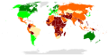
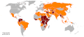
Category:Fragile state index maps of the world
Media in category "Fragile state index maps of the world"
The following 25 files are in this category, out of 25 total.
-
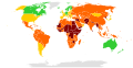
 Countries according to the Fragile States Index (2019).png 6,025 × 2,730; 1.85 MB
-
 Countries according to the Fragile States Index.svg 2,754 × 1,398; 1.19 MB
-
 Failed State Index 2.png 1,425 × 625; 47 KB
-
 Failed state index 2013.svg 863 × 443; 1.55 MB
-
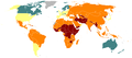
 Failed State Index.png 1,425 × 625; 52 KB
-
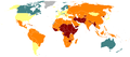
 Failed States 2014.png 1,600 × 750; 511 KB
-
 Failed States Index Map 2007.png 1,350 × 625; 93 KB
-
 Failed States.PNG 1,427 × 628; 71 KB
-
 Failed-states-index-2005.png 1,425 × 625; 20 KB
-
 Failed-states-index-2006.png 1,425 × 625; 20 KB
-
 Failed-states-index-2007.png 1,425 × 625; 20 KB
-
 Failed-states-index-2008.png 1,425 × 625; 25 KB
-
 Failed-states-index-2009w.png 1,425 × 625; 25 KB
-
 Failed-states-index-2010.png 1,425 × 625; 51 KB
-
 Failed-states-index-2011.png 1,425 × 625; 51 KB
-
 Failed-states-index-2012.png 1,425 × 625; 33 KB
-
 Failed-states-index-2012.svg 863 × 443; 1.63 MB
-
 Failed-states-index-loop-2009.gif 1,425 × 625; 134 KB
-
 Failed-states-index-loop-2013b.gif 1,425 × 625; 202 KB
-
 Failed-states-index-loop.gif 1,425 × 625; 88 KB
-
 Fragile State Index 2015.svg 863 × 443; 2.41 MB
-
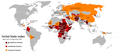
 Fragile State Index 2018.png 2,000 × 1,027; 334 KB
-
 Fragile States Index 2023.svg 2,754 × 1,398; 1.19 MB
-
 Fragilestates.tif 5,760 × 2,880; 5.49 MB
-

.png)


