Category:Framfield
village in East Sussex, United Kingdom  | |||||
| Upload media | |||||
| Instance of | |||||
|---|---|---|---|---|---|
| Location | Framfield, Wealden, East Sussex, South East England, England | ||||
| Area |
| ||||
 | |||||
English: Framfield is a village and civil parish in the Wealden District of East Sussex, England. The village is located two miles (3 km) east of Uckfield; the settlements of Blackboys, Palehouse and Halland form part of the parish area of 6,700 acres (2,706 ha).
Română: Blackboys este un sat în comitatul East Sussex, regiunea South East, Anglia. Satul se află în districtul Wealden.
Subcategories
This category has the following 7 subcategories, out of 7 total.
B
- Beckets, East Sussex (2 F)
F
H
- Hamilton Palace, Sussex (4 F)
- Hare and Hounds, Framfield (4 F)
O
- Oasts in Framfield (16 F)
Media in category "Framfield"
The following 200 files are in this category, out of 396 total.
(previous page) (next page)-
 A22 near Uckfield - geograph.org.uk - 2830128.jpg 4,320 × 3,240; 3.89 MB
-
 Abandoned farm machinery at Greatfields - geograph.org.uk - 1975069.jpg 1,600 × 1,200; 716 KB
-
 Across the field to Eason's Farm - geograph.org.uk - 2902946.jpg 640 × 480; 91 KB
-
 Acute bend on Hollow Lane - geograph.org.uk - 1843584.jpg 1,600 × 1,200; 648 KB
-
 Agricultural dealers off Pump Lane in Pump Wood - geograph.org.uk - 1976719.jpg 1,600 × 1,200; 584 KB
-
 Approaching Blackboys from the NE on the B2192 - geograph.org.uk - 1842652.jpg 1,600 × 1,200; 611 KB
-
 Approaching Hollow Lane - geograph.org.uk - 5789371.jpg 1,024 × 659; 275 KB
-
 Approaching Palehouse Common - geograph.org.uk - 5723148.jpg 1,024 × 640; 141 KB
-
 Arches Farm by Pump Lane - geograph.org.uk - 1976723.jpg 1,600 × 1,200; 528 KB
-
 Aunt Sally, Hundred House near Framfield - geograph.org.uk - 3603742.jpg 1,600 × 1,067; 667 KB
-
 B2102 approaching Framfield from Uckfield - geograph.org.uk - 1973221.jpg 1,600 × 1,200; 506 KB
-
 B2102 at Framfield, East Sussex - geograph.org.uk - 2748971.jpg 1,600 × 1,200; 658 KB
-
 B2102 crossroads in Blackboys - geograph.org.uk - 3491309.jpg 3,571 × 2,656; 1.41 MB
-
 B2102 enters Blackboys - geograph.org.uk - 3491296.jpg 3,188 × 2,431; 2.01 MB
-
 B2102 junction with Brookhouse Lane - geograph.org.uk - 3491432.jpg 3,440 × 2,549; 1.59 MB
-
 B2102 northeast of Bird in Eye Farm - geograph.org.uk - 3491438.jpg 3,147 × 2,388; 1.05 MB
-
 B2102 passing Bird in Eye Farm - geograph.org.uk - 2951465.jpg 3,264 × 2,448; 4.31 MB
-
 B2102 south of Tickerage Wood - geograph.org.uk - 3491317.jpg 3,397 × 2,556; 1.69 MB
-
 B2102 south of Upper Greatfield Farm - geograph.org.uk - 3491424.jpg 3,458 × 2,520; 1.43 MB
-
 B2192 and fields - geograph.org.uk - 2418278.jpg 640 × 480; 74 KB
-
 B2192 at Diamond Farmhouse - geograph.org.uk - 2363709.jpg 640 × 430; 56 KB
-
 B2192 at Hope Strict Baptist Church - geograph.org.uk - 2363698.jpg 640 × 411; 47 KB
-
 B2192 entering Easons Green - geograph.org.uk - 2363702.jpg 640 × 371; 53 KB
-
 B2192 north of Halland - geograph.org.uk - 2363734.jpg 640 × 320; 36 KB
-

-
 B2192 passes Blackboys Inn - geograph.org.uk - 2363582.jpg 640 × 377; 61 KB
-
 B2192 south of Pembroke Manor - geograph.org.uk - 2363678.jpg 640 × 382; 60 KB
-
 B2192 south west of Blackboys - geograph.org.uk - 2363663.jpg 640 × 476; 54 KB
-
 B2192 SW to Halland - geograph.org.uk - 1976772.jpg 1,600 × 1,200; 501 KB
-
 B2192, Blackboys - geograph.org.uk - 2363571.jpg 640 × 430; 67 KB
-
 B2192, Honey's green - geograph.org.uk - 4045596.jpg 640 × 622; 114 KB
-
 Bank erosion on Tickerage Stream - geograph.org.uk - 2112816.jpg 2,592 × 1,944; 2.84 MB
-
 Barn conversion at Palehouse Farm - geograph.org.uk - 3875347.jpg 640 × 427; 80 KB
-
 Barn in mist - geograph.org.uk - 1124816.jpg 600 × 400; 104 KB
-
 Barn off Sandy Lane - geograph.org.uk - 1981732.jpg 1,024 × 683; 158 KB
-
 Barns at Meadhurst Farm on Hollow Lane - geograph.org.uk - 1843579.jpg 1,600 × 1,200; 614 KB
-
 Beechy Road - geograph.org.uk - 2887772.jpg 480 × 640; 119 KB
-
 Beechy Road - geograph.org.uk - 5789019.jpg 1,024 × 647; 190 KB
-
 Beechy Road east to Hawkhurst Common - geograph.org.uk - 1976810.jpg 1,600 × 1,200; 493 KB
-
 Beechy Road leading off Hollow Lane to Eason's Green - geograph.org.uk - 1843620.jpg 1,600 × 1,200; 592 KB
-
 Beechy Road, east end - geograph.org.uk - 2903026.jpg 640 × 428; 127 KB
-
 Beechy Road, East Hoathly - geograph.org.uk - 1161279.jpg 480 × 640; 136 KB
-
 Bird in Eye farm - geograph.org.uk - 5363348.jpg 5,202 × 3,465; 4.14 MB
-
 Bird in Eye farm signs - geograph.org.uk - 5363346.jpg 5,202 × 3,465; 3.91 MB
-

-
 Bird-in-Eye Hill (B2102) on Framfield Road, Uckfield - geograph.org.uk - 5618418.jpg 2,697 × 1,963; 1.88 MB
-
 Blocked footpath off of Sand Hill Lane - geograph.org.uk - 1971617.jpg 1,600 × 1,200; 763 KB
-
 Bluebells in the wood off the B2109 - geograph.org.uk - 5363330.jpg 5,202 × 3,465; 4.15 MB
-

-
 Bridge carrying Pump Lane over Framfield Stream - geograph.org.uk - 1976742.jpg 1,600 × 1,200; 550 KB
-
 Bridge over the stream at Upton Mill - geograph.org.uk - 5362924.jpg 5,202 × 3,465; 4.36 MB
-
 Broken Sign - geograph.org.uk - 1740977.jpg 640 × 480; 139 KB
-
 Brook House Farm - geograph.org.uk - 2113610.jpg 2,592 × 1,944; 1.28 MB
-
 Brookhouse Lane entering Framfield from the south - geograph.org.uk - 1973139.jpg 1,600 × 1,200; 432 KB
-
 Brookhouse Lane, Framfield - geograph.org.uk - 5363316.jpg 4,485 × 2,660; 2.92 MB
-
 Browning's Farm Workshop display board - geograph.org.uk - 1842665.jpg 1,600 × 1,200; 538 KB
-
 Browning's Farm Workshops - geograph.org.uk - 1842672.jpg 1,600 × 1,200; 452 KB
-
 Bungalow on Bushbury Lane - geograph.org.uk - 5789350.jpg 1,024 × 688; 214 KB
-
 Bushberry Lane - geograph.org.uk - 2418304.jpg 640 × 480; 90 KB
-
 Bushbury Lane - geograph.org.uk - 2887778.jpg 640 × 480; 107 KB
-
 Bushbury Lane - geograph.org.uk - 5789039.jpg 1,024 × 667; 202 KB
-
 Bushbury Lane junction with the B2192 - geograph.org.uk - 1976778.jpg 1,600 × 1,200; 446 KB
-
 Buxted sign on bridge - geograph.org.uk - 5362906.jpg 5,202 × 3,465; 4.37 MB
-
 Caravan beside footpath to Beechy Lane - geograph.org.uk - 1976794.jpg 1,600 × 1,200; 415 KB
-
 Chapel Lane - geograph.org.uk - 1554355.jpg 640 × 427; 94 KB
-

-
 Clearcut path to Mill Farm - geograph.org.uk - 2113090.jpg 2,592 × 1,944; 2.39 MB
-
 Clover field near the Tickerage stream - geograph.org.uk - 35022.jpg 640 × 512; 260 KB
-
 Collection of signs, Eason's Green - geograph.org.uk - 3303805.jpg 1,600 × 1,259; 410 KB
-
 Communications Mast on the edge of The Bungers - geograph.org.uk - 1971585.jpg 1,600 × 1,200; 500 KB
-
 Construction work near Primrose Ghyll farm - geograph.org.uk - 5362892.jpg 5,202 × 3,465; 3.62 MB
-
 Converted farm building, Eason's Green - geograph.org.uk - 3303789.jpg 640 × 478; 222 KB
-
 Corner on Hollow Lane - geograph.org.uk - 5787746.jpg 1,600 × 1,047; 602 KB
-
 Cows on footpath near Pounsley Manor - geograph.org.uk - 1878160.jpg 1,600 × 1,200; 543 KB
-
 Crooked house next to St Thomas a Becket church - geograph.org.uk - 5363300.jpg 4,436 × 3,394; 2.31 MB
-
 Crossroads near Palehouse Common - geograph.org.uk - 2113611.jpg 2,592 × 1,944; 1.87 MB
-
 Crossroads of Etchingwood Lane and Sandy Lane - geograph.org.uk - 1974933.jpg 1,600 × 1,200; 544 KB
-
 Crossroads on the outskirts of Palehouse Common - geograph.org.uk - 2951454.jpg 3,264 × 2,448; 3.45 MB
-
 Definitely a horse trough - geograph.org.uk - 2112577.jpg 2,592 × 1,944; 2.01 MB
-
 Denche Wood - geograph.org.uk - 4045613.jpg 640 × 373; 31 KB
-
 Disused farm buildings near Gatehouse Lane - geograph.org.uk - 1975008.jpg 1,600 × 1,200; 516 KB
-
 Driveway to Little Goldsmith’s Farm - geograph.org.uk - 5789061.jpg 1,024 × 682; 239 KB
-
 Driveway to new house at Blackwell Farm - geograph.org.uk - 1843574.jpg 1,600 × 1,200; 545 KB
-
 Eastbourne Road - geograph.org.uk - 2541071.jpg 640 × 480; 132 KB
-

-
 Eastbourne Road, Mount Ephraim - geograph.org.uk - 4427328.jpg 640 × 480; 190 KB
-
-
 Entering Blackboys, B2102 - geograph.org.uk - 2363560.jpg 640 × 430; 65 KB
-
 Entering Kiln Wood - geograph.org.uk - 5789393.jpg 1,600 × 1,026; 590 KB
-
 Entering Palehouse Common - geograph.org.uk - 1741003.jpg 640 × 480; 102 KB
-
 Entrance drive to Dower House Farm - geograph.org.uk - 3293877.jpg 2,464 × 1,632; 1.06 MB
-
 Entrance to Blackboys youth hostel - geograph.org.uk - 1878207.jpg 1,600 × 1,200; 707 KB
-
 Entrance to Blackwell Farm - geograph.org.uk - 3293844.jpg 2,464 × 1,632; 1.02 MB
-
 Entrance to Browning's Farm - geograph.org.uk - 1842638.jpg 1,600 × 1,200; 638 KB
-

-
 Entrance to Possingworth Manor - geograph.org.uk - 1842507.jpg 1,600 × 1,200; 757 KB
-
 Etchingwood Lane at Hammonds Green - geograph.org.uk - 5363320.jpg 5,202 × 3,465; 4.5 MB
-

-
 Farm at Fair View - geograph.org.uk - 1887824.jpg 1,600 × 1,200; 325 KB
-
 Farmland by Heathfield Rd - geograph.org.uk - 4045611.jpg 640 × 430; 37 KB
-
 Farmland near Uckfield - geograph.org.uk - 4579057.jpg 640 × 382; 94 KB
-
 Farmland near Uckfield - geograph.org.uk - 5560811.jpg 4,896 × 3,672; 6.66 MB
-
 Field beside Bushbury Lane - geograph.org.uk - 5789362.jpg 1,024 × 656; 152 KB
-
 Field corner trees - geograph.org.uk - 2885483.jpg 640 × 480; 112 KB
-
 Field near to Oak Tree Farm - geograph.org.uk - 5787737.jpg 1,024 × 711; 217 KB
-
 Field off Beechy Road - geograph.org.uk - 2419661.jpg 640 × 480; 93 KB
-
 Field off Bushberry Lane - geograph.org.uk - 2418308.jpg 640 × 480; 92 KB
-
 Finger post at Pounsley - geograph.org.uk - 1878050.jpg 1,600 × 1,200; 581 KB
-
 Flower on Bushberry Lane - geograph.org.uk - 2418298.jpg 640 × 480; 68 KB
-
 Flower on Bushberry Lane - geograph.org.uk - 2418299.jpg 640 × 480; 83 KB
-
 Football pitch, Pavilion Recreation Ground, Framfield - geograph.org.uk - 3303810.jpg 1,600 × 1,083; 311 KB
-
 Footpath approach to Lower Honeys Green Farm - geograph.org.uk - 1971575.jpg 1,600 × 1,200; 625 KB
-
 Footpath linking Shepherds Hill with Pound Lane - geograph.org.uk - 1879608.jpg 1,600 × 1,200; 572 KB
-
 Footpath off Brookhouse Lane - geograph.org.uk - 1973126.jpg 1,600 × 1,200; 731 KB
-
 Footpath to Lidds Shaw - geograph.org.uk - 1973084.jpg 1,600 × 1,200; 614 KB
-
 Footpath towards Great Streele - geograph.org.uk - 5362899.jpg 5,202 × 3,465; 4.32 MB
-
 Footpath Turning - geograph.org.uk - 5787744.jpg 1,024 × 678; 210 KB
-

-
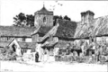
 Framfield (8628825625).jpg 3,367 × 2,278; 4.62 MB
-
 Framfield (8629927630).jpg 3,417 × 2,438; 4.81 MB
-
 Framfield and Blackboys v Forest Row (14103392099).jpg 2,766 × 1,801; 3.12 MB
-
 Framfield and Blackboys v Forest Row (14103398999).jpg 3,289 × 1,806; 4.96 MB
-
 Framfield and Blackboys v Forest Row (14103453918).jpg 2,394 × 1,775; 3.27 MB
-
 Framfield and Blackboys v Forest Row (14266965536).jpg 2,228 × 1,548; 2.44 MB
-
 Framfield and Blackboys v Forest Row (14288098192).jpg 2,448 × 1,895; 3.26 MB
-
 Framfield and Blackboys v Forest Row (14288106802).jpg 2,459 × 1,641; 2.59 MB
-
 Framfield and Blackboys v Forest Row (14310266323).jpg 1,520 × 1,200; 1.23 MB
-
 Framfield and Blackboys v Forest Row (14310273133).jpg 1,584 × 1,331; 1.67 MB
-
 Framfield chapel, now a private house - geograph.org.uk - 5363295.jpg 5,202 × 3,465; 2.88 MB
-
 Framfield church tower - geograph.org.uk - 2113604.jpg 2,592 × 1,944; 1.06 MB
-
 Framfield churchyard, East Sussex - geograph.org.uk - 2877852.jpg 1,600 × 1,150; 507 KB
-
 Framfield Memorial Hall - geograph.org.uk - 2113589.jpg 2,592 × 1,944; 1.7 MB
-
 Framfield Memorial Hall - geograph.org.uk - 5363291.jpg 4,710 × 2,819; 3.13 MB
-
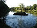 Framfield Park fishery - geograph.org.uk - 2113607.jpg 2,592 × 1,944; 1.47 MB
-
 Framfield village sign - geograph.org.uk - 2113592.jpg 2,592 × 1,944; 1.26 MB
-
 Framfield village sign - geograph.org.uk - 5363296.jpg 5,202 × 3,465; 3.73 MB
-
 Framfield.png 2,083 × 1,386; 1.83 MB
-
 Garden Cottage - geograph.org.uk - 5363325.jpg 5,202 × 3,465; 3.4 MB
-
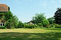 Garden, The Hundred House, Framfield - geograph.org.uk - 3603752.jpg 1,600 × 1,051; 400 KB
-
 Gate and track off Eastbourne Road - geograph.org.uk - 2540099.jpg 640 × 480; 149 KB
-
 Gatehouse - geograph.org.uk - 5363267.jpg 5,202 × 3,465; 3.96 MB
-
 Gatehouse Green farm - geograph.org.uk - 5363253.jpg 5,202 × 3,465; 3.18 MB
-
 Gatehouse junction with The Street, Framfield - geograph.org.uk - 5363287.jpg 5,202 × 3,465; 3.3 MB
-
 Gatehouse Lane - geograph.org.uk - 1740931.jpg 640 × 480; 65 KB
-
 Gatehouse Lane - geograph.org.uk - 5363264.jpg 5,202 × 3,465; 3.06 MB
-
 Gatehouse Lane NE of Framfield - geograph.org.uk - 2113585.jpg 2,592 × 1,944; 1.86 MB
-
 Gatehouse Lane splits left and right - geograph.org.uk - 2885269.jpg 640 × 480; 180 KB
-
 Gatehouse Lane, Framfield - geograph.org.uk - 4427285.jpg 571 × 640; 371 KB
-
 Grass triangle at the junction - geograph.org.uk - 2885285.jpg 640 × 480; 115 KB
-
 Gun Road - geograph.org.uk - 3813748.jpg 3,072 × 2,048; 412 KB
-
 Gun Road - geograph.org.uk - 5542736.jpg 3,120 × 2,080; 7.59 MB
-
 Gun Road climbing through Shawford Wood - geograph.org.uk - 1879571.jpg 1,600 × 1,200; 789 KB
-
 Gun Road junction with Shepherds Hill - geograph.org.uk - 1879586.jpg 1,600 × 1,200; 610 KB
-
 Hailwell Farm, The Bungalow - geograph.org.uk - 5363341.jpg 5,202 × 3,465; 3.58 MB
-
 Hallwell farm entrance - geograph.org.uk - 5363333.jpg 5,202 × 3,465; 4.65 MB
-
 Hare and Hounds, Framfield - geograph.org.uk - 5363310.jpg 4,956 × 3,104; 2.62 MB
-
 Heading towards Bushbury Lane - geograph.org.uk - 5787739.jpg 1,024 × 695; 147 KB
-
 Heavers Mill Streele Lane - geograph.org.uk - 2113118.jpg 2,592 × 1,944; 1.69 MB
-
 Hidden Gap - geograph.org.uk - 5789257.jpg 1,024 × 707; 239 KB
-
 Hollow Lane - geograph.org.uk - 2887785.jpg 640 × 480; 83 KB
-
 Hollow Lane - geograph.org.uk - 5789375.jpg 1,024 × 607; 280 KB
-
 Hollow Lane crossing stream south of Blackboys - geograph.org.uk - 1842756.jpg 1,600 × 1,200; 764 KB
-
 Hollow Lane near Blackwell Farm - geograph.org.uk - 5789387.jpg 1,024 × 664; 208 KB
-
 Honey's Green caravan park on the B2192 - geograph.org.uk - 1971559.jpg 1,600 × 1,200; 535 KB
-
 Horse by the B2192 - geograph.org.uk - 2418290.jpg 640 × 480; 92 KB
-

-
 House on Streele Lane - geograph.org.uk - 2885216.jpg 640 × 480; 118 KB
-
 House on the corner of Bushbury Lane and the B2192 - geograph.org.uk - 1976764.jpg 1,600 × 1,200; 434 KB
-
 Houses on The Street - geograph.org.uk - 1740997.jpg 640 × 427; 66 KB
-
 Houses, Framfield - geograph.org.uk - 1751384.jpg 640 × 428; 92 KB
-
 Information board for Isfield and District Angling Club - geograph.org.uk - 2112678.jpg 2,592 × 1,944; 2.19 MB
-

-

-

-

-

-

-

-

-
 Ivy Cottages sign - geograph.org.uk - 5363339.jpg 5,202 × 3,465; 3.58 MB
-
 Jubilee Cottage near Framfield - geograph.org.uk - 4427320.jpg 640 × 498; 238 KB
-
 Jubilee Cottages - geograph.org.uk - 2113621.jpg 2,592 × 1,944; 1.88 MB
-
 Junction of Sharlands Lane with B2102 - geograph.org.uk - 3293873.jpg 2,464 × 1,632; 1.02 MB
-
 Junction of Streele Lane and Upton Mill Lane - geograph.org.uk - 5362904.jpg 5,202 × 3,465; 4.34 MB
-
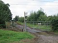
 Junction of Wilderness Lane at Pounsley - geograph.org.uk - 3293856.jpg 2,464 × 1,632; 1.02 MB
-
 Junction on the B2102 - geograph.org.uk - 5543387.jpg 3,300 × 2,200; 7.57 MB
-
 Lane leading to works, Uckfield - geograph.org.uk - 5619939.jpg 2,816 × 2,112; 1.74 MB
-
 Leaving Kiln Wood - geograph.org.uk - 5789417.jpg 1,024 × 670; 304 KB
-
 Leaving Palehouse Common - geograph.org.uk - 5723154.jpg 1,024 × 601; 112 KB
-
 Looking Eastwards on Bushbury Lane - geograph.org.uk - 5789357.jpg 1,024 × 656; 187 KB
-
 Magnificent Oak near Great Streele Farm - geograph.org.uk - 2112689.jpg 2,592 × 1,944; 1.48 MB
-
 Marshy meadow on eastern side of Framfield Stream, Uckfield - geograph.org.uk - 5618436.jpg 2,816 × 2,112; 2.15 MB
-
 Mausoleum near Uckfield - geograph.org.uk - 1575873.jpg 640 × 480; 49 KB
-
 Meadhurst Farm - geograph.org.uk - 5789380.jpg 1,024 × 650; 206 KB
-

-
 Mill building - geograph.org.uk - 177719.jpg 640 × 481; 267 KB
-
 Mill Farm, barn conversion - geograph.org.uk - 5362917.jpg 4,912 × 3,356; 3.4 MB
-
 Mineral water supplier at Paygate Farm - geograph.org.uk - 1973024.jpg 1,600 × 1,200; 459 KB
-
 Minor road junction, Palehouse Common, East Sussex - geograph.org.uk - 3303797.jpg 1,600 × 1,222; 352 KB
-
 New Handrails - geograph.org.uk - 5789407.jpg 1,600 × 1,035; 592 KB


_on_Framfield_Road,_Uckfield_-_geograph.org.uk_-_5618418.jpg)


,_Framfield_Road,_Uckfield_-_geograph.org.uk_-_5618449.jpg)


.jpg)
.jpg)
.jpg)
.jpg)
.jpg)
.jpg)
.jpg)
.jpg)
.jpg)
.jpg)


_-_geograph.org.uk_-_5339527.jpg)
_-_geograph.org.uk_-_5339528.jpg)
_-_geograph.org.uk_-_5339529.jpg)
_-_geograph.org.uk_-_5339530.jpg)
_-_geograph.org.uk_-_5339531.jpg)
_-_geograph.org.uk_-_5339533.jpg)
_-_geograph.org.uk_-_5339536.jpg)
_-_geograph.org.uk_-_5339537.jpg)


