Category:Franziskanerkloster Marburg
| Object location | | View all coordinates using: OpenStreetMap |
|---|
 | |||||
| Upload media | |||||
| Instance of | |||||
|---|---|---|---|---|---|
| Location | Marburg, Marburg-Biedenkopf, Giessen Government Region, Hesse, Germany | ||||
 | |||||
This is the category of the Hessian Kulturdenkmal (cultural monument) with the ID Unknown? (Wikidata)
|
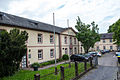
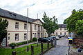
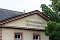
Bilder des ehemaligen Franziskanerklosters in Marburg an der Lahn.
Media in category "Franziskanerkloster Marburg"
The following 40 files are in this category, out of 40 total.
-
 Franziskanerkloster Aufgang01.jpg 1,000 × 1,500; 772 KB
-
 Franziskanerkloster Aufgang02.jpg 1,000 × 1,500; 654 KB
-
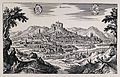
 Franziskanerkloster Dilich 1605.jpg 595 × 433; 88 KB
-
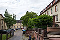 Franziskanerkloster Hof01.jpg 2,000 × 1,333; 966 KB
-
 Marburg - Barfüßerstraße 03 ies.jpg 3,888 × 2,592; 1.81 MB
-
 Marburg Franziskanerkloster Südseite von SW.jpg 4,232 × 2,848; 6.63 MB
-
 Marburg, Germany; panorama with crest. Reproduction of a lin Wellcome V0012679.jpg 3,608 × 2,316; 4.34 MB
-
 Münster Marburg.jpg 3,513 × 2,048; 6.13 MB
-
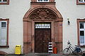
 Franziskanerkloster Reithalle Inschrift.jpg 2,000 × 1,333; 1.18 MB
-
 Franziskanerkloster Reithalle01.jpg 2,000 × 1,333; 1.1 MB
-
 Franziskanerkloster Reithalle02.jpg 1,000 × 1,500; 520 KB
-
 Franziskanerkloster Reithalle03.jpg 1,000 × 1,500; 586 KB
-
 Franziskanerkloster Reithalle04.jpg 1,000 × 1,500; 509 KB
-
 Franziskanerkloster Reithalle05.jpg 1,000 × 1,500; 496 KB
-
 Franziskanerkloster Reithalle06.jpg 2,000 × 1,333; 994 KB
-
 Franziskanerkloster Reithalle07.jpg 1,000 × 1,500; 505 KB
-
 Franziskanerkloster Reithalle08.jpg 1,000 × 1,500; 513 KB
-
 Franziskanerkloster Reithalle09.jpg 1,000 × 1,500; 593 KB
-
 Franziskanerkloster Stadtmauer Westen01.jpg 2,000 × 1,333; 1.15 MB
-
 Franziskanerkloster Stadtmauer Westen02.jpg 1,000 × 1,500; 668 KB
-
 Franziskanerkloster Stadtmauer Westen03.jpg 2,000 × 1,333; 1.31 MB
-
 Straßenschild Barfüßerstraße.jpg 2,000 × 1,333; 1.14 MB
-
 Franziskanerkloster Südflügel Schild.jpg 2,000 × 1,145; 944 KB
-
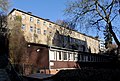
 Franziskanerkloster Südflügel03.jpg 2,000 × 1,333; 1.36 MB
-
 Franziskanerkloster Südflügel01.jpg 2,000 × 1,333; 1.5 MB
-
 Franziskanerkloster Südflügel02.jpg 2,000 × 1,333; 1.33 MB
-
 Franziskanerkloster Südflügel04.jpg 2,000 × 1,333; 1.26 MB
-
 Franziskanerkloster Südflügel05.jpg 2,000 × 1,333; 998 KB
-
 Franziskanerkloster Südflügel06.jpg 1,000 × 1,500; 799 KB
-
 Franziskanerkloster Südflügel07.jpg 1,000 × 1,500; 675 KB
-
 Franziskanerkloster Südflügel08.jpg 2,000 × 1,333; 922 KB
-
 Franziskanerkloster Südflügel09.jpg 2,000 × 1,333; 908 KB
-
 Franziskanerkloster Südflügel10.jpg 2,000 × 1,333; 972 KB
-
 Franziskanerkloster Südflügel11.jpg 2,000 × 1,333; 849 KB
-
 Franziskanerkloster Südflügel12.jpg 2,000 × 1,333; 888 KB
-
 Franziskanerkloster Südflügel14.jpg 2,000 × 1,333; 832 KB
-
 Franziskanerkloster Südflügel15.jpg 2,000 × 1,333; 1,009 KB
-
 Franziskanerkloster Westflügel01.jpg 2,000 × 1,333; 889 KB
-
 Franziskanerkloster Westflügel02.jpg 2,000 × 1,333; 911 KB
-
 Franziskanerkloster Westseite.jpg 2,000 × 1,333; 1.18 MB


